
Short entry9.4 miles away
Caerlaverock NNR public trails
Hollands and Castle Corner, south of Dumfries · Merse, reedbed, mudflats and coastal woodland
 the ai birderBirding near me
The AI Birder · one-page field sheet
North Plain, Bowness-on-Solway, Cumbria · CA7 5AG

Oystercatcher · Lapwing · Curlew · Dunlin · Tree Sparrow · Reed Bunting
Main wetland hide (descriptive label) · East-facing scrape hide (descriptive label) · West-facing scrape hide (descriptive label) · Signed roadside lay-by viewpoints · Farmland circular trail · Information Barn · Bog boardwalk · Viewing screens (follow current signs)
Check current access, hide closures and operator notices before travelling. Seasonal birds are possibilities, not promised sightings. Keep to authorised routes and give wildlife space.
Opening and charges checked 2026-10-18. Operator: https://www.rspb.org.uk/days-out/reserves/campfield-marsh
Full guide and current source links: https://aibirder.co.uk/reserves/rspb-campfield-marsh
EN 91 · RSPB reserve guide
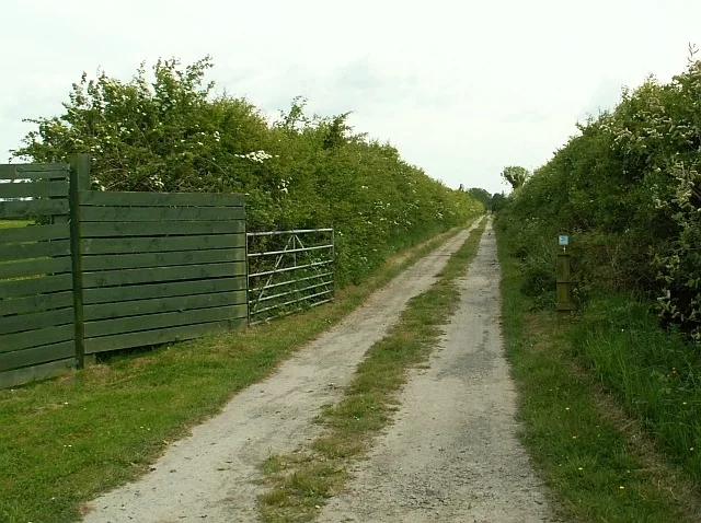
North Plain, Bowness-on-Solway, Cumbria
Solway waders, winter wildfowl and summer bog wildlife
Decide if the visit fits.
Last checked 18 October 2026.
Opening and charges information · checked .
Stay nearby →Reserve overview
Solway waders, winter wildfowl and summer bog wildlife
Eight checks for a smoother visit.
Conditions change: check the operator and transport notices before travelling.
January: Typically make the Main wetland hide your first stop for Wigeon, Teal and Pintail. Then compare the signed roadside lay-by viewpoints around high tide for Curlew and Dunlin, keeping the day within the available winter light.
February: Wigeon and Shoveler usually remain the wetland focus from the Main wetland hide. A quieter walk around the Farmland circular trail can add Tree Sparrows and Linnets; stay on the path rather than inspecting the hedges.
March: Typically watch Oystercatchers and Curlews from the signed roadside lay-by viewpoints, then listen for Skylarks along the Farmland circular trail. The spring change is gradual, and the actual tide can matter more than a calendar date.
April: The Farmland circular trail is our choice for a listening walk, with Skylark, Linnet and Reed Bunting as typically useful targets. Give the same hedge a patient watch and allow wetland birds space rather than approaching field edges.
May: Typically divide your time between Skylarks over the Farmland circular trail and Tree Sparrows around its permitted margins. The source-backed list here deliberately favours established farmland birds; it does not turn occasional reported rarities into expected encounters.
June: Linnets, Reed Buntings and Tree Sparrows usually make a slow Farmland circular trail circuit worthwhile. Stop where the public path gives a clear view, then let birds return to their normal feeding rather than following them across a field.
July: Typically listen for Skylarks and watch Linnets from the Farmland circular trail before the day becomes windy. The scrape hides offer alternative public viewing, but their individual species records were not established in the sources reviewed.
August: Tree Sparrows and Reed Buntings remain sensible Farmland circular trail targets. Choose sheltered pauses when vegetation is moving in the wind; the month does not guarantee close views, and walking farther onto the marsh would disturb feeding birds.
September: Typically compare returning Dunlin and Lapwing from the signed roadside lay-by viewpoints as autumn builds. Follow with Linnets along the Farmland circular trail; arrive with a tide plan rather than expecting the same birds throughout the day.
October: Curlews and Oystercatchers usually reward the signed roadside lay-by viewpoints, especially as high water reduces feeding ground. Check the Main wetland hide for arriving Wigeon, remembering that the winter peak develops with weather and migration.
November: Typically favour Teal, Wigeon and Shoveler from the Main wetland hide, then use an official roadside viewpoint for high-water Dunlin. Carry warm layers for stationary watching and keep enough daylight for the walk back from the hide.
December: Pintail and Wigeon usually justify a patient Main wetland hide session. Tree Sparrows on the Farmland circular trail provide a closer alternative when distant saltmarsh views are poor; avoid planning the visit around an unverified rare-bird report.
Best conditions: Our choice is a high-water saltmarsh watch from the signed roadside lay-bys combined with a wetland-hide session. Typically a lighter wind makes farmland listening easier; exposed Solway views can be uncomfortable in poor weather. Light advice for the two scrape hides follows the Carlisle group’s stated east/west viewing directions; other light and scope ratings are editorial. Do not walk out onto saltmarsh to shorten a view.
The RSPB tariff checked on 18 October 2026 lists free reserve admission for adults and children and free car parking for members and non-members. The reserve itself is shown as open 24 hours, while the current calendar gives 10am–3pm for the visitor centre and toilets. Its separate café calendar label uses the same hours, although the facilities page describes self-service hot drinks and explicitly says there is no café. Plan for drinks rather than a catered lunch. The parking area has 25 spaces, with no overnight parking or camping. Check the operator's reserve updates before travelling, especially after heavy rain or unusually high tides, which can affect a low-lying wetland visit.
Access times: Reserve: Open24hours on the October2026 RSPB calendar. · Hides: Three public hides are listed; separate hide locking hours were not published. Check current on-site signs. · Car park: Operator lists daytime visitor parking with no overnight parking or camping; a separate gate schedule was not published. · Dawn access: partly. Operator opening information.
Campfield rewards a route that moves between the coast, wet fields and raised bog. The main North Plain entrance leads towards the inland hides, with viewing screens providing additional places to pause. A signposted farmland circuit passes ponds, hedgerows and fields; the operator gives it as 1.5 miles, or 2.5 kilometres. The separate peat-bog loop is listed as 2.5 miles, or four kilometres, using boardwalk across the open bog landscape. Use the map at the Solway Wetlands Centre to understand how the sections join before setting off. For a 2-hour plan, begin with a sustained watch from the main wetland hide and allow time for the nearby screens on the return. If a high tide is the reason for the visit, swap that order and first use one of the signed roadside viewing lay-bys, then spend the remaining time inland. Never stop a vehicle where it narrows the coast road or blocks a gate. For a full-day plan, combine a morning farmland circuit with a long hide stop, take a lunch break, and then follow the bog loop in suitable conditions. The coast can occupy the final part of the day if its tide and light are favourable. Avoid rushing the boardwalk simply to complete every habitat: a quieter day with two long watches often reveals more than a fast tour of all three hides. The Information Barn on the opposite side of the reserve offers another broad view when that part of the trail is open. The Solway's broad views favour a telescope, but binoculars remain valuable for following a flock that moves between fields. Try first to understand the whole scene: where are birds feeding, where are they resting, and which groups are using the same habitat? Then choose individual birds for closer study. On the bog, slow down enough to notice how the vegetation changes beside the boardwalk. A pocket notebook can help separate a morning coastal count from an afternoon inland count, avoiding the temptation to add every repeated flock into a single total. Remain behind the screens while watching nearby birds.
Use the linked reserve map and directions with current access notices. Species are typical seasonal targets. Light and telescope advice reflects our choice of viewpoint.
Wet grassland and managed wetland, from the surfaced main-hide approach
The operator specifies an800m flat surfaced approach. This label describes the main hide; it is not a verified proper name.
Winter: Teal, Wigeon, Pintail, Shoveler
Spring: Teal
Autumn: Wigeon, Teal
Light: either. Scope: useful.
An east-facing view over a scrape
Carlisle RSPB describes two scrape hides facing east and west. Proper names and individual species records were not verified; follow current signs.
Light: afternoon. Scope: useful.
A west-facing view over a scrape
Descriptive label only. Use current signed access; light advice follows the operator’s stated view direction.
Light: morning. Scope: useful.
Solway saltmarsh and the tidal edge from designated roadside viewpoints
Use only the signed lay-bys described by RSPB; do not stop where traffic is obstructed or walk onto the marsh.
Winter: Oystercatcher, Lapwing, Curlew, Dunlin
Spring: Oystercatcher, Curlew
Autumn: Oystercatcher, Lapwing, Curlew, Dunlin
Light: either. Scope: essential.
Tide: High tide brings birds onto saltmarsh; stay at the official viewpoints.
Seed-bearing farmland margins and hedges beside the permitted circular walk
About1.5miles/2.5km. Watch from the path without entering crops or following birds into hedges.
Winter: Tree Sparrow, Reed Bunting, Linnet, Skylark
Spring: Tree Sparrow, Reed Bunting, Linnet, Skylark
Summer: Tree Sparrow, Reed Bunting, Linnet, Skylark
Autumn: Tree Sparrow, Reed Bunting, Linnet, Skylark
Light: either. Scope: not needed.
Panoramic reserve views from the operator’s information building
Opposite the main reserve. No separately sourced bird assemblage is assigned to this indoor viewpoint.
Light: either. Scope: useful.
Raised-bog habitat along the permitted boardwalk loop
About2.5miles/4km for the bog-boardwalk circular route. No unverified bog bird targets are added.
Light: either. Scope: not needed.
The several public screened views listed by the operator
The operator lists several screens but does not publish individual names or a complete current location inventory. Follow on-site signs; no unsupported species associations are added.
Light: either. Scope: useful.
| Spot | Overlooks | Key species by season | Best light | Scope | Tide |
|---|---|---|---|---|---|
| Main wetland hide (descriptive label)The operator specifies an800m flat surfaced approach. This label describes the main hide; it is not a verified proper name. | Wet grassland and managed wetland, from the surfaced main-hide approach | Winter: Teal, Wigeon, Pintail, Shoveler Spring: Teal Autumn: Wigeon, Teal | either | useful | — |
| East-facing scrape hide (descriptive label)Carlisle RSPB describes two scrape hides facing east and west. Proper names and individual species records were not verified; follow current signs. | An east-facing view over a scrape | — | afternoon | useful | — |
| West-facing scrape hide (descriptive label)Descriptive label only. Use current signed access; light advice follows the operator’s stated view direction. | A west-facing view over a scrape | — | morning | useful | — |
| Signed roadside lay-by viewpointsUse only the signed lay-bys described by RSPB; do not stop where traffic is obstructed or walk onto the marsh. | Solway saltmarsh and the tidal edge from designated roadside viewpoints | Winter: Oystercatcher, Lapwing, Curlew, Dunlin Spring: Oystercatcher, Curlew Autumn: Oystercatcher, Lapwing, Curlew, Dunlin | either | essential | High tide brings birds onto saltmarsh; stay at the official viewpoints. |
| Farmland circular trailAbout1.5miles/2.5km. Watch from the path without entering crops or following birds into hedges. | Seed-bearing farmland margins and hedges beside the permitted circular walk | Winter: Tree Sparrow, Reed Bunting, Linnet, Skylark Spring: Tree Sparrow, Reed Bunting, Linnet, Skylark Summer: Tree Sparrow, Reed Bunting, Linnet, Skylark Autumn: Tree Sparrow, Reed Bunting, Linnet, Skylark | either | not needed | — |
| Information BarnOpposite the main reserve. No separately sourced bird assemblage is assigned to this indoor viewpoint. | Panoramic reserve views from the operator’s information building | — | either | useful | — |
| Bog boardwalkAbout2.5miles/4km for the bog-boardwalk circular route. No unverified bog bird targets are added. | Raised-bog habitat along the permitted boardwalk loop | — | either | not needed | — |
| Viewing screens (follow current signs)The operator lists several screens but does not publish individual names or a complete current location inventory. Follow on-site signs; no unsupported species associations are added. | The several public screened views listed by the operator | — | either | useful | — |
Month chips show typical presence or our preferred viewing season. Choose birds that suit the time of your visit.
RSPB describes autumn-to-spring high-tide gatherings on the saltmarsh. Use official roadside viewpoints; no minimum tide height or fixed arrival interval is published in the sources checked.
UKHO EasyTide: Annan Waterfoot (opposite side of the Solway; local timing may differ) · RNLI tide safety
A flat surfaced track connects the main car park with the hide, a distance the RSPB gives as 800 metres each way. Blue Badge parking is available beside the hide for visitors unable to manage that approach, as well as four designated spaces at the North Plain visitor centre. Confirm how to reach the hide-side spaces with the reserve team before using the access track. The visitor centre entrance has double doors reached over a hard surface with a slight slope; inside, the limestone-flagged floor is level. The accessible toilet is at ground level beside the entrance, with support rails and an emergency alarm cord. These details apply to the centre and main hide route, not automatically to the entire bog circuit. Boardwalks, wet weather and exposure can change the effort required elsewhere. A picnic bench in the Discovery Zone has wheelchair bays on a rolled-stone surface. Anyone relying on a mobility aid should discuss the intended circuit and turning points, not merely whether the reserve has an accessibility symbol.
The Solway Wetlands Centre is the reserve's information hub, with self-service hot drinks. Bring a proper picnic if spending the day here. The Discovery Zone opposite the centre provides natural play and self-led activities, and the adjacent picnic area is handy for families. A ground-level toilet room includes hand washing and baby changing. The hides provide shelter for birdwatching, while the bog and coastal viewing places are much more exposed. Educational groups should arrange their visit through the reserve.
Dogs are welcome on public rights of way, under close control and on a lead throughout. Keep them away from wet fields, shorebird flocks and the vegetation beside the boardwalk. Visitors with assistance dogs are welcome at RSPB Campfield Marsh, including throughout its visitor routes. Carry bags and remove waste rather than leaving it beside a path.
Carlisle is the nearest railway station identified by the RSPB, about 13 miles from the reserve. Stagecoach's service 93 links Carlisle with Bowness-on-Solway and Anthorn; the operator's January 2026 timetable gives a Monday-to-Saturday pattern excluding public holidays. The RSPB describes Bowness-on-Solway as the bus arrival point, followed by about 1.5 miles west along the coast road to North Plain Farm. This is a substantial extra walk with passing traffic, so allow for both directions and the day's weather. Cumberland Council separately publishes Sunday service 93S, operated by Reays; confirm the particular date and return stop before relying on it. A prebooked taxi from Carlisle is an alternative for a long hide session or limited mobility. If cycling, use the main entrance and keep the bike clear of the visitor centre doors and pedestrian access.
Useful bases for an early start.
Booking.com links are affiliate links: we may earn a commission at no extra cost to you. How these links work.
About 1.9 miles by road, roughly 3 minutes’ drive to the reserve arrival point (OSRM, measured 18 October 2026; estimate without live traffic).
Measured driving route · 18 October 2026. Map estimates exclude live traffic.
Staying close to the Solway coastFind places to stay in Bowness-on-Solway on Booking.comAbout 12.1 miles by road, roughly 23 minutes’ drive to the reserve arrival point (OSRM, measured 18 October 2026; estimate without live traffic).
Measured driving route · 18 October 2026. Map estimates exclude live traffic.
A small-town base inland from the SolwayFind places to stay in Wigton on Booking.comAbout 16.5 miles by road, roughly 27 minutes’ drive to the reserve arrival point (OSRM, measured 18 October 2026; estimate without live traffic).
Measured driving route · 18 October 2026. Map estimates exclude live traffic.
Mainline rail arrival and a city baseFind places to stay in Carlisle on Booking.comExplore Cumbria’s full guides and smaller birding sites
Contact campfield.marsh@rspb.org.uk or 01697 351330 for Campfield Marsh. Ask about the route you intend to use, particularly the bog loop after prolonged rain or hide-side Blue Badge access. The reserve can advise organised groups about self-guided educational activities and visits. Useful sightings should include the date, approximate time and official hide or trail section; report sensitive breeding information directly to the team rather than circulating precise locations.
Check Cumbria Bird Club reporting service: dated county bird records. most days Reports show what has been seen, not what will be.
Follow the BTO Birders’ Code and give wildlife space.
RSPB Campfield Marsh: Free entry and parking.
RSPB Campfield Marsh: Dogs are welcome on public rights of way, under close control and on a lead throughout.
RSPB Campfield Marsh: Autumn–winter waders and wildfowl; spring birds and summer insects.
RSPB Campfield Marsh: The visitor centre entrance has double doors reached over a hard surface with a slight slope; inside, the limestone-flagged floor is level.
RSPB Campfield Marsh: Carlisle is the nearest railway station identified by the RSPB, about 13 miles from the reserve.
Shorter stops within 15 miles in a straight line. Use the operator’s arrival directions for the journey.
Hollands and Castle Corner, south of Dumfries · Merse, reedbed, mudflats and coastal woodland
Nearby complete guides.
Stops with a purpose: use one as a contrasting habitat or weather-proof Plan B. Distances are straight-line estimates, not road journeys.