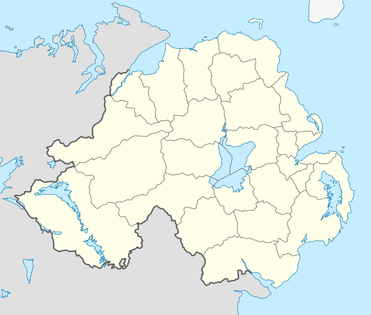
Short entry14.3 miles away
Killard National Nature Reserve
Mill Quarter Bay, near Strangford · Coastal grassland · cliffs · rocky shore · scrub
 the ai birderBirding near me
The AI Birder · one-page field sheet
Keel Point, Dundrum, County Down, Northern Ireland · BT33 0LW · BT33 0LW

Brent Goose · Black-tailed Godwit · Dunlin · Teal · Wigeon · Redshank
Dundrum Coastal Path · Keel Point bridge — public crossing · North Point nature trail — heathland section · South End nature trail — public beach outlook
Check current access, hide closures and operator notices before travelling. Seasonal birds are possibilities, not promised sightings. Keep to authorised routes and give wildlife space.
Opening and charges checked 2026-10-25. Operator: https://www.nationaltrust.org.uk/visit/northern-ireland/murlough-national-nature-reserve
Full guide and current source links: https://aibirder.co.uk/reserves/murlough-national-nature-reserve
NI 06 · National Trust reserve guide
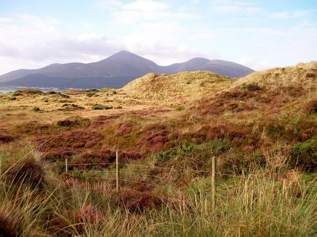
Keel Point, Dundrum, County Down, Northern Ireland · BT33 0LW
Pale-bellied Brent Geese, Dunlin, Curlew and Oystercatchers gather around Dundrum Bay, while Stonechats, Meadow Pipits, Reed Buntings and Cuckoos use the reserve's dunes, scrub and heath.
Decide if the visit fits.
Last checked 18 October 2026.
Opening and charges information · checked .
Stay nearby →Reserve overview
Pale-bellied Brent Geese, Dunlin, Curlew and Oystercatchers gather around Dundrum Bay, while Stonechats, Meadow Pipits, Reed Buntings and Cuckoos use the reserve's dunes, scrub and heath.
Eight checks for a smoother visit.
Conditions change: check the operator and transport notices before travelling.
January: January usually favours the Dundrum Coastal Path for Brent Goose, Wigeon, Teal and Redshank. Use the Keel Point bridge public crossing for a separate look at Shelduck and Oystercatcher. Our choice is a calm falling-tide daylight watch from established paths, with a scope for birds across the bay.
February: In February, compare Greenshank and Redshank from the Dundrum Coastal Path, then look for Black-tailed Godwit and Dunlin from the Keel Point bridge. A broad view lets birds feed without disturbance. Never step onto mud or descend below the bridge to approach a flock that appears just beyond binocular range.
March: March typically retains Brent Goose and winter ducks in Inner Bay, watched from the Dundrum Coastal Path, while the North Point nature trail adds Meadow Pipit and Stonechat. Choose the route according to conditions: the longer dune walk includes uneven ground and steps and is not equivalent to the sheltered bay path.
April: April is a transition month for Brent Goose on the Dundrum Coastal Path and more conspicuous Meadow Pipit activity along the North Point nature trail. Shelduck can be watched from Keel Point bridge. Departures depend on conditions, and a previous year’s late flock should not be treated as a regular late-April promise.
May: May is our choice for Meadow Pipit and Stonechat from the signed North Point nature trail, with Little Egret and Grey Heron on a separate Dundrum Coastal Path watch. Remain on established paths around heath and dunes. Alarm calls or repeatedly circling adults are reasons to move away without searching for a nest.
June: In June, use the North Point nature trail for Meadow Pipit and Stonechat, then the Dundrum Coastal Path for Little Egret and Grey Heron. Shorebird numbers differ from winter. The South End public beach outlook can add Oystercatcher, but visitors must obey any seasonal breeding-area signs and avoid repeatedly displacing feeding birds.
July: July usually suits an early daytime dune walk for Stonechat and Meadow Pipit from the North Point nature trail, followed by Oystercatcher from a safe public beach outlook. That is a habitat-led plan, not a promised species list. Keep dogs controlled, leave livestock space and choose a shorter route in strong wind.
August: August typically rewards a mix of dune watching and changing shorebirds: Stonechat from the North Point nature trail and Oystercatcher from Keel Point bridge. Little Egret remains worth looking for from the Dundrum Coastal Path. Scan from the path before moving closer, and give resting or feeding birds a broad buffer.
September: September usually starts the shift towards Dunlin and Black-tailed Godwit from Keel Point bridge and Greenshank along the Dundrum Coastal Path. Arrival timing and the tide both influence what is visible. Check the actual report dates and keep sufficient daylight for the inland return rather than following exposed beach or mud.
October: In October, Brent Goose, Teal and Wigeon usually make the Dundrum Coastal Path the first choice, with Redshank and Curlew on suitable exposed margins. The Keel Point bridge offers a second perspective on Shelduck and Dunlin. A fresh regional report helps choose a day without guaranteeing the same birds will remain.
November: November is our choice for a patient comparison of Greenshank and Redshank from the Dundrum Coastal Path, followed by Black-tailed Godwit and Oystercatcher at Keel Point bridge. The RSPB group recorded these public viewpoints in November 2024. Receding water helped that visit; no fixed local tide height is claimed.
December: December usually keeps Brent Goose and winter ducks central to the Dundrum Coastal Path visit, with Dunlin and Lapwing from Keel Point bridge. Strong wind can make the open bay difficult to scan. Historical offshore records are interesting context, but are not added as guaranteed regular winter targets or reasons to enter unsafe shore.
Best conditions: Our choice is a calm clear winter day with a falling tide for Inner Bay, starting on the Dundrum Coastal Path and comparing the view from Keel Point bridge. A scope is essential for distant ducks and waders across the bay. The North Point heathland route is better in lighter wind, using binoculars for Meadow Pipit and Stonechat. Light advice is editorial: choose a public angle with glare to one side and never seek a better view by crossing mud, entering dunes off-path or approaching resting flocks.
Parking tariffs published by the National Trust and checked on 18 October 2026 are £5 for cars from January to April and September to December, and £7 from May to August. National Trust members and Blue Badge holders park free. Other published charges are motorbikes £7, minibuses £10 and coaches £20; bicycles are free. Machines accept cards, and JustPark payment is available, but payment does not reserve a space. Scan a membership card at the machine to register member parking. The beach and dunes need planning independently of payment: check access notices, weather and tide before setting out. Use designated visitor parking, leave access clear and do not assume a parking ticket permits entry to private ground or closed conservation areas.
Access times: Reserve: National Trust calendar inspected for 18 October 2026 displays 8am–5pm for the nature reserve; facilities closed. Check intended date because this is a dated entry, not annual opening. · Hides: No public bird hide verified. Watch from the official Coastal Path, signed nature trails and public bridge; obey closures and breeding-area signs. · Car park: Pay-and-display applies all year. Separate current gate hours not shown in inspected calendar; confirm before planning early or late parking. · Dawn access: no. Operator opening information.
Murlough's routes pass through dune heath, scrub and woodland as well as reaching the beach. The official South End nature trail is three miles, with a published walking estimate of one hour fifteen minutes before birdwatching stops. It begins at the main Murlough car park and follows boardwalks into the reserve. North Point is another three-mile nature trail, starting from the concrete standing at Keel Point. The woodland walk offers a shorter option, approximately one to one-and-a-half miles. For a bay-focused visit, the Dundrum Coastal Path follows an old railway alignment and runs for around 2.5 kilometres. Its views across the mudflats suit herons, egrets and feeding waders. Choose the route according to the birds and tide you want to watch rather than expecting hides or a single circular circuit linking every viewpoint. Two-hour plan: begin with the boardwalk and a measured section of South End, allowing repeated stops beside scrub and open dune habitat. Turn towards the beach view only where the signed route permits, then return with enough time to examine birds you heard but missed on the outward leg. In winter, a shorter out-and-back bay watch may be a better use of the same time than completing the full circuit. Full-day plan: take the South End circuit in the morning, concentrating on songbirds and the transition between wooded and open ground. After a break, choose either North Point or the separate coastal path for a longer look across the bay. Return to an earlier viewpoint if the tide has changed substantially. This editorial plan allows time for observation; the operator's walking times assume a more continuous pace. Keep to paths to protect fragile dune vegetation. Give freely roaming cattle and ponies space, leave gates as found and avoid feeding or touching livestock. If you find suspected ammunition, do not touch or move it: record the location and contact police on 999, following the Trust's safety guidance.
Use the linked reserve map and directions with current access notices. Species are typical seasonal targets. Light and telescope advice reflects our choice of viewpoint.
Dundrum Inner Bay mudflats and shallow water
Official old-railway public path. Use designated parking; take care at the busy A2 crossing. Never walk across mudflats.
Winter: Brent Goose, Teal, Wigeon, Redshank, Greenshank, Little Egret, Curlew, Oystercatcher
Spring: Brent Goose, Redshank, Little Egret, Curlew
Summer: Little Egret, Grey Heron, Oystercatcher
Autumn: Brent Goose, Teal, Wigeon, Greenshank, Redshank
Light: either. Scope: essential.
Tide: Falling tide just after high water worked on the dated operator group visit; watch from the path rather than following the waterline.
Inner and Outer Bay water and exposed margins
Actual operator-group public bridge observation point. Keep the crossing clear; no descent beneath the bridge or approach to resting birds.
Winter: Shelduck, Oystercatcher, Curlew, Black-tailed Godwit, Dunlin, Lapwing, Mute Swan
Spring: Shelduck, Oystercatcher, Curlew
Summer: Oystercatcher, Mute Swan
Autumn: Black-tailed Godwit, Dunlin, Shelduck, Curlew
Light: either. Scope: essential.
Tide: Choose a safe falling-tide daylight watch; tide timing at Newcastle is a regional planning reference, not an exact Inner Bay water-level forecast.
Open heath, gorse and dune scrub beside the signed public route
Official trail has steps, stiles and uneven ground; remain on the signed route and leave grazing livestock space.
Winter: Meadow Pipit, Stonechat, Kestrel, Sparrowhawk
Spring: Meadow Pipit, Stonechat, Kestrel, Sparrowhawk
Summer: Meadow Pipit, Stonechat, Kestrel, Sparrowhawk
Autumn: Meadow Pipit, Stonechat, Kestrel, Sparrowhawk
Light: either. Scope: not needed.
Dundrum Bay shore and offshore water from established beach access
Public beach access only, subject to live signs, weather and tide. Never enter protected breeding areas or follow birds along the strand.
Winter: Dunlin, Oystercatcher
Spring: Oystercatcher
Summer: Oystercatcher
Autumn: Dunlin, Oystercatcher
Light: either. Scope: useful.
Tide: Watch from a safe established access point with an inland return available. Do not rely on exposed sand as a permanent route.
| Spot | Overlooks | Key species by season | Best light | Scope | Tide |
|---|---|---|---|---|---|
| Dundrum Coastal PathOfficial old-railway public path. Use designated parking; take care at the busy A2 crossing. Never walk across mudflats. | Dundrum Inner Bay mudflats and shallow water | Winter: Brent Goose, Teal, Wigeon, Redshank, Greenshank, Little Egret, Curlew, Oystercatcher Spring: Brent Goose, Redshank, Little Egret, Curlew Summer: Little Egret, Grey Heron, Oystercatcher Autumn: Brent Goose, Teal, Wigeon, Greenshank, Redshank | either | essential | Falling tide just after high water worked on the dated operator group visit; watch from the path rather than following the waterline. |
| Keel Point bridge — public crossingActual operator-group public bridge observation point. Keep the crossing clear; no descent beneath the bridge or approach to resting birds. | Inner and Outer Bay water and exposed margins | Winter: Shelduck, Oystercatcher, Curlew, Black-tailed Godwit, Dunlin, Lapwing, Mute Swan Spring: Shelduck, Oystercatcher, Curlew Summer: Oystercatcher, Mute Swan Autumn: Black-tailed Godwit, Dunlin, Shelduck, Curlew | either | essential | Choose a safe falling-tide daylight watch; tide timing at Newcastle is a regional planning reference, not an exact Inner Bay water-level forecast. |
| North Point nature trail — heathland sectionOfficial trail has steps, stiles and uneven ground; remain on the signed route and leave grazing livestock space. | Open heath, gorse and dune scrub beside the signed public route | Winter: Meadow Pipit, Stonechat, Kestrel, Sparrowhawk Spring: Meadow Pipit, Stonechat, Kestrel, Sparrowhawk Summer: Meadow Pipit, Stonechat, Kestrel, Sparrowhawk Autumn: Meadow Pipit, Stonechat, Kestrel, Sparrowhawk | either | not needed | — |
| South End nature trail — public beach outlookPublic beach access only, subject to live signs, weather and tide. Never enter protected breeding areas or follow birds along the strand. | Dundrum Bay shore and offshore water from established beach access | Winter: Dunlin, Oystercatcher Spring: Oystercatcher Summer: Oystercatcher Autumn: Dunlin, Oystercatcher | either | useful | Watch from a safe established access point with an inland return available. Do not rely on exposed sand as a permanent route. |
Month chips show typical presence or our preferred viewing season. Choose birds that suit the time of your visit.
Our choice is a falling tide just after high water for Inner Bay, following the actual November 2024 operator-group watch. Watch from paths and public viewpoints; do not cross mud, channels or the bay.
UKHO EasyTide: Newcastle, Northern Ireland (UKHO 0630) · RNLI tide safety
The National Trust identifies a wheelchair-friendly boardwalk, designated accessible parking and accessible toilet provision. The boardwalk is not classed as all-terrain, and there is no wheelchair access onto the beach. A route that reaches a coastal view therefore does not necessarily provide a practical transfer down to the sand. Choose the viewing objective and return distance before setting out with a mobility aid. Natural slopes and surfaces vary across the reserve. The South End trail is suitable only in parts for visitors with restricted mobility. North Point includes steps, stiles and uneven ground, with beach walking and sections that need more effort; it should not be treated as a continuous wheelchair circuit. Rain can make natural ground less straightforward even where a summer description looks inviting. The Trust links a detailed AccessAble guide for planning. Use it to compare the approach, barriers and facilities with your own equipment rather than relying on a general accessible symbol. Contact the reserve about the exact section you want to use and confirm any current boardwalk restrictions. For a short visit, an out-and-back boardwalk excursion with a clear turning point can be more comfortable than committing to a longer signed nature trail.
Toilets are seasonal: the Trust lists weekends in April and May, 10:00–16:00, and daily June to August, 10:00–17:00. Outside those periods use public facilities in Dundrum. The reserve has a natural play area with wooden features. Bring drinking water and food for a long birding visit, or plan a separate stop in the village. Take litter home, keep picnic food secure around wildlife and leave space for others at the car park and path entrances.
Dogs must remain on leads and under close control throughout the reserve. Keep to marked routes around grazing livestock and ground-nesting birds. The Trust excludes dogs from the Blue Flag beach area during July and August. Follow local signs where restrictions define the boundary, and clear up after your dog.
The National Trust directs visitors to Ulsterbus route 20 between Belfast and Newcastle, alighting at Lazy BJ Caravan Park beyond Dundrum. Translink also publishes the Belfast–Newcastle corridor timetable under routes 518/520/37; check its journey planner for the actual day's route number and stop before booking onward travel. Do not assume that every departure on the corridor uses the same stopping pattern. The Trust describes the entrance as about one mile from the south side of Dundrum via Keel Point Road. Visitors staying in Newcastle can consider the longer walking approach, which includes about two miles along the beach, provided conditions and their chosen return route suit. A prearranged taxi is useful when combining bus arrivals with a particular trail start or carrying heavy optics. There is no railway station at the reserve. Use Belfast as the rail interchange and plan the onward bus or taxi connection separately. National Cycle Network Route 99 passes the entrance. Drivers approach from the A2 between Dundrum and Newcastle, taking care to choose the car park corresponding to their intended walk.
Useful bases for an early start.
Booking.com links are affiliate links: we may earn a commission at no extra cost to you. How these links work.
About 2.0 miles by road, roughly 3 minutes’ drive from the mapped town-centre point to the public access point. OpenStreetMap estimate for Dundrum, measured 18 October 2026. For the Dundrum journey linked to Murlough National Nature Reserve, leave additional time for traffic and reaching your precise accommodation address.
Measured driving route · 2026-10-18. Map estimates exclude live traffic.
A village stay beside the inner bay.Find places to stay in Dundrum on Booking.comAbout 2.6 miles by road, roughly 6 minutes’ drive from the mapped town-centre point to the public access point. OpenStreetMap estimate for Newcastle, measured 18 October 2026. For the Newcastle journey linked to Murlough National Nature Reserve, leave additional time for traffic and reaching your precise accommodation address.
Measured driving route · 2026-10-18. Map estimates exclude live traffic.
Combining coastal birding with the Mourne foothills.Find places to stay in Newcastle on Booking.comAbout 10.9 miles by road, roughly 18 minutes’ drive from the mapped town-centre point to the public access point. OpenStreetMap estimate for Downpatrick, measured 18 October 2026. For the Downpatrick journey linked to Murlough National Nature Reserve, leave additional time for traffic and reaching your precise accommodation address.
Measured driving route · 2026-10-18. Map estimates exclude live traffic.
Adding Strangford Lough and Lecale to a longer visit.Find places to stay in Downpatrick on Booking.comExplore County Down’s full guides and smaller birding sites
Contact the National Trust reserve team on 028 4375 1467 or murlough@nationaltrust.org.uk. The main visitor address is Keel Point, Dundrum, County Down, BT33 0LW. The South End trail page separately gives BT33 0NQ, so choose the named trail start as well as a postcode when navigating. Use the Trust's main page for the opening calendar and parking information, its individual trail pages for walking details, and the wildlife article for the habitats and birds associated with each part of the bay.
Check Operator actual seasonal sightings update. seasonal; update date not published Reports show what has been seen, not what will be.
Follow the BTO Birders’ Code and give wildlife space.
Murlough National Nature Reserve: Parking £5 September–April or £7 May–August; NT members and Blue Badge holders free.
Murlough National Nature Reserve: Dogs must remain on leads and under close control throughout the reserve.
Murlough National Nature Reserve: Autumn–winter wildfowl · rewarding year-round.
Murlough National Nature Reserve: The National Trust identifies a wheelchair-friendly boardwalk, designated accessible parking and accessible toilet provision.
Murlough National Nature Reserve: The National Trust directs visitors to Ulsterbus route 20 between Belfast and Newcastle, alighting at Lazy BJ Caravan Park beyond Dundrum.
Shorter stops within 15 miles in a straight line. Use the operator’s arrival directions for the journey.
Mill Quarter Bay, near Strangford · Coastal grassland · cliffs · rocky shore · scrub
Castle Ward Bay, near Strangford · Tidal bay · loughside · woodland edge
Nearby complete guides.
Stops with a purpose: use one as a contrasting habitat or weather-proof Plan B. Distances are straight-line estimates, not road journeys.