

Short entry4.3 miles away
Brampton Wood
Brampton Road, west of Brampton · Ancient mixed woodland and coppiced rides
 the ai birderBirding near me
The AI Birder · one-page field sheet
Little Paxton, Cambridgeshire · PE19 6ET

Kingfisher · Great Crested Grebe · Little Egret · Cormorant · Grey Heron · Gadwall
Hayden Hide · Kingfisher Hide · Cobham Hide · River viewpoint · Washout Pit public viewpoints · Island Pit public viewpoint · Meadow Trail · Visitor Centre viewing window · Dodder Fen hide (name not published)
Check current access, hide closures and operator notices before travelling. Seasonal birds are possibilities, not promised sightings. Keep to authorised routes and give wildlife space.
Opening and charges checked 2026-10-18. Operator: https://www.huntingdonshire.gov.uk/leisure/parks-nature-reserves-and-green-spaces/paxton-pits-nature-reserve/
Full guide and current source links: https://aibirder.co.uk/reserves/paxton-pits-nature-reserve
EN 101 · Huntingdonshire District Council reserve guide
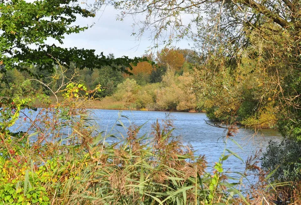
Little Paxton, Cambridgeshire
Nightingale listening from public paths and a varied network of lake trails.
Decide if the visit fits.
Last checked 18 October 2026.
Opening and charges information · checked .
Stay nearby →Reserve overview
Nightingale listening from public paths and a varied network of lake trails.
Eight checks for a smoother visit.
Conditions change: check the operator and transport notices before travelling.
January: typically look for Pochard and Tufted Duck from Island Pit public viewpoint. A scope is useful on the deep water. Compare the open water with the wooded edge before deciding whether another lake needs a longer stop. February: typically look for Wigeon and Gadwall from Kingfisher Hide. Compare different lakes before moving on. A quieter watch from one seat makes subtle differences in duck shape easier to follow. March: typically look for Great Crested Grebe from Cobham Hide. Watch from the hide without approaching waterside cover. Let birds move into view themselves; a promising patch of cover is not an invitation to approach. April: typically look for Chiffchaff from Meadow Trail. Listen from the public path. Keep a few minutes for calls from the scrub, without leaving the established route to trace them. May: typically look for Kingfisher from Cobham Hide. No nest-searching or bank access. If a bird repeatedly returns to one bank, leave it space and continue watching elsewhere. June: typically look for Little Egret and Grey Heron from Hayden Hide. Keep to the hide and trail. Take a broad look first, then study individual birds through gaps in the visible waterside vegetation. July: typically look for Great Crested Grebe from Cobham Hide. Birds and water levels vary. Use a comfortable position and check the whole visible water before moving to another stop. August: typically look for Lapwing from Washout Pit public viewpoints. Working quarry ground is not public. The public viewpoint is the limit of the approach, even when interesting birds are farther away. September: typically look for Shoveler and Teal from Washout Pit public viewpoints. Check the current reserve report. Take time with bill shapes and proportions, particularly when the ducks look less colourful than expected. October: typically look for Great White Egret from Cobham Hide. A recent report is not a promise. Watch the same patch of open water for a while, because birds can disappear behind cover. November: typically look for Wigeon and Pochard from Island Pit public viewpoint. Plan for good visibility. Light and wind decide whether a distant scope view is useful; there is no need to force it. December: typically look for Gadwall and Little Grebe from Kingfisher Hide. Keep time for the return before dark. Keep refreshments and toilet needs separate from reserve access, since the centre has its own hours.
Best conditions: Choose a calm morning for listening and steady lake scans; in winter use a scope on Island Pit from the public viewpoint. Rain can muddy paths and floodwater changes the available edges. Never enter working quarry land to improve a view.
Huntingdonshire District Council states that the nature reserve is open at all times. The visitor centre normally opens 10am–4pm daily, subject to volunteer availability, with toilets open 10am–4pm. The Friends of Paxton Pits describe free access, and donations support the reserve. Use the High Street, Little Paxton entrance and postcode PE19 6ET. Arrive within centre hours if you want refreshments, route advice or a booked mobility vehicle, rather than assuming facilities share the reserve’s unrestricted hours. Coaches need prior arrangements. Check the council and Friends’ current visitor information before setting out, as weather and management can alter the usable paths. Events, educational activities and organised visits have their own booking arrangements.
Access times: Reserve: Council says reserve open to visitors at all times; private quarry areas remain out of bounds. · Hides: No independent unlocking timetable for the hides is published. Visitor Centre viewing window is normally available 10am–4pm, subject to volunteer availability. · Car park: Free parking by the Visitor Centre; an independent vehicle gate timetable was not published in the checked council facilities page. · Dawn access: partly. Operator opening information.
The two-hour choice is the Heron Trail, described by the council as a 3.2km circuit passing lakes, woodland and the river bank, with three bird hides. Give the first hide enough time to settle into the view. Watch one waterbird rather than constantly swapping targets: a cormorant drying, a grebe diving or a coot defending space can provide a complete short lesson in behaviour. Continue at listening pace through the scrub and woodland, then return by the waymarked route. A shorter out-and-back is equally sensible if your party spends longer in the first hide. For a full day, combine the Heron Trail with a separate Meadow Trail session after a break. The latter is 2.4km and offers a useful change of emphasis towards flowers, insects and birds along the more open edges. The council’s map shows the River Trail and permissive links, allowing longer combinations up to about 6.4km. Choose those links from the map rather than assuming every gravel track belongs to the visitor reserve. This is a landscape of former and active extraction areas, so fences and access notices matter. In spring, stop at established public-path listening places without crowding a singing bird. A nightingale heard clearly from a respectful distance is an excellent encounter even when it remains concealed. Keep photography to the paths and hides, and do not move into scrub to locate the singer. During a family visit, choose one lake, one hide and one meadow activity instead of insisting on every trail. End with a look at the centre’s sightings book while allowing enough time to reach the toilets before they close. The bird feeding station is for watching through the provided view; keep brought food separate from wildlife feeding.
Use the linked reserve map and directions with current access notices. Species are typical seasonal targets. Light and telescope advice reflects our choice of viewpoint.
Heronry South Lake
Use the public Heron Trail.
Winter: Cormorant, Grey Heron
Spring: Cormorant, Grey Heron
Summer: Cormorant, Grey Heron
Autumn: Cormorant, Grey Heron
Light: either. Scope: useful.
Heronry North and South Lakes
Use the public Heron Trail.
Winter: Little Egret, Gadwall, Wigeon, Little Grebe
Spring: Little Egret, Gadwall, Wigeon, Little Grebe
Summer: Little Egret, Gadwall, Little Grebe
Autumn: Little Egret, Gadwall, Wigeon, Little Grebe
Light: either. Scope: useful.
Lake and reed margins from the relocated Haul Road hide
Relocated Cobham Hide on Haul Road, verified December 2025; follow current signs.
Winter: Kingfisher, Great Crested Grebe, Great White Egret
Spring: Kingfisher, Great Crested Grebe, Great White Egret
Summer: Kingfisher, Great Crested Grebe, Great White Egret
Autumn: Kingfisher, Great Crested Grebe, Great White Egret
Light: either. Scope: useful.
River Great Ouse and banks
Remain on the designated riverside path.
Winter: Cetti’s Warbler
Spring: Cetti’s Warbler
Summer: Cetti’s Warbler
Autumn: Cetti’s Warbler
Light: either. Scope: useful.
Washout Pit from public path
Only the public Ouse Valley Way viewpoints; quarry land remains private.
Winter: Teal, Shoveler, Lapwing, Snipe
Spring: Teal, Shoveler, Lapwing, Snipe
Summer: Lapwing
Autumn: Teal, Shoveler, Lapwing, Snipe
Light: either. Scope: essential.
Southern half of Island Pit
Only the maintained public viewpoint; the pit itself is not open.
Winter: Tufted Duck, Pochard
Spring: Tufted Duck, Pochard
Summer: Tufted Duck
Autumn: Tufted Duck, Pochard
Light: either. Scope: essential.
Meadow, scrub and lake margins
Some gates and surfaces require route advice or a RADAR key.
Spring: Chiffchaff, Nightingale
Spring: Chiffchaff
Summer: Chiffchaff, Nightingale
Autumn: Chiffchaff
Light: either. Scope: useful.
Feeding station and meadow
Visitor Centre hours and volunteer availability apply.
Winter: Robin
Spring: Robin
Summer: Robin
Autumn: Robin
Light: either. Scope: useful.
Dodder Fen wetland near the River viewpoint
New public hide reported May 2026; follow signs and ask the reserve about its name.
Spring: Grey Heron, Little Egret
Light: either. Scope: useful.
| Spot | Overlooks | Key species by season | Best light | Scope | Tide |
|---|---|---|---|---|---|
| Hayden HideUse the public Heron Trail. | Heronry South Lake | Winter: Cormorant, Grey Heron Spring: Cormorant, Grey Heron Summer: Cormorant, Grey Heron Autumn: Cormorant, Grey Heron | either | useful | — |
| Kingfisher HideUse the public Heron Trail. | Heronry North and South Lakes | Winter: Little Egret, Gadwall, Wigeon, Little Grebe Spring: Little Egret, Gadwall, Wigeon, Little Grebe Summer: Little Egret, Gadwall, Little Grebe Autumn: Little Egret, Gadwall, Wigeon, Little Grebe | either | useful | — |
| Cobham HideRelocated Cobham Hide on Haul Road, verified December 2025; follow current signs. | Lake and reed margins from the relocated Haul Road hide | Winter: Kingfisher, Great Crested Grebe, Great White Egret Spring: Kingfisher, Great Crested Grebe, Great White Egret Summer: Kingfisher, Great Crested Grebe, Great White Egret Autumn: Kingfisher, Great Crested Grebe, Great White Egret | either | useful | — |
| River viewpointRemain on the designated riverside path. | River Great Ouse and banks | Winter: Cetti’s Warbler Spring: Cetti’s Warbler Summer: Cetti’s Warbler Autumn: Cetti’s Warbler | either | useful | — |
| Washout Pit public viewpointsOnly the public Ouse Valley Way viewpoints; quarry land remains private. | Washout Pit from public path | Winter: Teal, Shoveler, Lapwing, Snipe Spring: Teal, Shoveler, Lapwing, Snipe Summer: Lapwing Autumn: Teal, Shoveler, Lapwing, Snipe | either | essential | — |
| Island Pit public viewpointOnly the maintained public viewpoint; the pit itself is not open. | Southern half of Island Pit | Winter: Tufted Duck, Pochard Spring: Tufted Duck, Pochard Summer: Tufted Duck Autumn: Tufted Duck, Pochard | either | essential | — |
| Meadow TrailSome gates and surfaces require route advice or a RADAR key. | Meadow, scrub and lake margins | Spring: Chiffchaff, Nightingale Spring: Chiffchaff Summer: Chiffchaff, Nightingale Autumn: Chiffchaff | either | useful | — |
| Visitor Centre viewing windowVisitor Centre hours and volunteer availability apply. | Feeding station and meadow | Winter: Robin Spring: Robin Summer: Robin Autumn: Robin | either | useful | — |
| Dodder Fen hide (name not published)New public hide reported May 2026; follow signs and ask the reserve about its name. | Dodder Fen wetland near the River viewpoint | Spring: Grey Heron, Little Egret | either | useful | — |
Month chips show typical presence or our preferred viewing season. Choose birds that suit the time of your visit.
The council identifies wheelchair access to the visitor centre and toilets, disabled parking and an accessible toilet. The Heron and Meadow Trails can be accessed through RADAR gates, but conditions differ along individual paths. Some other routes include squeeze gates, steps or stiles, so a general reserve map is not enough to establish a complete step-free circuit. The Heron Trail is hard-surfaced for much of its length and is the council’s preferred option in wet conditions, although mud can still affect the wider network. A Tramper electric mobility vehicle is available to book; first-time users need an induction arranged with a ranger. Plan that before fixing train and taxi times. Ask about the specific hide approaches and comfortable viewing positions if these are central to the visit. A short visit around the centre and one firm trail can be rewarding without completing the advertised distance. Give the group time for rest stops and keep a clear turning option. The combination of lake-side paths and deep water also means close supervision is important for children or anyone who might wander from the route.
The visitor centre sells drinks, light snacks, ice creams, leaflets and small wildlife-related items. It has a sightings book and a view of the feeding station and meadow, making it a useful start and finish for an unfamiliar reserve. Toilets include accessible provision. Bring a packed lunch if you want a substantial meal during a full-day visit rather than expecting a restaurant service. The environmental education centre is a separate Wildlife Trust facility supporting booked learning activities. Download the trail leaflet or obtain one at the visitor centre so the network of paths remains easy to follow.
Dogs are welcome under close control, with leads particularly important during the April–July breeding season and wherever signs request them. Keep dogs on marked routes and out of the water or winter ice. The council warns that lake and ditch water can contain toxic algae; take drinking water and remove dog waste.
St Neots is the useful rail gateway, with current services and accessibility information available from Great Northern and National Rail. A pre-booked taxi to Paxton Pits Visitor Centre in Little Paxton is the straightforward car-free option, especially if carrying a scope or travelling with limited mobility. Arrange the return at the same time and agree the pickup point rather than relying on a driver recognising a generic lake pin. Walking from town or combining local buses may suit confident walkers, but use a dated journey plan and the reserve’s actual entrance rather than guessing the last leg. Drivers should follow the council’s High Street directions and leave service tracks clear. If arriving early for spring birdsong, remember that toilets and refreshments are tied to centre hours. The stay-base figures below were measured with OSRM on 18 October 2026 and describe estimated road travel without traffic or stopping time.
Useful bases for an early start.
Booking.com links are affiliate links: we may earn a commission at no extra cost to you. How these links work.
About 2.5 miles by road, roughly 7 minutes’ drive from the visitor entrance; OSRM estimate measured 18 October 2026, excluding traffic.
Measured driving route · 2026-10-18. Map estimates exclude live traffic.
A short return after an early spring walkFind places to stay in St Neots on Booking.comAbout 8.7 miles by road, roughly 17 minutes’ drive from the visitor entrance; OSRM estimate measured 18 October 2026, excluding traffic.
Measured driving route · 2026-10-18. Map estimates exclude live traffic.
A base for several Cambridgeshire wetlandsFind places to stay in Huntingdon on Booking.comAbout 19.9 miles by road, roughly 32 minutes’ drive from the visitor entrance; OSRM estimate measured 18 October 2026, excluding traffic.
Measured driving route · 2026-10-18. Map estimates exclude live traffic.
A longer town stay with rail connectionsFind places to stay in Bedford on Booking.comExplore Cambridgeshire’s full guides and smaller birding sites
The visitor centre telephone is 01480 406795. Huntingdonshire District Council’s official Paxton Pits pages cover access, trails and facilities, while the Friends of Paxton Pits provide local visitor information and activities. Contact the rangers ahead for a Tramper induction, a coach visit or an organised group. The council manages the reserve with strong Friends support; the Wildlife Trust’s involvement in the education centre should not be mistaken for management of the whole reserve.
Check Friends of Paxton Pits wildlife reports. dated September 2026 report; usually monthly Reports show what has been seen, not what will be.
Follow the BTO Birders’ Code and give wildlife space.
Paxton Pits Nature Reserve: Free reserve access and visitor-centre parking; donations welcome.
Paxton Pits Nature Reserve: Dogs are welcome under close control, with leads particularly important during the April–July breeding season and wherever signs request them.
Paxton Pits Nature Reserve: Late April–June birdsong; winter waterbirds; summer dragonflies.
Paxton Pits Nature Reserve: The council identifies wheelchair access to the visitor centre and toilets, disabled parking and an accessible toilet.
Paxton Pits Nature Reserve: St Neots is the useful rail gateway, with current services and accessibility information available from Great Northern and National Rail.
Shorter stops within 15 miles in a straight line. Use the operator’s arrival directions for the journey.
Brampton Road, west of Brampton · Ancient mixed woodland and coppiced rides
Long Lane approach from Gamlingay · Ancient oak, ash and field-maple woodland
Cow Lane, northeast of Godmanchester · Former gravel lakes, grassland, hedges and reedbeds
Cambourne country park · Meadows, wetland lakes and woodland
Church-lane approach, Knapwell · Elm woodland and old oak trees
Highfields Caldecote approach, west of Cambridge · Ancient coppiced woodland
B1090 and Woodwalton-road approaches near Woodwalton · Ancient oak, ash and field-maple woodland
Station Road between Swavesey and Over · Flooding grassland, ditches and ponds
Barkers Lane, Bedford · Lakes, river meadow, reedbeds, scrub and mature trees
Upwood village, near Ramsey · Traditional clay meadows, hedges and dew ponds
The Causeway, north of Felmersham · Gravel-pit lakes, reed margins, woodland and grassland
Great Raveley Drain entrance west of Ramsey Heights · Fen, reedbed, wet woodland, meres and drainage channels
Station Approach and lake entrance, Somersham · Lake, former railway land, woodland and grassland
Earith · Reedbeds, open water and wet grassland
Nearby complete guides.
Stops with a purpose: use one as a contrasting habitat or weather-proof Plan B. Distances are straight-line estimates, not road journeys.