
Short entry1.1 miles away
Rockland Marshes
Rockland St Mary · Reedbeds, grazing marsh, wet woodland and open water
 the ai birderBirding near me
The AI Birder · one-page field sheet
Buckenham, Norfolk Broads · NR13 4HW

Current planning alert (2026-10-18): RSPB notice checked 18 October 2026: the viewing hide near the river is closed for the time being. Use the public track and bank views; no reopening date is given.
Rook · Jackdaw · Wigeon · Pink-footed Goose · Teal · Shoveler
RSPB car park beside Buckenham station · Station-to-river public track · River Yare public riverbank path · Riverside viewing hide (closed)
Check current access, hide closures and operator notices before travelling. Seasonal birds are possibilities, not promised sightings. Keep to authorised routes and give wildlife space.
Opening and charges checked 2026-10-18. Operator: https://www.rspb.org.uk/days-out/reserves/buckenham-marshes
Full guide and current source links: https://aibirder.co.uk/reserves/rspb-buckenham-marshes
EN 71 · RSPB reserve guide
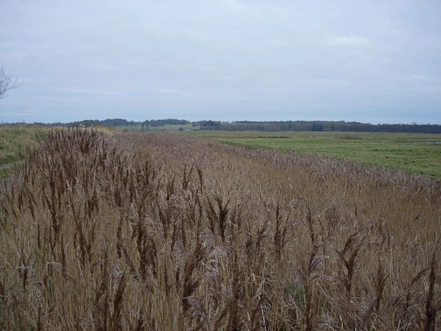
Buckenham, Norfolk Broads
Winter geese, wigeon and lapwings; the winter rook and jackdaw roost
Decide if the visit fits.
Last checked 18 October 2026.
RSPB notice checked 18 October 2026: the viewing hide near the river is closed for the time being. Use the public track and bank views; no reopening date is given.
Opening and charges information · checked .
Stay nearby →Reserve overview
Winter geese, wigeon and lapwings; the winter rook and jackdaw roost
Eight checks for a smoother visit.
Conditions change: check the operator and transport notices before travelling.
January: typically begin on Station-to-river public track for Wigeon and White-fronted Goose, then return to RSPB car park beside Buckenham station before dusk for the permitted Rook and Jackdaw watch.
February: usually a useful winter-wildfowl month. Compare Wigeon along Station-to-river public track with Pintail from River Yare public riverbank path, keeping a comfortable turning point before the short day ends.
March: typically Lapwings and Redshanks become more noticeable from Station-to-river public track. Look for remaining Wigeon without expecting winter goose flocks to stay throughout spring. The riverside hide is closed.
April: usually use Station-to-river public track for Lapwing and Snipe. Watch display from the permitted route rather than following birds into the wet grassland or looking for nests.
May: typically breeding-wader behaviour is the main interest: Lapwing and Redshank from Station-to-river public track. Choose a quiet early daylight watch and leave enough room for farm and management vehicles.
June: usually a patient look across the grazing marsh from Station-to-river public track can find Lapwing and Snipe. River Yare public riverbank path offers a wider Oystercatcher watch when the surface is safe.
July: typically compare Lapwing flocks from Station-to-river public track with Oystercatcher from River Yare public riverbank path. The reserve’s open landscape is a place for scanning, not an invitation to enter grazing fields.
August: usually check Station-to-river public track for Lapwing and passing Black-tailed Godwit, using the latest reports to decide whether a pool watch is worth extending. No closed-hide access is needed.
September: typically Teal and early Wigeon begin to add interest around pools viewed from Station-to-river public track. Black-tailed Godwit may share exposed mud; water levels change the most useful standing position.
October: usually the winter emphasis returns, with Wigeon and Pink-footed Goose from Station-to-river public track. Rooks and Jackdaws can be watched later from RSPB car park beside Buckenham station without approaching roost trees.
November: typically make an afternoon wetland watch for Wigeon and White-fronted Goose along Station-to-river public track, then be back at RSPB car park beside Buckenham station before dusk for corvid arrivals.
December: usually a compact wildfowl-and-corvid visit works well: Shoveler and Teal from Station-to-river public track, then Rook and Jackdaw flight from the official station-side car-park position. Carry a torch for your own return.
Best conditions: Our choice is a calm winter afternoon on the public track followed by a return to the operator’s car-park corvid viewpoint before dusk. Typically this open marsh is much colder in wind than the sheltered woodland at neighbouring Strumpshaw. A telescope helps with distant wildfowl, but binoculars suffice for overhead corvid flight. Light and scope ratings are editorial. The riverbank may flood; the closed hide is not a weather refuge.
The RSPB table checked on 18 October 2026 lists adult admission, child admission and parking as free for members and non-members. The opening calendar gives 24-hour reserve access. Parking is at Buckenham railway station, with an additional informal area nearby that the RSPB warns can become muddy in winter. Use the marked spaces without obstructing railway access or local residents. The RSPB's current facilities page says the viewing hide near the river is closed for the time being. Plan your birdwatch around the public track and bank views, with outdoor clothing for a stationary watch in the exposed marsh landscape. Check the reserve's latest notices and the weather before travelling, especially after prolonged rain. The charges-page instruction to pay at a visitor centre is generic wording: Buckenham has no staffed visitor centre, and the actual tariff table is free.
Access times: Reserve: Open24hours on the operator calendar, subject to flooding, signs and responsible use of public routes. · Hides: Riverside hide closed for the time being. Do not plan a visit around its shelter or accessible entrance. · Car park: Station-side RSPB parking is the official winter rook-roost viewpoint. No separate gate schedule was published; avoid blocking the station approach or neighbouring properties. · Dawn access: yes. Operator opening information.
The approach from the railway station brings you directly to the reserve edge. Begin with the view across the grazing marsh before continuing down the vehicle track towards the river. This is an open landscape, so use binoculars to locate birds before committing to a longer walk. A telescope helps separate ducks and geese that are feeding beyond the nearer ditches. The RSPB describes approximately three miles of trails along riverbank footpaths and says a trail map is available from neighbouring Strumpshaw Fen. Choose a clear public route beside the Yare, keeping out of grazing fields and management access. The riverbank perspective adds moving boats, reed edges and a different angle across the wet grassland. Pause where the path allows others to pass comfortably, rather than blocking a narrow section with a tripod. Two-hour plan: spend an unhurried first watch on the station-to-river track, then take a short riverbank section if conditions suit. Turn with enough time for a second scan across the fields on the return. In winter, a two-hour afternoon visit can instead focus on wildfowl followed by the rook and jackdaw gathering from the station-side car park. Keep a torch for the ordinary landward return, without shining it into roosting wildlife. Full-day plan: begin with the marsh and riverbank route in the morning and use the map to select a comfortable turning point. Take food and a drink break, then return to the most productive stretch of public track for a different view of feeding birds. A longer Yare Valley day can include Strumpshaw Fen as a separate visit with its own admission and opening arrangements. Finish with the winter roost only when the return journey leaves a safe margin.
Use the linked reserve map and directions with current access notices. Species are typical seasonal targets. Light and telescope advice reflects our choice of viewpoint.
The permitted winter corvid flight view above the reserve
Operator’s official rook-roost watching position. Keep parking and pedestrian access clear; do not move towards the roost woodland.
Winter: Rook, Jackdaw
Autumn: Rook, Jackdaw
Light: either. Scope: not needed.
Grazing marsh, ditches and wet pools beside the approach
Firm but uneven vehicle track, with potholes and winter puddles. Stay out of fields and management tracks.
Winter: Wigeon, Teal, Shoveler, Pink-footed Goose, White-fronted Goose
Spring: Lapwing, Redshank, Snipe
Summer: Lapwing, Snipe
Autumn: Wigeon, Teal, Black-tailed Godwit
Light: either. Scope: useful.
The river and a broader view across the grazing marsh
Unsurfaced paths may be muddy or partly flooded. Use only the public route and turn back if unsafe.
Winter: Pintail, Ruff, Mute Swan, Hen Harrier
Spring: Lapwing, Redshank, Hen Harrier
Summer: Oystercatcher
Autumn: Pintail, Black-tailed Godwit, Hen Harrier
Light: either. Scope: essential.
The marsh from a currently unavailable covered hide
CLOSED for the time being according to the RSPB facilities page. No target, itinerary or accessible-space promise relies on using it.
Light: either. Scope: useful.
| Spot | Overlooks | Key species by season | Best light | Scope | Tide |
|---|---|---|---|---|---|
| RSPB car park beside Buckenham stationOperator’s official rook-roost watching position. Keep parking and pedestrian access clear; do not move towards the roost woodland. | The permitted winter corvid flight view above the reserve | Winter: Rook, Jackdaw Autumn: Rook, Jackdaw | either | not needed | — |
| Station-to-river public trackFirm but uneven vehicle track, with potholes and winter puddles. Stay out of fields and management tracks. | Grazing marsh, ditches and wet pools beside the approach | Winter: Wigeon, Teal, Shoveler, Pink-footed Goose, White-fronted Goose Spring: Lapwing, Redshank, Snipe Summer: Lapwing, Snipe Autumn: Wigeon, Teal, Black-tailed Godwit | either | useful | — |
| River Yare public riverbank pathUnsurfaced paths may be muddy or partly flooded. Use only the public route and turn back if unsafe. | The river and a broader view across the grazing marsh | Winter: Pintail, Ruff, Mute Swan, Hen Harrier Spring: Lapwing, Redshank, Hen Harrier Summer: Oystercatcher Autumn: Pintail, Black-tailed Godwit, Hen Harrier | either | essential | — |
| Riverside viewing hide (closed)CLOSED for the time being according to the RSPB facilities page. No target, itinerary or accessible-space promise relies on using it. | The marsh from a currently unavailable covered hide | — | either | useful | — |
Month chips show typical presence or our preferred viewing season. Choose birds that suit the time of your visit.
Season: Winter Rook and Jackdaw gathering; typically the colder autumn and winter months. Numbers and flight paths vary, and no numerical peak is promised.. Arrival time: Be at the RSPB car park beside Buckenham station before dusk, after any daylight marsh walk. This is a natural arrival period, not a published clock-time performance. No fixed advance-arrival interval is stated by the operator.. Use the official station-side RSPB car-park viewpoint and leave entrances clear. Stay away from the roost woodland. No booking requirement for an independent car-park watch was found; any organised walk has its own advertised booking terms, which must be checked for its year. The riverside hide remains closed.
The track towards the riverside hide is firm but uneven, with potholes and large winter puddles identified by the RSPB. The other routes are mainly unsurfaced and can become muddy or partly flooded. These details matter more than the reserve's generally level appearance: the open marsh can be difficult for a wheelchair, scooter or pushchair after wet weather. The closed hide was described as wheelchair-accessible when open, but its former access specification does not establish a usable watch there now. Discuss the current station-side track and a suitable turning point with the RSPB if step-free access is important. It may be possible to enjoy a shorter open-air scan without undertaking the full bank walk, depending on the individual and conditions. There is no accessible toilet on the reserve. The RSPB currently directs visitors needing an accessible or Changing Places facility to Norwich, around eleven miles away. Ordinary toilets at Strumpshaw Fen are a separate facility with their own visiting arrangements. Plan that stop before the marsh outing rather than treating the nearby reserve as an always-open convenience.
Buckenham has cycle racks but no visitor centre, café or shop, and no reserve toilets. The RSPB directs visitors to Strumpshaw Fen for visitor services, refreshments and ordinary toilet facilities. Carry food and drinks when planning a longer marsh walk, and bring a bag to remove litter. A telescope and weatherproof layer are useful for watching the open fields while stationary. There is no staffed reception at Buckenham to store belongings or supply equipment during the visit.
Assistance dogs and other dogs on leads are welcome at all times under the RSPB's published rule. Keep a dog beside you on the public route, away from grazing livestock and feeding wildfowl. Stop well back if birds become alert, and take all dog waste away from the marsh.
Buckenham station is immediately beside the reserve approach, but the train service is limited. Greater Anglia's Wherry Lines timetable must be checked for the exact day and return: do not assume every Norwich–Great Yarmouth or Lowestoft train calls here. Where a requested stop is shown, follow the operator's instructions for boarding and alighting. An alternative is a pre-arranged taxi from Brundall or Norwich with a fixed collection point. The RSPB identifies First Bus Green Line 16 on the Brundall–Strumpshaw road, with the stop at the Long Lane/Stone Road junction approximately 1.5 miles from the reserve. First's current Green Line page provides the timetable from 30 August 2026. Follow the mapped public road approach via Stone Road, Low Road and Station Road, allowing separately for that walk. Use the bus or train's actual travel-date pattern and consider the available daylight for the rural final leg. A winter roost can end after a convenient service has departed, so arrange the return around the watch you really intend to make.
Useful bases for an early start.
Booking.com links are affiliate links: we may earn a commission at no extra cost to you. How these links work.
About 11.3 miles by road, roughly 20 minutes’ drive to the reserve arrival point (OSRM, measured 18 October 2026; an estimate without live traffic).
Measured driving route · 18 October 2026. Map estimates exclude live traffic.
A base in Norwich suits a longer break that includes RSPB Buckenham Marshes.Find places to stay in Norwich on Booking.comAbout 3.1 miles by road, roughly 6 minutes’ drive to the reserve arrival point (OSRM, measured 18 October 2026; an estimate without live traffic).
Measured driving route · 18 October 2026. Map estimates exclude live traffic.
A base in Brundall suits a longer break that includes RSPB Buckenham Marshes.Find places to stay in Brundall on Booking.comAbout 5.3 miles by road, roughly 9 minutes’ drive to the reserve arrival point (OSRM, measured 18 October 2026; an estimate without live traffic).
Measured driving route · 18 October 2026. Map estimates exclude live traffic.
A base in Acle suits a longer break that includes RSPB Buckenham Marshes.Find places to stay in Acle on Booking.comExplore Norfolk’s full guides and smaller birding sites
The RSPB Buckenham Marshes pages provide the official visitor information and directions from Brundall. For detailed route conditions or the status of the riverside hide, use the neighbouring Strumpshaw Fen reserve team's contact information through the RSPB. The published Buckenham address is Yarmouth Road, Norwich, Norfolk, NR13 4HW, while the visitor approach is beside the railway station. Obtain the reserve trail map before attempting a longer riverbank route, and keep the transport operator's contact separate for timetable or station-assistance questions.
Check RSPB Strumpshaw: separately labelled Buckenham and Cantley recent birds. irregular list; no observation dates supplied Reports show what has been seen, not what will be.
Follow the BTO Birders’ Code and give wildlife space.
RSPB Buckenham Marshes: Free entry and parking.
RSPB Buckenham Marshes: Assistance dogs and other dogs on leads are welcome at all times under the RSPB's published rule.
RSPB Buckenham Marshes: Winter wildfowl and roost flights; spring marsh birds.
RSPB Buckenham Marshes: These details matter more than the reserve's generally level appearance: the open marsh can be difficult for a wheelchair, scooter or pushchair after wet weather.
RSPB Buckenham Marshes: Buckenham station is immediately beside the reserve approach, but the train service is limited.
Shorter stops within 15 miles in a straight line. Use the operator’s arrival directions for the journey.
Rockland St Mary · Reedbeds, grazing marsh, wet woodland and open water
The Covey, Surlingham · Open fen, reedbed, wet woodland and broads
Brundall · Meadow, pond and scrub
Brundall · Wet woodland and fen
Surlingham · Reedbeds, fen, pools and grazing marsh
Brundall · Young woodland, orchard and flower-rich grassland
Brundall · Young woodland and farmland edges
Between Upton and South Walsham, near Acle · Reedbeds · Woodland · Grassland
Thorpe St Andrew, eastern Norwich · Lakes · Reedbeds · Grassland
Ranworth village, Norfolk Broads · Lakes · Woodland · Reedbeds
Trowse, Norwich · Open water and woodland
Thorpe Hamlet, Norwich · Woodland
Bure Marshes, near Wroxham · wetland · woodland
Norwich · Woodland and heathland
Near Ludham and the River Thurne · wetland · grassland
Marston Lane, Norwich · Broadleaved woodland on former chalk workings
Ludham · Wetland and woodland
Filby and Rollesby, north of Great Yarmouth · Lakes · Reedbeds · Woodland
Eaton, Norwich · Wetland and grassland
Near Hoveton, Norfolk Broads · Reedbeds · Woodland · Lakes
Mile Cross and Wensum, Norwich · Grassland · Reedbeds · Woodland
Irstead and Neatishead, near Hoveton · Lakes · Woodland · Reedbeds
West Earlham, Norwich · Mature urban broadleaved woodland
West Norwich, River Yare · Wetland and grassland
Marsh Lane, Worlingham · Grazing marsh, wet woodland, fen, scrub and river
West Somerton, near Winterton-on-Sea · Lakes · Reedbeds · Grassland
Horsey · wetland · grassland
Winterton-on-Sea · coast · heathland · grassland
Between Horsford and Felthorpe · Woodland · Heathland · Grassland
Ashwellthorpe, southeast of Wymondham · Woodland
Burgh-next-Aylsham, Brampton, Oxnead and Buxton · wetland · grassland · woodland
Skeyton, near North Walsham · grassland · woodland
Heath Road, near Hevingham · Heathland · Woodland
Nearby complete guides.
Stops with a purpose: use one as a contrasting habitat or weather-proof Plan B. Distances are straight-line estimates, not road journeys.