Short entry0.7 miles away
Southwick Coast
Solway coast between Caulkerbush and Sandyhills Bay · Wooded sea cliffs, meadow and saltmarsh
 the ai birderBirding near me
The AI Birder · one-page field sheet
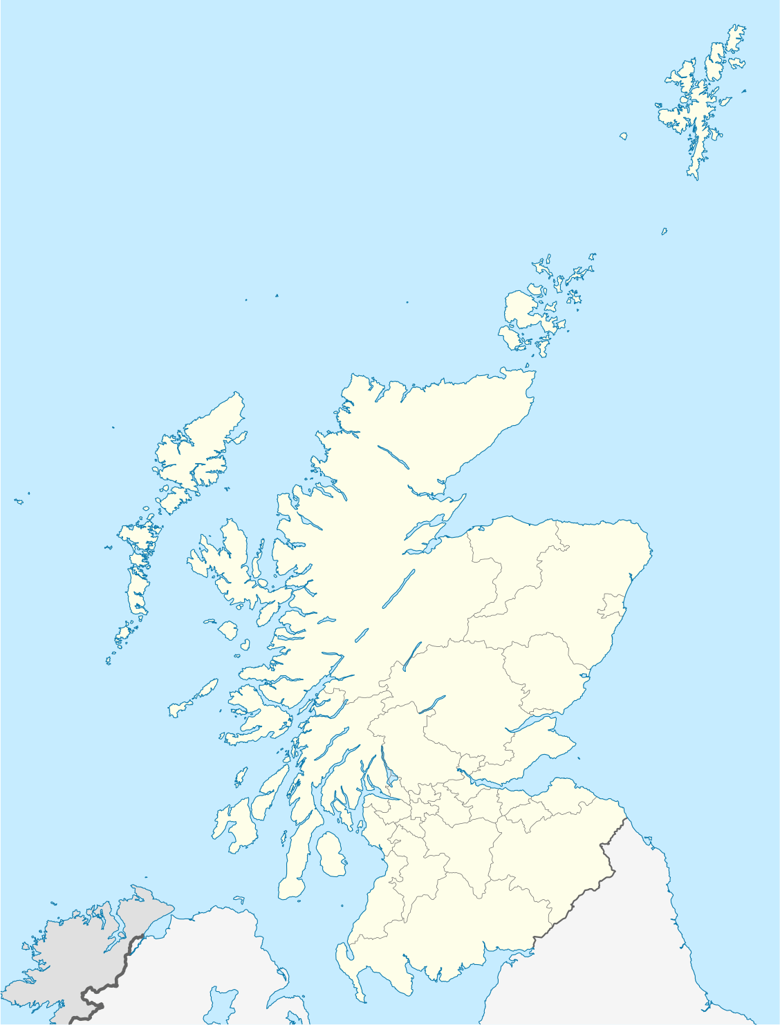
Southwick, Dumfries and Galloway, Scotland · DG2 8AH · DG2 8AH

Barnacle Goose · Lapwing · Marsh Harrier · Wigeon · Teal · Pintail
Meida Hide · Bruaich Hide · Visitor Centre viewing window · Wetland Trail woodland and grassland sections · Coastal Trail public beach section
Check current access, hide closures and operator notices before travelling. Seasonal birds are possibilities, not promised sightings. Keep to authorised routes and give wildlife space.
Opening and charges checked 2026-10-25. Operator: https://www.rspb.org.uk/days-out/reserves/mersehead
Full guide and current source links: https://aibirder.co.uk/reserves/rspb-mersehead
SC 08 · RSPB reserve guide
Southwick, Dumfries and Galloway, Scotland · DG2 8AH
Large winter flocks of Barnacle Geese gather across the Solway fields and wetlands, while spring brings displaying Lapwings, woodland song and the chance to hear Natterjack Toads after dark.
Decide if the visit fits.
Last checked 18 October 2026.
Opening and charges information · checked .
Stay nearby →Reserve overview
Large winter flocks of Barnacle Geese gather across the Solway fields and wetlands, while spring brings displaying Lapwings, woodland song and the chance to hear Natterjack Toads after dark.
Eight checks for a smoother visit.
Conditions change: check the operator and transport notices before travelling.
January: typically look for Barnacle Goose and Pintail from Bruaich Hide. Use a scope for distant wetland birds and check flood information before leaving home. Reserve access does not establish that every hide or vehicle entrance is available throughout the night. February: typically look for Gadwall and Little Grebe from Bruaich Hide. An actual February 2026 operator-group visit supports these local winter birds. Give the water and reed margins a patient scan rather than treating a first quiet window as an empty reserve. March: typically look for Lapwing and Skylark from Wetland Trail woodland and grassland sections. Listen from the public Wetland Trail as spring activity builds. Watch displaying birds from the route and keep fields, reeds and any alarm-calling birds out of the walking plan. April: typically look for Shelduck and Redshank from Meida Hide. Settle at Meida Hide and let feeding birds come into view. Water levels depend on reserve conditions as well as rain, so a seasonal recommendation cannot promise suitable exposed mud. May: typically look for Song Thrush and Goldfinch from Wetland Trail woodland and grassland sections. Choose a calmer morning for listening along hedges and woodland. Binoculars are more useful here than a distant-water scope, and a hidden singer does not need to be approached. June: typically look for Lapwing and Mallard from Meida Hide. Watch from the official hide without following adults towards vegetation or nests. A short sustained wetland session leaves time for woodland birds without requiring a full coastal circuit. July: typically look for Little Grebe and Gadwall from Bruaich Hide. Use a quiet hide watch and compare open water with cover. Check paths after heavy rain; a published all-year reserve season does not override flooding or a temporary closure sign. August: typically look for Ringed Plover and Oystercatcher from Coastal Trail public beach section. Only take the coastal route when current tide and access conditions allow. Scan from established public ground and resist walking after a bird that keeps moving away along the beach. September: typically look for Snipe and Teal from Meida Hide. Autumn water levels determine the available feeding edges. Check the latest local records and scan slowly from Meida Hide rather than assuming the same shallow pool looks identical between visits. October: typically look for Tree Sparrow and Yellowhammer from Visitor Centre viewing window. The operator’s actual October 2024 report documents these feeding-station birds. Use the centre during its opening hours and keep the window watch separate from any proposed late wetland visit. November: typically look for Wigeon and Shoveler from Meida Hide. A compact freshwater plan is useful when wind or tide makes the shore unsuitable. Contact the reserve after heavy rain or surge conditions; do not use the beach as an improvised diversion. December: typically look for Chaffinch from the Visitor Centre viewing window, adding Barnacle Goose from Bruaich Hide when the approach is safe. Watch nearby wetland and the feeding station from the visitor window, with distant geese checked separately from Bruaich Hide if conditions permit. Any Starling outing must follow current operator advice without publishing a roost location.
Best conditions: Our choice is a calm, clear winter wetland watch with time for a separate woodland pause. Scope distant geese and ducks from the hides; binoculars suit the feeding station and hedges. Strong winds, tidal surges and heavy rain can flood the reserve. Contact the operator before travel in those conditions and use an open freshwater route rather than assuming the beach remains passable.
2026 prices checked on 18 October: reserve admission is free for adults and children. Parking costs £5 for non-members and is free for RSPB members. The official charges page says advance booking is unnecessary. Paid guided events have their own booking arrangements; ordinary reserve entry does not imply a place on an event. The October opening page lists the nature reserve open 24 hours and visitor centre 10:00–16:00. Plan use of the building within that separate window, particularly during a winter visit that extends towards dusk. The car park is reached by the signed approach from the coast road. Check the RSPB's current access updates, weather and tides before travelling: flooding and tidal surges can affect the reserve and its approach.
Access times: Reserve: October 2026 calendar lists reserve open 24 hours, subject to flooding and tidal restrictions on the coastal trail. · Hides: Two public hides confirmed; independent daily unlocking hours not published in the checked facilities page. Visitor Centre viewing window 10am–4pm in October calendar. · Car park: Operator describes visitor-centre parking but no independent vehicle-gate timetable was verified; ask before relying on dawn or late access. · Dawn access: partly. Operator opening information.
The Wetland Trail is approximately two miles, or three kilometres, with two hides overlooking the wetland. It suits a visit built around patient observation of the pools and adjacent fields. The Coastal Trail is longer at around two-and-a-half miles, or four kilometres, bringing the Solway shore and beach into the day. Tide restrictions apply to that route, so make the coastal decision before leaving the main reserve area rather than treating the beach as an automatic extension. Two-hour plan: spend the opening fifteen minutes orientating yourself from the visitor-centre area and locating the busiest fields. Follow the Wetland Trail towards the hides, giving Meida or Bruaich a substantial first watch. Scan the complete pool before studying one target species, then move only when you have understood the feeding and resting groups. Return by the signed route, leaving time to revisit a field that held geese or displaying waders. This editorial plan favours a few sustained stops over a hurried attempt to cover the coast as well. Full-day plan: use the first part of the morning for the wetland and farmland views, when bird activity and light usually make identification easier. After a break, add the Coastal Trail only if current access advice and tide allow. The beach offers a very different horizon from the pools, with distant birds requiring careful scanning. Return to a wetland hide later and compare the scene with the morning. Autumn and winter visitors can keep the final daylight for goose movement or an advised Starling viewpoint. Carry binoculars and consider a telescope for distant flocks. Read a whole group before approaching another viewpoint: birds lifting together may reveal a passing raptor, but repeatedly flushing resting birds wastes energy they need for feeding. Remain on marked routes, respect closed areas and keep clear of soft intertidal ground.
Use the linked reserve map and directions with current access notices. Species are typical seasonal targets. Light and telescope advice reflects our choice of viewpoint.
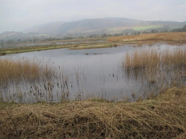
Shallow freshwater pools, reeds and wet grassland
Ramped approach; hide access track can be muddy. Confirm any flood restriction.
Winter: Lapwing, Wigeon, Teal, Shoveler, Mallard, Snipe, Water Rail, Redshank, Shelduck, Marsh Harrier
Spring: Lapwing, Wigeon, Teal, Shoveler, Mallard, Snipe, Water Rail, Redshank, Shelduck, Marsh Harrier
Summer: Lapwing, Mallard, Snipe, Water Rail, Redshank, Shelduck, Marsh Harrier
Autumn: Lapwing, Wigeon, Teal, Shoveler, Mallard, Snipe, Water Rail, Redshank, Shelduck, Marsh Harrier
Light: either. Scope: useful.
Freshwater pools, reed edges and wet fields
Operator says ramped step-free hides; linked access survey records a small step at Bruaich. Confirm individual access needs.
Winter: Barnacle Goose, Pintail, Gadwall, Little Grebe
Spring: Barnacle Goose, Pintail, Gadwall, Little Grebe
Summer: Gadwall, Little Grebe
Autumn: Barnacle Goose, Pintail, Gadwall, Little Grebe
Light: either. Scope: useful.
Feeding station and nearby wetland
Step-free centre; October calendar lists 10am–4pm; staffing and flood conditions affect services.
Winter: Tree Sparrow, Chaffinch, Yellowhammer
Spring: Tree Sparrow, Chaffinch, Yellowhammer
Summer: Tree Sparrow, Chaffinch, Yellowhammer
Autumn: Tree Sparrow, Chaffinch, Yellowhammer
Light: either. Scope: not needed.
Woodland, hedges, grazed fields and wetland edges
Wide hard main trail, narrower muddy hide spurs; remain on signed routes.
Winter: Linnet, Song Thrush, Goldcrest, Goldfinch
Spring: Linnet, Skylark, Song Thrush, Goldcrest, Goldfinch
Summer: Linnet, Skylark, Song Thrush, Goldcrest, Goldfinch
Autumn: Linnet, Skylark, Song Thrush, Goldcrest, Goldfinch
Light: either. Scope: not needed.
Solway intertidal sand, mud and shoreline
Tide-dependent coastal trail with soft grass/sand and narrow kissing gates. Do not follow birds onto mud.
Winter: Ringed Plover, Oystercatcher, Curlew
Spring: Ringed Plover, Oystercatcher, Curlew
Summer: Ringed Plover, Oystercatcher, Curlew
Autumn: Ringed Plover, Oystercatcher, Curlew
Light: either. Scope: essential.
Tide: Check local tide and surge warnings before entering the coastal route; high water can restrict access.
| Spot | Overlooks | Key species by season | Best light | Scope | Tide |
|---|---|---|---|---|---|
| Meida HideRamped approach; hide access track can be muddy. Confirm any flood restriction. | Shallow freshwater pools, reeds and wet grassland | Winter: Lapwing, Wigeon, Teal, Shoveler, Mallard, Snipe, Water Rail, Redshank, Shelduck, Marsh Harrier Spring: Lapwing, Wigeon, Teal, Shoveler, Mallard, Snipe, Water Rail, Redshank, Shelduck, Marsh Harrier Summer: Lapwing, Mallard, Snipe, Water Rail, Redshank, Shelduck, Marsh Harrier Autumn: Lapwing, Wigeon, Teal, Shoveler, Mallard, Snipe, Water Rail, Redshank, Shelduck, Marsh Harrier | either | useful | — |
| Bruaich HideOperator says ramped step-free hides; linked access survey records a small step at Bruaich. Confirm individual access needs. | Freshwater pools, reed edges and wet fields | Winter: Barnacle Goose, Pintail, Gadwall, Little Grebe Spring: Barnacle Goose, Pintail, Gadwall, Little Grebe Summer: Gadwall, Little Grebe Autumn: Barnacle Goose, Pintail, Gadwall, Little Grebe | either | useful | — |
| Visitor Centre viewing windowStep-free centre; October calendar lists 10am–4pm; staffing and flood conditions affect services. | Feeding station and nearby wetland | Winter: Tree Sparrow, Chaffinch, Yellowhammer Spring: Tree Sparrow, Chaffinch, Yellowhammer Summer: Tree Sparrow, Chaffinch, Yellowhammer Autumn: Tree Sparrow, Chaffinch, Yellowhammer | either | not needed | — |
| Wetland Trail woodland and grassland sectionsWide hard main trail, narrower muddy hide spurs; remain on signed routes. | Woodland, hedges, grazed fields and wetland edges | Winter: Linnet, Song Thrush, Goldcrest, Goldfinch Spring: Linnet, Skylark, Song Thrush, Goldcrest, Goldfinch Summer: Linnet, Skylark, Song Thrush, Goldcrest, Goldfinch Autumn: Linnet, Skylark, Song Thrush, Goldcrest, Goldfinch | either | not needed | — |
| Coastal Trail public beach sectionTide-dependent coastal trail with soft grass/sand and narrow kissing gates. Do not follow birds onto mud. | Solway intertidal sand, mud and shoreline | Winter: Ringed Plover, Oystercatcher, Curlew Spring: Ringed Plover, Oystercatcher, Curlew Summer: Ringed Plover, Oystercatcher, Curlew Autumn: Ringed Plover, Oystercatcher, Curlew | either | essential | Check local tide and surge warnings before entering the coastal route; high water can restrict access. |
Month chips show typical presence or our preferred viewing season. Choose birds that suit the time of your visit.
The operator explicitly makes Coastal Trail access dependent on tides and warns of tidal-surge flooding. Check Southerness Point predictions and current reserve advice before taking the shore route; use the freshwater hides if access is restricted. No numeric safe height or universal high-tide window is verified.
UKHO EasyTide: Southerness Point — nearby UKHO prediction station · RNLI tide safety
The RSPB describes the Wetland Trail as broad and hard surfaced, while the approaches to hides narrow and can become muddy. The Coastal Trail includes soft grass and sand and two narrow kissing gates. It has no stiles, but that does not make the full route suitable for every wheelchair or pushchair. Choose equipment and distance with the actual surfaces in mind. The visitor centre occupies one level, with a step-free entrance over a slight threshold and a viewing window. Two Blue Badge spaces are about twenty metres from the building. The operator identifies additional parking nearer the hides; arrange that option with the team before relying on it for a visit. Accessible toilets and baby changing usable from a seated position are in the centre. The RSPB's general description calls both hide approaches ramped and step-free. Its linked AccessAble assessment should be consulted for the detailed entrance measurements, especially if small thresholds or a heavy door would prevent independent access. Explain your equipment width and transfer needs when contacting the reserve. A shorter out-and-back wetland visit is a reasonable editorial choice when muddy connections or stamina make a longer circuit uncomfortable.
Hot drinks and snacks are available when the visitor centre is staffed; it is not a full-service café. The RSPB identifies Dalbeattie, about ten miles away, for hot food, so bring lunch if spending the day on the reserve. Picnic tables are beside the centre, including provision for a wheelchair user. There are cycle racks and coach-parking arrangements. Take water and weatherproof layers for the exposed coast. Barbecues are prohibited because of the fire risk to people and habitat.
Visitors with assistance dogs are welcome at RSPB Mersehead, including throughout its visitor routes. During the ground-nesting season, 1 April–15 August, the RSPB asks owners to keep other dogs close, preferably on a short lead. Clean up after your dog and maintain effective control around wildlife, livestock and visitors throughout the year. Avoid allowing a dog to approach feeding birds or wetland nesting areas.
Bus 372 links Dumfries and Dalbeattie through the Solway villages. The RSPB identifies Caulkerbush, also described as Southwick, as the nearest stop, approximately one mile from the visitor centre. The council's published 372 timetable includes Southwick and separate day-of-week columns. Check the actual journey date and return service rather than assuming every bus continues to every coastal village. Dumfries is the nearest railway station. Continue by bus and the final walk, or prearrange a taxi to the reserve. When carrying a telescope or travelling with limited mobility, a booked road transfer can make the rural last section more practical. Include the station-to-bus interchange and a waiting margin in the itinerary. Drivers from Dumfries follow the A710 through New Abbey, Kirkbean and Mainsriddle; the reserve is signed before Caulkerbush. From Dalbeattie, approach through the Colvend coast and look for the turn beyond Caulkerbush bridge. The final mile is single track with passing places. Keep those places clear and drive slowly for walkers, cyclists and oncoming vehicles.
Useful bases for an early start.
Booking.com links are affiliate links: we may earn a commission at no extra cost to you. How these links work.
About 16.4 miles by road, roughly 26 minutes’ drive from the mapped town-centre point to the reserve approach. OpenStreetMap estimate for Dumfries, measured 18 October 2026. For the Dumfries journey linked to RSPB Mersehead, leave additional time for traffic and reaching your precise accommodation address.
Measured driving route · 2026-10-18. Map estimates exclude live traffic.
Rail arrivals and a wider range of city services.Find places to stay in Dumfries on Booking.comAbout 10.3 miles by road, roughly 16 minutes’ drive from the mapped town-centre point to the reserve approach. OpenStreetMap estimate for Dalbeattie, measured 18 October 2026. For the Dalbeattie journey linked to RSPB Mersehead, leave additional time for traffic and reaching your precise accommodation address.
Measured driving route · 2026-10-18. Map estimates exclude live traffic.
A town base for the Colvend coast.Find places to stay in Dalbeattie on Booking.comAbout 7.8 miles by road, roughly 13 minutes’ drive from the mapped town-centre point to the reserve approach. OpenStreetMap estimate for Kippford, measured 18 October 2026. For the Kippford journey linked to RSPB Mersehead, leave additional time for traffic and reaching your precise accommodation address.
Measured driving route · 2026-10-18. Map estimates exclude live traffic.
A coastal village stay beside the Urr estuary.Find places to stay in Kippford on Booking.comExplore Dumfries and Galloway’s full guides and smaller birding sites
Contact the reserve on 01387 780579 or mersehead@rspb.org.uk. The visitor address is Mersehead Nature Reserve, Southwick, Dumfries, DG2 8AH. For accessibility advice, describe the specific route and hide you want to use, together with any equipment requirements. The RSPB facilities page directs visitors to RSPB Dumfries and Galloway updates for flooding and access information. Use those current operator notices to decide whether a coastal extension is sensible, especially after heavy rain or strong onshore wind.
Check RSPB actual Mersehead winter bird report. dated February 2026 visit Reports show what has been seen, not what will be.
Follow the BTO Birders’ Code and give wildlife space.
RSPB Mersehead: Free entry; parking £5 for non-members, free for RSPB members.
RSPB Mersehead: Visitors with assistance dogs are welcome at RSPB Mersehead, including throughout its visitor routes.
RSPB Mersehead: Autumn and winter geese · spring breeding waders.
RSPB Mersehead: It has no stiles, but that does not make the full route suitable for every wheelchair or pushchair.
RSPB Mersehead: Bus 372 links Dumfries and Dalbeattie through the Solway villages.
Shorter stops within 15 miles in a straight line. Use the operator’s arrival directions for the journey.
Solway coast between Caulkerbush and Sandyhills Bay · Wooded sea cliffs, meadow and saltmarsh
Hollands and Castle Corner, south of Dumfries · Merse, reedbed, mudflats and coastal woodland
Nearby complete guides.
Stops with a purpose: use one as a contrasting habitat or weather-proof Plan B. Distances are straight-line estimates, not road journeys.