


Short entry5.3 miles away
Bowling Green and Goosemoor
Topsham · Estuary and wetland
 the ai birderBirding near me
The AI Birder · one-page field sheet
Dawlish Warren, Devon, England · EX7 0NF · EX7 0NF

Little Grebe · Stonechat · Sanderling · Sandwich Tern · Moorhen · Mallard
Main Pond — viewing platform · Entrance Bushes — public main track · Promenade and resort-side beach — before Groyne 9 · Greenland Lake — signed public path
Check current access, hide closures and operator notices before travelling. Seasonal birds are possibilities, not promised sightings. Keep to authorised routes and give wildlife space.
Opening and charges checked 2026-10-18. Operator: https://southeastdevonwildlife.org.uk/areas/dawlish-warren
Full guide and current source links: https://aibirder.co.uk/reserves/dawlish-warren-national-nature-reserve
EN 106 · Teignbridge District Council and Devon Wildlife Trust reserve guide
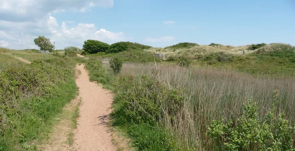
Dawlish Warren, Devon, England · EX7 0NF
An Exe Estuary birdwatching day where tide planning and keeping clear of resting flocks matter more than distance walked.
Decide if the visit fits.
Last checked 18 October 2026.
Opening and charges information · checked .
Stay nearby →Reserve overview
An Exe Estuary birdwatching day where tide planning and keeping clear of resting flocks matter more than distance walked.
Eight checks for a smoother visit.
Conditions change: check the operator and transport notices before travelling.
January: January usually offers Sanderling, Turnstone and Rock Pipit along the accessible resort-side shore before Groyne 9, with Great Crested Grebe offshore in suitable visibility. Add the Main Pond viewing platform for Little Grebe and Moorhen. The former bird hide is closed: a winter visit must not depend on reaching it.
February: In February, compare Sanderling and Turnstone from the promenade or a safe open beach position before Groyne 9. At the Main Pond viewing platform, listen for Water Rail without entering the reedbed. Keep clear of all resting flocks and let the available safe public ground determine how long you stay.
March: March typically combines lingering offshore Great Crested Grebes with the return of Sandwich Terns, watched from the promenade or resort-side beach. Listen for Chiffchaff along the main track by the Entrance Bushes. Read the current tide and erosion notices before adding any beach walking to this compact plan.
April: April usually brings more migration interest: try the signed Greenland Lake path for Wheatear and Stonechat, and the public seafront for Sandwich Tern. Chiffchaff sings around the Entrance Bushes. Use existing paths throughout; a bird disappearing into scrub is a reason to wait quietly rather than follow it.
May: In May, Sanderling passage can make a careful beach watch rewarding from the permitted resort-side shore. Combine that with Stonechat and Linnet from the signed Greenland Lake public path. The Main Pond platform offers Little Grebe. Do not seek breeding locations or assume that a published annual record describes today’s birds.
June: June favours a short early watch for Little Grebe and Moorhen from the Main Pond platform, followed by Stonechat from the signed Greenland Lake path. Sandwich Terns can be watched fishing offshore from the public promenade. Leave families of birds undisturbed and return along the same open public routes.
July: In July, watch Sandwich Tern and Gannet offshore from the promenade, then compare Pied Wagtail and Rock Pipit on the resort-side shore when it is quiet. A Greenland Lake path stop may add Stonechat. The recording group notes summer absences of Little Grebe, so do not build the entire day around that species.
August: August usually brings returning Sanderling and Turnstone to the wider shore and Sandwich Terns offshore. Use the safe resort-side beach or promenade; there is no need to approach a high-tide gathering. The signed Greenland Lake public path can provide Stonechat and a first look for autumn Wheatear.
September: September often combines offshore Sandwich Terns with Sanderling and Turnstone on the beach. Watch from the public promenade or safe resort-side beach before Groyne 9. Add the Greenland Lake public path for Stonechat and Wheatear, then the Entrance Bushes main track for Chiffchaff. Avoid routes into the bight refuge.
October: October usually suits a mix of coastal and sheltered watching: Sanderling and Rock Pipit from the resort-side shore, Stonechat from the Greenland Lake public path and Chiffchaff from the Entrance Bushes track. Little Grebe may again be at the Main Pond platform. Storms can change the available access overnight.
November: In November, start at the Main Pond viewing platform for Little Grebe, Moorhen and a possible Water Rail, then scan offshore for Great Crested Grebe from the promenade. For shorebirds, choose a safe resort-side beach watch. Never try to reach the closed hide to improve a view of winter flocks.
December: December usually rewards a short visit built around good visibility and a safe tide. Compare Turnstone and Sanderling before Groyne 9, then use the Main Pond platform for Little Grebe and Robin. If wind or spray makes the seafront uncomfortable, shorten the day rather than continue towards the eroded outer Warren.
Best conditions: Our choice is a dry day with clear offshore visibility and a tide plan that leaves a safe return on public ground. Use the promenade for sea scans when swell or water levels make the beach unsuitable. For small birds, the sheltered Entrance Bushes track and Main Pond platform can be more productive than an exposed walk. Avoid prolonged staring into low sun; move only between open public positions. High tide does not justify approaching resting flocks.
Access information checked 18 October 2026: public paths serve the reserve, with signed restrictions protecting wildlife and visitors. South East Devon Wildlife warns that erosion has closed some routes, that the former dune-ridge route to the bird hide is no longer available, and that the end of the sand spit is restricted at high tide. Follow the current notices rather than planning on that old route. The Exe Estuary partnership identifies joint ownership by Teignbridge District Council and Devon Wildlife Trust. Council car parks serve the Warren; use the machine's tariff for your intended stay, as the reserve information does not give a current parking price. Entry to the open reserve paths is separate from resort attractions. Read the official access page before travelling because erosion, weather and wildlife restrictions can change the walk.
Access times: Reserve: Outer Warren public access is generally open; changing erosion, refuge boundaries and high water restrict particular routes. Inner Warren golf-course land requires permission. · Hides: Bird hide inaccessible for the foreseeable future: no public approach via the former dune-ridge path. · Car park: Council public car parks; a single current gate timetable was not verified. Check car-park notices separately. · Dawn access: partly. Operator opening information.
Begin at the established visitor approach and read the access and tide notices before choosing the day's route. Dawlish Warren is a narrow, changing sand spit: a map that once showed a circuit does not establish that the same circuit remains safe. The main track towards the visitor centre and beyond is the useful starting spine. Use only the signed open paths to reach permitted views of the estuary. The wildlife refuge includes the bight, mudflats and saltmarsh, so exposed ground is not an invitation to take a shortcut. Two-hour plan, our suggestion: spend the first few minutes checking tide information and the current path signs. Walk a modest section of the main route, pause for a sustained estuary scan, then return by an open path with time to compare birds closer to the visitor approach. In winter, avoid the beach beyond Groyne 9 for roughly three hours either side of medium to spring high tides, as the operator asks. Full-day plan, our suggestion: place the estuary watch at the centre of the day, with an earlier sheltered scrub session and a lunch break back towards the resort. Revisit a safe viewpoint as the tide changes instead of adding distance towards the spit. A second look from the same place often reveals different feeding birds. Leave the beach to the birds when resting flocks occupy it, and do not use the former dune-ridge line to try to reach a hide. A simple fieldcraft exercise here is to watch one feeding group for several minutes and note how far apart the birds stand, how quickly they move and whether they probe or pick at the surface. Those differences can be clearer than plumage in dull weather. Keep your own position steady and let the water bring the action into view. If a rising tide reduces the available resting space, increase your distance instead of trying to hold the closest viewing position. On a busy coast, choosing the least disruptive public outlook is part of having a successful day, especially when several other visitors are also watching.
Use the linked reserve map and directions with current access notices. Species are typical seasonal targets. Light and telescope advice reflects our choice of viewpoint.
Freshwater pond, open water and reed margins
Use the established public viewing platform and signed approach; sand and gates can affect accessibility.
Winter: Little Grebe, Moorhen, Water Rail
Spring: Little Grebe, Mallard, Moorhen
Summer: Little Grebe, Moorhen
Autumn: Little Grebe, Water Rail, Robin
Light: either. Scope: not needed.
Scrub, trees and the vegetation beside the visitor approach
Remain on the open public track; do not enter scrub or follow birds into cover.
Winter: Robin, Chiffchaff, Cirl Bunting
Spring: Chiffchaff, Blackbird, Cirl Bunting
Summer: Chiffchaff, Linnet, Cirl Bunting
Autumn: Chiffchaff, Greenfinch, Linnet, Cirl Bunting
Light: either. Scope: not needed.
The open sea, permitted beach and groynes
Use the open promenade or a safe resort-side beach position; do not extend into the wildlife refuge or an eroded path.
Winter: Sanderling, Turnstone, Rock Pipit, Great Crested Grebe
Spring: Sandwich Tern, Sanderling, Gannet
Summer: Sandwich Tern, Gannet, Pied Wagtail
Autumn: Sanderling, Turnstone, Sandwich Tern, Rock Pipit
Light: either. Scope: useful.
Tide: Check the Exmouth predictions and beach notices; abandon a beach watch before water removes the safe return.
Open dune grassland and scrub around the seasonally wet hollow
Watch from the currently signed open public path; check the on-site access map, grazing gates and sand.
Winter: Stonechat
Spring: Stonechat, Linnet
Summer: Stonechat, Linnet
Autumn: Stonechat, Wheatear, Greenfinch
Light: either. Scope: not needed.
| Spot | Overlooks | Key species by season | Best light | Scope | Tide |
|---|---|---|---|---|---|
| Main Pond — viewing platformUse the established public viewing platform and signed approach; sand and gates can affect accessibility. | Freshwater pond, open water and reed margins | Winter: Little Grebe, Moorhen, Water Rail Spring: Little Grebe, Mallard, Moorhen Summer: Little Grebe, Moorhen Autumn: Little Grebe, Water Rail, Robin | either | not needed | — |
| Entrance Bushes — public main trackRemain on the open public track; do not enter scrub or follow birds into cover. | Scrub, trees and the vegetation beside the visitor approach | Winter: Robin, Chiffchaff, Cirl Bunting Spring: Chiffchaff, Blackbird, Cirl Bunting Summer: Chiffchaff, Linnet, Cirl Bunting Autumn: Chiffchaff, Greenfinch, Linnet, Cirl Bunting | either | not needed | — |
| Promenade and resort-side beach — before Groyne 9Use the open promenade or a safe resort-side beach position; do not extend into the wildlife refuge or an eroded path. | The open sea, permitted beach and groynes | Winter: Sanderling, Turnstone, Rock Pipit, Great Crested Grebe Spring: Sandwich Tern, Sanderling, Gannet Summer: Sandwich Tern, Gannet, Pied Wagtail Autumn: Sanderling, Turnstone, Sandwich Tern, Rock Pipit | either | useful | Check the Exmouth predictions and beach notices; abandon a beach watch before water removes the safe return. |
| Greenland Lake — signed public pathWatch from the currently signed open public path; check the on-site access map, grazing gates and sand. | Open dune grassland and scrub around the seasonally wet hollow | Winter: Stonechat Spring: Stonechat, Linnet Summer: Stonechat, Linnet Autumn: Stonechat, Wheatear, Greenfinch | either | not needed | — |
Month chips show typical presence or our preferred viewing season. Choose birds that suit the time of your visit.
Plan around a safe public viewing position and return route, not a close approach to a roost. The operator asks everyone to avoid the beach north-east of Groyne 9 for about three hours either side of medium-to-spring high water in winter. The hide remains inaccessible.
South East Devon Wildlife says the main track from the car park towards the visitor centre and beyond can suit terrain-capable wheelchairs and buggies. This is a qualified description: soft sand covers much of the site and the kissing gates used around grazing ponies can be an obstacle. The promenade and boardwalk provide another approach, but drifting sand can affect short sections there too. Choose a short out-and-back route based on the actual surface on the day. Anyone using a mobility scooter should establish whether their equipment can manage the gates and sand before attempting an outer route. Ask the countryside team about the most suitable current viewpoint, accessible parking and toilet provision when planning a visit with specific needs. A storm-eroded path should never be treated as a manageable alternative simply because it looks shorter. For visual or hearing needs, a companion who can interpret notices and help locate the safest return path may make an exposed coastal visit more comfortable. Allow extra clothing and rest time, since remaining still in estuary wind can be tiring even when the walking distance is modest.
The visitor centre provides the natural point for information about the reserve, but plan food and drink independently of its opening. The neighbouring resort has visitor services separate from the wildlife paths. Bring a telescope if you have one, a waterproof layer, and something to protect optics from blown sand. Keep lunch stops on the public visitor side, carry litter out and leave the refuge free of picnics or abandoned equipment.
Dogs are excluded beyond Groyne 9 throughout the year. Other parts of the reserve have their own signed requirements, shown on the official dog map. Use the map before setting off, keep a dog away from all bird flocks and choose a permitted resort-side walk if its needs conflict with your birdwatching route.
Dawlish Warren station makes this one of the more practical Devon coastal reserves to approach by rail. Use GWR's current timetable to plan the service and return connection, then follow the public route through the Warren towards the visitor area. The railway and the resort approach are easier to identify than a remote countryside lane, but the final paths still require the access checks described above. Do not substitute a walk along an exposed sea wall for a cancelled rail connection during bad weather. Drivers should follow signs for Dawlish Warren's public car parks and check whether their chosen car park allows the intended duration. A car-free day works best with a modest birding circuit and a return train comfortably within daylight. Keep an alternative sheltered activity in mind if storm conditions make the coast unsuitable, rather than pressing on towards the outer reserve to fill the time.
Useful bases for an early start.
Booking.com links are affiliate links: we may earn a commission at no extra cost to you. How these links work.
About 2 miles by road, roughly 7 minutes’ drive to the public visitor approach. OSRM measured the Dawlish journey for Dawlish Warren National Nature Reserve on 18 October 2026; the estimate excludes live traffic.
Measured driving route · 2026-10-18. Map estimates exclude live traffic.
A nearby Dawlish base for an unhurried start at Dawlish Warren National Nature Reserve.Find places to stay in Dawlish on Booking.comAbout 4.9 miles by road, roughly 14 minutes’ drive to the public visitor approach. OSRM measured the Teignmouth journey for Dawlish Warren National Nature Reserve on 18 October 2026; the estimate excludes live traffic.
Measured driving route · 2026-10-18. Map estimates exclude live traffic.
Compare stays in Teignmouth if this measured approach fits your wider route.Find places to stay in Teignmouth on Booking.comAbout 12.2 miles by road, roughly 29 minutes’ drive to the public visitor approach. OSRM measured the Exeter journey for Dawlish Warren National Nature Reserve on 18 October 2026; the estimate excludes live traffic.
Measured driving route · 2026-10-18. Map estimates exclude live traffic.
Consider Exeter when its location suits the other places in your itinerary.Find places to stay in Exeter on Booking.comExplore Devon’s full guides and smaller birding sites
Use South East Devon Wildlife's Dawlish Warren pages for the access map and current wildlife guidance. The Exe Estuary Management Partnership also publishes the Dawlish Warren Code, including the division of ownership and refuge rules. Teignbridge District Council is the contact for its car parks and countryside facilities. When asking about access, identify the actual path or viewing area you hope to use and your planned date, especially if an older guide mentions the dune-ridge hide route.
Check Dawlish Warren Recording Group — latest sightings. most days; weather and observer coverage vary Reports show what has been seen, not what will be.
Follow the BTO Birders’ Code and give wildlife space.
Dawlish Warren National Nature Reserve: Price not published by operator; council parking charges apply separately.
Dawlish Warren National Nature Reserve: Dogs are excluded beyond Groyne 9 throughout the year.
Dawlish Warren National Nature Reserve: Year-round · autumn and winter waders.
Dawlish Warren National Nature Reserve: South East Devon Wildlife says the main track from the car park towards the visitor centre and beyond can suit terrain-capable wheelchairs and buggies.
Dawlish Warren National Nature Reserve: Dawlish Warren station makes this one of the more practical Devon coastal reserves to approach by rail.
Shorter stops within 15 miles in a straight line. Use the operator’s arrival directions for the journey.
Topsham · Estuary and wetland
Between Maidencombe and Shaldon · Coastal grassland, scrub, farmland and woodland
Nearby complete guides.
Stops with a purpose: use one as a contrasting habitat or weather-proof Plan B. Distances are straight-line estimates, not road journeys.