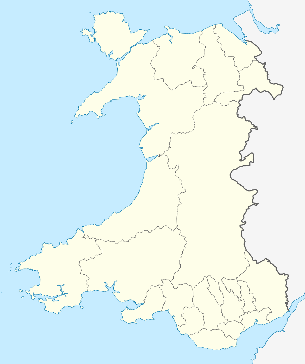

Short entry10.4 miles away
Cemlyn Nature Reserve
Cemlyn Bay, near Cemaes · Coastal lagoon, shingle ridge, grassland and rocky headland
 the ai birderBirding near me
The AI Birder · one-page field sheet
Holyhead, Isle of Anglesey, Wales · LL65 1YH · LL65 1YH

Chough · Peregrine · Gannet · Herring Gull · Raven · Rock Pipit
Ellin’s Tower and outside viewpoint · Puffin Trail · Dragonfly Trail · World War II Lookout
Check current access, hide closures and operator notices before travelling. Seasonal birds are possibilities, not promised sightings. Keep to authorised routes and give wildlife space.
Opening and charges checked 2026-10-25. Operator: https://www.rspb.org.uk/days-out/reserves/south-stack
Full guide and current source links: https://aibirder.co.uk/reserves/rspb-south-stack
WA 06 · RSPB reserve guide
Holyhead, Isle of Anglesey, Wales · LL65 1YH
Guillemots and Razorbills are the main breeding-cliff spectacle, alongside a small Puffin colony; Choughs use the coastal grassland throughout the year.
Decide if the visit fits.
Last checked 18 October 2026.
Opening and charges information · checked .
Stay nearby →Reserve overview
Guillemots and Razorbills are the main breeding-cliff spectacle, alongside a small Puffin colony; Choughs use the coastal grassland throughout the year.
Eight checks for a smoother visit.
Conditions change: check the operator and transport notices before travelling.
January: Typically choose Puffin Trail for a short Chough and Raven watch, with Rock Pipit near Ellin’s Tower and outside viewpoint. This is a clifftop winter outing rather than an auk-colony visit. Keep the route short if exposed wind makes standing uncomfortable.
February: Chough usually remains the main attraction along Puffin Trail, while Fulmar may begin revisiting the cliffs below Ellin’s Tower and outside viewpoint. The tower itself opens seasonally. Check wind and use the outside public outlook only when conditions allow safe watching.
March: Usually scan from Ellin’s Tower and outside viewpoint for returning Guillemot and Razorbill, without expecting summer numbers on a particular date. Dragonfly Trail adds Meadow Pipit and Skylark. Listen from the path and keep away from territorial birds.
April: Typically start at Ellin’s Tower and outside viewpoint for Guillemot, Razorbill and a careful Puffin search among them. The smaller Puffin presence needs patience and a telescope. Add Chough from Puffin Trail rather than treating one missed bird as a failed day.
May: Usually give Ellin’s Tower and outside viewpoint the longest stop for auks, Kittiwake and Fulmar. World War II Lookout offers a separate distant Gannet scan. Keep safely behind edges and allow other visitors space to use shared viewpoints.
June: Guillemot and Razorbill typically dominate Ellin’s Tower and outside viewpoint; Puffin remains a smaller-number possibility. Dragonfly Trail supplies Stonechat, Meadow Pipit and Linnet interest away from the busiest seabird watch. Carry water and let birds feed undisturbed.
July: Usually watch the early part of the month for Guillemot, Razorbill and Kittiwake from Ellin’s Tower and outside viewpoint. Departure timing varies and empty ledges later are normal. Chough on Puffin Trail provides another reason to visit after the colony changes.
August: Stonechat and Meadow Pipit usually make Dragonfly Trail our choice, with distant Gannet from World War II Lookout when visibility is good. Do not expect a spring Puffin scene. A modest landbird walk can suit the season better than prolonged searching for absent auks.
September: Typically try a short Manx Shearwater scan from Ellin’s Tower and outside viewpoint, then use Dragonfly Trail for Stonechat and Linnet. Movement depends on conditions. Recent Anglesey records provide context, not a reason to expose yourself to dangerous weather.
October: Chough and Raven usually reward Puffin Trail while Rock Pipit adds interest at Ellin’s Tower and outside viewpoint. Check seasonal tower arrangements independently of reserve opening. For autumn passage, watch patiently from existing public routes and avoid crossing heath after a bird.
November: Usually plan around Chough on Puffin Trail and Stonechat from Dragonfly Trail. A short Herring Gull comparison at Ellin’s Tower and outside viewpoint can sharpen identification. Limited daylight and gusts decide the outing more than the length of your target list.
December: Typically favour a compact Puffin Trail Chough watch, adding Raven and Meadow Pipit where they appear naturally. Ellin’s Tower and outside viewpoint may offer Rock Pipit when safe. Leave before poor light makes the rocky or stepped return difficult to judge.
Best conditions: Our choice is a clear, relatively calm morning for the west-facing seabird outlooks, typically reducing glare and making a telescope easier to hold steady. Light and scope ratings are editorial map-based guidance, not operator guarantees. Strong wind can make exposed cliffs unsuitable; use the Holyhead forecast and choose a shorter inland-facing trail or postpone.
Opening and charges checked on 18 October 2026. Reserve admission is free for adults and children, with no advance booking required for an ordinary visit. The published 2026 non-member parking charges are £3.50 for up to one hour or £7.50 all day; RSPB members, Blue Badge holders and motorbikes park free. Coaches and buses pay £8 for up to an hour or £20 all day. Parking charges apply throughout the year and overnight parking or camping is prohibited. The October opening calendar lists the reserve and car parks as open 24 hours, and the visitor centre, shop, café and toilets as 10:00–17:00. Ellin’s Tower opens seasonally, so do not depend on indoor viewing without confirming the arrangements for your date. Check the RSPB calendar, weather and current access notices before travelling. The lighthouse is a separate visit: reserve admission and parking do not establish its opening or ticket arrangements.
Access times: Reserve: RSPB calendar checked 19 October 2026 lists 24-hour reserve access. Use public and permitted paths only. · Hides: Ellin’s Tower opens seasonally; confirm staffed hours before relying on indoor viewing. Outside public viewpoints remain subject to safe conditions. · Car park: Listed open 24 hours on the checked October calendar. Visitor hub and toilets are separately listed 10:00–17:00. · Dawn access: yes. Operator opening information.
The RSPB map identifies two useful short circuits. Puffin Trail is 1.2 kilometres, with a suggested walking time of about 30 minutes, passing the Tŷ Mawr hut circles and reaching the Ellin’s Tower area. Dragonfly Trail is 1.6 kilometres, with a suggested time of about 45 minutes, taking in ponds and wider coastal views. Add birdwatching stops to those walking estimates: a short map distance can easily provide the focus of a much longer visit. South Stack’s main birdwatching locations are viewpoints rather than a conventional series of wetland hides. Ellin’s Tower and the outdoor viewpoints let visitors examine the breeding cliffs, while the heathland routes show the open habitat used by Choughs. Use the map to connect these places without cutting across the vegetation. A telescope is useful for comparing distant auks, but binoculars are often easier for following birds flying across the cliff face. Two-hour plan: begin at the visitor hub and choose a suitable mapped approach to the tower viewpoints. Spend the largest part of the visit watching the cliffs and sea below, identifying Guillemots and Razorbills before searching for Puffins. Finish with a short grassland watch on the return, looking for Choughs feeding rather than only checking the sky. In autumn or winter, give more of the time to heathland and coastal residents. Full-day plan: combine a morning cliff watch with the Puffin Trail, a meal break and the Dragonfly Trail in suitable weather. Revisit the tower area when the light changes, rather than assuming a single scan has revealed every bird. In summer, the ponds and flowering heath add interest between seabird watches; in winter, a second sheltered pause may be more useful than completing every path. The coastal setting makes flexibility sensible: shorten the walk when exposed conditions make careful observation difficult. Keep children close, stay on the landward side of barriers and secure bags before lifting binoculars. Follow any seasonal exclusion signs protecting nesting areas.
Use the linked reserve map and directions with current access notices. Species are typical seasonal targets. Light and telescope advice reflects our choice of viewpoint.
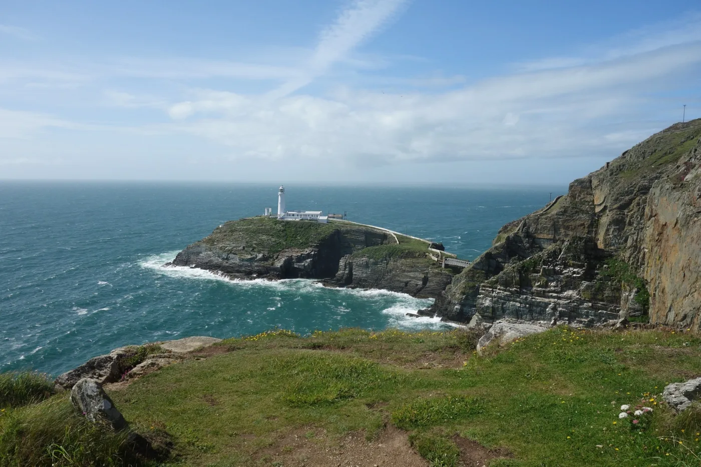
Seabird cliffs and open sea from the official tower outlook and adjacent public viewpoint
Tower opens seasonally and has internal stairs. Outside viewpoint has a wide flat path from Ellin’s Tower car park; do not assume upper-floor wheelchair access.
Winter: Herring Gull, Rock Pipit, Peregrine
Spring: Guillemot, Razorbill, Puffin, Fulmar, Peregrine
Summer: Kittiwake, Guillemot, Razorbill, Manx Shearwater, Peregrine
Autumn: Manx Shearwater, Rock Pipit, Peregrine
Light: morning. Scope: useful.
Clifftop airspace and grazed coastal grass from the signed Puffin Trail
The full 1.2 km circuit has steep steps; use the outside tower path for a shorter alternative. No nest directions are supplied.
Winter: Chough, Raven
Spring: Chough, Raven
Summer: Chough, Raven
Autumn: Chough, Raven
Light: either. Scope: not needed.
Heath, grassland and ponds from the mapped Dragonfly Trail
Rocky and steep sections, natural steps and gradients up to 15%; stay on the permitted trail.
Winter: Stonechat, Meadow Pipit
Spring: Stonechat, Meadow Pipit, Skylark, Linnet
Summer: Stonechat, Meadow Pipit, Linnet
Autumn: Stonechat, Meadow Pipit, Linnet
Light: either. Scope: not needed.
Open sea from the official mapped historic lookout on the public route
Open exposed outlook; a safe sheltered alternative is preferable during strong wind. Watch from the public route, without entering unsafe structures.
Spring: Gannet
Summer: Gannet
Autumn: Gannet
Light: morning. Scope: essential.
| Spot | Overlooks | Key species by season | Best light | Scope | Tide |
|---|---|---|---|---|---|
| Ellin’s Tower and outside viewpointTower opens seasonally and has internal stairs. Outside viewpoint has a wide flat path from Ellin’s Tower car park; do not assume upper-floor wheelchair access. | Seabird cliffs and open sea from the official tower outlook and adjacent public viewpoint | Winter: Herring Gull, Rock Pipit, Peregrine Spring: Guillemot, Razorbill, Puffin, Fulmar, Peregrine Summer: Kittiwake, Guillemot, Razorbill, Manx Shearwater, Peregrine Autumn: Manx Shearwater, Rock Pipit, Peregrine | morning | useful | — |
| Puffin TrailThe full 1.2 km circuit has steep steps; use the outside tower path for a shorter alternative. No nest directions are supplied. | Clifftop airspace and grazed coastal grass from the signed Puffin Trail | Winter: Chough, Raven Spring: Chough, Raven Summer: Chough, Raven Autumn: Chough, Raven | either | not needed | — |
| Dragonfly TrailRocky and steep sections, natural steps and gradients up to 15%; stay on the permitted trail. | Heath, grassland and ponds from the mapped Dragonfly Trail | Winter: Stonechat, Meadow Pipit Spring: Stonechat, Meadow Pipit, Skylark, Linnet Summer: Stonechat, Meadow Pipit, Linnet Autumn: Stonechat, Meadow Pipit, Linnet | either | not needed | — |
| World War II LookoutOpen exposed outlook; a safe sheltered alternative is preferable during strong wind. Watch from the public route, without entering unsafe structures. | Open sea from the official mapped historic lookout on the public route | Spring: Gannet Summer: Gannet Autumn: Gannet | morning | essential | — |
Month chips show typical presence or our preferred viewing season. Choose birds that suit the time of your visit.
These are elevated cliff and heath viewpoints, not a tidal crossing. Choose safe wind and visibility rather than an invented high-water window; check Holyhead predictions only as coastal context. Lighthouse access is a separate operation.
Access checked on 18 October 2026. A wide, level route from Ellin’s Tower car park reaches the outdoor viewpoint in front of the tower. The alternative connection from the visitor centre includes 25 uneven steps. The full Puffin Trail has 74 steps and gradients up to 12%; Dragonfly Trail reaches 15% and includes natural steps of varying height. The coastal sections can be narrow, rocky and uneven, so choose the actual route rather than relying on its short distance. Ellin’s Tower has level entry through a wide doorway but a staircase to the upper viewing area; the ground-floor space accommodates one wheelchair. The visitor centre has a one-centimetre threshold and a heavy door, with its facilities on one level. The access map lists hearing loops in the shop and café, and warns that the hub can be busy and noisy, especially June–September. Seven Blue Badge spaces are distributed between the visitor-centre and Ellin’s Tower parking areas. An accessible toilet is in the visitor centre; no toilet is provided at the tower. Wheelchair-suitable picnic tables are available. Discuss particular turning-space, doorway or viewing-height needs with the reserve team before deciding which approach to use.
The visitor hub contains a shop and café, with hot and cold drinks and snacks. Indoor seating, sheltered outdoor seating and open-air seats provide alternatives for a break between watches. Picnic areas allow visitors to bring food, and baby-changing provision is available in the visitor-centre toilets. Binoculars can be hired from the shop. Cycle parking is marked on the reserve map. Carry water for the headland walk and take litter home if a bin is unavailable. Barbecues are prohibited because of the fire risk to the heath and its wildlife.
Dogs are welcome on the reserve and in Ellin’s Tower, kept under control and on the paths; the trail map specifies leads. Pet dogs are excluded from the café and visitor centre, while assistance dogs are welcome throughout. Water bowls are provided at the visitor-centre and tower doors. Keep dogs away from grazing livestock, cliff edges and feeding Choughs.
Travel information checked on 18 October 2026. Holyhead is the nearest railway station, with taxis providing the final connection. The RSPB explicitly states that no public transport reaches the reserve, so there is no reserve bus route number to quote. Arrange an outward taxi and return pickup before leaving the town; a headland visit should not depend on finding an unbooked vehicle at the end. Tell the operator which car park you intend to use, as the visitor hub and tower approach are different meeting places. Drivers take the A55 into Holyhead and follow the brown signs towards South Stack, which the RSPB describes as about three miles from the town. National Cycle Network Route 8 passes about three miles away, leaving a separate final approach to the reserve. Consider the gradients, exposure and return conditions before choosing to cycle with heavy optics. Stay-base drive figures use OSRM/OpenStreetMap routes measured on 18 October 2026 and exclude live traffic or time spent finding a parking space.
Useful bases for an early start.
Booking.com links are affiliate links: we may earn a commission at no extra cost to you. How these links work.
About 2.8 miles by road, roughly 7 minutes’ drive. OSRM measured the Holyhead journey for RSPB South Stack on 18 October 2026; the estimate excludes live traffic.
Measured driving route · 2026-10-18. Map estimates exclude live traffic.
A rail-and-taxi base close to the reserve.Find places to stay in Holyhead on Booking.comAbout 4.2 miles by road, roughly 10 minutes’ drive. OSRM measured the Trearddur Bay journey for RSPB South Stack on 18 October 2026; the estimate excludes live traffic.
Measured driving route · 2026-10-18. Map estimates exclude live traffic.
A seaside base for a coastal break on Holy Island.Find places to stay in Trearddur Bay on Booking.comAbout 8.3 miles by road, roughly 14 minutes’ drive. OSRM measured the Valley journey for RSPB South Stack on 18 October 2026; the estimate excludes live traffic.
Measured driving route · 2026-10-18. Map estimates exclude live traffic.
A village base for exploring western Anglesey.Find places to stay in Valley on Booking.comExplore Anglesey’s full guides and smaller birding sites
Call the reserve on 01407 762100 or email south.stack@rspb.org.uk. The address is South Stack, Holyhead, Isle of Anglesey, LL65 1YH. The official reserve updates link carries wildlife and event news; book advertised guided walks through the RSPB arrangements. Report wildlife from a named public viewpoint with the date and approximate time. RSPB conservation reporting confirms breeding-season access restrictions in 2025 and 2026, so respect exclusion signs protecting sensitive nesting places. Drones are prohibited from 1 March to 31 July under the published reserve rules.
Check RSPB Wirral group — South Stack observations, June 2026. dated field report Reports show what has been seen, not what will be.
Follow the BTO Birders’ Code and give wildlife space.
RSPB South Stack: Entry free; non-member parking £3.50/hour or £7.50/day; members and Blue Badge holders free.
RSPB South Stack: Dogs are welcome on the reserve and in Ellin’s Tower, kept under control and on the paths; the trail map specifies leads.
RSPB South Stack: Spring seabirds · Chough year-round.
RSPB South Stack: A wide, level route from Ellin’s Tower car park reaches the outdoor viewpoint in front of the tower.
RSPB South Stack: Travel information checked on 18 October 2026.
Shorter stops within 15 miles in a straight line. Use the operator’s arrival directions for the journey.
Cemlyn Bay, near Cemaes · Coastal lagoon, shingle ridge, grassland and rocky headland
Nearby complete guides.
Stops with a purpose: use one as a contrasting habitat or weather-proof Plan B. Distances are straight-line estimates, not road journeys.