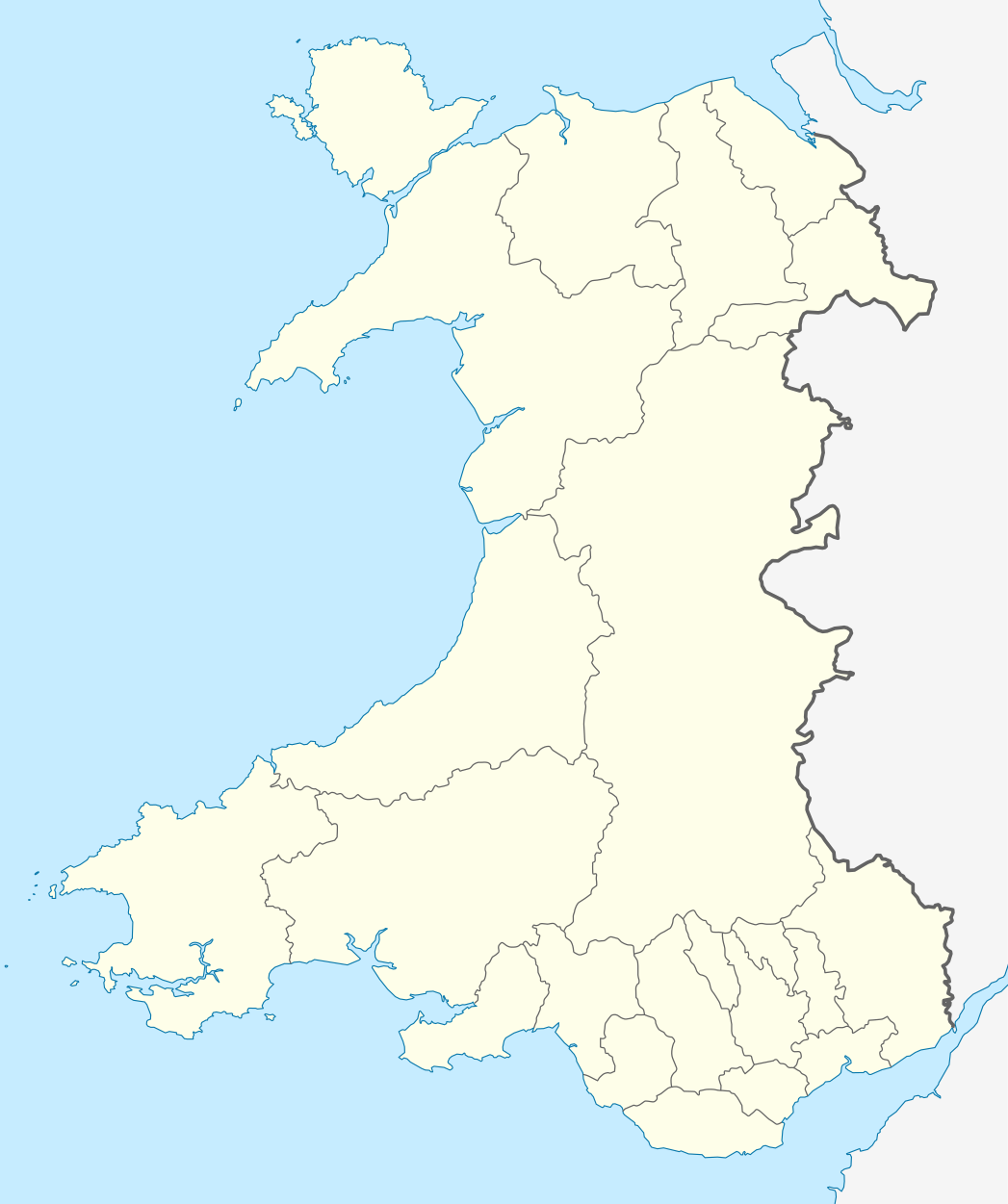
Short entry4.0 miles away
Cemaes Head
West of Poppit Sands, Teifi estuary mouth · Maritime grassland, heath and sea cliffs
 the ai birderBirding near me
The AI Birder · one-page field sheet
Cilgerran, near Cardigan, North Pembrokeshire, Wales · SA43 2TB · SA43 2TB

Kingfisher · Mallard · Curlew · Cetti’s Warbler · Moorhen · Grey Heron
Kingfisher Hide · Creek Hide · Mallard Hide · Curlew Hide · Marsh Hide · Tree Tops Hide · Wetland Trail · Mapped public viewpoints
Check current access, hide closures and operator notices before travelling. Seasonal birds are possibilities, not promised sightings. Keep to authorised routes and give wildlife space.
Opening and charges checked 2026-10-25. Operator: https://www.welshwildlife.org/nature-reserves/teifi-marshes
Full guide and current source links: https://aibirder.co.uk/reserves/teifi-marshes-nature-reserve
WA 13 · Wildlife Trust of South and West Wales reserve guide
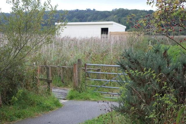
Cilgerran, near Cardigan, North Pembrokeshire, Wales · SA43 2TB
A 107-hectare wetland beside the lower River Teifi, where pools, reedbeds, carr woodland, pasture and tidal mudbanks bring winter Teal, Wigeon, Snipe and Lapwing, breeding Reed, Sedge and Cetti's Warblers, regular Kingfisher activity and occasional Otter encounters. Winter flooding can also draw Water Rails and a large Starling roost, with Peregrines hunting over the marsh.
For the wider context of a falcon watch at Teifi Marshes, read the Peregrine watching guide, which explains the bird’s outline and responsible public watching.
Decide if the visit fits.
Last checked 18 October 2026.
Opening and charges information · checked .
Stay nearby →Reserve overview
A 107-hectare wetland beside the lower River Teifi, where pools, reedbeds, carr woodland, pasture and tidal mudbanks bring winter Teal, Wigeon, Snipe and Lapwing, breeding Reed, Sedge and Cetti's Warblers, regular Kingfisher activity and occasional Otter encounters. Winter flooding can also draw Water Rails and a large Starling roost, with Peregrines hunting over the marsh.
Eight checks for a smoother visit.
Conditions change: check the operator and transport notices before travelling.
January: Typically begin at Kingfisher Hide for a patient pool watch, checking Teal and the reed edge rather than expecting a bird on a particular branch. Curlew Hide offers a separate river view for Curlew and winter Wigeon.
February: Water Rails and Snipe usually make quiet Wetland Trail pauses worthwhile, although birds can remain hidden despite being present. Compare Mallard Hide’s pool with the broader river view from Curlew Hide, keeping the route flexible if winter flooding affects access.
March: Typically listen for Cetti’s Warbler along the Wetland Trail and watch Kingfishers from the public hide. A calm listening session can reveal activity missed during a fast circuit; do not enter reed margins to turn a call into a photograph.
April: Sedge Warblers usually bring spring song to the Wetland Trail, while Shelduck adds an open-water target. Kingfisher Hide provides a different pace between walks; watch feeding behaviour from inside, without looking for a nest site or following a bird upriver.
May: Typically allow an early Wetland Trail circuit for Reed Warbler, Sedge Warbler and Whitethroat. Lesser Whitethroat is a scarcer possibility, supported by reserve records; distinguish its song carefully rather than assuming every similar movement in scrub is the same species.
June: Reed and Sedge Warblers usually remain the listening focus along the Wetland Trail, with Moorhens from Mallard Hide as a closer waterbird comparison. Give Grey Herons a broad public watch from Curlew Hide without investigating the neighbouring breeding colony.
July: Typically combine Kingfisher Hide with a Wetland Trail reedbed session for Reed Warbler and Cetti’s Warbler. Birds can be quieter after spring, so settle in a comfortable public view instead of repeatedly walking towards movement in dense cover.
August: Kingfishers and Moorhens usually offer a useful Kingfisher Hide and Mallard Hide pairing. A patient Wetland Trail stop can still reveal Cetti’s Warbler; reeds and water levels change the view, so an obscured bird is a reason to wait, not leave the path.
September: Typically compare Curlews from Curlew Hide with Kingfishers from Creek Hide as autumn develops. River levels alter feeding opportunities, while freshwater pools offer an alternative; take the tide prediction as planning context rather than a guarantee of birds beside the hide.
October: Teal and Wigeon usually become more relevant from Kingfisher Hide and Curlew Hide. Add a quiet Wetland Trail listen for Cetti’s Warbler, and check actual county reports rather than assuming a rare summer visitor will still be present.
November: Typically combine winter ducks from Curlew Hide with Water Rail possibilities along Wetland Trail margins. The operator highlights winter Starling murmurations; ask the centre about the appropriate public viewpoint and safe evening exit, without following birds into a roost.
December: Winter usually suits an unhurried Kingfisher Hide watch for Teal and a separate Curlew Hide scan for Wigeon and Curlew. Plan any Starling session around current gate arrangements and a daylight arrival; the café’s opening hours do not establish after-dark reserve access.
Best conditions: Our choice is a quiet morning Wetland Trail circuit with long hide stops, then a separate Curlew Hide river watch as the tide changes. Typically light wind helps hear warblers and detect reed-edge Water Rails. Winter flooding may change access. The2025map gives the public hide positions; habitat-to-view bird selections and scope/light advice are editorial, with no fixed perch or sighting promised. Ask the centre before planning a dusk Starling watch.
2026 prices checked on 18 October: admission to the reserve and Welsh Wildlife Centre is free. All-day parking is £5, with free parking for Wildlife Trust members and qualifying residents in SA43 and SA37. Residents need proof of address and the centre's application process. The main current visitor page supersedes older Trust blogs still showing £4 parking. The Welsh Wildlife Centre, Glasshouse Café and gift shop open Wednesday–Sunday, 10:00–16:00. The café is normally closed Mondays and Tuesdays except bank holidays. The reserve page describes year-round visiting excluding national holidays, so check holiday arrangements for the intended date. Consult the Trust's current notices and weather before travelling: water levels and access can change across this wetland.
Access times: Reserve: Operator says all year excluding national holidays; no daily reserve access timetable is published. Confirm evening arrangements with the centre. · Hides: Six named hides on the current map; separate locking hours are not published. Check holiday and flooding restrictions before travel. · Car park: No gate timetable is published. Visitor centre and café normally Wednesday–Sunday10:00–16:00; these are building hours, not a confirmed car-park closing time. · Dawn access: partly. Operator opening information.
The Trust's current map separates four walks: the Wetland Trail is 2.8 kilometres, Explorer Trail 0.75 kilometres, and Woodland and Gorge trails each 1.25 kilometres. A cycle route provides another connection across the reserve towards Cardigan. Choose a route for its habitat rather than simply adding every coloured line into one long circuit. For wetland birds, the hides and connecting reed-edge paths are the main attraction. The current2025operator map names six hides: Tree Tops, Kingfisher, Creek, Mallard, Curlew and Marsh. Older Heron or Pentwd names are not treated as additional current hides. Use the current reserve map and signs to establish the actual route between them. Hide names on an older report can be more useful as a locality clue than as a complete walking instruction. Two-hour plan: start with a wetland hide and give its pool at least twenty minutes. Work slowly along the connecting trail, listening for reedbed calls, then choose a second hide with a different outlook. Spend the final part returning by the signed route and revisiting a promising reed edge. This editorial plan leaves room for a Kingfisher or Water Rail to appear without turning every sighting into a race to the next stop. Full-day plan: devote the morning to the Wetland Trail and several long hide watches. After a break, add the Explorer Trail or a suitable Woodland or Gorge section to compare the open marsh with carr and more enclosed vegetation. Return to a pool later to see how feeding activity has changed. In winter, retain the final daylight for an advised Starling viewpoint and a safe return. Stay on public routes and respect temporary barriers. The river Piliau cuts through the marshes in a narrow but deep channel; observe from the paths rather than following birds towards the water. A telescope helps with distant flocks, while binoculars are better for birds moving quickly along nearby cover.
Use the linked reserve map and directions with current access notices. Species are typical seasonal targets. Light and telescope advice reflects our choice of viewpoint.
Freshwater pool and reed margins from mapped Hide2
One of the six named hides on the2025operator map. Stay inside the hide and leave birds’ feeding approaches clear.
Winter: Teal, Water Rail, Black-tailed Godwit
Spring: Kingfisher, Moorhen
Summer: Kingfisher, Moorhen
Autumn: Kingfisher, Teal
Light: either. Scope: useful.
The tidal creek and its reed-fringed edge from mapped Hide3
Follow the Wetland Trail and current signs. The creek is deep; no bank approach is suggested.
Winter: Curlew, Teal, Black-tailed Godwit
Spring: Kingfisher
Summer: Kingfisher
Autumn: Curlew, Teal
Light: either. Scope: useful.
Tide: Water level changes the exposed mud. No operator-published optimum height or fixed interval was verified.
Freshwater pond beside the Wetland Trail, mapped Hide4
Mapped official hide. These are reserve-wide pond species selected editorially for habitat, not a claim of a fixed daily assemblage.
Winter: Mallard, Teal
Spring: Mallard, Moorhen
Summer: Mallard, Moorhen
Autumn: Mallard, Teal
Light: either. Scope: useful.
River Teifi and adjacent tidal marsh from mapped Hide5
The current county report explicitly names this public hide. Distant river birds may need a scope; no riverbank shortcut is proposed.
Winter: Curlew, Lapwing, Wigeon, Black-tailed Godwit, Peregrine
Spring: Curlew, Peregrine
Summer: Grey Heron, Peregrine
Autumn: Curlew, Wigeon, Peregrine
Light: either. Scope: essential.
Tide: Compare exposed river margins as the tide changes; use the public hide rather than following birds onto mud.
Southern marsh from mapped Hide6
Current2025map calls this Marsh Hide. It does not label it Heron or Pentwd; older names are not assumed to describe a separate present-day hide.
Light: either. Scope: useful.
Woodland and the broad reserve landscape from mapped Hide1
Use the signed Woodland Trail approach. The map confirms the hide, but a distinct sourced bird assemblage and step-free access were not established.
Light: either. Scope: useful.
Reedbeds, carr, wetland pools and visible grassland from the signed trail
2.8km route on the current map. The centre identifies four accessible hides on its Wetland Trail; ask which approaches suit your needs after flooding.
Winter: Water Rail, Snipe, Teal, Wigeon, Lapwing
Spring: Sedge Warbler, Reed Warbler, Cetti’s Warbler, Whitethroat, Lesser Whitethroat
Summer: Reed Warbler, Sedge Warbler, Cetti’s Warbler, Shelduck, Moorhen
Autumn: Cetti’s Warbler, Teal, Wigeon
Light: either. Scope: not needed.
Official landscape viewpoints marked around the trail network
Current map shows several unnamed viewpoints. Treat them as a collective inventory, without inventing names, individual species records or a roost approach.
Light: either. Scope: useful.
| Spot | Overlooks | Key species by season | Best light | Scope | Tide |
|---|---|---|---|---|---|
| Kingfisher HideOne of the six named hides on the2025operator map. Stay inside the hide and leave birds’ feeding approaches clear. | Freshwater pool and reed margins from mapped Hide2 | Winter: Teal, Water Rail, Black-tailed Godwit Spring: Kingfisher, Moorhen Summer: Kingfisher, Moorhen Autumn: Kingfisher, Teal | either | useful | — |
| Creek HideFollow the Wetland Trail and current signs. The creek is deep; no bank approach is suggested. | The tidal creek and its reed-fringed edge from mapped Hide3 | Winter: Curlew, Teal, Black-tailed Godwit Spring: Kingfisher Summer: Kingfisher Autumn: Curlew, Teal | either | useful | Water level changes the exposed mud. No operator-published optimum height or fixed interval was verified. |
| Mallard HideMapped official hide. These are reserve-wide pond species selected editorially for habitat, not a claim of a fixed daily assemblage. | Freshwater pond beside the Wetland Trail, mapped Hide4 | Winter: Mallard, Teal Spring: Mallard, Moorhen Summer: Mallard, Moorhen Autumn: Mallard, Teal | either | useful | — |
| Curlew HideThe current county report explicitly names this public hide. Distant river birds may need a scope; no riverbank shortcut is proposed. | River Teifi and adjacent tidal marsh from mapped Hide5 | Winter: Curlew, Lapwing, Wigeon, Black-tailed Godwit, Peregrine Spring: Curlew, Peregrine Summer: Grey Heron, Peregrine Autumn: Curlew, Wigeon, Peregrine | either | essential | Compare exposed river margins as the tide changes; use the public hide rather than following birds onto mud. |
| Marsh HideCurrent2025map calls this Marsh Hide. It does not label it Heron or Pentwd; older names are not assumed to describe a separate present-day hide. | Southern marsh from mapped Hide6 | — | either | useful | — |
| Tree Tops HideUse the signed Woodland Trail approach. The map confirms the hide, but a distinct sourced bird assemblage and step-free access were not established. | Woodland and the broad reserve landscape from mapped Hide1 | — | either | useful | — |
| Wetland Trail2.8km route on the current map. The centre identifies four accessible hides on its Wetland Trail; ask which approaches suit your needs after flooding. | Reedbeds, carr, wetland pools and visible grassland from the signed trail | Winter: Water Rail, Snipe, Teal, Wigeon, Lapwing Spring: Sedge Warbler, Reed Warbler, Cetti’s Warbler, Whitethroat, Lesser Whitethroat Summer: Reed Warbler, Sedge Warbler, Cetti’s Warbler, Shelduck, Moorhen Autumn: Cetti’s Warbler, Teal, Wigeon | either | not needed | — |
| Mapped public viewpointsCurrent map shows several unnamed viewpoints. Treat them as a collective inventory, without inventing names, individual species records or a roost approach. | Official landscape viewpoints marked around the trail network | — | either | useful | — |
Month chips show typical presence or our preferred viewing season. Choose birds that suit the time of your visit.
The reserve includes tidal mudbanks as well as freshwater pools. Watch changing exposed margins from Curlew and Creek Hides; no operator-published optimum tide height or fixed arrival interval was verified. Stay off mudbanks and the deep Piliau channel.
The Trust describes the Welsh Wildlife Centre and Glasshouse Café as wheelchair accessible. Its visitor page identifies four accessible hides on the Wetland Trail, while the official reserve map specifically marks the Explorer Trail and cycle route as suitable for disabled access and pushchairs. These statements apply to particular routes and buildings, rather than promising that every woodland or gorge connection has the same surface. Accessible toilets and dedicated disabled parking are provided. Choose the required drop-off and parking location before committing to a walking loop, especially if using a heavy mobility aid. For a visit centred on one hide, an out-and-back route can make better use of energy than completing every trail. Winter flooding is part of the marsh environment. Ask the centre about the exact route you plan to use and describe the equipment involved, including any width, turning or assistance requirement. A path's nominal distance does not explain how comfortable a wet stretch will feel. The Visit Wales accessibility guide also describes lifts within the centre. Allow extra time for moving between levels, taking a break and positioning comfortably at a viewing window, rather than treating the café and hides as interchangeable access experiences.
The centre provides a gift shop, wildlife displays, toilets and the Glasshouse Café. Lunch service is listed from noon to 14:30, with cakes and refreshments also available. Display rooms can be used for activities and are not always available during school holidays, so build a family visit around the outside reserve rather than depending on a particular exhibition. Play areas add another stopping point. Bring water and a snack for a longer circuit, and take litter home.
Keep dogs on leads throughout the reserve, clear up after them and prevent swimming in open water. Only assistance dogs enter the Welsh Wildlife Centre. Visitors with pets can use the outside balcony when using the café. Give grazing animals room and keep dogs away from feeding or resting birds.
Richards Bros route 430 links Cardigan and Narberth through Cilgerran and Crymych. Its operator timetable lists Cilgerran Cardiff Arms and Pendre, giving a village connection rather than a direct bus to the visitor-centre door. Check the current operating day and return before travelling, then plan the remaining route with the reserve map. Carrying a telescope or travelling with limited mobility may make a prebooked taxi preferable for that last section. Cardigan provides the other practical car-free base, with the mapped walking and cycle connection entering the reserve from the town side. Use the signed public route and allow time for a slower return after a long hide watch. Bus arrivals into Cardigan should be planned separately from the final reserve approach. Drivers enter from Cilgerran, taking the turn before the bridge when heading towards Cardigan and continuing along the single-track approach to the main parking area. Keep passing places clear, expect walkers and cyclists, and select Welsh Wildlife Centre as the destination. The centre and reserve extend well beyond one postcode point, so follow the local signs for the correct entrance.
Useful bases for an early start.
Booking.com links are affiliate links: we may earn a commission at no extra cost to you. How these links work.
About 1.9 miles by road, roughly 11 minutes’ drive from the mapped town-centre point to the visitor approach. OpenStreetMap estimate for Cilgerran, measured 18 October 2026. For the Cilgerran journey linked to Teifi Marshes Nature Reserve, leave additional time for traffic and reaching your precise accommodation address.
Measured driving route · 2026-10-18. Map estimates exclude live traffic.
The nearest village road approach to the visitor centre.Find places to stay in Cilgerran on Booking.comAbout 4.4 miles by road, roughly 16 minutes’ drive from the mapped town-centre point to the visitor approach. OpenStreetMap estimate for Cardigan, measured 18 October 2026. For the Cardigan journey linked to Teifi Marshes Nature Reserve, leave additional time for traffic and reaching your precise accommodation address.
Measured driving route · 2026-10-18. Map estimates exclude live traffic.
Town services and the separate walking connection into the reserve.Find places to stay in Cardigan on Booking.comAbout 11.5 miles by road, roughly 30 minutes’ drive from the mapped town-centre point to the visitor approach. OpenStreetMap estimate for Newcastle Emlyn, measured 18 October 2026. For the Newcastle Emlyn journey linked to Teifi Marshes Nature Reserve, leave additional time for traffic and reaching your precise accommodation address.
Measured driving route · 2026-10-18. Map estimates exclude live traffic.
A Teifi Valley base for a wider inland itinerary.Find places to stay in Newcastle Emlyn on Booking.comExplore Pembrokeshire’s full guides and smaller birding sites
Contact the Welsh Wildlife Centre on 01239 621600 or wwc@welshwildlife.org. Explain which trail or hide you want to use when asking about access, especially if a particular surface or doorway matters. The Trust's visitor-centre page provides current opening and parking arrangements, while its reserve page and downloadable map explain the habitats and routes. Use the centre team for current conditions and any planned evening visit that depends on a particular roost viewpoint or return route.
Check Pembrokeshire Bird Group: datedJune2026county observations. completed monthly archive Reports show what has been seen, not what will be.
Follow the BTO Birders’ Code and give wildlife space.
Teifi Marshes Nature Reserve: Entry free; parking £5/day, free for members and qualifying local residents.
Teifi Marshes Nature Reserve: Keep dogs on leads throughout the reserve, clear up after them and prevent swimming in open water.
Teifi Marshes Nature Reserve: Winter wildfowl and Starlings · spring and summer warblers · rewarding year-round.
Teifi Marshes Nature Reserve: The Trust describes the Welsh Wildlife Centre and Glasshouse Café as wheelchair accessible.
Teifi Marshes Nature Reserve: Richards Bros route 430 links Cardigan and Narberth through Cilgerran and Crymych.
Shorter stops within 15 miles in a straight line. Use the operator’s arrival directions for the journey.
West of Poppit Sands, Teifi estuary mouth · Maritime grassland, heath and sea cliffs
North Pembrokeshire · Ancient oak woodland, wet valleys and small streams
Nearby complete guides.
Stops with a purpose: use one as a contrasting habitat or weather-proof Plan B. Distances are straight-line estimates, not road journeys.