
Short entry3.6 miles away
Rhosili Headland and The Vile
Rhosili village and public headland paths, Gower · Coastal grassland, field margins, heath and sea cliffs
 the ai birderBirding near me
The AI Birder · one-page field sheet
Cwm Ivy, North Gower, Swansea, Wales · SA3 1DJ · SA3 1DJ

Little Egret · Kingfisher · Oystercatcher · Grey Heron · Lapwing · Curlew
Monterey Hide · Cheriton Hide · Whiteford Burrows: signed landward shore path · Cwm Ivy Wood: official hide approach
Check current access, hide closures and operator notices before travelling. Seasonal birds are possibilities, not promised sightings. Keep to authorised routes and give wildlife space.
Opening and charges checked 2026-10-25. Operator: https://www.nationaltrust.org.uk/visit/wales/whiteford-and-north-gower
Full guide and current source links: https://aibirder.co.uk/reserves/whiteford-national-nature-reserve
WA 24 · National Trust reserve guide
Cwm Ivy, North Gower, Swansea, Wales · SA3 1DJ
Watch Cwm Ivy's tidal marsh from two official hides, then choose whether the dunes justify a longer walk.
Decide if the visit fits.
Last checked 18 October 2026.
Opening and charges information · checked .
Stay nearby →Reserve overview
Watch Cwm Ivy's tidal marsh from two official hides, then choose whether the dunes justify a longer walk.
Eight checks for a smoother visit.
Conditions change: check the operator and transport notices before travelling.
January: Typically start in Monterey Hide for Little Egret and Lapwing, then consider Oystercatcher from Whiteford Burrows: signed landward shore path. January county reports provide historical winter evidence, not a forecast of this year’s flock.
February: Usually Cheriton Hide offers a sheltered Kingfisher and Little Egret watch, with Curlew along the landward shore path when weather permits. Choose a safe return route and do not use low tide as permission to enter the estuary.
March: Typically compare Shelduck and Great Crested Grebe from Whiteford Burrows: signed landward shore path, adding Chiffchaff along Cwm Ivy Wood: official hide approach. County March2024 observations support this seasonal mix without guaranteeing another sighting.
April: Usually the signed landward shore path is worth a patient scan for Whimbrel and Ringed Plover, followed by Little Egret from Monterey Hide. Keep a wide gap from feeding birds rather than walking repeatedly through them.
May: Typically watch Dunlin and Whimbrel from Whiteford Burrows: signed landward shore path. Cheriton Hide gives an alternative for Marsh Harrier over the marsh; no nest location or route into marsh habitat is supplied.
June: Usually give Cheriton Hide time for Kingfisher and Monterey Hide for Little Egret. A summer visit should be built around feeding activity and quiet observation, rather than assuming winter sea-duck numbers remain offshore.
July: Typically use Monterey Hide for Grey Heron and Little Egret, adding Chiffchaff on Cwm Ivy Wood: official hide approach. Watch from the permitted path and let birds move through the vegetation naturally.
August: Usually Oystercatcher and Curlew become the shore priorities from Whiteford Burrows: signed landward shore path. Passage timing and tide change the available views; a scope helps identification without advancing towards a flock.
September: Typically compare Dunlin and Curlew from the safe landward shore path, with Kingfisher from Cheriton Hide as a contrasting option. Windy exposed conditions are a good reason to keep the outing to the mapped hide route.
October: Usually start at Monterey Hide for Lapwing and Little Egret, then use Whiteford Burrows: signed landward shore path for Oystercatcher. The returning tide can reduce shore space quickly: stop well before your exit becomes uncertain.
November: Typically Brent Goose and Red-breasted Merganser are worth scanning for from the landward shore path, while Cheriton Hide offers Kingfisher. Watch Hen Harrier from the public hides without seeking a roost; do not follow a hunting bird inland.
December: Usually choose a short daylight visit: Lapwing from Monterey Hide or Little Egret from Cheriton Hide. A longer shore watch for Oystercatcher needs settled weather, a checked tide and enough time for the uphill return.
Best conditions: Our choice is a calm daylight hide visit, with a shore extension only when tide, visibility and return conditions are clear. A telescope helps distant waders and sea ducks; binoculars are easier in the woodland. Light and scope advice is editorial. Watch the changing feeding edge from firm land, leave plenty of space for birds, and never make the offshore lighthouse a walking objective.
Access checked 18 October 2026: the National Trust lists the countryside as open from dawn to dusk. The official Cwm Ivy walk starts at a privately owned car park, where charges apply; this is not a National Trust car park, so membership should not be assumed to cover parking. Its tariff is not given on the Trust's walk page. Use the terms displayed by the landowner and carry a suitable payment option. There is no timed admission ticket described for the countryside walk. The postcode SA3 1DJ identifies the Cwm Ivy walk's start rather than the outer dunes. Read the Trust's current visitor information before travel, since tides, path conditions and estate work can affect the outing.
Access times: Reserve: National Trust countryside calendar says dawn–dusk. Follow public signed routes and local safety or conservation closures. · Hides: The operator describes Monterey and Cheriton as public hides on its mapped walk; no separate locking schedule was verified. Plan within countryside daylight hours. · Car park: Cwm Ivy car park is privately owned and charged, not National Trust. Use its displayed current terms; no verified dawn-opening or overnight entitlement is supplied. · Dawn access: partly. Operator opening information.
The National Trust's Exploring Cwm Ivy walk provides a useful framework: a 1.5-mile route, graded moderate, with an advertised walking allowance of around an hour and a half. Birdwatching easily extends that. The walk descends from the village, follows the signed approach into the woodland, and reaches Monterey hide. Its other branch reaches Cheriton hide through Cwm Ivy woodland. Follow the official route map rather than trying to connect the hides across the marsh. Each outlook gives a different perspective on the tidal habitat. Two-hour plan, our suggestion: walk directly to the first hide at a comfortable pace, settle long enough to identify the common birds, and return by the mapped route. Add the second hide only if the ground and your remaining time make it an enjoyable choice. Full-day plan, our suggestion: begin with the complete Cwm Ivy hide route, take a packed lunch or a village break, then consider a signed continuation towards Whiteford Burrows. Use the dunes and pine woodland as a change of habitat, and return with enough daylight for the uphill approach to the car park. Do not make the offshore lighthouse an objective: the safe public land route already offers a full day. Scan from firm ground and leave saltmarsh channels alone, even at low water. If flocks begin lifting in front of your progress, stop and take the wider permitted path instead of pushing them repeatedly ahead of you. Inside a hide, start with the closest exposed ground before scanning the far marsh. Follow the edges of each visible pool and note whether birds are feeding, bathing or simply resting. This makes a changing tidal view easier to understand than repeatedly counting every bird at once. Keep voices low and leave room at the viewing openings for someone arriving behind you. With a family group, use a landmark such as a visible channel bend to help children find the same bird. The approach woodland also deserves a listening stop: it provides a useful contrast to the distant, open views from the marsh hides.
Use the linked reserve map and directions with current access notices. Species are typical seasonal targets. Light and telescope advice reflects our choice of viewpoint.
Cwm Ivy tidal saltmarsh, pools and feeding edges
Reach by the National Trust mapped route. Natural paths, short steep sections and mud; do not cross marsh channels.
Winter: Little Egret, Grey Heron, Lapwing, Hen Harrier
Spring: Little Egret, Lapwing
Summer: Little Egret, Grey Heron
Autumn: Little Egret, Lapwing, Hen Harrier
Light: either. Scope: useful.
Tide: Pools and feeding edges change as the tide moves. Keep watching from the hide, not from the tidal marsh.
Cwm Ivy tidal pools and open marsh from the woodland-side hide
Official woodland approach is mapped by the National Trust. No step-free threshold or guaranteed wheelchair route was verified.
Winter: Kingfisher, Little Egret, Lapwing
Spring: Kingfisher, Marsh Harrier
Summer: Kingfisher, Little Egret, Marsh Harrier
Autumn: Kingfisher, Lapwing
Light: either. Scope: useful.
Tide: The operator describes tidal pools attracting feeding birds; no numerical tide height or exact high-water interval was verified.
Shore, intertidal feeding edge and offshore water from firm permitted land
Use signed land routes and the safe landward edge only. No route to the offshore lighthouse, mudflats, islands or roosts is given.
Winter: Oystercatcher, Curlew, Ringed Plover, Brent Goose, Red-breasted Merganser
Spring: Whimbrel, Oystercatcher, Ringed Plover, Dunlin, Shelduck
Summer: Oystercatcher, Shelduck
Autumn: Oystercatcher, Curlew, Dunlin
Light: either. Scope: essential.
Tide: Read the tide before leaving. Turn back when water, wind or the return route becomes uncertain; never follow birds onto exposed flats.
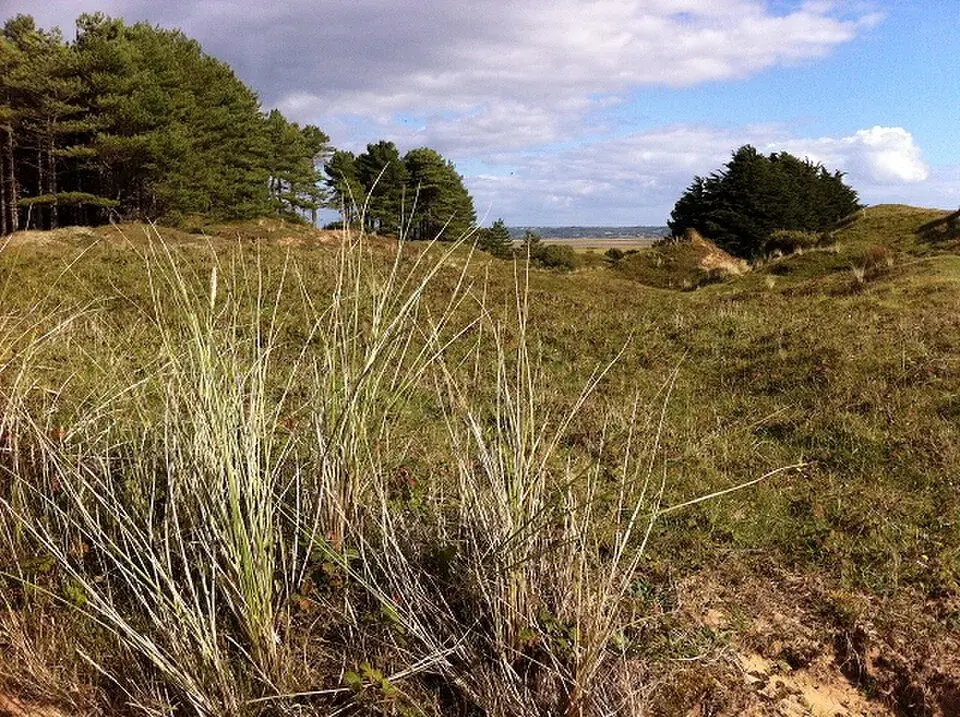
Broadleaved woodland and scrub on the official approach between village and hides
The official walk includes woodland, uneven ground and an uphill return. Remain on the mapped approach rather than entering singing-bird cover.
Spring: Chiffchaff
Summer: Chiffchaff
Autumn: Chiffchaff
Light: either. Scope: not needed.
| Spot | Overlooks | Key species by season | Best light | Scope | Tide |
|---|---|---|---|---|---|
| Monterey HideReach by the National Trust mapped route. Natural paths, short steep sections and mud; do not cross marsh channels. | Cwm Ivy tidal saltmarsh, pools and feeding edges | Winter: Little Egret, Grey Heron, Lapwing, Hen Harrier Spring: Little Egret, Lapwing Summer: Little Egret, Grey Heron Autumn: Little Egret, Lapwing, Hen Harrier | either | useful | Pools and feeding edges change as the tide moves. Keep watching from the hide, not from the tidal marsh. |
| Cheriton HideOfficial woodland approach is mapped by the National Trust. No step-free threshold or guaranteed wheelchair route was verified. | Cwm Ivy tidal pools and open marsh from the woodland-side hide | Winter: Kingfisher, Little Egret, Lapwing Spring: Kingfisher, Marsh Harrier Summer: Kingfisher, Little Egret, Marsh Harrier Autumn: Kingfisher, Lapwing | either | useful | The operator describes tidal pools attracting feeding birds; no numerical tide height or exact high-water interval was verified. |
| Whiteford Burrows: signed landward shore pathUse signed land routes and the safe landward edge only. No route to the offshore lighthouse, mudflats, islands or roosts is given. | Shore, intertidal feeding edge and offshore water from firm permitted land | Winter: Oystercatcher, Curlew, Ringed Plover, Brent Goose, Red-breasted Merganser Spring: Whimbrel, Oystercatcher, Ringed Plover, Dunlin, Shelduck Summer: Oystercatcher, Shelduck Autumn: Oystercatcher, Curlew, Dunlin | either | essential | Read the tide before leaving. Turn back when water, wind or the return route becomes uncertain; never follow birds onto exposed flats. |
| Cwm Ivy Wood: official hide approachThe official walk includes woodland, uneven ground and an uphill return. Remain on the mapped approach rather than entering singing-bird cover. | Broadleaved woodland and scrub on the official approach between village and hides | Spring: Chiffchaff Summer: Chiffchaff Autumn: Chiffchaff | either | not needed | — |
Month chips show typical presence or our preferred viewing season. Choose birds that suit the time of your visit.
Choose a tide that leaves feeding birds visible from the official hides or safe landward shore path. National Trust describes the tidal pools and county reports include both high-water and feeding-edge observations. No minimum height or fixed arrival offset is verified. Check Burry Port and local warnings, keeping a safe return at all times.
The National Trust describes a tarmac approach changing to rough footpath, with sand dunes on the way to the beach. Its Cwm Ivy walk includes short steep sections and footpaths that may be muddy after rain. Some parts are unsuitable for pushchairs. These details mean a hide visit should be planned around the actual route, not simply the short distance printed on a map. Contact the estate about gate arrangements, hide thresholds, seating and the return gradient if you use a wheelchair, scooter or walking aid. The privately owned car park has its own surface and parking terms. There are no toilets at the Trust's countryside property, an important limitation for anyone requiring a predictable facility during a longer stay. Visitors who can walk a little but tire on gradients may prefer one hide and a rest over attempting the complete loop. Bring footwear with grip, keep hands available on uneven sections and take a companion if carrying a telescope would interfere with balance. Woodland shelter can help in windy weather, but muddy ground may remain demanding even when the coast itself looks calm.
The Trust lists a car park near Whiteford, with village services in Llanmadoc rather than a staffed reserve café. Its walk page identifies a village shop and pub as possible stops. Carry your own water and food if your visit depends on an early start or a long dune extension. The hides provide birdwatching shelter, not a place to leave bags while walking elsewhere. Take litter away and keep picnic stops off the marsh edges.
Dogs are welcome on leads on the National Trust's Cwm Ivy walk, with livestock making close control particularly important. Keep them away from the tidal pools and bird flocks as well as sheep or cattle. A quiet route back through woodland is preferable to letting a dog run onto open marsh or beach birds.
The Trust identifies Swansea and Gowerton as rail approaches. Public transport on Gower needs a current connection check: the property page lists Gower Explorer services, but travellers should compare the timetable and exact Llanmadoc-area stop with Traveline Cymru before setting out. Do not assume an old route number provides a convenient return from the car-park lane. A pre-arranged taxi from the station or a suitable connecting village is a sensible alternative when services do not match a daylight birdwatching visit. Drivers approach via the B4295 and local roads towards Llanmadoc, following the Trust's directions to the privately owned Cwm Ivy car park. Narrow village lanes need care and are unsuitable for informal roadside parking. Save the official walking map before leaving mobile coverage. A car-free outing works best with a modest hide route and a definite collection point, rather than a beach circuit that ends far from the agreed transport.
Useful bases for an early start.
Booking.com links are affiliate links: we may earn a commission at no extra cost to you. How these links work.
About 0.3 miles by road, roughly 1 minutes’ drive to the public visitor approach. OSRM measured the Llanmadoc journey for Whiteford National Nature Reserve on 18 October 2026; the estimate excludes live traffic.
Measured driving route · 2026-10-18. Map estimates exclude live traffic.
A nearby Llanmadoc base for an unhurried start at Whiteford National Nature Reserve.Find places to stay in Llanmadoc on Booking.comAbout 4.2 miles by road, roughly 11 minutes’ drive to the public visitor approach. OSRM measured the Llanrhidian journey for Whiteford National Nature Reserve on 18 October 2026; the estimate excludes live traffic.
Measured driving route · 2026-10-18. Map estimates exclude live traffic.
Compare stays in Llanrhidian if this measured approach fits your wider route.Find places to stay in Llanrhidian on Booking.comAbout 14.8 miles by road, roughly 36 minutes’ drive to the public visitor approach. OSRM measured the Swansea journey for Whiteford National Nature Reserve on 18 October 2026; the estimate excludes live traffic.
Measured driving route · 2026-10-18. Map estimates exclude live traffic.
Consider Swansea when its location suits the other places in your itinerary.Find places to stay in Swansea on Booking.comExplore Swansea and Gower’s full guides and smaller birding sites
The National Trust publishes 01792 390636 and visit.rhosili@nationaltrust.org.uk for Whiteford and North Gower enquiries. Ask about the named Cwm Ivy route and a specific hide if you need access details; an enquiry about “Whiteford” alone could refer to a much larger area. Private parking terms belong to the car-park owner. The Trust's walk page and main property page provide the practical map and visitor rules, while its Cwm Ivy conservation article explains the changing marsh landscape.
Check Gower Ornithological Society: dated county sightings. regular public reports Reports show what has been seen, not what will be.
Follow the BTO Birders’ Code and give wildlife space.
Whiteford National Nature Reserve: Price not published by operator.
Whiteford National Nature Reserve: Dogs are welcome on leads on the National Trust's Cwm Ivy walk, with livestock making close control particularly important.
Whiteford National Nature Reserve: Year-round · autumn and winter waders.
Whiteford National Nature Reserve: Contact the estate about gate arrangements, hide thresholds, seating and the return gradient if you use a wheelchair, scooter or walking aid.
Whiteford National Nature Reserve: The Trust identifies Swansea and Gowerton as rail approaches.
Shorter stops within 15 miles in a straight line. Use the operator’s arrival directions for the journey.
Rhosili village and public headland paths, Gower · Coastal grassland, field margins, heath and sea cliffs
Pembrey · Coastal pine forest, broadleaved woodland, grassland and pools
South of Overton village, south Gower · Limestone grassland, coastal heath, scrub, sea cliff and shore
Pembrey · Fen, reedbed, wet pasture and open water
Oxwich Bay, south Gower · Lakes, reedbeds, dunes, woodland and coastal marsh
Northern edge of Fairwood Common, Gower · Wet and dry broadleaved woodland, open rides, streams and pond
Kidwelly · Tidal estuary, saltmarsh, canal and freshwater marsh
Blackpill seafront, Swansea Bay · Intertidal beach, mudflats and coastal feeding shore
Nearby complete guides.
Stops with a purpose: use one as a contrasting habitat or weather-proof Plan B. Distances are straight-line estimates, not road journeys.