Short entry1.7 miles away
Coed Simdde Lwyd
Rheidol Valley · Ancient upland oak woodland and stream
 the ai birderBirding near me
The AI Birder · one-page field sheet
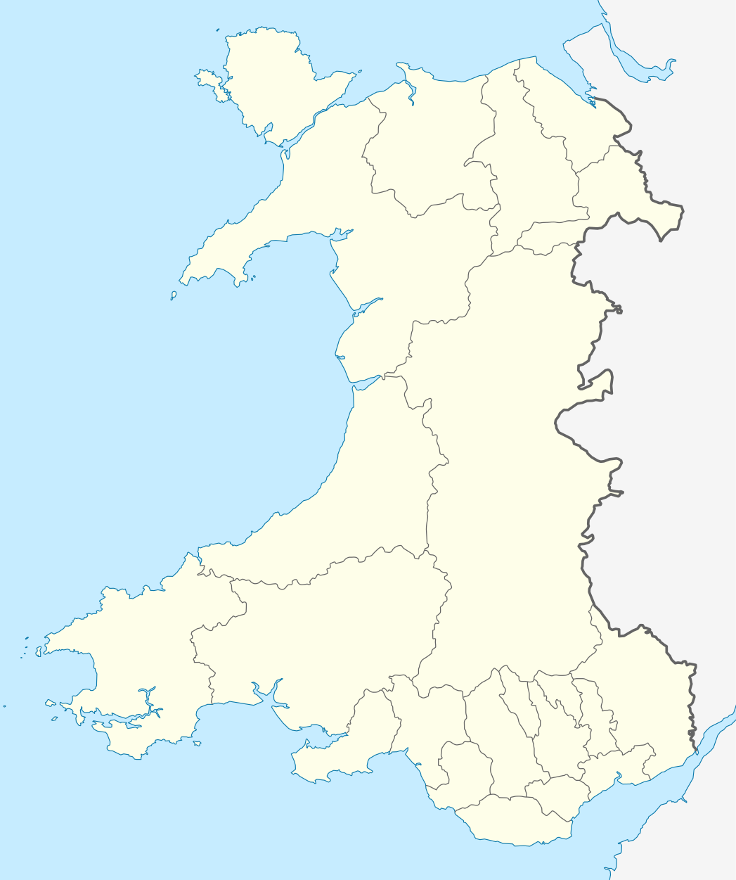
Near Ponterwyd, Ceredigion · SY23 3AB

Red Kite · Little Grebe · Tufted Duck · Mallard · Moorhen · Crossbill
Red Kite viewing area · Barcud Trail bird hide · Barcud Trail — wooded lakeside section
Check current access, hide closures and operator notices before travelling. Seasonal birds are possibilities, not promised sightings. Keep to authorised routes and give wildlife space.
Opening and charges checked 2026-10-25. Operator: https://naturalresources.wales/days-out/places-to-visit/mid-wales/bwlch-nant-yr-arian-forest-visitor-centre/?lang=en
Full guide and current source links: https://aibirder.co.uk/reserves/bwlch-nant-yr-arian
WA 18 · Natural Resources Wales reserve guide
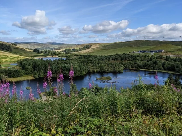
Near Ponterwyd, Ceredigion
Daily Red Kite feeding and lakeside watching
Decide if the visit fits.
Last checked 18 October 2026.
Opening and charges information · checked .
Stay nearby →Reserve overview
Daily Red Kite feeding and lakeside watching
Eight checks for a smoother visit.
Conditions change: check the operator and transport notices before travelling.
January: Usually make Red Kite watching at the official viewing area the centre of a January visit. Before the feed, check the lake from the Barcud Trail bird hide for Goosander and Tufted Duck. Winter waterbirds vary; an old county record is not a report of birds present today.
February: In February, compare Mallard and Tufted Duck from the Barcud Trail bird hide, then settle at the Red Kite viewing area before the operator’s daily feed. The ridge is exposed in poor weather, so a careful lakeside session can be a better use of the short day.
March: March can combine Red Kite at the viewing area with Goosander or Little Grebe on the lake from the Barcud Trail bird hide. Listen for Crossbill while following the wooded lakeside section. The county archive includes March records, but flocks and winter visitors need not remain throughout the month.
April: Willow Warblers typically become a useful listening target in April along the Barcud Trail’s wooded lakeside section. The Red Kite viewing area remains the reliable place to plan the afternoon’s watching. Study Little Grebes from the bird hide without following birds towards cover or breeding activity.
May: In May, listen quietly for Willow Warbler and, less reliably, Wood Warbler from the Barcud Trail wooded section. The county report confirms Wood Warbler in Nant yr Arian conifers; it does not identify a territory beside a particular tree. Return to the official viewing area for Red Kites.
June: June offers a different scale of watching before the Red Kite feed: look for Little Grebe and Tufted Duck from the Barcud Trail bird hide. Willow Warbler may be heard along the wooded lakeside section. Stay on the route and leave families of waterbirds plenty of space.
July: July is a good month to watch the contrast between Little Grebe diving on the lake and Red Kite manoeuvring over the official feeding area. Use the Barcud Trail bird hide for the waterbirds. A longer ridge walk is optional and should leave ample time to return comfortably.
August: In August, start with Tufted Duck and Mallard from the Barcud Trail bird hide and spend a quiet spell listening for Crossbill over the wooded lakeside section. Crossbills range widely with food availability. Finish at the Red Kite viewing area rather than searching forestry tracks for closer views.
September: September usually suits an unhurried lake circuit: check Little Grebe and Moorhen from the Barcud Trail bird hide, then watch Red Kite from the dedicated viewing area. Crossbill can be searched for from the wooded lakeside path. Clear visibility makes a ridge walk more useful than low cloud does.
October: In October, watch for migrating Redwing over the wooded Barcud Trail section, with Crossbill and occasional Brambling adding interest around the trees. These are county-recorded possibilities rather than a fixed feeding-station list. Make the Red Kite viewing area the final watching stop while there is good light.
November: November usually puts Goosander back on the lake-watching agenda from the Barcud Trail bird hide. County records also support Brambling and Greenfinch around Nant yr Arian in autumn, so inspect moving finch flocks from the wooded section. Use the official viewpoint for the afternoon Red Kite feed.
December: For December, choose a compact circuit between the Barcud Trail bird hide and Red Kite viewing area. Search the lake for Goosander, Mallard and Tufted Duck before settling for the feed. Avoid extending onto an exposed ridge if fog, ice or strong wind makes a safe return uncertain.
Best conditions: Our choice is a calm, clear afternoon for the official lake watch. Allow time to settle before the 2pm Red Kite feed; this is the current NRW timetable rather than the older summer 3pm advice. Use the sheltered lake circuit in low cloud or strong wind. For birds overhead, move within the public viewing area to keep bright sun out of the line of sight; no fixed best-light direction is claimed for every season.
Natural Resources Wales manages Bwlch Nant yr Arian. The published October 2026 parking tariff is: up to 30 minutes for drop-off or collection is free, up to one hour £1, two hours £3, four hours £7 and all day £12. Overnight parking is not allowed. The machine takes contactless payments rather than cash. RingGo is an alternative and adds an administration fee, with optional notification fees shown during payment. Blue Badge parking is free but requires the vehicle registration arrangements described in the accessibility information. The postcode SY23 3AB covers a wide area: follow the official A44 directions and signed visitor entrance instead of assuming a postcode pin marks the car park. Check NRW's current notices before travelling, especially during snow, ice or high winds.
Access times: Reserve: Forest and waymarked trails open throughout the year, subject to operational restrictions and weather. · Hides: No separate hide opening or locking times published; feeding is currently daily at 2pm. · Car park: NRW publishes parking charges from 6am to 11.59pm; overnight parking from midnight to 6am is prohibited. This is a parking rule, not a verified gate timetable. · Dawn access: partly. Operator opening information.
Start with the Barcud Trail if the feeding lake is the main reason for visiting. This 0.8-mile or 1.3-km circular route is the natural introduction to the site and leads to the viewing area and bird hide. The red-kite information posts help explain what you are watching; take time to follow an individual bird's flight rather than trying to count every kite at once. The Miners' Trail extends the walk to 1.4 miles or 2.3 km, passing an old mining leat and climbing towards the ridge and Giant's Chair viewpoint. The Ridgetop Trail is longer at 2.5 miles or 4.1 km and introduces more exposed views over the wider country. Use the walking waymarkers: the forest also has separately graded mountain-bike, running and horse-riding routes, and these are not interchangeable shortcuts between birdwatching positions. Two-hour plan: arrive with time for the Barcud circuit before the feeding session, settle in one official viewing place and leave space afterwards to watch birds dispersing. This puts the spectacle at the centre without adding an exposed walk under pressure. Full-day plan: choose the Miners' or Ridgetop route in the morning according to the conditions, carry lunch and return comfortably to the lake for the feed. Finish with a quieter lakeside walk or woodland observation instead of extending into another remote circuit late in the day. Follow signed diversions and allow mountain bikers and horse riders room where routes meet. The most memorable part is often the change from kites circling high above the trees to their quick, precise descent over the feeding ground.
Use the linked reserve map and directions with current access notices. Species are typical seasonal targets. Light and telescope advice reflects our choice of viewpoint.
The official feeding ground beside the lake
Reached by the accessible Barcud Trail; keep the feeding ground clear.
Winter: Red Kite
Spring: Red Kite
Summer: Red Kite
Autumn: Red Kite
Light: either. Scope: not needed.
The lake, its banks and the feeding-area outlook
Official large hide after the viewing area on the Barcud circuit; no separate unlocking hours published.
Winter: Goosander, Tufted Duck, Mallard
Spring: Little Grebe, Tufted Duck, Mallard
Summer: Little Grebe, Tufted Duck
Autumn: Goosander, Moorhen, Mallard
Light: either. Scope: useful.
The trees and sheltered lake margins along the signed circuit
Accessible waymarked lakeside circuit; finch flocks move and no feeder is assumed to be operating.
Winter: Brambling, Greenfinch, Crossbill
Spring: Willow Warbler, Wood Warbler, Crossbill
Summer: Willow Warbler, Wood Warbler
Autumn: Redwing, Crossbill, Brambling
Light: either. Scope: not needed.
| Spot | Overlooks | Key species by season | Best light | Scope | Tide |
|---|---|---|---|---|---|
| Red Kite viewing areaReached by the accessible Barcud Trail; keep the feeding ground clear. | The official feeding ground beside the lake | Winter: Red Kite Spring: Red Kite Summer: Red Kite Autumn: Red Kite | either | not needed | — |
| Barcud Trail bird hideOfficial large hide after the viewing area on the Barcud circuit; no separate unlocking hours published. | The lake, its banks and the feeding-area outlook | Winter: Goosander, Tufted Duck, Mallard Spring: Little Grebe, Tufted Duck, Mallard Summer: Little Grebe, Tufted Duck Autumn: Goosander, Moorhen, Mallard | either | useful | — |
| Barcud Trail — wooded lakeside sectionAccessible waymarked lakeside circuit; finch flocks move and no feeder is assumed to be operating. | The trees and sheltered lake margins along the signed circuit | Winter: Brambling, Greenfinch, Crossbill Spring: Willow Warbler, Wood Warbler, Crossbill Summer: Willow Warbler, Wood Warbler Autumn: Redwing, Crossbill, Brambling | either | not needed | — |
Month chips show typical presence or our preferred viewing season. Choose birds that suit the time of your visit.
Times: NRW states daily feeding at 2pm, checked 18 October 2026. This current timetable applies throughout the year; older summer 3pm advice is superseded.
Hides: The official lake viewing area and the large bird hide are reached from the Barcud Trail. Settle before the feed and keep the feeding ground clear.
Booking: The official page publishes no advance ticket arrangement for ordinary viewing. Use the public viewing area; contact NRW separately about organised activities.
Prices: No charge to watch the feeding, according to NRW in October 2026. Parking is charged separately as set out in Entry.
NRW classifies the Barcud Trail as accessible and suitable for wheelchairs and pushchairs. It has no steps or stiles, gradients no greater than ten per cent and resting bays on uphill portions. Those details make it a clearer choice than the longer walking routes for visitors needing a predictable lakeside circuit. The viewing area and hide are reached from that trail, but discuss a particular viewing-space requirement with NRW if your equipment needs additional room. Blue Badge holders must both display the badge and register the vehicle for free parking, either for the day's visit through RingGo using the designated code or through NRW for a year. Displaying a badge without the required registration is not the complete arrangement. Accessible toilets are listed by the operator, alongside the current portable-toilet provision. The Miners' and Ridgetop routes have long or steep climbs and descents, with rough or wet patches and exposure to weather. They should be assessed separately from Barcud's accessible grading. NRW says trails are not treated in icy conditions, and the approach road can become slippery after leaving the A44.
The former café and shop are no longer operating and the visitor centre is unstaffed, with no first-aid provision. NRW instead lists portable toilets and a hot-drink and cold-food unit in the car park. That unit normally operates six days a week, including weekends and bank holidays, from 10am–4pm, extending to 5pm from Easter to autumn half term. Bring your own essentials for a longer outing because the published six-day pattern does not identify a guaranteed service every weekday. Two timber play areas are provided.
Dogs are welcome on the walking, running and mountain-bike trails, on a lead or under close control. Keep them particularly close around other visitors and the feeding viewpoint. Pick up and bag waste; NRW permits disposal in the site's refuse bins. Do not allow a dog to approach birds or enter the feeding ground.
Aberystwyth is the nearest mainline railway station. NRW identifies the X47 between Aberystwyth and Llanidloes as stopping on request at the car-park entrance. Traveline Cymru's current X47 timetable provides the transport detail, including journey restrictions and request-stop arrangements. Tell the driver where you need to alight and confirm the return boarding point and time before starting the walk. A bus-based visit needs to fit the feeding session rather than assume a frequent shuttle. If the available journeys leave too little time, a prebooked taxi from Aberystwyth is the realistic alternative; arrange collection before travelling into the forest. By road, take the A44 towards Llangurig and follow the signed entrance approximately nine miles east of Aberystwyth. The measured stay routes below finish at the visitor approach and are estimates without live traffic, while the amount of walking depends on the trail chosen.
Useful bases for an early start.
Booking.com links are affiliate links: we may earn a commission at no extra cost to you. How these links work.
About 11 miles by road, roughly 19 minutes’ drive to the reserve visitor approach. OSRM measured the Aberystwyth journey for Bwlch Nant yr Arian on 18 October 2026; the estimate excludes live traffic.
Measured driving route · 18 October 2026. Map estimates exclude live traffic.
A coastal town with mainline rail and the operator-listed X47 connection.Find places to stay in Aberystwyth on Booking.comAbout 2.6 miles by road, roughly 4 minutes’ drive to the reserve visitor approach. OSRM measured the Ponterwyd journey for Bwlch Nant yr Arian on 18 October 2026; the estimate excludes live traffic.
Measured driving route · 18 October 2026. Map estimates exclude live traffic.
A nearby village base for a short drive to the kite-feeding lake.Find places to stay in Ponterwyd on Booking.comAbout 5.2 miles by road, roughly 8 minutes’ drive to the reserve visitor approach. OSRM measured the Devils Bridge journey for Bwlch Nant yr Arian on 18 October 2026; the estimate excludes live traffic.
Measured driving route · 18 October 2026. Map estimates exclude live traffic.
A separate inland village base south of the forest visitor entrance.Find places to stay in Devils Bridge on Booking.comExplore Ceredigion’s full guides and smaller birding sites
There are no staff based at this visitor location. Direct general enquiries to Natural Resources Wales' Customer Hub on 0300 0653000 during weekday office hours or enquiries@naturalresourceswales.gov.uk. Name Bwlch Nant yr Arian and explain whether the question concerns accessible parking, visitor facilities or a particular trail. The official place page carries operational notices and the current feeding information. For an emergency, use the appropriate emergency service rather than expecting an on-site reception team to provide first aid.
Check Ceredigion Birds — sightings archive (ended April 2026). archived; publication ended 27 April 2026 Reports show what has been seen, not what will be.
Follow the BTO Birders’ Code and give wildlife space.
Bwlch Nant yr Arian: Parking £1/hour, £3/two hours, £7/four hours or £12/day.
Bwlch Nant yr Arian: Dogs are welcome on the walking, running and mountain-bike trails, on a lead or under close control.
Bwlch Nant yr Arian: All year; winter often brings more Red Kites.
Bwlch Nant yr Arian: NRW classifies the Barcud Trail as accessible and suitable for wheelchairs and pushchairs.
Bwlch Nant yr Arian: Aberystwyth is the nearest mainline railway station.
Shorter stops within 15 miles in a straight line. Use the operator’s arrival directions for the journey.
Rheidol Valley · Ancient upland oak woodland and stream
Tre’r-ddôl · Broadleaved woodland, stream and heath pockets
Near Lledrod · Valley mire, gorse heath and hedgerows
Nearby complete guides.
Stops with a purpose: use one as a contrasting habitat or weather-proof Plan B. Distances are straight-line estimates, not road journeys.