Short entry5.0 miles away
St Cyrus National Nature Reserve
Near Northwater Bridge, north of Montrose · Coastal grassland, dunes, beach, cliffs and estuary
 the ai birderBirding near me
The AI Birder · one-page field sheet
Rossie Braes, Montrose, Angus, Scotland · DD10 9TA · DD10 9TA

Pink-footed Goose · Kingfisher · Wigeon · Shelduck · Eider · Black-tailed Godwit
Visitor-centre windows · Bank of Scotland Hide · Goose Hide (Tayock) · Wigeon Hide · Shelduck Hide · The Lurgies public sea wall · Old Mill approach to Shelduck and Wigeon hides
Check current access, hide closures and operator notices before travelling. Seasonal birds are possibilities, not promised sightings. Keep to authorised routes and give wildlife space.
Opening and charges checked 2026-10-25. Operator: https://scottishwildlifetrust.org.uk/reserve/montrose-basin/
Full guide and current source links: https://aibirder.co.uk/reserves/montrose-basin
SC 07 · Scottish Wildlife Trust reserve guide
Rossie Braes, Montrose, Angus, Scotland · DD10 9TA
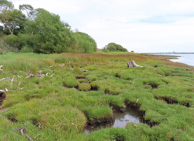
This 750-hectare enclosed estuary is internationally important for Pink-footed Geese, Knot and Redshank, with Ospreys fishing in summer and Kingfishers, Eiders, Wigeon and other wildfowl rewarding a well-timed visit.
Decide if the visit fits.
Last checked 18 October 2026.
Opening and charges information · checked .
Stay nearby →Reserve overview
This 750-hectare enclosed estuary is internationally important for Pink-footed Geese, Knot and Redshank, with Ospreys fishing in summer and Kingfishers, Eiders, Wigeon and other wildfowl rewarding a well-timed visit.
Eight checks for a smoother visit.
Conditions change: check the operator and transport notices before travelling.
January: typically look for Wigeon from Wigeon Hide. Allow a changing-tide watch, keeping to signed paths. Summer Osprey can be watched from The Lurgies public sea wall; winter goose flights depend on the birds, not an event timetable. February: typically look for Kingfisher from Visitor-centre windows. Allow a changing-tide watch, keeping to signed paths. Summer Osprey can be watched from The Lurgies public sea wall; winter goose flights depend on the birds, not an event timetable. March: typically look for Eider from Wigeon Hide. Allow a changing-tide watch, keeping to signed paths. Summer Osprey can be watched from The Lurgies public sea wall; winter goose flights depend on the birds, not an event timetable. April: typically look for Reed Bunting from The Lurgies public sea wall. Allow a changing-tide watch, keeping to signed paths. Summer Osprey can be watched from The Lurgies public sea wall; winter goose flights depend on the birds, not an event timetable. May: typically look for Common Tern from Visitor-centre windows. Allow a changing-tide watch, keeping to signed paths. Summer Osprey can be watched from The Lurgies public sea wall; winter goose flights depend on the birds, not an event timetable. June: typically look for Sedge Warbler from Shelduck Hide. Allow a changing-tide watch, keeping to signed paths. Summer Osprey can be watched from The Lurgies public sea wall; winter goose flights depend on the birds, not an event timetable. July: typically look for Sand Martin from Visitor-centre windows. Allow a changing-tide watch, keeping to signed paths. Summer Osprey can be watched from The Lurgies public sea wall; winter goose flights depend on the birds, not an event timetable. August: typically look for Greenshank from Visitor-centre windows. Allow a changing-tide watch, keeping to signed paths. Summer Osprey can be watched from The Lurgies public sea wall; winter goose flights depend on the birds, not an event timetable. September: typically look for Pink-footed Goose from Goose Hide (Tayock). Allow a changing-tide watch, keeping to signed paths. Summer Osprey can be watched from The Lurgies public sea wall; winter goose flights depend on the birds, not an event timetable. October: typically look for Pink-footed Goose from Goose Hide (Tayock). Allow a changing-tide watch, keeping to signed paths. Summer Osprey can be watched from The Lurgies public sea wall; winter goose flights depend on the birds, not an event timetable. November: typically look for Wigeon from Wigeon Hide. Allow a changing-tide watch, keeping to signed paths. Summer Osprey can be watched from The Lurgies public sea wall; winter goose flights depend on the birds, not an event timetable. December: typically look for Water Rail from The Lurgies public sea wall. Allow a changing-tide watch, keeping to signed paths. Summer Osprey can be watched from The Lurgies public sea wall; winter goose flights depend on the birds, not an event timetable.
Best conditions: Usually choose calm weather for distant wildfowl and a clear horizon for goose flights. Fit Wigeon Hide to high water and compare feeding mud at lower water from public paths. Tayock/Goose Hide is an operator-recommended sunrise or sunset watch; reach it from its own access, without relying on the locked centre car park.
Admission checked on the Scottish Wildlife Trust’s operator page on 18 October 2026: adult £6.50, concession £6, with members and children under 16 free. These are the published 2026 visitor-centre prices; reserve walks and their car parks are free. Centre admission covers an indoor viewing experience rather than a ticket for every separate walk around the basin. Choose the entrance for your intended watch before travelling: the remote hides cannot be reached by walking directly across the estuary from reception. Organised activities can have their own booking arrangements. Check the operator’s current notices before travelling, and ask the centre for advice if your visit depends on a particular facility or event.
Access times: Reserve: Separate reserve walks available independently of centre hours; follow local closures and farmland restrictions. · Hides: Operator walk guide states all hides open 24 hours, seven days a week. Visitor centre: mid-February–31 October daily 10:30–17:00;1 November–mid-February Friday–Monday 10:30–16:00. · Car park: Visitor-centre car park closes 17:00 in summer and 16:00 in winter in the operator walk guide. Separate walk car parks are not the centre car park; no other locking hours stated. · Dawn access: partly. Operator opening information.
The reserve is a collection of walks from different starting places around a tidal basin, rather than a single circuit from reception. Get the official map and decide which side of the water suits your birds, tide and available time. The centre and nearby Bank of Scotland Hide give one perspective; Goose Hide at Tayock, the Lurgies and the Shelduck and Wigeon hides provide others. Avoid trying to walk directly between viewpoints across mudflat or saltmarsh. Two-hour plan — an editorial itinerary: spend the first part at the visitor-centre windows, learning where the main flocks are concentrated. Follow that with one modest outing, such as Goose Hide at Tayock from its own car park, allowing for the transfer and return walk. If birds are showing well from the centre, use the extra time there instead. A patient watch through a changing tide can produce more than hurried visits to several quiet hides. Full-day plan — an editorial itinerary: choose an early Goose Hide at Tayock watch if the season and sunrise make it worthwhile. Follow with a centre visit for orientation and the latest local advice, then devote the main walking period to the Lurgies or the Old Mill approach to Wigeon and Shelduck hides. Bring a food break into the plan and leave enough time to return before losing daylight. This is a flexible sequence; spread the more distant walks over separate visits if you prefer a less demanding day. The Trust's route guide describes two Lurgies options, including a longer extension towards Bridge of Dun, and separate tracks from Old Mill for the northern hides. Use that guide for the route you select. When watching a feeding flock, look for changes in spacing and direction: approaching water often gathers birds into a smaller area. Stay back from a roost so that your search for a better angle does not cause the flock to take flight.
Use the linked reserve map and directions with current access notices. Species are typical seasonal targets. Light and telescope advice reflects our choice of viewpoint.
South-eastern basin, exposed mud and nearby water
Wheelchair-accessible centre; seasonal staffed hours.
Winter: Kingfisher, Redshank, Wigeon
Spring: Eider, Shelduck
Summer: Common Tern, Sand Martin, Eider
Autumn: Kingfisher, Greenshank, Curlew
Light: either. Scope: essential.
Tide: Exposed mud at low water for feeding waders; never walk onto it.
Near-shore water and basin beside the centre
Small pedestrian gate beside locked main entrance, followed by steps; not wheelchair suitable.
Winter: Kingfisher, Redshank
Spring: Eider, Shelduck
Summer: Eider, Common Tern
Autumn: Kingfisher, Redshank
Light: either. Scope: useful.
Basin flight lines, rocky shore and exposed mud
2025 leaflet calls this Goose Hide; older operator page calls it Tayock Hide. Separate parking.
Winter: Pink-footed Goose, Redshank, Curlew
Spring: Curlew, Oystercatcher
Summer: Oystercatcher, Redshank
Autumn: Pink-footed Goose, Curlew, Redshank
Light: either. Scope: useful.
Tide: Exposed mud at low water for feeding waders; never walk onto it.
Western basin mudflats and high-water bird concentrations
Stilted hide from Old Mill parking through working farmland.
Winter: Wigeon, Shelduck, Eider, Black-tailed Godwit
Spring: Shelduck, Eider
Summer: Shelduck, Eider
Autumn: Wigeon, Black-tailed Godwit, Greenshank
Light: either. Scope: essential.
Tide: Around high water, as recommended by the operator.
The Slunks where the South Esk meets the basin
Separate Old Mill approach; farmland and reedbeds.
Winter: Mute Swan, Kingfisher, Shelduck
Spring: Mute Swan, Reed Bunting
Summer: Sedge Warbler, Reed Bunting, Shelduck
Autumn: Kingfisher, Little Egret, Mute Swan
Light: either. Scope: useful.
South Esk river margin, reeds and basin mud
Keep to public sea wall and riverbank; livestock possible.
Winter: Water Rail, Kingfisher, Mute Swan
Spring: Reed Bunting, Mute Swan, Osprey
Summer: Sedge Warbler, Reed Bunting, Osprey
Autumn: Kingfisher, Water Rail, Eider, Osprey
Light: either. Scope: useful.
Tide: Exposed mud at low water for feeding waders; never walk onto it.
Arable margins, reed edge and grassland
Working farm tracks; stay on signed route.
Winter: Twite, Linnet, Yellowhammer
Spring: Yellowhammer, Skylark
Summer: Yellowhammer, Skylark
Autumn: Linnet, Twite
Light: either. Scope: not needed.
| Spot | Overlooks | Key species by season | Best light | Scope | Tide |
|---|---|---|---|---|---|
| Visitor-centre windowsWheelchair-accessible centre; seasonal staffed hours. | South-eastern basin, exposed mud and nearby water | Winter: Kingfisher, Redshank, Wigeon Spring: Eider, Shelduck Summer: Common Tern, Sand Martin, Eider Autumn: Kingfisher, Greenshank, Curlew | either | essential | Exposed mud at low water for feeding waders; never walk onto it. |
| Bank of Scotland HideSmall pedestrian gate beside locked main entrance, followed by steps; not wheelchair suitable. | Near-shore water and basin beside the centre | Winter: Kingfisher, Redshank Spring: Eider, Shelduck Summer: Eider, Common Tern Autumn: Kingfisher, Redshank | either | useful | — |
| Goose Hide (Tayock)2025 leaflet calls this Goose Hide; older operator page calls it Tayock Hide. Separate parking. | Basin flight lines, rocky shore and exposed mud | Winter: Pink-footed Goose, Redshank, Curlew Spring: Curlew, Oystercatcher Summer: Oystercatcher, Redshank Autumn: Pink-footed Goose, Curlew, Redshank | either | useful | Exposed mud at low water for feeding waders; never walk onto it. |
| Wigeon HideStilted hide from Old Mill parking through working farmland. | Western basin mudflats and high-water bird concentrations | Winter: Wigeon, Shelduck, Eider, Black-tailed Godwit Spring: Shelduck, Eider Summer: Shelduck, Eider Autumn: Wigeon, Black-tailed Godwit, Greenshank | either | essential | Around high water, as recommended by the operator. |
| Shelduck HideSeparate Old Mill approach; farmland and reedbeds. | The Slunks where the South Esk meets the basin | Winter: Mute Swan, Kingfisher, Shelduck Spring: Mute Swan, Reed Bunting Summer: Sedge Warbler, Reed Bunting, Shelduck Autumn: Kingfisher, Little Egret, Mute Swan | either | useful | — |
| The Lurgies public sea wallKeep to public sea wall and riverbank; livestock possible. | South Esk river margin, reeds and basin mud | Winter: Water Rail, Kingfisher, Mute Swan Spring: Reed Bunting, Mute Swan, Osprey Summer: Sedge Warbler, Reed Bunting, Osprey Autumn: Kingfisher, Water Rail, Eider, Osprey | either | useful | Exposed mud at low water for feeding waders; never walk onto it. |
| Old Mill approach to Shelduck and Wigeon hidesWorking farm tracks; stay on signed route. | Arable margins, reed edge and grassland | Winter: Twite, Linnet, Yellowhammer Spring: Yellowhammer, Skylark Summer: Yellowhammer, Skylark Autumn: Linnet, Twite | either | not needed | — |
Month chips show typical presence or our preferred viewing season. Choose birds that suit the time of your visit.
Use Wigeon Hide around high water; low water exposes feeding mud watched from the centre, Tayock or Lurgies paths. Check the actual prediction for the date. Stay off tidal mud and do not try to make a circuit across the basin.
Season: Pink-footed Goose flights: typically autumn and winter; operator highlights October–February.. Arrival time: Goose Hide at Tayock is the official ordinary-watch choice: arrive before sunrise for departure or before sunset for return, with time to settle quietly. The birds choose their own timing.. Hotline: https://scottishwildlifetrust.org.uk/things-to-do/wildlife-events/. Use the separate Tayock access and keep flight/roost areas clear. Ordinary reserve walks need no admission booking; guided or late-opening centre events use the Trust’s dated booking listing. The 2026 festival is over; do not reuse its dates.
The visitor centre is the clearest option for visitors requiring a wheelchair-accessible watch. The Trust describes it as wheelchair accessible and provides a detailed access guide, linked below. That guide predates the pandemic, so discuss any essential dimension, equipment or assistance requirement directly rather than relying on an old measurement alone. Tell the centre whether you need step-free access, a particular viewing height or space for a companion. The access guide describes designated Blue Badge parking, a surfaced ramped approach and an accessible toilet. It also identifies a wheelchair-suitable Tayock approach from a different car park, with gravel surfaces and minor slopes. These arrangements should not be taken to mean every reserve walk offers equivalent access. The Bank of Scotland Hide approach includes steps, and the farm and river routes need a separate terrain assessment. Choose a shorter watch if sustained travel over gravel or an exposed route would be uncomfortable. A sheltered centre session may offer a satisfying day without requiring an outdoor hide circuit. For a group with different needs, agree a meeting point and comfortable break arrangements before splitting between walks. Reserve paths and viewing facilities are distinct destinations when discussing what is suitable.
The centre provides binoculars and telescopes for watching the basin, hot drinks and a small wildlife-themed shop. Children's activities are available, and interpretation helps explain the changing estuary. Pack water and suitable outdoor clothing for any separate hide walk, even if you begin indoors. Take your food packaging away and keep equipment tidy in shared viewing areas. For education visits or organised activities, contact the centre about the programme and any costs rather than assuming ordinary admission includes a guided event.
Dogs can accompany reserve walks under responsible control, but pet dogs are excluded from the visitor centre. Assistance-dog arrangements should be discussed with the centre when planning your visit. Keep dogs close around livestock, nesting birds and roosting flocks; do not allow them to chase birds or run onto tidal mud. Remove waste from the paths.
Montrose has a mainline station, with the visitor centre south of town at Rossie Braes on the A92. The Trust identifies rail services from the main Scottish cities and recommends an onward bus from Montrose towards Arbroath or Dundee, requesting the stop at the top of the centre drive. Check the specific service and return stop before travelling. Stagecoach's Angus information lists the 30/33/40 corridor through Arbroath and Montrose; its own attraction article specifically identifies service 30 for the reserve. Use the current journey planner to confirm the Nature Reserve stop on the day you need, rather than treating an older promotional article as a timetable. The X7 also serves the Dundee–Arbroath–Montrose–Aberdeen corridor, but the Trust's access guide places its stops at Montrose High Street or Rossie Island rather than the entrance. For the simplest rail connection, arrange a taxi from Montrose station directly to the centre. Remote walks need their own transport plan because they start from separate car parks. Agree where a return taxi should collect you if you finish at a different viewpoint, and consider the final connection before committing to a dusk watch.
Useful bases for an early start.
Booking.com links are affiliate links: we may earn a commission at no extra cost to you. How these links work.
About 1.4 miles by road, roughly 4 minutes’ drive from Montrose centre; OSRM / OpenStreetMap estimate measured 18 October 2026, excluding live traffic.
Measured driving route · 2026-10-18. Map estimates exclude live traffic.
Rail-connected town base for the shortest centre transfer.Find places to stay in Montrose on Booking.comAbout 11.2 miles by road, roughly 18 minutes’ drive from Arbroath centre; OSRM / OpenStreetMap estimate measured 18 October 2026, excluding live traffic.
Measured driving route · 2026-10-18. Map estimates exclude live traffic.
A coastal town base for combining basin birding with other Angus outings.Find places to stay in Arbroath on Booking.comAbout 8.0 miles by road, roughly 16 minutes’ drive from Brechin centre; OSRM / OpenStreetMap estimate measured 18 October 2026, excluding live traffic.
Measured driving route · 2026-10-18. Map estimates exclude live traffic.
An inland base for a longer stay exploring the Angus countryside.Find places to stay in Brechin on Booking.comExplore Angus’s full guides and smaller birding sites
Contact the Scottish Wildlife Trust team on 01674 676336 or montrosebasin@scottishwildlifetrust.org.uk. The visitor address is Montrose Basin, Rossie Braes, Angus, DD10 9TA. The official reserve page and Montrose Basin Facebook page carry updates; compare the date and actual viewpoint with the visit you are planning. The Trust's audio tours cover the centre, Tayock, Lurgies and the northern hides and can help you understand the landscape before choosing a walk. Keep a note of the tide stage with your own sightings, since a bird absent from one area may simply be feeding elsewhere in the basin.
Check Scottish Wildlife Trust actual wader observations, 6 August 2026. individual dated seasonal report, not a daily October feed Reports show what has been seen, not what will be.
Follow the BTO Birders’ Code and give wildlife space.
Montrose Basin: Centre adult £6.50; concession £6; members and under-16s free.
Montrose Basin: Dogs can accompany reserve walks under responsible control, but pet dogs are excluded from the visitor centre.
Montrose Basin: Autumn geese · winter waders · summer Ospreys.
Montrose Basin: The visitor centre is the clearest option for visitors requiring a wheelchair-accessible watch.
Montrose Basin: Montrose has a mainline station, with the visitor centre south of town at Rossie Braes on the A92.
Shorter stops within 15 miles in a straight line. Use the operator’s arrival directions for the journey.
Near Northwater Bridge, north of Montrose · Coastal grassland, dunes, beach, cliffs and estuary
Victoria Park esplanade, Arbroath · Sea cliffs, coastal grassland and exposed shore
North of the A932 east of Forfar · Freshwater loch, reedbeds and willow carr
Arbroath Road, east of Forfar · Former gravel workings, lochs, wetland and meadow
Nearby complete guides.
Stops with a purpose: use one as a contrasting habitat or weather-proof Plan B. Distances are straight-line estimates, not road journeys.