Short entry3.1 miles away
Lurgan Park
Lurgan · Urban park lake, mature woodland and grassland
 the ai birderBirding near me
The AI Birder · one-page field sheet
Annaloiste Road, Craigavon, County Armagh, Northern Ireland · BT66 6NJ · BT66 6NJ

Current planning alert (2026-10-09): At Lough Neagh, avoid discoloured water or shoreline scum and keep children and dogs away from suspected algae. DAERA’s confirmed-locations viewer is updated weekly; check it and onsite signs before visiting.
Goldeneye · Great Crested Grebe · Cormorant · Little Grebe · Coot · Pochard
Croaghan Hide · Kinnego Hide · Closet viewing area · Waterside viewing area · Woodland public paths
Check current access, hide closures and operator notices before travelling. Seasonal birds are possibilities, not promised sightings. Keep to authorised routes and give wildlife space.
Opening and charges checked 2026-10-25. Operator: https://getactiveabc.com/facility/oxfordisland/
Full guide and current source links: https://aibirder.co.uk/reserves/oxford-island-national-nature-reserve
NI 10 · Council reserve guide
Annaloiste Road, Craigavon, County Armagh, Northern Ireland · BT66 6NJ
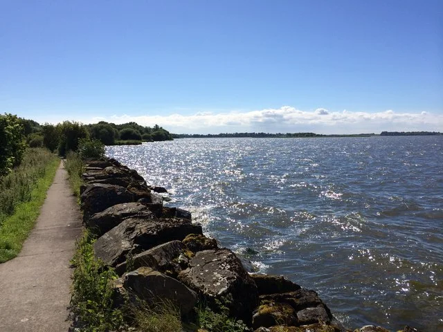
Sheltered bays on Lough Neagh hold wintering diving ducks including Goldeneye, Pochard and Tufted Duck. Great Crested and Little Grebes, Coot, Moorhen, terns and Cormorants can be watched from the hides, while Whooper Swans use nearby fields.
Decide if the visit fits.
Last checked 18 October 2026.
At Lough Neagh, avoid discoloured water or shoreline scum and keep children and dogs away from suspected algae. DAERA’s confirmed-locations viewer is updated weekly; check it and onsite signs before visiting.
Opening and charges information · checked .
Stay nearby →Reserve overview
Sheltered bays on Lough Neagh hold wintering diving ducks including Goldeneye, Pochard and Tufted Duck. Great Crested and Little Grebes, Coot, Moorhen, terns and Cormorants can be watched from the hides, while Whooper Swans use nearby fields.
Eight checks for a smoother visit.
Conditions change: check the operator and transport notices before travelling.
January: January usually makes Kinnego Hide a good starting point for Pochard, Tufted Duck and Coot, followed by Goldeneye from Croaghan Hide or the Waterside viewing area. Use a scope when birds gather farther out. The reserve opens at nine, so a winter watch should fit within the actual gate arrangements.
February: In February, compare Great Crested and Little Grebes from Kinnego Hide, then scan the Waterside viewing area for Teal and Goldeneye. The Woodland public paths can add Wren and Great Tit between longer water watches. Choose the bay with the least glare and avoid approaching reeds to bring birds closer.
March: March typically combines winter Pochard and Goldeneye with increasingly active Great Crested Grebes. Use Kinnego Hide and Croaghan Hide for the different habitats, then pause at the Closet viewing area for Mallard and Grey Heron. A mild day does not establish that all winter ducks have already left the lough.
April: April usually suits Great Crested Grebe and Tufted Duck from Kinnego Hide, with Swallow increasingly possible from the Closet viewing area. Returning Common Terns have historical late-April county records, but their arrival is weather-dependent. Begin with the birds actually visible and do not turn an old record into a fixed annual deadline.
May: May is our choice for Common Tern from Croaghan Hide and Sedge Warbler from Kinnego Hide, with Great Crested Grebe on the bay. Watch island and reedbed birds from the established public facilities. No island landing, nesting-bank visit or movement into reed vegetation is needed for a worthwhile view.
June: In June, combine a Common Tern watch from Croaghan Hide with Great Crested and Little Grebes from Kinnego Hide. The Closet viewing area can add Swallow over the water. Treat family activity as something to observe quietly from a distance, without following adults or looking for a concealed nesting location.
July: July usually rewards patient observation of grebes, Coot and Moorhen from Kinnego Hide, with Common Tern over the lough from Croaghan Hide. A calmer day makes it easier to locate repeatedly diving birds. Check water-quality notices and avoid contact with discoloured or suspect water rather than treating the shore as a bathing place.
August: August typically offers Tufted Duck and Gadwall from the Waterside viewing area, with Great Crested Grebe from Kinnego Hide and some Common Terns still over the lough. Compare eclipse ducks slowly. Not every late-summer visit will show the same number of terns or the same visible breeding activity.
September: September usually shifts attention towards changing duck groups: Teal and Tufted Duck from the Waterside viewing area, with Coot and Great Crested Grebe from Kinnego Hide. The Woodland public paths provide another short stop for Chaffinch and Wren. Finish a circuit within gate hours rather than making a distant hide essential at closing.
October: In October, Goldeneye and Pochard typically become more useful targets, using Croaghan Hide for the first broad scan and Kinnego Hide for sheltered water. Teal are worth checking at the Waterside viewing area. Regional reports are context, not confirmation that a rare duck mentioned elsewhere is currently at Oxford Island.
November: November usually suits a slow comparison of Pochard, Tufted Duck and Goldeneye from Kinnego and Croaghan hides. Red-breasted Merganser is a further possibility from the Waterside viewing area, supported by identified reserve photographs. Use the current council map and signs; older five-hide totals do not establish a fifth public hide name.
December: December is a good month for a compact waterbird visit: Great Crested Grebe and Coot from Kinnego Hide, then Goldeneye and Tufted Duck from the Waterside viewing area. Allow time for the nine o’clock opening and winter closing. The Discovery Centre has separate hours, so check building facilities independently from outdoor access.
Best conditions: Our choice is a clear calm day, comparing sheltered bays before scanning the open lough. A scope helps with distant Goldeneye and Pochard, while binoculars suit grebes repeatedly surfacing near cover and birds along woodland paths. The council map directly links the principal bays to waterbird groups; additional species come from identified RSPB reserve photographs. Light advice is editorial: use another permitted viewpoint when glare obscures detail. Check current council and DAERA water-quality notices and remain on paths and established viewing areas.
Admission is free on the council’s visitor page, checked on 18 October 2026. The page does not show a separate parking tariff. Use the designated visitor parking and follow local signs rather than stopping along the approach road or restricting marina access. The Discovery Centre and Kinnego Marina are different facilities within the wider destination; check the council’s information for the part you need rather than assuming every service follows the same arrangements. Read access notices, weather forecasts and local water-safety signs before approaching the shore. A family or group should allow time to return to its starting place and should check any organised activities with the council, without assuming that a listing guarantees availability on the day.
Access times: Reserve: Council publishes daily opening from 9am, winter closing 6pm; summer closing progressively extends up to 9pm as daylight increases. Exact seasonal change dates not supplied. · Hides: No separate hide timetable published in inspected sources. Plan public-hide visits within reserve opening and check current closure signs. · Car park: Use council reserve gate hours: from 9am, winter to 6pm, summer progressively up to 9pm. Discovery Centre separately Monday–Friday9am–5pm, weekends10am–5pm, Sunday to6pm April–September. · Dawn access: no. Operator opening information.
Use the council's reserve map to distinguish the different bays and observation points. Croaghan Hide looks towards island rocks and reeds and the sand-martin bank area, with Cormorants, terns and Goldeneye among the birds identified on the map. Kinnego Hide faces reedbeds and sheltered water associated with Great Crested and Little Grebes, Coots and diving ducks. Closet viewing area gives a broader view across Closet Bay, while Waterside provides another sheltered-bay outlook. Two-hour plan: begin at the Discovery Centre area and choose one hide as the main destination. Walk slowly enough to listen along the woodland edge, then spend at least half an hour comparing birds on open water and near cover. Add a second viewpoint only if the return fits comfortably within your time. Revisit a promising bay on the way back rather than using every minute to reach a more distant corner. This is an editorial observation plan, not an official timed circuit. Full-day plan: explore the Croaghan side in the morning, concentrating on island birds and the contrast between the open lough and nearer reeds. After a break, take the signed connections towards Kinnego Bay and its hide. Meadows and woodland add seasonal flowers, insects and small birds between water watches. Finish with a familiar viewpoint where you can compare afternoon behaviour with the morning. The marina is a separate working recreation area, so remain aware of other visitors and vehicles on connecting routes. Watch from the hides and established paths, allowing birds to continue feeding and resting undisturbed. A telescope is useful for distant ducks, but binoculars are often easier for grebes repeatedly disappearing behind vegetation. Give each bay time: a surface that looks empty at first can reveal diving birds when they reappear together. Keep a simple note of the direction and location of a flock before switching optics or moving to another window.
Use the linked reserve map and directions with current access notices. Species are typical seasonal targets. Light and telescope advice reflects our choice of viewpoint.
Croaghan Island rocks, reeds and adjacent open lough
Use the mapped public hide approach. Observe island birds from the hide; no nest-bank or island approach directions.
Winter: Cormorant, Goldeneye
Spring: Cormorant, Common Tern
Summer: Cormorant, Common Tern
Autumn: Cormorant, Goldeneye
Light: either. Scope: useful.
Reedbeds and sheltered bay water
Official mapped public hide. Check current path/hide availability at Discovery Centre; no individual doorway dimensions verified.
Winter: Great Crested Grebe, Little Grebe, Coot, Pochard, Tufted Duck, Moorhen
Spring: Great Crested Grebe, Little Grebe, Tufted Duck, Coot
Summer: Great Crested Grebe, Little Grebe, Coot, Moorhen, Sedge Warbler
Autumn: Pochard, Tufted Duck, Coot, Great Crested Grebe
Light: either. Scope: useful.
Broad view across Closet Bay
Follow the council map to established viewing space. No approach to island rocks, reed margins or concealed birds.
Winter: Grey Heron, Mallard, Great Crested Grebe
Spring: Grey Heron, Mallard, Common Tern
Summer: Grey Heron, Common Tern, Swallow
Autumn: Mallard, Grey Heron, Great Crested Grebe
Light: either. Scope: useful.
Sheltered corner of Kinnego Bay
Council map explicitly identifies this bay outlook. Shelter does not remove open-water hazards; remain behind barriers.
Winter: Tufted Duck, Goldeneye, Teal, Red-breasted Merganser
Spring: Tufted Duck, Gadwall
Summer: Tufted Duck, Gadwall
Autumn: Tufted Duck, Teal, Goldeneye
Light: either. Scope: useful.
Native woodland and shoreline scrub on the mapped visitor network
Mapped public paths only; broad habitat recommendation from RSPB identified reserve photographs, not a precise tree or nesting location.
Winter: Wren, Great Tit, Chaffinch
Spring: Wren, Great Tit, Chaffinch
Summer: Wren, Great Tit, Chaffinch
Autumn: Wren, Great Tit, Chaffinch
Light: either. Scope: not needed.
| Spot | Overlooks | Key species by season | Best light | Scope | Tide |
|---|---|---|---|---|---|
| Croaghan HideUse the mapped public hide approach. Observe island birds from the hide; no nest-bank or island approach directions. | Croaghan Island rocks, reeds and adjacent open lough | Winter: Cormorant, Goldeneye Spring: Cormorant, Common Tern Summer: Cormorant, Common Tern Autumn: Cormorant, Goldeneye | either | useful | — |
| Kinnego HideOfficial mapped public hide. Check current path/hide availability at Discovery Centre; no individual doorway dimensions verified. | Reedbeds and sheltered bay water | Winter: Great Crested Grebe, Little Grebe, Coot, Pochard, Tufted Duck, Moorhen Spring: Great Crested Grebe, Little Grebe, Tufted Duck, Coot Summer: Great Crested Grebe, Little Grebe, Coot, Moorhen, Sedge Warbler Autumn: Pochard, Tufted Duck, Coot, Great Crested Grebe | either | useful | — |
| Closet viewing areaFollow the council map to established viewing space. No approach to island rocks, reed margins or concealed birds. | Broad view across Closet Bay | Winter: Grey Heron, Mallard, Great Crested Grebe Spring: Grey Heron, Mallard, Common Tern Summer: Grey Heron, Common Tern, Swallow Autumn: Mallard, Grey Heron, Great Crested Grebe | either | useful | — |
| Waterside viewing areaCouncil map explicitly identifies this bay outlook. Shelter does not remove open-water hazards; remain behind barriers. | Sheltered corner of Kinnego Bay | Winter: Tufted Duck, Goldeneye, Teal, Red-breasted Merganser Spring: Tufted Duck, Gadwall Summer: Tufted Duck, Gadwall Autumn: Tufted Duck, Teal, Goldeneye | either | useful | — |
| Woodland public pathsMapped public paths only; broad habitat recommendation from RSPB identified reserve photographs, not a precise tree or nesting location. | Native woodland and shoreline scrub on the mapped visitor network | Winter: Wren, Great Tit, Chaffinch Spring: Wren, Great Tit, Chaffinch Summer: Wren, Great Tit, Chaffinch Autumn: Wren, Great Tit, Chaffinch | either | not needed | — |
Month chips show typical presence or our preferred viewing season. Choose birds that suit the time of your visit.
The council offers mobility-scooter hire through the Discovery Centre. Telephone ahead to reserve a scooter and bring photographic identification when collecting it. Discuss how far you want to travel and which hide you intend to use; equipment availability is only one part of planning a comfortable route. The council-linked AccessAble description identifies a step-free approach from the play-park side towards the northern bird hide and loughside benches, with slight gradients. Elsewhere the path network includes natural and surfaced ground, and a complete circuit should not be assumed to have the same character as a shorter out-and-back route. Choose a turning point that suits your stamina and the weather. The detailed access guide is the appropriate place to compare doorways, slopes and parking arrangements with a particular mobility aid. If any measurement is essential to your visit, confirm it with the centre before travelling. Explain the width of your equipment and whether you need assistance opening a door. A companion can help with carrying optics, while a shorter seated watch can provide a rewarding visit without attempting every part of the reserve.
The Discovery Centre contains toilets, a small natural-history and wildlife exhibition, and a café. The council lists café service Wednesday–Sunday, 10:00–16:00, from September to June, and daily during July and August. Food choices advertised include soup, scones and children's meals. Bring drinking water and a snack for a longer walk or a day when the café is not operating. The council map also identifies play areas and meadow and garden features for a mixed family visit.
The council's reserve map requires dogs to be kept on a lead. Keep them beside you on the designated paths and away from feeding birds and reed margins. Prevent drinking or swimming in water affected by algae and follow any local restriction signs. Clear up after your dog and leave other visitors room at hide entrances.
Lurgan is the practical railway base for Oxford Island. Use Translink's journey planner for the train service and arrange a taxi from the station to the Discovery Centre or your chosen visitor entrance. Book the return pickup before committing to a long shore walk, particularly during winter when the available daylight and gate time are shorter. The council-linked accessibility information says there is no bus stop within 150 metres of the reserve. A through bus to a hide or the visitor centre should therefore not be assumed. If using a local bus for part of the journey, confirm its stop and the remaining walk with Translink; a prearranged rail-and-taxi connection avoids relying on an unverified route number. Drivers follow signs from M1 junction 10 along Kinnego Embankment towards Oxford Island. The council gives approach directions from Belfast, Armagh, Banbridge and Craigavon. Select the Discovery Centre as the destination when meeting others, since Kinnego Marina and the wider reserve have different activity areas. Cyclists should plan the rural road connection to match their experience and daylight.
Useful bases for an early start.
Booking.com links are affiliate links: we may earn a commission at no extra cost to you. How these links work.
About 3.6 miles by road, roughly 9 minutes’ drive from the mapped town-centre point to the reserve approach. OpenStreetMap estimate for Lurgan, measured 18 October 2026. For the Lurgan journey linked to Oxford Island National Nature Reserve, leave additional time for traffic and reaching your precise accommodation address.
Measured driving route · 2026-10-18. Map estimates exclude live traffic.
The nearest practical rail base.Find places to stay in Lurgan on Booking.comAbout 8.6 miles by road, roughly 14 minutes’ drive from the mapped town-centre point to the reserve approach. OpenStreetMap estimate for Portadown, measured 18 October 2026. For the Portadown journey linked to Oxford Island National Nature Reserve, leave additional time for traffic and reaching your precise accommodation address.
Measured driving route · 2026-10-18. Map estimates exclude live traffic.
Rail connections and a longer County Armagh itinerary.Find places to stay in Portadown on Booking.comFrom the mapped town-centre point, the reserve approach is about 7.8 road miles away, with an estimated drive of roughly 13 minutes. OpenStreetMap estimate for Craigavon, measured 18 October 2026. For the Craigavon journey linked to Oxford Island National Nature Reserve, leave additional time for traffic and reaching your precise accommodation address.
Measured driving route · 2026-10-18. Map estimates exclude live traffic.
A central base for the southern Lough Neagh area.Find places to stay in Craigavon on Booking.comExplore County Armagh’s full guides and smaller birding sites
For the Lough Neagh Discovery Centre call 028 3832 2205 or 0330 056 1016. Give Oxford Island NNR, Craigavon, BT66 6NJ when discussing the location. Use the council's Get Active ABC page for current centre arrangements and scooter reservations. DAERA provides separate information on blue-green algae and how to report a suspected bloom: avoid contact with discoloured water or scum and keep children and animals clear. The NIEA incident hotline is 0800 80 70 60.
Check NI Birds — regional reports retained on 19 October 2026. usually daily; retained October 2026 reports, not a freshly fetched live page Reports show what has been seen, not what will be.
Follow the BTO Birders’ Code and give wildlife space.
Oxford Island National Nature Reserve: Free admission; separate parking price not published.
Oxford Island National Nature Reserve: The council's reserve map requires dogs to be kept on a lead.
Oxford Island National Nature Reserve: Winter diving ducks and swans · spring grebes and broods · summer meadows and terns.
Oxford Island National Nature Reserve: The council-linked AccessAble description identifies a step-free approach from the play-park side towards the northern bird hide and loughside benches, with slight gradients.
Oxford Island National Nature Reserve: Lurgan is the practical railway base for Oxford Island.
Shorter stops within 15 miles in a straight line. Use the operator’s arrival directions for the journey.
Lurgan · Urban park lake, mature woodland and grassland
Craigavon · Lakes, wet meadow and planted woodland
Near Derryhubbert, south-west of Lough Neagh · Raised bog, fen, woodland and orchards
Moy, near Dungannon · River and wooded estate
Flowbog Road, Belfast Hills · Unimproved meadows, rush pasture and grassland
Nearby complete guides.
Stops with a purpose: use one as a contrasting habitat or weather-proof Plan B. Distances are straight-line estimates, not road journeys.