Short entry1.3 miles away
Strathclyde Loch
Strathclyde Country Park, Motherwell · Open freshwater loch, shore and adjoining river corridor
 the ai birderBirding near me
The AI Birder · one-page field sheet
Motherwell, North Lanarkshire · ML1 2PZ

Kingfisher · Green Sandpiper · Nuthatch · Wigeon · Teal · Gadwall
Marsh Hide · Causeway Hide · Phoenix Hide (former; unavailable) · Centenary Hide (former; unavailable) · Dalzell woodland public paths · Clyde walkway: signed open sections
Check current access, hide closures and operator notices before travelling. Seasonal birds are possibilities, not promised sightings. Keep to authorised routes and give wildlife space.
Opening and charges checked 2026-10-25. Operator: https://www.rspb.org.uk/days-out/reserves/barons-haugh
Full guide and current source links: https://aibirder.co.uk/reserves/rspb-baron-s-haugh
SC 25 · RSPB reserve guide
Motherwell, North Lanarkshire
Winter ducks, woodland Nuthatches and river Kingfishers
Decide if the visit fits.
Last checked 18 October 2026.
Opening and charges information · checked .
Stay nearby →Reserve overview
Winter ducks, woodland Nuthatches and river Kingfishers
Eight checks for a smoother visit.
Conditions change: check the operator and transport notices before travelling.
January: typically start at Marsh Hide for Teal and Green Sandpiper, with Goldeneye from Causeway Hide as a second watch. The county’s January2026 archive confirms winter Green Sandpiper use, without guaranteeing a repeat.
February: usually pair Wigeon at Marsh Hide with Nuthatch along Dalzell woodland public paths. An early daylight walk gives time to find a sheltered position rather than relying on the damaged riverside loop.
March: typically compare Little Grebes from Marsh Hide with Lapwings at Causeway Hide. Chiffchaff song along Dalzell woodland public paths usually adds the first signs of spring passage.
April: usually give Marsh Hide a patient watch for Little Grebe and Gadwall, then use Dalzell woodland public paths for Great Spotted Woodpecker. Do not assume the former Phoenix or Centenary hide routes are available.
May: typically woodland watching for Nuthatch and Chiffchaff along Dalzell woodland public paths complements Tufted Ducks from Causeway Hide. Follow the current map and any closure signs before extending the route.
June: usually combine Kingfisher watching from Marsh Hide with Great Spotted Woodpecker along Dalzell woodland public paths. A quiet seated watch is preferable to searching a riverbank for a nesting hole.
July: typically Green Sandpipers begin to make Marsh Hide worth another visit, while Lapwings gather around the Haugh viewed from Causeway Hide. The amount of exposed mud depends on water levels.
August: usually spend time in both Marsh Hide and Causeway Hide for Green Sandpiper, Snipe and Black-tailed Godwit. These share a wetland but offer changing views rather than a reason to approach feeding birds.
September: typically passage waders remain a useful aim from Causeway Hide, especially Black-tailed Godwit and Green Sandpiper. Add Goldcrest along Dalzell woodland public paths if the open pools are quiet.
October: usually the mix shifts towards winter ducks: Shoveler and Goldeneye from Causeway Hide, with Wigeon from Marsh Hide. Check the current signed route before trying a Clyde walkway section.
November: typically choose Marsh Hide for Teal and Water Rail, watching patiently at vegetation edges. Nuthatch along Dalzell woodland public paths gives a separate option when river levels make bank paths unsuitable.
December: usually keep to a compact daylight visit, comparing Wigeon at Marsh Hide with Goldeneye at Causeway Hide. Goosander is a possible additional watch only from Clyde walkway: signed open sections.
Best conditions: Our choice is an early daylight session in the nearer hides, then a woodland walk when conditions permit. Typically exposed mud and the river level determine wader opportunities more than the length of the walk. The Clyde is a dynamic floodplain: avoid rising water and unstable banks, and do not try to join disconnected parts of the old circuit. Light and scope ratings are editorial, not measured hide bearings.
Admission is free for adults and children according to the RSPB tariff checked on 18 October 2026, and the reserve calendar lists 24-hour access. The official facilities page describes a 40-space car park but the charges table does not publish a separate parking tariff. If a confirmed parking charge is needed for your plans, obtain the current position from the reserve team before travelling. The site's unlit parking is unsuitable as a reason to extend a casual visit into darkness. Check the RSPB's current reserve updates before setting off, especially after wet weather. The team welcomes groups and asks anyone wanting RSPB involvement to make arrangements in advance.
Access times: Reserve: Open24hours on the operator calendar, subject to temporary signed closures and river conditions. · Hides: Use Marsh Hide and Causeway Hide via signed access. No separate locking schedule was published. Phoenix and Centenary are former/demolished facilities in the sources checked, without a verified reopening. · Car park: No separate gate hours published; firm level ground and no lighting. Reserve24-hour access does not establish overnight facilities. · Dawn access: partly. Operator opening information.
Baron’s Haugh combines the wetland hides with Dalzell woodland paths and the Clyde walkway, but the old circular hide circuit must not be assumed usable. The RSPB facilities page still describes four hides and two circular walks. More specific field evidence records the former Phoenix Hide beside a breached bund and the demolition of Centenary Hide in2024, with riverbank erosion interrupting the loop. Neither former hide is presented here as a destination. Start at the large-print map on the car-park noticeboard and follow current signs for Marsh Hide and Causeway Hide. For a two-hour visit, choose these two watching sessions and a short woodland return. Spend time comparing the pool margins from each hide rather than trying to regain an old route beyond a closed section. A longer day can add Dalzell woodland public paths and only those Clyde walkway sections signed open, with a lunch stop away from viewing slots. This is an out-and-back or locally signed alternative, not a promise of a complete riverside loop. Water levels are deliberately allowed to vary, so expect the balance of mud, vegetation and open water to change. Keep clear of cattle and leave room for other visitors at hide entrances. Watch Kingfishers from the public hides or safe open paths; never descend an eroded bank or look for nesting holes. Set up quietly, keep windows and doors clear, and let birds resume feeding before changing position. A sustained watch in a nearer hide is often more productive than walking farther beside a rising river. If a sign, gate or damaged path prevents progress, turn back by the known route and ask the RSPB for the current alternative. No2026 reconstruction or reopening of the lost hides was verified in this review.
Use the linked reserve map and directions with current access notices. Species are typical seasonal targets. Light and telescope advice reflects our choice of viewpoint.
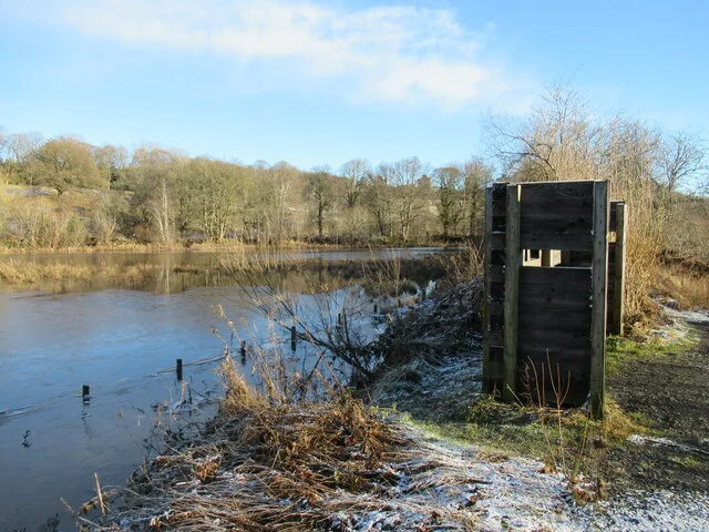
The Haugh’s open water, shallow margins and wet vegetation
One of the nearer public hides; operator describes lowered viewing slots at its two nearest hides. Check the current noticeboard for diversions.
Winter: Wigeon, Teal, Gadwall, Shoveler, Goldeneye, Snipe, Kingfisher
Spring: Lapwing, Little Grebe, Kingfisher
Summer: Gadwall, Little Grebe, Kingfisher
Autumn: Lapwing, Snipe, Green Sandpiper, Black-tailed Godwit, Kingfisher
Light: either. Scope: useful.
The Haugh’s pools and exposed mud
Use signed public access; water levels fluctuate and some onward riverside paths have been lost.
Winter: Wigeon, Teal, Gadwall, Shoveler, Goldeneye, Snipe
Spring: Lapwing, Little Grebe
Summer: Gadwall, Little Grebe
Autumn: Lapwing, Snipe, Green Sandpiper, Black-tailed Godwit
Light: either. Scope: useful.
Mature woodland adjoining the wetland route
Select a signed inland route from the car-park map; avoid unofficial riverbank diversions.
Winter: Nuthatch, Treecreeper, Goldcrest, Tawny Owl
Spring: Nuthatch, Great Spotted Woodpecker, Chiffchaff, Tawny Owl
Summer: Jay, Great Spotted Woodpecker, Tawny Owl
Autumn: Nuthatch, Goldcrest, Tawny Owl
Light: either. Scope: not needed.
The River Clyde from a permitted safe path
Only use sections signed open; erosion and bank collapse can interrupt the old circular route. Do not descend the bank.
Winter: Goosander
Spring: Kingfisher
Summer: Kingfisher
Autumn: Goosander, Kingfisher
Light: either. Scope: useful.
| Spot | Overlooks | Key species by season | Best light | Scope | Tide |
|---|---|---|---|---|---|
| Marsh HideOne of the nearer public hides; operator describes lowered viewing slots at its two nearest hides. Check the current noticeboard for diversions. | The Haugh’s open water, shallow margins and wet vegetation | Winter: Wigeon, Teal, Gadwall, Shoveler, Goldeneye, Snipe, Kingfisher Spring: Lapwing, Little Grebe, Kingfisher Summer: Gadwall, Little Grebe, Kingfisher Autumn: Lapwing, Snipe, Green Sandpiper, Black-tailed Godwit, Kingfisher | either | useful | — |
| Causeway HideUse signed public access; water levels fluctuate and some onward riverside paths have been lost. | The Haugh’s pools and exposed mud | Winter: Wigeon, Teal, Gadwall, Shoveler, Goldeneye, Snipe Spring: Lapwing, Little Grebe Summer: Gadwall, Little Grebe Autumn: Lapwing, Snipe, Green Sandpiper, Black-tailed Godwit | either | useful | — |
| Phoenix Hide (former; unavailable)UNAVAILABLE: SOC’s August2024 report identifies this as the former hide beside the breached bund. Do not walk towards it or use old maps to cross the gap. | Former wetland-bank hide site; not a public watching destination | — | either | useful | — |
| Centenary Hide (former; unavailable)UNAVAILABLE: RSPB Forth Valley’s October2024 report says the hide was demolished and the circular route could not be walked. No reopening was verified. | Former hide and riverbank route; not a usable viewing stop | — | either | useful | — |
| Dalzell woodland public pathsSelect a signed inland route from the car-park map; avoid unofficial riverbank diversions. | Mature woodland adjoining the wetland route | Winter: Nuthatch, Treecreeper, Goldcrest, Tawny Owl Spring: Nuthatch, Great Spotted Woodpecker, Chiffchaff, Tawny Owl Summer: Jay, Great Spotted Woodpecker, Tawny Owl Autumn: Nuthatch, Goldcrest, Tawny Owl | either | not needed | — |
| Clyde walkway: signed open sectionsOnly use sections signed open; erosion and bank collapse can interrupt the old circular route. Do not descend the bank. | The River Clyde from a permitted safe path | Winter: Goosander Spring: Kingfisher Summer: Kingfisher Autumn: Goosander, Kingfisher | either | useful | — |
Month chips show typical presence or our preferred viewing season. Choose birds that suit the time of your visit.
Most paths are described by the RSPB as wide and surfaced, but the longer circuit includes steeper slopes, softer ground and gates. The two closest hides are each about 750 metres from the car park and have lowered viewing slots. Two more distant hides require steps. Fixed-distance descriptions should not obscure the extra time needed for birdwatching or a slow return. Seating is available in the hides and along parts of the Clyde walkway. The parking area is firm and level, without height restrictions, while the large-print map on the noticeboard can help with route choice before departure. Conditions beside a river and wetland can deteriorate after rain, so identify a turn-back point while the first section is still comfortable. A wheelchair user may be able to enjoy an appropriate shorter visit without finding the full circuit suitable. Discuss hide entrances, path condition and any assistance required directly with the team; the general statement that paths are surfaced does not establish an entirely step-free loop.
There is no visitor centre, café or shop on the reserve, so bring food and drinking water if staying through lunch. Motherwell is the operator's suggested place for refreshments. There are no reserve toilets or baby-changing facilities; the nearest public options, including accessible toilets, are in Motherwell around a mile away. Hides provide seats and weather shelter for observing birds. Keep meals away from open viewing slots, leave surfaces clean and take rubbish out with you.
Responsible access follows the Scottish Outdoor Access Code. The RSPB asks for dogs close by, preferably on a short lead, during 1 April–15 August and around livestock. Dogs must stay out of the wetlands and pools at all times. Visitors with assistance dogs are welcome at RSPB Baron's Haugh. Clean up promptly and avoid blocking hide entrances with a lead.
Airbles station offers a useful railway approach within Motherwell; National Rail confirms it is on Airbles Road and managed by ScotRail. Plan the onward pedestrian route to the reserve entrance through the local streets, or arrange a taxi if additional walking would make the hide visit difficult. The RSPB travel page mentions buses around the neighbouring Airbles estate but does not give verified route numbers. Rail plus an agreed walking route or booked transfer is therefore the clearer option here, rather than selecting an unsupported bus. Motherwell's main station provides another arrival point for longer-distance journeys. The reserve can also be reached on foot or by bicycle from different points around Dalzell Estate and along the Clyde walkway. Check the return rail service before entering the woods, and carry a map showing the same entrance you intend to leave by.
Useful bases for an early start.
Booking.com links are affiliate links: we may earn a commission at no extra cost to you. How these links work.
About 1.6 miles by road, roughly 5 minutes’ drive to the reserve arrival point (OSRM, measured 18 October 2026; estimate without live traffic).
Measured driving route · 18 October 2026. Map estimates exclude live traffic.
A local rail-connected baseFind places to stay in Motherwell on Booking.comAbout 3.6 miles by road, roughly 9 minutes’ drive to the reserve arrival point (OSRM, measured 18 October 2026; estimate without live traffic).
Measured driving route · 18 October 2026. Map estimates exclude live traffic.
A separate Clyde Valley town baseFind places to stay in Hamilton on Booking.comAbout 15.8 miles by road, roughly 24 minutes’ drive to the reserve arrival point (OSRM, measured 18 October 2026; estimate without live traffic).
Measured driving route · 18 October 2026. Map estimates exclude live traffic.
City accommodation and rail connectionsFind places to stay in Glasgow on Booking.comExplore Glasgow and the Clyde’s full guides and smaller birding sites
Contact baronshaugh@rspb.org.uk or 0141 3310993 for questions about the reserve. Be specific about the nearer hides, longer circuit or group activity when requesting advice. Schools and groups seeking RSPB participation should arrange it beforehand through the same address. If you find a damaged path or a problem with a hide, identify the public route and date so that the team can locate it without ambiguity.
Check Clyde SOC: September2026 dated regional archive. monthly archive; use site navigation for newer summaries Reports show what has been seen, not what will be.
Follow the BTO Birders’ Code and give wildlife space.
RSPB Baron's Haugh: Free reserve entry; separate parking tariff not published.
RSPB Baron's Haugh: Responsible access follows the Scottish Outdoor Access Code.
RSPB Baron's Haugh: Winter wetland birds; spring woodland song.
RSPB Baron's Haugh: The parking area is firm and level, without height restrictions, while the large-print map on the noticeboard can help with route choice before departure.
RSPB Baron's Haugh: Airbles station offers a useful railway approach within Motherwell; National Rail confirms it is on Airbles Road and managed by ScotRail.
Shorter stops within 15 miles in a straight line. Use the operator’s arrival directions for the journey.
Strathclyde Country Park, Motherwell · Open freshwater loch, shore and adjoining river corridor
Wishaw (2 mi / 3.2 km) · Ancient woodland on the steep sides of Garrion Burn
East Kilbride (2 mi / 3.2 km) · Fen and marshy grassland
Cartland and Cleghorn gorges, near Lanark · Ancient gorge woodland, river banks and burns
Cumbernauld Road, northeast Glasgow · Shallow loch, island, marshy ponds and woodland
Cumbernauld (0 mi / 0 km) · Ancient woodland and meadow
Lambhill, Glasgow, beside the Forth and Clyde Canal · Freshwater loch, marsh, fen, willow scrub and grassland
Nearby complete guides.
Stops with a purpose: use one as a contrasting habitat or weather-proof Plan B. Distances are straight-line estimates, not road journeys.