
Short entry7.3 miles away
Langstone Harbour
Stoke · Estuary, saltmarsh, shingle and lagoons
 the ai birderBirding near me
The AI Birder · one-page field sheet
Earnley, England · PO20 7NE · PO20 7NE

Skylark · Yellowhammer · Brent Goose · Teal · Shoveler · Little Grebe
Easton Viewpoint · Earnley Viewpoint · Ham Viewpoint · Breach Viewpoint · Stilt Pools — public bank path · Easton Lane bank approach
Check current access, hide closures and operator notices before travelling. Seasonal birds are possibilities, not promised sightings. Keep to authorised routes and give wildlife space.
Opening and charges checked 2026-10-18. Operator: https://www.rspb.org.uk/days-out/reserves/medmerry
Full guide and current source links: https://aibirder.co.uk/reserves/rspb-medmerry
EN 79 · RSPB reserve guide
Earnley, England · PO20 7NE
Avocet pools and wide views across a restored coastal wetland.
Decide if the visit fits.
Last checked 18 October 2026.
Opening and charges information · checked .
Stay nearby →Reserve overview
Avocet pools and wide views across a restored coastal wetland.
Eight checks for a smoother visit.
Conditions change: check the operator and transport notices before travelling.
January: January usually makes Teal and Shoveler at the Stilt Pools a useful first target. Use the public bank path and then scan from Earnley or Breach Viewpoint for Brent Geese across the broader marsh. A scope helps with distant flocks; avoid crossing exposed mud to shorten the viewing distance.
February: In February, check the Easton Lane bank approach for Yellowhammer, Linnet and Stonechat before scanning the freshwater Stilt Pools for Little Grebe and Teal. A brief stationary watch at Easton Viewpoint can add Buzzard or Kestrel. Choose a route length that leaves enough warmth for patient observation.
March: March typically brings a stronger Skylark soundtrack along the Easton bank and returning Avocets at the Stilt Pools. Yellowhammer may be easier to find by listening near the approach. The March 2023 group report is evidence of reserve occurrence, not a guarantee that a repeat visit will reproduce its list.
April: April usually rewards the public Stilt Pools bank for Avocet and the Easton approach for Skylark and Yellowhammer. Ham Viewpoint adds a different listening position for returning Sedge Warbler in the mapped reedbed. Stay on public rights of way and allow breeding birds to choose their own distance.
May: May is our choice for the combination of Avocet at the Stilt Pools, Skylark along the public bank and Sedge Warbler from Ham Viewpoint. Corn Bunting is another farmland possibility. Use the existing raised outlooks rather than searching through crop margins, reedbeds or nesting areas for a closer encounter.
June: In June, watch Avocet from the public Stilt Pools path and listen for Sedge Warbler from Ham Viewpoint. The Easton bank approach can add Yellowhammer and Skylark. Public viewpoints provide the watching position; they do not justify following adults carrying food or moving towards chicks beside the water.
July: July usually still offers Avocet at the Stilt Pools and Linnet or Skylark along the Easton bank. Ham Viewpoint gives another scan over farmland and reedbed. The open reserve can feel hot and exposed, so carry water and choose a shorter walk if comfortable observation becomes difficult.
August: August typically shifts attention to changing flocks and returning Lapwing. Try Earnley Viewpoint for the broad marsh and the Stilt Pools for birds using freshwater edges. Linnet and Stonechat remain useful targets along the Easton bank. Habitat water levels can matter more than the calendar for any particular pool.
September: September usually suits alternating field and wetland watches: Linnet and Stonechat from the Easton approach, Lapwing and returning Teal from the public Stilt Pools bank or Earnley Viewpoint. The circuit offers little indoor shelter. Check the forecast before committing to a long return along the exposed banks.
October: In October, Brent Geese typically return to the watching plan from Breach or Earnley Viewpoint, while Teal and Shoveler increase the interest of the Stilt Pools. Yellowhammer and Linnet can reward the Easton approach. A rising tide may move birds, but it never makes the breach safe to cross.
November: November usually favours a scope-led scan from the official viewpoints for Brent Geese, Shelduck and Lapwing, with Teal at the Stilt Pools. Easton Viewpoint offers a broad Buzzard and Kestrel watch. Raptors are reserve possibilities best watched from the public viewpoints, without seeking a roost or following a particular bird.
December: December is a month for a flexible out-and-back: Yellowhammer and Linnet from the Easton bank, then Teal or Shoveler from the Stilt Pools if conditions allow. The public reserve is open around the clock, but winter light, wind and water should decide the length of the visit.
Best conditions: Choose a clear day with manageable wind for the raised banks and broad marsh views. Binoculars are enough for songbirds near the route; a scope is useful at every large-water outlook and particularly helpful from Breach Viewpoint. Light changes around the circuit, so choose a public viewing angle with the sun behind or to one side rather than leaving the route. There are no enclosed hides or toilets at Medmerry; bring layers and make a shorter plan in driving rain.
Entry to Medmerry is free, checked 18 October 2026. The RSPB's charges table separately lists parking free for members and £3 for non-members for up to four hours or £4 for longer. Overnight parking and camping are prohibited . Earnley car park, postcode PO20 7JL, has 15 spaces; Easton Lane, PO20 7JY, has five. The official reserve address uses Pagham Harbour's PO20 7NE, so select your actual arrival point before navigating. The small parking areas can fill, and roadside verges or gateways must remain clear for residents and emergency vehicles. Medmerry’s RSPB charges page mentions paying at a visitor centre, while its facilities page says there is no centre. Arrange provisions around your chosen entrance. Check current reserve notices, payment instructions and the coastal forecast before travelling.
Access times: Reserve: Current RSPB calendar lists the nature reserve open 24 hours; keep to public footpaths and bridleways. · Hides: No enclosed hide; four raised seated viewpoints are mapped, with no separate gate timetable. · Car park: Earnley and Easton Lane car parks open at all times. Unlit; no overnight parking or camping. Nearby Pagham facilities have separate hours. · Dawn access: yes. Operator opening information.
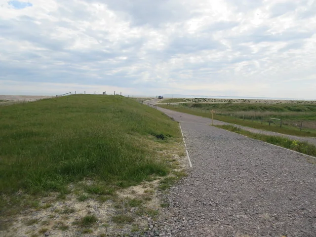
Medmerry's visitor routes follow the new sea-defence landscape around open wetland. Use the reserve's trail guide to connect the four raised viewpoints and select a circuit of an appropriate length. The RSPB publishes a total trail network of 10 kilometres, which describes the available paths rather than a single compulsory circuit. Watch from the banks and public outlooks, leaving pools, mud and shingle to the wildlife. Two-hour plan, editorial suggestion: choose either Earnley or Easton Lane as your starting point, identify the nearest suitable wetland viewpoint on the official map and make that the main destination. Spend a sustained spell scanning before returning by the established route. Include a second outlook only if it fits comfortably. This avoids using most of a short visit simply walking between distant corners of the reserve. Full-day plan, editorial suggestion: begin with a Stilt Pools watch, then build a longer route linking contrasting views across the tidal area and inland margins. Pause for lunch away from sensitive feeding areas, and use the afternoon light to revisit the most productive water. An alternative is a morning at Medmerry followed by Pagham Harbour, using the marked connection and allowing time for the transfer. Do not treat the entire reserve network plus both reserves as an effortless short stroll. The bank-top public footpath is not a cycle route, and some paths in the Ham area are also excluded from cycling. Use the permitted bridleways when arriving by bicycle, slowing for walkers and horses. Water sports and unauthorised drone take-off or landing are prohibited. The public banks provide ample scope for a rewarding visit without entering the wetland basin.
Use the linked reserve map and directions with current access notices. Species are typical seasonal targets. Light and telescope advice reflects our choice of viewpoint.
Ruth’s Marsh, farmland and the northern realignment landscape
Official raised viewpoint with seating, reached on public routes from Easton Lane. Contact reserve staff for individual mobility requirements.
Winter: Linnet, Buzzard, Kestrel
Spring: Skylark, Yellowhammer, Shelduck
Summer: Skylark, Linnet, Yellowhammer
Autumn: Linnet, Stonechat, Buzzard
Light: either. Scope: useful.
Western saltmarsh, channels and grassland
Use the signed public bank path and viewpoint; no access into tidal channels.
Winter: Brent Goose, Teal, Lapwing, Merlin, Short-eared Owl
Spring: Shelduck, Redshank, Skylark, Merlin, Short-eared Owl
Summer: Skylark, Linnet
Autumn: Lapwing, Redshank, Teal, Merlin, Short-eared Owl
Light: either. Scope: useful.
Tide: An incoming tide may concentrate birds in visible channels; a falling tide exposes more feeding mud. No numeric threshold published.
Ham reedbed, fields and eastern marsh
Official seated viewpoint; Ham public footpaths are not cycle routes. Remain outside reedbeds and fields.
Winter: Brent Goose, Buzzard, Stonechat, Hen Harrier, Marsh Harrier
Spring: Sedge Warbler, Corn Bunting, Skylark, Hen Harrier, Marsh Harrier
Summer: Sedge Warbler, Corn Bunting, Linnet, Marsh Harrier
Autumn: Linnet, Stonechat, Yellowhammer, Hen Harrier, Marsh Harrier
Light: either. Scope: useful.
The open realignment, tidal entrance and coastal water
Watch only from the mapped viewpoint and public route. Never cross the breach or enter mud and tidal currents.
Winter: Brent Goose, Shelduck, Herring Gull, Peregrine
Spring: Shelduck, Herring Gull, Peregrine
Summer: Herring Gull
Autumn: Brent Goose, Herring Gull, Peregrine
Light: either. Scope: essential.
Tide: Check tide, wind and swell together. The breach is not a crossing at any predicted state.
The mapped freshwater Stilt Pools
Use the existing bank path. Watch breeding Avocets from the public route without approaching islands or following chicks.
Winter: Teal, Shoveler, Little Grebe
Spring: Avocet, Teal, Shoveler
Summer: Avocet
Autumn: Teal, Shoveler, Lapwing
Light: either. Scope: useful.
Tide: Freshwater pools are not a direct tide spectacle; water level and disturbance matter more than a chosen sea height.
Fields, hedges and rough grass beside the public raised-bank route
This is the established public bank approach, not a new hide. Keep cycle use to the mapped bridleways, not the top-bank footpath.
Winter: Yellowhammer, Linnet, Stonechat
Spring: Skylark, Yellowhammer, Stonechat, Stock Dove
Summer: Skylark, Yellowhammer, Linnet
Autumn: Linnet, Stonechat, Yellowhammer
Light: either. Scope: not needed.
| Spot | Overlooks | Key species by season | Best light | Scope | Tide |
|---|---|---|---|---|---|
| Easton ViewpointOfficial raised viewpoint with seating, reached on public routes from Easton Lane. Contact reserve staff for individual mobility requirements. | Ruth’s Marsh, farmland and the northern realignment landscape | Winter: Linnet, Buzzard, Kestrel Spring: Skylark, Yellowhammer, Shelduck Summer: Skylark, Linnet, Yellowhammer Autumn: Linnet, Stonechat, Buzzard | either | useful | — |
| Earnley ViewpointUse the signed public bank path and viewpoint; no access into tidal channels. | Western saltmarsh, channels and grassland | Winter: Brent Goose, Teal, Lapwing, Merlin, Short-eared Owl Spring: Shelduck, Redshank, Skylark, Merlin, Short-eared Owl Summer: Skylark, Linnet Autumn: Lapwing, Redshank, Teal, Merlin, Short-eared Owl | either | useful | An incoming tide may concentrate birds in visible channels; a falling tide exposes more feeding mud. No numeric threshold published. |
| Ham ViewpointOfficial seated viewpoint; Ham public footpaths are not cycle routes. Remain outside reedbeds and fields. | Ham reedbed, fields and eastern marsh | Winter: Brent Goose, Buzzard, Stonechat, Hen Harrier, Marsh Harrier Spring: Sedge Warbler, Corn Bunting, Skylark, Hen Harrier, Marsh Harrier Summer: Sedge Warbler, Corn Bunting, Linnet, Marsh Harrier Autumn: Linnet, Stonechat, Yellowhammer, Hen Harrier, Marsh Harrier | either | useful | — |
| Breach ViewpointWatch only from the mapped viewpoint and public route. Never cross the breach or enter mud and tidal currents. | The open realignment, tidal entrance and coastal water | Winter: Brent Goose, Shelduck, Herring Gull, Peregrine Spring: Shelduck, Herring Gull, Peregrine Summer: Herring Gull Autumn: Brent Goose, Herring Gull, Peregrine | either | essential | Check tide, wind and swell together. The breach is not a crossing at any predicted state. |
| Stilt Pools — public bank pathUse the existing bank path. Watch breeding Avocets from the public route without approaching islands or following chicks. | The mapped freshwater Stilt Pools | Winter: Teal, Shoveler, Little Grebe Spring: Avocet, Teal, Shoveler Summer: Avocet Autumn: Teal, Shoveler, Lapwing | either | useful | Freshwater pools are not a direct tide spectacle; water level and disturbance matter more than a chosen sea height. |
| Easton Lane bank approachThis is the established public bank approach, not a new hide. Keep cycle use to the mapped bridleways, not the top-bank footpath. | Fields, hedges and rough grass beside the public raised-bank route | Winter: Yellowhammer, Linnet, Stonechat Spring: Skylark, Yellowhammer, Stonechat, Stock Dove Summer: Skylark, Yellowhammer, Linnet Autumn: Linnet, Stonechat, Yellowhammer | either | not needed | — |
Month chips show typical presence or our preferred viewing season. Choose birds that suit the time of your visit.
There is no operator-published optimum height. Our choice is an incoming-tide channel scan from a raised public viewpoint, or falling water for exposed feeding mud. Stilt Pools are freshwater and should not be sold as a direct tide spectacle. Never cross the breach: dangerous currents and soft mud remain hazardous at any state.
The RSPB describes most of the reserve as flat, with compacted-stone bridleways, some mown grass sections and slight gradients reaching the seawall. These are useful surface descriptions, but the operator still asks wheelchair and pushchair users to contact the team for detailed advice. A long, exposed stone route may be tiring even when its gradient is modest. Explain your equipment, desired distance and need for rest stops before choosing an arrival point. The raised viewpoints have seats, while the published bridleway description says there are no gates or barriers around that track. Earnley parking has a height barrier, which may matter for an adapted van; confirm clearance rather than assuming the reserve's general accessibility information covers your vehicle. Car parks are unlit. If avoiding loose surfaces or inclines is important, ask which specific approach best suits you and whether recent weather has changed it. Plan for the same route on the return, when fatigue, an incoming headwind or reduced visibility may alter what initially looked like a comfortable distance.
Medmerry has no toilets, café, shop or visitor centre. Nearby RSPB Pagham Harbour provides the staffed base, refreshments and toilet facilities, so make any necessary comfort stop before committing to a long bank walk. The operator lists Pagham Harbour's centre as open daily 10am–4pm except Christmas Day and Boxing Day, checked October 2026; those are neighbouring facilities rather than services at every Medmerry entrance. Bring water and a packed lunch for a full day, keep food waste contained, and take litter home. Barbecues are not permitted.
Dogs may accompany visitors on designated public footpaths and bridleways, kept on a lead and under close, effective control. Wildlife and grazing livestock both need space. Assistance dogs are welcomed throughout the reserve. Follow the mapped rights of way and prevent a dog running down the bank towards resting or feeding birds.
Chichester is the railway connection for Medmerry. Stagecoach's current Chichester network includes service 51 to Selsey via Pagham Harbour and the 52/53 Witterings circuit. For an Earnley approach, the RSPB identifies the Clappers Lane stop followed by the lane towards Earnley Church and the signed reserve entrance. Select the correct direction and return stop using the current operator timetable. Alternatively, service 51 stops at Pagham Harbour Visitor Centre, from which the RSPB describes a 1.8-mile public-path connection to Medmerry. Include that connecting walk in your day's distance rather than beginning the birding itinerary only on reaching the wetland. A station taxi to a chosen reserve car park is useful where the lane walk, limited daylight or mobility needs make the bus connection awkward. Confirm the pickup location for the return. Cycling visitors can use Route 88 towards Pagham Harbour and the Medmerry Cycle Link, observing the separate on-reserve restrictions described with the trails.
Useful bases for an early start.
Booking.com links are affiliate links: we may earn a commission at no extra cost to you. How these links work.
About 7.2 road miles, roughly 16 minutes by car; OSRM estimate measured 18 October 2026, excluding live traffic.
Measured driving route · 18 October 2026. Map estimates exclude live traffic.
Rail arrival and a city base for the Sussex coast.Find places to stay in Chichester on Booking.comAbout 8.0 road miles, roughly 18 minutes by car; OSRM estimate measured 18 October 2026, excluding live traffic.
Measured driving route · 18 October 2026. Map estimates exclude live traffic.
A coastal base for Medmerry and Pagham Harbour.Find places to stay in Selsey on Booking.comAbout 1.8 road miles, roughly 5 minutes by car; OSRM estimate measured 18 October 2026, excluding live traffic.
Measured driving route · 18 October 2026. Map estimates exclude live traffic.
A western coastal base close to the Earnley approach.Find places to stay in East Wittering on Booking.comExplore West Sussex’s full guides and smaller birding sites
Medmerry enquiries are handled by the Pagham Harbour team at pagham.harbour@rspb.org.uk or 01243 641508. Name the car park and viewpoint you intend to use when asking about route conditions; the reserve is broad enough for a generic access question to miss the relevant detail. The team also provides information about guided walks. Bring a telescope if distant wader identification is the main aim, but keep the equipment clear of shared walking and riding routes. Report damaged signs or livestock problems promptly through the official contact.
Check Sussex Ornithological Society — recent county bird sightings. most days; dated submissions, not a complete reserve census Reports show what has been seen, not what will be.
Follow the BTO Birders’ Code and give wildlife space.
RSPB Medmerry: Free entry; non-member parking £3 up to 4h / £4 longer; members free.
RSPB Medmerry: Dogs may accompany visitors on designated public footpaths and bridleways, kept on a lead and under close, effective control.
RSPB Medmerry: Birdwatching through the seasons.
RSPB Medmerry: These are useful surface descriptions, but the operator still asks wheelchair and pushchair users to contact the team for detailed advice.
RSPB Medmerry: Chichester is the railway connection for Medmerry.
Shorter stops within 15 miles in a straight line. Use the operator’s arrival directions for the journey.
Stoke · Estuary, saltmarsh, shingle and lagoons
West Stoke, near Chichester · Ancient yew woodland and chalk grassland
Brading · Wetland and woodland
Nearby complete guides.
Stops with a purpose: use one as a contrasting habitat or weather-proof Plan B. Distances are straight-line estimates, not road journeys.