

Short entry2.5 miles away
Ledston Luck Nature Reserve
Ridge Road, near Kippax and Castleford · Former colliery · ponds · meadow · woodland · scrub
 the ai birderBirding near me
The AI Birder · one-page field sheet
West Yorkshire, England · WF10 2BH · WF10 2BH

Kingfisher · Bittern · Little Egret · Great White Egret · Cattle Egret · Grey Heron
Pickup Hide · Kingfisher Screen · Charlie’s Hide · Bob Dickens Hide · Lin Dike Hide · Village Bay viewpoint · Roy Taylor Trail public lagoon views · Arrow Lane Trail public flash views
Check current access, hide closures and operator notices before travelling. Seasonal birds are possibilities, not promised sightings. Keep to authorised routes and give wildlife space.
Opening and charges checked 2026-10-18. Operator: https://www.rspb.org.uk/days-out/reserves/fairburn-ings
Full guide and current source links: https://aibirder.co.uk/reserves/rspb-fairburn-ings
EN 30 · RSPB reserve guide
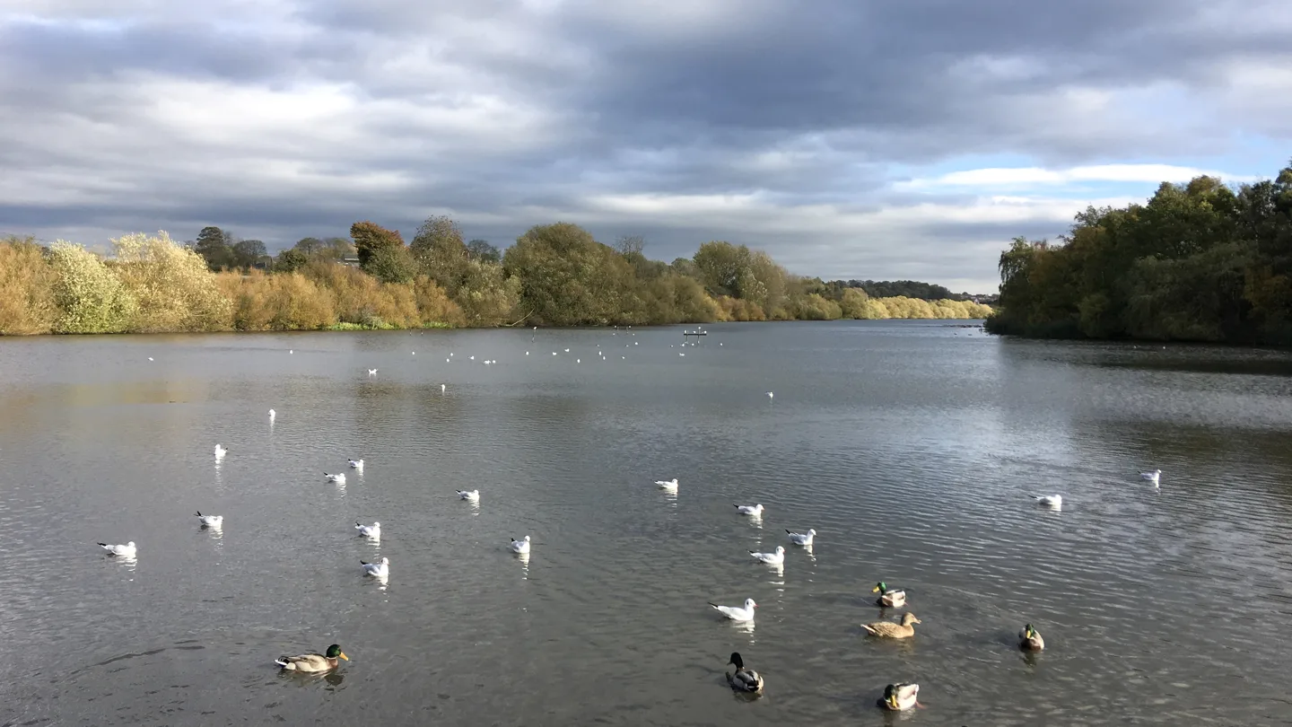
West Yorkshire, England · WF10 2BH
Kingfishers, winter ducks and reedbed birds in a landscape reclaimed from coal mining.
Decide if the visit fits.
Last checked 18 October 2026.
Opening and charges information · checked .
Stay nearby →Reserve overview
Kingfishers, winter ducks and reedbed birds in a landscape reclaimed from coal mining.
Eight checks for a smoother visit.
Conditions change: check the operator and transport notices before travelling.
January: typically look for Pochard from Bob Dickens Hide. Use the public mapped view and allow time for the birds to move naturally. Wetland species range between water bodies; a record elsewhere on the reserve does not fix a bird in front of a hide. February: typically look for Shoveler from Charlie’s Hide. Use the public mapped view and allow time for the birds to move naturally. Wetland species range between water bodies; a record elsewhere on the reserve does not fix a bird in front of a hide. March: typically look for Skylark from Roy Taylor Trail public lagoon views. Use the public mapped view and allow time for the birds to move naturally. Wetland species range between water bodies; a record elsewhere on the reserve does not fix a bird in front of a hide. April: typically look for Kingfisher from Kingfisher Screen. Use the public mapped view and allow time for the birds to move naturally. Wetland species range between water bodies; a record elsewhere on the reserve does not fix a bird in front of a hide. May: typically look for Spoonbill from Arrow Lane Trail public flash views. Use the public mapped view and allow time for the birds to move naturally. Wetland species range between water bodies; a record elsewhere on the reserve does not fix a bird in front of a hide. June: typically look for Reed Warbler from Roy Taylor Trail public lagoon views. Use the public mapped view and allow time for the birds to move naturally. Wetland species range between water bodies; a record elsewhere on the reserve does not fix a bird in front of a hide. July: typically look for Common Tern from Charlie’s Hide. Use the public mapped view and allow time for the birds to move naturally. Wetland species range between water bodies; a record elsewhere on the reserve does not fix a bird in front of a hide. August: typically look for Cattle Egret from Arrow Lane Trail public flash views. Use the public mapped view and allow time for the birds to move naturally. Wetland species range between water bodies; a record elsewhere on the reserve does not fix a bird in front of a hide. September: typically look for Black-tailed Godwit from Lin Dike Hide. Use the public mapped view and allow time for the birds to move naturally. Wetland species range between water bodies; a record elsewhere on the reserve does not fix a bird in front of a hide. October: typically look for Great White Egret from Arrow Lane Trail public flash views. Use the public mapped view and allow time for the birds to move naturally. Wetland species range between water bodies; a record elsewhere on the reserve does not fix a bird in front of a hide. November: typically look for Teal from Village Bay viewpoint. Use the public mapped view and allow time for the birds to move naturally. Wetland species range between water bodies; a record elsewhere on the reserve does not fix a bird in front of a hide. December: typically look for Grey Heron from Pickup Hide. Use the public mapped view and allow time for the birds to move naturally. Wetland species range between water bodies; a record elsewhere on the reserve does not fix a bird in front of a hide.
Best conditions: Usually choose calm conditions for distant duck identification and an early quiet listening stop for reedbed song. After heavy rain, check flood and trail notices before choosing the Lin Dike connection. Repeat the Main Bay watch when glare changes rather than assuming a particular hide always has favourable light.
Admission and parking checked 18 October 2026: the RSPB charges page lists free entry for adults and children. Non-member car parking is £4; RSPB members and Blue Badge holders park free. Coach parking is £20. The parking machine accepts a card or app, not cash. Ordinary visits need no advance reservation; groups of ten or more are directed to the RSPB group-booking arrangements. Check the operator’s calendar and notices before travelling, especially after heavy rain or when planning an early start. Admission and parking are separate arrangements, so visitors arriving on foot do not need to budget for a parking charge. Select the mapped entrance and walking route before setting out, especially if you plan to use the remote Lin Dike side.
Access times: Reserve: October 2026 RSPB calendar: dawn–dusk. Follow closures after flooding. · Hides: No separate hide door timetable published; use within reserve dawn–dusk access. October visitor centre/shop/toilets 10:00–17:00. · Car park: October 2026 calendar 06:00–20:00. Check the date-specific operator calendar for later seasons. · Dawn access: partly. Operator opening information.
Fairburn is best explored as a series of pauses across a former mining landscape. The RSPB publishes five signposted trails and a map covering the bays, flashes, woodland and river. Pick a route that gives time to watch a single area properly instead of using every path as a target. Main Bay and Village Bay offer broad water views; the Riverbank trail brings a different perspective on the river and its vegetated edges. The Discovery Trail provides a compact introduction near the visitor centre. The operator’s map identifies Pickup hide, the Kingfisher screen, Charlie’s hide, Bob Dickens hide and Lin Dike hide. Its facilities text instead says three hides and two viewpoints. These official descriptions do not fully agree about the hide inventory, so use the current map and reserve notices to decide which viewing places are available rather than promising access to every named structure. The Riverbank route is listed as two miles each way. The Roy Taylor circuit is 1.5 miles. Published distances for the Lin Dike link conflict: the current facilities page says approximately two miles, while the linked map says 1.5 miles one way. Arrow Lane is similarly described as 1.2 miles on the facilities page and 0.6 miles one way on the map. Allow for an outward and return walk when joining these routes. Two-hour plan — our suggestion: begin with the Discovery Trail and an unhurried watch at its waterside viewing places, then spend the remaining time scanning Main Bay. Give the Kingfisher screen a settled wait if it is quiet, rather than sacrificing all the visit to a single hoped-for species. Return by the same familiar paths. Full-day plan — our suggestion: use the first part of the morning around Main Bay and the Riverbank route, break near the visitor centre, then choose either Roy Taylor for the grassland panorama or a longer extension towards Lin Dike. Save time at the end to revisit whichever bay had the most interesting feeding activity. Keep to the public routes and let birds approach their own feeding areas without following them along the shore.
Use the linked reserve map and directions with current access notices. Species are typical seasonal targets. Light and telescope advice reflects our choice of viewpoint.
Wetland beside Discovery Trail
Flat Discovery Trail; check current notices for hide availability.
Winter: Grey Heron, Lapwing, Teal
Spring: Grey Heron, Lapwing
Summer: Grey Heron, Little Egret
Autumn: Lapwing, Teal, Grey Heron
Light: either. Scope: useful.
Waterway beside the signed screen
Official mapped screen; wait quietly without following birds along the bank.
Winter: Kingfisher
Spring: Kingfisher
Summer: Kingfisher
Autumn: Kingfisher
Light: either. Scope: useful.
Main Bay open water
On Riverbank Trail; uneven/undulating approach.
Winter: Great Crested Grebe, Tufted Duck, Shoveler
Spring: Great Crested Grebe, Gadwall
Summer: Common Tern, Great Crested Grebe
Autumn: Shoveler, Pochard, Tufted Duck
Light: either. Scope: essential.
Main Bay from the Riverbank Trail
Named on operator map although facilities summary gives a different total hide count; follow local notices.
Winter: Tufted Duck, Pochard
Spring: Great Crested Grebe, Gadwall
Summer: Common Tern, Tufted Duck
Autumn: Shoveler, Great Crested Grebe
Light: either. Scope: essential.
Lin Dike wetland, flashes and reed margin
Separate Lin Dike approach; longer linking paths can be wet and uneven.
Winter: Little Egret, Great White Egret, Snipe
Spring: Spoonbill, Little Egret
Summer: Spoonbill, Cattle Egret, Little Egret
Autumn: Snipe, Black-tailed Godwit, Great White Egret
Light: either. Scope: essential.
Village Bay open water
Use the mapped public viewpoint between Riverbank hides.
Winter: Gadwall, Teal
Spring: Great Crested Grebe, Mute Swan
Summer: Tufted Duck, Mute Swan
Autumn: Teal, Gadwall
Light: either. Scope: essential.
High reed-fringed lagoons and grassland
Steep approaches and uneven gravel; stay on signed trail.
Winter: Reed Bunting, Bittern
Spring: Skylark, Reed Bunting, Bittern
Summer: Reed Warbler, Reed Bunting, Bittern
Autumn: Reed Bunting, Cetti’s Warbler, Bittern
Light: either. Scope: useful.
Flashes and wetland from the public route
No entry to wet margins or private land; do not infer a nesting location from a feeding bird.
Winter: Great White Egret, Little Egret
Spring: Spoonbill, Little Egret
Summer: Cattle Egret, Spoonbill
Autumn: Cattle Egret, Great White Egret, Black-tailed Godwit
Light: either. Scope: essential.
| Spot | Overlooks | Key species by season | Best light | Scope | Tide |
|---|---|---|---|---|---|
| Pickup HideFlat Discovery Trail; check current notices for hide availability. | Wetland beside Discovery Trail | Winter: Grey Heron, Lapwing, Teal Spring: Grey Heron, Lapwing Summer: Grey Heron, Little Egret Autumn: Lapwing, Teal, Grey Heron | either | useful | — |
| Kingfisher ScreenOfficial mapped screen; wait quietly without following birds along the bank. | Waterway beside the signed screen | Winter: Kingfisher Spring: Kingfisher Summer: Kingfisher Autumn: Kingfisher | either | useful | — |
| Charlie’s HideOn Riverbank Trail; uneven/undulating approach. | Main Bay open water | Winter: Great Crested Grebe, Tufted Duck, Shoveler Spring: Great Crested Grebe, Gadwall Summer: Common Tern, Great Crested Grebe Autumn: Shoveler, Pochard, Tufted Duck | either | essential | — |
| Bob Dickens HideNamed on operator map although facilities summary gives a different total hide count; follow local notices. | Main Bay from the Riverbank Trail | Winter: Tufted Duck, Pochard Spring: Great Crested Grebe, Gadwall Summer: Common Tern, Tufted Duck Autumn: Shoveler, Great Crested Grebe | either | essential | — |
| Lin Dike HideSeparate Lin Dike approach; longer linking paths can be wet and uneven. | Lin Dike wetland, flashes and reed margin | Winter: Little Egret, Great White Egret, Snipe Spring: Spoonbill, Little Egret Summer: Spoonbill, Cattle Egret, Little Egret Autumn: Snipe, Black-tailed Godwit, Great White Egret | either | essential | — |
| Village Bay viewpointUse the mapped public viewpoint between Riverbank hides. | Village Bay open water | Winter: Gadwall, Teal Spring: Great Crested Grebe, Mute Swan Summer: Tufted Duck, Mute Swan Autumn: Teal, Gadwall | either | essential | — |
| Roy Taylor Trail public lagoon viewsSteep approaches and uneven gravel; stay on signed trail. | High reed-fringed lagoons and grassland | Winter: Reed Bunting, Bittern Spring: Skylark, Reed Bunting, Bittern Summer: Reed Warbler, Reed Bunting, Bittern Autumn: Reed Bunting, Cetti’s Warbler, Bittern | either | useful | — |
| Arrow Lane Trail public flash viewsNo entry to wet margins or private land; do not infer a nesting location from a feeding bird. | Flashes and wetland from the public route | Winter: Great White Egret, Little Egret Spring: Spoonbill, Little Egret Summer: Cattle Egret, Spoonbill Autumn: Cattle Egret, Great White Egret, Black-tailed Godwit | either | essential | — |
Month chips show typical presence or our preferred viewing season. Choose birds that suit the time of your visit.
Access information checked 18 October 2026: Fairburn’s short Discovery Trail is the clearest choice for visitors needing a compact, relatively predictable outing. The RSPB describes it as 500 metres, flat, with firm gravel and boardwalk surfaces. The longer routes require a different judgement: Riverbank has uneven gravel or mud and gradients steeper than 1:12 in places, while the Lin Dike link begins with a steep section of about 200 metres. Arrow Lane is explicitly described as unsuitable for wheelchairs, pushchairs or mobility scooters; Roy Taylor includes steep hills and uneven ground. Six Blue Badge bays are approximately 100 metres from the centre. The centre is raised, with a 1:12 ramp as an alternative to its steps. The operator describes assisted doors, level internal access and a ground-floor accessible toilet. Viewing structures have steps or ramps, level hide entrances and fixed benches. Four kissing gates use RADAR keys, with a spare key available from the centre. Some boardwalks are narrower than the paths elsewhere. Read the linked AccessAble guide and discuss your proposed route with the reserve team before travelling if gradients, gate operation or a particular viewing position could decide whether the visit works for you.
The visitor centre combines a shop with a self-service refreshments area; plan a picnic if you want a longer meal in the middle of the day. There are picnic tables, an outdoor shelter and a nature-themed play area. Toilets and baby-changing provision make the central area a useful base between walks. Binocular hire is offered, with different models and return arrangements set by the centre. Bring a bag for food packaging and take it home. Barbecues are prohibited, and drones require permission from reserve management.
Dogs must remain on a short lead on the designated public footpaths and bridleways. They cannot enter the visitor centre or shop, except assistance dogs, which are welcome throughout the reserve. Water bowls are provided outside. Choose your walk around these rules and collect dog waste so that feeding birds and other visitors can use the paths undisturbed.
Castleford is the nearest railway station, about three miles from the reserve according to the RSPB. Rail followed by a pre-booked taxi is the simplest car-free option when you want to reach the visitor centre directly. Arrange the return collection as well, giving the Newton Lane entrance rather than merely the name of the wetland. Metro lists service 493 between Pontefract and Sherburn, serving Fairburn village; the RSPB describes village buses as infrequent. This is a village approach, not a bus to the visitor-centre door. Check the dated 493 timetable for your travel day and plan the remaining walk from the actual stop. Do not assume a Sunday service or a safe, continuous pavement along every rural road. A Castleford taxi connection is a better choice if that walk does not suit your party. Drivers approach along Newton Lane using the operator’s directions from the A1(M) or M1. Cycle racks are provided. If combining Fairburn with nearby St Aidan’s, treat it as a separate transfer and leave enough time for a useful visit at each reserve.
Useful bases for an early start.
Booking.com links are affiliate links: we may earn a commission at no extra cost to you. How these links work.
About 3.5 miles by road, roughly 8 minutes’ drive; OSRM estimate measured 18 October 2026, without live traffic.
Measured driving route · 2026-10-18. Map estimates exclude live traffic.
A short road transfer and a rail connection for an Aire Valley visit.Find places to stay in Castleford on Booking.comAbout 6.8 miles by road, roughly 13 minutes’ drive; OSRM estimate measured 18 October 2026, without live traffic.
Measured driving route · 2026-10-18. Map estimates exclude live traffic.
A separate town base for combining the wetlands with other local outings.Find places to stay in Pontefract on Booking.comAbout 16.4 miles by road, roughly 29 minutes’ drive; OSRM estimate measured 18 October 2026, without live traffic.
Measured driving route · 2026-10-18. Map estimates exclude live traffic.
A city stay with wider rail connections and an evening choice of places to eat.Find places to stay in Leeds on Booking.comExplore West Yorkshire’s full guides and smaller birding sites
Contact the RSPB Fairburn Ings team on 01977 628191 or fairburnings@rspb.org.uk. The visitor address is RSPB Fairburn Ings Visitor Centre, Newton Lane, Castleford, West Yorkshire, WF10 2BH. The operator’s reserve page links to its map, access information and events, which are the best starting points for a group visit. Include your intended date and the specific route or facility you need when requesting practical advice. For another Aire Valley wetland day, compare the St Aidan’s guide before choosing your base.
Check RSPB Newcastle group actual reserve observations, 11 July 2026. individual dated outing report, updated 2 August 2026 Reports show what has been seen, not what will be.
Follow the BTO Birders’ Code and give wildlife space.
RSPB Fairburn Ings: Free entry; non-member parking £4; members and Blue Badge holders free.
RSPB Fairburn Ings: Dogs must remain on a short lead on the designated public footpaths and bridleways.
RSPB Fairburn Ings: Winter wildfowl · spring song · summer reedbed birds.
RSPB Fairburn Ings: Arrow Lane is explicitly described as unsuitable for wheelchairs, pushchairs or mobility scooters; Roy Taylor includes steep hills and uneven ground.
RSPB Fairburn Ings: Castleford is the nearest railway station, about three miles from the reserve according to the RSPB.
Shorter stops within 15 miles in a straight line. Use the operator’s arrival directions for the journey.
Ridge Road, near Kippax and Castleford · Former colliery · ponds · meadow · woodland · scrub
Milner Lane, near Bardsey and Scarcroft · Ancient woodland · beck · meadow
Barlow, south of Selby · Woodland, ponds, wetland and flower-rich grassland
Netherton, near Wakefield · Ancient oak-and-birch woodland · beck · wet woodland
South Lane, near Midgley, Wakefield · Acid grassland · young woodland · scrub · pond
Beside Golden Acre Park, Leeds · Lake · wet woodland · dry woodland · marsh
Off the A1036 at the south-western edge of York · Ancient peatland, fen, woodland and ponds
Nearby complete guides.
Stops with a purpose: use one as a contrasting habitat or weather-proof Plan B. Distances are straight-line estimates, not road journeys.