

Short entry7.1 miles away
Dearne Valley - Adwick Washland
Bolton Upon Dearne, Mexborough · Wetland and grassland
 the ai birderBirding near me
The AI Birder · one-page field sheet
Doncaster, South Yorkshire, England · DN4 8DB · DN4 8DB

Bittern · Marsh Harrier · Willow Tit · Green Sandpiper · Little Egret · Teal
Loversall Pool Hide · Beeston Hide · Willow Pool Hide · Old Eaa Hide · Decoy Marsh Hide · Cottage Drain Hide · Duchess Hide · Hawthorn Bank Hide · St Catherine’s Hide · Tofield Hide · Roger Mitchell Hide · West Scrape Hide · Piper Marsh Hide · Discovery Zone woodland viewpoint · East Scrape open viewpoint · Railway Route public path
Check current access, hide closures and operator notices before travelling. Seasonal birds are possibilities, not promised sightings. Keep to authorised routes and give wildlife space.
Opening and charges checked 2026-10-18. Operator: https://www.ywt.org.uk/potteric-carr
Full guide and current source links: https://aibirder.co.uk/reserves/potteric-carr
EN 47 · Yorkshire Wildlife Trust reserve guide
Doncaster, South Yorkshire, England · DN4 8DB
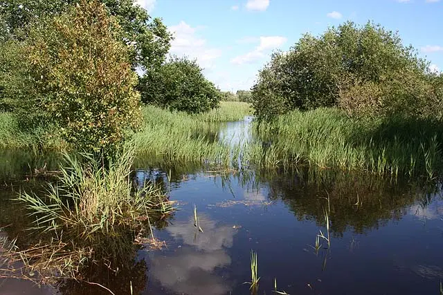
Bitterns and Marsh Harriers in a mosaic of reedbeds, pools, woodland and wet grassland on Doncaster’s edge.
Decide if the visit fits.
Last checked 18 October 2026.
Opening and charges information · checked .
Stay nearby →Reserve overview
Bitterns and Marsh Harriers in a mosaic of reedbeds, pools, woodland and wet grassland on Doncaster’s edge.
Eight checks for a smoother visit.
Conditions change: check the operator and transport notices before travelling.
January: typically look for Pochard and Teal from Decoy Marsh Hide. Make an ordinary daytime visit within confirmed opening hours. Dawn entry is not advertised, and a late Starling watch needs separate operator agreement rather than an assumption that the gate stays open. February: typically look for Willow Tit from Willow Pool Hide. The operator map identifies the Willow Marsh feeding area as a legitimate watching place. Be patient and compare calls and plumage carefully, without entering woodland or approaching a nest cavity. March: typically look for Sand Martin from Tofield Hide and Shoveler from Loversall Pool Hide. Use Tofield for a broad marsh-and-sky scan, adding Loversall Pool for Shoveler. Spring arrival and flight activity vary with weather, so a month chip is a planning aid rather than a guarantee. April: typically look for Avocet and Little Ringed Plover from West Scrape Hide. Watch from West Scrape Hide and keep all breeding islands out of the route. Water management changes the available edges; check the current reserve report before choosing a long circuit. May: typically look for Reed Warbler and Cetti’s Warbler from Piper Marsh Hide. Listen from Piper Marsh Hide and the authorised approach. A hidden bird can be identified by sound without a photograph; do not step into reed cover to settle an uncertain identification. June: typically look for Marsh Harrier from Roger Mitchell Hide and Common Tern from Tofield Hide. Use Roger Mitchell Hide for the reedbed skyline and Tofield for the wider water. The historical operator map recommends this general marsh watch, without locating nests or promising birds at a fixed time. July: typically look for Green Sandpiper and Reed Bunting from Piper Marsh Hide. Give Piper Marsh time before changing hides. Actual operator archives support regular late-summer wetland use, while current regional reports provide a fresher check on which parts of the reserve deserve attention. August: typically look for Little Egret and Great White Egret from Duchess Hide. Compare size and feeding behaviour from Duchess Hide, a habitat-based marsh recommendation. The July 2026 local report supports both species at the reserve, without giving a guaranteed hide-specific encounter. September: typically look for Snipe and Lapwing from West Scrape Hide. Scan the scrape margins slowly and compare birds in the same light. Passage fluctuates with water levels and weather; a report from another Doncaster wetland should never be silently attributed to Potteric Carr. October: typically look for Gadwall from Old Eaa Hide and Blackcap from Hawthorn Bank Hide. Use Old Eaa for a water scan and Hawthorn Bank for listening near cover. Midges can still affect a calm damp visit; plan a useful shorter circuit rather than rushing uncomfortably between every hide. November: typically look for Teal and Pochard from Decoy Marsh Hide. Winter closing begins on 3 November 2026 in the checked operator notice. Confirm any later visit at the welcome desk and keep the ordinary daytime return inside the published gate arrangements. December: typically look for Water Rail from Cottage Drain Hide and Willow Tit from Willow Pool Hide. Combine a quiet Cottage Drain reed-edge watch with a separate Willow Pool session. Public access has its own days and hours: an attractive winter forecast does not override the normal Monday closure.
Best conditions: Our choice is a calm morning after opening for woodland calls, followed by sustained marsh-hide scans in clear light. Wind may make the exposed wetland windows awkward while trees offer a shorter alternative. Binoculars suit woodland and near reeds; a scope helps across Huxter Well and the scrapes. Current access instructions and weather decide the route, and an evening spectacle needs explicit operator arrangements.
Admission checked 18 October 2026: Wildlife Trust members enter free; adult non-members pay £6; visitors aged 18 and under enter free. The concession price is £4.50 for students, disabled visitors and people receiving Universal or Pension Credit. The operator’s detailed page gives Tuesday–Sunday and Bank Holiday Monday opening, 9.30am–5pm in the 2026 summer season from 4 May, changing to 9.30am–4pm from 3 November 2026. Ordinary Mondays are closed. Hot food finishes at 2.30pm and the café closes at 3.30pm. The car park is off Mallard Way. Confirm any separate vehicle charge with Yorkshire Wildlife Trust before travelling. Check the reserve’s current notices before travelling, including any separately booked late-opening event.
Access times: Reserve: Tuesday–Sunday and Bank Holiday Mondays: 9.30am–5pm summer from 4 May 2026; 9.30am–4pm winter from 3 November 2026. Closed ordinary Mondays. · Hides: Use hides during authorised reserve access. Any late spectacle or extended stay requires the visitor-centre arrangement; no independent dawn hide access advertised. · Car park: Operator says gates lock at 5pm and later stays must be arranged at welcome desk before then. Winter reserve closes 4pm, so use the earlier visitor closing time unless explicitly authorised. · Dawn access: no. Operator opening information.
Potteric Carr’s appeal lies in the close succession of open water, reedbed, woodland and meadow. Start at the visitor centre and choose a route from the current reserve map that connects the habitat you most want to watch. Huxter Well Marsh provides a wetland focus, while the woodland gives shelter and a different set of birds. The Trust’s main reserve photographs identify Beeston Hide as another viewing destination. Use the current map for the permitted links rather than following a railway embankment or an informal path because it appears to lead towards open water. Two-hour plan, editorial suggestion: spend a few minutes orientating yourself at the centre, walk directly to a suitable wetland hide, and give it most of the first hour. Return by a contrasting woodland or pool-side section if the map and conditions permit, leaving time for a final view near the entrance. This is a birdwatching visit rather than a challenge to cover the greatest distance; a single hide may hold enough activity for the entire session. Full-day plan, editorial suggestion: devote the morning to the main marsh and hides, returning for a food break before taking a quieter woodland and meadow route in the afternoon. Revisit the most promising pool towards the end instead of adding a new distant destination. Watch how feeding behaviour changes with light and disturbance, and keep the last part of the outing close enough to the exit for an unhurried departure. In winter, plan an ordinary daytime visit unless you have an operator-confirmed arrangement for a late spectacle. Respect grazing compartments and habitat work signs, and clean footwear before visiting another wetland to reduce the risk of carrying unwanted plants or other material between reserves.
Use the linked reserve map and directions with current access notices. Species are typical seasonal targets. Light and telescope advice reflects our choice of viewpoint.
Loversall Pool
Use the current visitor-centre map and open signed routes; historical operator map distinguishes ramp and step access, so confirm the facility needed.
Winter: Shoveler, Great Crested Grebe
Spring: Shoveler, Great Crested Grebe
Summer: Shoveler, Great Crested Grebe
Autumn: Shoveler, Great Crested Grebe
Light: either. Scope: useful.
Western edge of Willow Marsh
Use the current visitor-centre map and open signed routes; historical operator map distinguishes ramp and step access, so confirm the facility needed.
Light: either. Scope: useful.
Willow Marsh and nearby trees
Use the current visitor-centre map and open signed routes; historical operator map distinguishes ramp and step access, so confirm the facility needed.
Winter: Willow Tit
Spring: Willow Tit
Summer: Willow Tit
Autumn: Willow Tit
Light: either. Scope: not needed.
Old Eaa Marsh
Use the current visitor-centre map and open signed routes; historical operator map distinguishes ramp and step access, so confirm the facility needed.
Winter: Gadwall
Spring: Gadwall
Summer: Gadwall
Autumn: Gadwall
Light: either. Scope: useful.
Decoy Marsh open water
Use the current visitor-centre map and open signed routes; historical operator map distinguishes ramp and step access, so confirm the facility needed.
Winter: Teal, Pochard, Little Grebe
Spring: Teal, Pochard, Little Grebe
Summer: Little Grebe
Autumn: Teal, Pochard, Little Grebe
Light: either. Scope: useful.
Southern Willow Marsh and drain
Use the current visitor-centre map and open signed routes; historical operator map distinguishes ramp and step access, so confirm the facility needed.
Winter: Water Rail
Spring: Water Rail
Summer: Water Rail
Autumn: Water Rail
Light: either. Scope: not needed.
Western Huxter Well Marsh
Use the current visitor-centre map and open signed routes; historical operator map distinguishes ramp and step access, so confirm the facility needed.
Winter: Little Egret
Spring: Little Egret, Great White Egret
Summer: Little Egret, Great White Egret
Autumn: Little Egret, Great White Egret
Light: either. Scope: useful.
Western Huxter Well Marsh
Use the current visitor-centre map and open signed routes; historical operator map distinguishes ramp and step access, so confirm the facility needed.
Spring: Blackcap
Summer: Blackcap
Autumn: Blackcap
Light: either. Scope: useful.
Huxter Well Marsh
Use the current visitor-centre map and open signed routes; historical operator map distinguishes ramp and step access, so confirm the facility needed.
Light: either. Scope: useful.
Southern Huxter Well Marsh
Use the current visitor-centre map and open signed routes; historical operator map distinguishes ramp and step access, so confirm the facility needed.
Spring: Common Tern, Sand Martin
Summer: Common Tern, Sand Martin
Autumn: Sand Martin
Light: either. Scope: useful.
Huxter Well Marsh reeds and water
Use the current visitor-centre map and open signed routes; historical operator map distinguishes ramp and step access, so confirm the facility needed.
Winter: Bittern, Marsh Harrier, Reed Bunting
Spring: Bittern, Marsh Harrier, Reed Bunting
Summer: Bittern, Marsh Harrier, Reed Bunting
Autumn: Bittern, Marsh Harrier, Reed Bunting
Light: either. Scope: useful.
West Scrape
Use the current visitor-centre map and open signed routes; historical operator map distinguishes ramp and step access, so confirm the facility needed.
Winter: Snipe, Lapwing
Spring: Avocet, Little Ringed Plover, Snipe, Lapwing
Summer: Avocet, Little Ringed Plover, Snipe, Lapwing
Autumn: Snipe, Lapwing
Light: either. Scope: useful.
Piper Marsh
Use the current visitor-centre map and open signed routes; historical operator map distinguishes ramp and step access, so confirm the facility needed.
Winter: Green Sandpiper
Spring: Green Sandpiper, Reed Warbler
Summer: Green Sandpiper, Reed Warbler
Autumn: Green Sandpiper, Reed Warbler
Light: either. Scope: useful.
Woodland and field edge
Use the current visitor-centre map and open signed routes; historical operator map distinguishes ramp and step access, so confirm the facility needed.
Light: either. Scope: not needed.
East Scrape and grassland
Use the current visitor-centre map and open signed routes; historical operator map distinguishes ramp and step access, so confirm the facility needed.
Light: either. Scope: useful.
Trees, scrub and wetland edges
Use the current visitor-centre map and open signed routes; historical operator map distinguishes ramp and step access, so confirm the facility needed.
Winter: Cetti’s Warbler
Spring: Cetti’s Warbler, Chiffchaff
Summer: Cetti’s Warbler, Chiffchaff
Autumn: Cetti’s Warbler, Chiffchaff
Light: either. Scope: not needed.
| Spot | Overlooks | Key species by season | Best light | Scope | Tide |
|---|---|---|---|---|---|
| Loversall Pool HideUse the current visitor-centre map and open signed routes; historical operator map distinguishes ramp and step access, so confirm the facility needed. | Loversall Pool | Winter: Shoveler, Great Crested Grebe Spring: Shoveler, Great Crested Grebe Summer: Shoveler, Great Crested Grebe Autumn: Shoveler, Great Crested Grebe | either | useful | — |
| Beeston HideUse the current visitor-centre map and open signed routes; historical operator map distinguishes ramp and step access, so confirm the facility needed. | Western edge of Willow Marsh | — | either | useful | — |
| Willow Pool HideUse the current visitor-centre map and open signed routes; historical operator map distinguishes ramp and step access, so confirm the facility needed. | Willow Marsh and nearby trees | Winter: Willow Tit Spring: Willow Tit Summer: Willow Tit Autumn: Willow Tit | either | not needed | — |
| Old Eaa HideUse the current visitor-centre map and open signed routes; historical operator map distinguishes ramp and step access, so confirm the facility needed. | Old Eaa Marsh | Winter: Gadwall Spring: Gadwall Summer: Gadwall Autumn: Gadwall | either | useful | — |
| Decoy Marsh HideUse the current visitor-centre map and open signed routes; historical operator map distinguishes ramp and step access, so confirm the facility needed. | Decoy Marsh open water | Winter: Teal, Pochard, Little Grebe Spring: Teal, Pochard, Little Grebe Summer: Little Grebe Autumn: Teal, Pochard, Little Grebe | either | useful | — |
| Cottage Drain HideUse the current visitor-centre map and open signed routes; historical operator map distinguishes ramp and step access, so confirm the facility needed. | Southern Willow Marsh and drain | Winter: Water Rail Spring: Water Rail Summer: Water Rail Autumn: Water Rail | either | not needed | — |
| Duchess HideUse the current visitor-centre map and open signed routes; historical operator map distinguishes ramp and step access, so confirm the facility needed. | Western Huxter Well Marsh | Winter: Little Egret Spring: Little Egret, Great White Egret Summer: Little Egret, Great White Egret Autumn: Little Egret, Great White Egret | either | useful | — |
| Hawthorn Bank HideUse the current visitor-centre map and open signed routes; historical operator map distinguishes ramp and step access, so confirm the facility needed. | Western Huxter Well Marsh | Spring: Blackcap Summer: Blackcap Autumn: Blackcap | either | useful | — |
| St Catherine’s HideUse the current visitor-centre map and open signed routes; historical operator map distinguishes ramp and step access, so confirm the facility needed. | Huxter Well Marsh | — | either | useful | — |
| Tofield HideUse the current visitor-centre map and open signed routes; historical operator map distinguishes ramp and step access, so confirm the facility needed. | Southern Huxter Well Marsh | Spring: Common Tern, Sand Martin Summer: Common Tern, Sand Martin Autumn: Sand Martin | either | useful | — |
| Roger Mitchell HideUse the current visitor-centre map and open signed routes; historical operator map distinguishes ramp and step access, so confirm the facility needed. | Huxter Well Marsh reeds and water | Winter: Bittern, Marsh Harrier, Reed Bunting Spring: Bittern, Marsh Harrier, Reed Bunting Summer: Bittern, Marsh Harrier, Reed Bunting Autumn: Bittern, Marsh Harrier, Reed Bunting | either | useful | — |
| West Scrape HideUse the current visitor-centre map and open signed routes; historical operator map distinguishes ramp and step access, so confirm the facility needed. | West Scrape | Winter: Snipe, Lapwing Spring: Avocet, Little Ringed Plover, Snipe, Lapwing Summer: Avocet, Little Ringed Plover, Snipe, Lapwing Autumn: Snipe, Lapwing | either | useful | — |
| Piper Marsh HideUse the current visitor-centre map and open signed routes; historical operator map distinguishes ramp and step access, so confirm the facility needed. | Piper Marsh | Winter: Green Sandpiper Spring: Green Sandpiper, Reed Warbler Summer: Green Sandpiper, Reed Warbler Autumn: Green Sandpiper, Reed Warbler | either | useful | — |
| Discovery Zone woodland viewpointUse the current visitor-centre map and open signed routes; historical operator map distinguishes ramp and step access, so confirm the facility needed. | Woodland and field edge | — | either | not needed | — |
| East Scrape open viewpointUse the current visitor-centre map and open signed routes; historical operator map distinguishes ramp and step access, so confirm the facility needed. | East Scrape and grassland | — | either | useful | — |
| Railway Route public pathUse the current visitor-centre map and open signed routes; historical operator map distinguishes ramp and step access, so confirm the facility needed. | Trees, scrub and wetland edges | Winter: Cetti’s Warbler Spring: Cetti’s Warbler, Chiffchaff Summer: Cetti’s Warbler, Chiffchaff Autumn: Cetti’s Warbler, Chiffchaff | either | not needed | — |
Month chips show typical presence or our preferred viewing season. Choose birds that suit the time of your visit.
The visitor centre has an accessible entrance and toilet facilities, and the Trust identifies reserve routes suitable for wheelchairs and pushchairs. Its official page links to Accessible Nature for fuller information for wheelchair, powerchair and mobility-equipment users. Use that route-specific guidance to decide which hides and surfaces fit your needs, rather than treating a general accessibility statement as a guarantee about every path across this large reserve. Before travelling, ask about thresholds, turning space and viewing height at the particular hide you intend to visit. Explain whether you can manage a ramp or gate independently, how far you want to travel between rest points and whether you need a companion to help on an uneven section. Conditions following rain can matter as much as the usual surface description. A short route from the centre to one wetland viewpoint may be more satisfying than a long loop that uses all your stamina on the outward leg. Keep a comfortable turning point in mind and allow extra time to return after a prolonged seated watch. Sensory preferences also deserve a specific enquiry: choose a quieter period with the operator if crowded rooms or busy events would make the visit difficult.
The visitor centre provides toilets, baby changing, a gift shop and a café overlooking water. The shop includes books, optics and other wildlife-related items, while picnic spots offer an alternative for visitors carrying lunch. Bring binoculars even if you mainly hope to use a hide: many small birds are first noticed along the connecting paths. Insect repellent can be useful in warmer conditions. Keep food and litter contained, and avoid feeding wildlife while waiting for the next part of your walk.
Only assistance and guide dogs are permitted on the reserve. The Trust explains that sensitive wildlife, plants and grazing animals are the reason for excluding pet dogs. Arrange another outing for a pet rather than planning to leave it in a vehicle during a long hide session. Discuss any assistance-dog access needs before travelling.
Doncaster station and the adjacent Frenchgate Interchange provide the rail-and-bus starting point. Yorkshire Wildlife Trust’s current detailed visit information identifies services X11 or 372 for the onward journey, while an older Trust car-free article still gives service 72. First Bus’s current timetables list X11 and the 372 Lakeside circular; use those current service pages instead of relying on the older number. The reserve directions tell visitors to alight near B&Q and cross White Rose Way at the traffic lights before continuing to Mallard Way. Check the direction-specific stop, service notices and return timetable for your date, especially on Sundays and Bank Holidays. Map the final walk separately from the bus ride so you know how much time to leave after a hide session. If the walking approach is unsuitable, arrange a taxi from the station and describe any optics or mobility equipment when booking. Give the driver the visitor-centre entrance rather than simply a point inside the wider wetland. Leave enough margin to reach your train without turning the final birdwatching stop into a rushed departure.
Useful bases for an early start.
Booking.com links are affiliate links: we may earn a commission at no extra cost to you. How these links work.
About 3.0 miles by road, roughly 7 minutes’ drive from the measured central base point; OSRM/OpenStreetMap estimate measured 18 October 2026, excluding live traffic, parking and walking.
Measured driving route · 2026-10-18. Map estimates exclude live traffic.
Rail connections and the shortest measured reserve transfer.Find places to stay in Doncaster on Booking.comAbout 8.0 miles by road, roughly 12 minutes’ drive from the measured central base point; OSRM/OpenStreetMap estimate measured 18 October 2026, excluding live traffic, parking and walking.
Measured driving route · 2026-10-18. Map estimates exclude live traffic.
An independent town base south of the wetland.Find places to stay in Bawtry on Booking.comAbout 6.2 miles by road, roughly 11 minutes’ drive from the measured central base point; OSRM/OpenStreetMap estimate measured 18 October 2026, excluding live traffic, parking and walking.
Measured driving route · 2026-10-18. Map estimates exclude live traffic.
Combining the reserve with a smaller South Yorkshire base.Find places to stay in Tickhill on Booking.comExplore South Yorkshire’s full guides and smaller birding sites
The reserve publishes 01302 325736 and potteric.carr@ywt.org.uk. Use that contact for practical visit questions, specifying the day, the route or hide you need and any access requirements. For a winter dusk visit, obtain the actual event or late-opening arrangement before buying travel, rather than interpreting a general mention of murmurations as an admission schedule. The Trust’s own events calendar is the appropriate place to confirm a separately bookable activity. Send a clear location and observation time when reporting an access problem or disturbance concern.
Check YWT Potteric Carr wildlife-report archive. 2018 archive, not a current daily feed Reports show what has been seen, not what will be.
Follow the BTO Birders’ Code and give wildlife space.
Potteric Carr: Adults £6; concessions £4.50; Wildlife Trust members and under-19s free. Parking: confirm with operator.
Potteric Carr: Only assistance and guide dogs are permitted on the reserve.
Potteric Carr: Winter wildfowl · spring breeding birds · autumn migration.
Potteric Carr: The visitor centre has an accessible entrance and toilet facilities, and the Trust identifies reserve routes suitable for wheelchairs and pushchairs.
Potteric Carr: Doncaster station and the adjacent Frenchgate Interchange provide the rail-and-bus starting point.
Shorter stops within 15 miles in a straight line. Use the operator’s arrival directions for the journey.
Bolton Upon Dearne, Mexborough · Wetland and grassland
RSPB Old Moor and Manvers Lake · Wetland and reedbed
Daneshill Road between Torworth and Lound · Flooded gravel pits, damp willow woodland, drier woodland and grassland
Broomhill, Barnsley · Fen meadow and dry grassland
Broomhill · Wetland and grassland
West of Epworth, Isle of Axholme · Former peat workings, woodland and wetland
Riverside Way, Rotherham · River · ponds · reedbed · wetland · meadow bank
North Road, Retford · Lakes, wetlands, grassland, woodland and scrub
Beckingham · Wet grassland and meadow
Nearby complete guides.
Stops with a purpose: use one as a contrasting habitat or weather-proof Plan B. Distances are straight-line estimates, not road journeys.