

Short entry0.7 miles away
Waters’ Edge Country Park
Maltkiln Road, Barton-upon-Humber · Ponds, reedbeds, woodland, meadow and Humber foreshore
 the ai birderBirding near me
The AI Birder · one-page field sheet
Barton-upon-Humber, North Lincolnshire, England · DN18 5RG · DN18 5RG

Bittern · Bearded Tit · Pink-footed Goose · Water Rail · Teal · Gadwall
Ness End double-decker hide · North-west Ness Pit hide · Scrapes hide · Target Lake hide · Hotel Pit hide · Pursuit Pit hide · Humber-bank Viking Way · Visitor Centre viewing area
Check current access, hide closures and operator notices before travelling. Seasonal birds are possibilities, not promised sightings. Keep to authorised routes and give wildlife space.
Opening and charges checked 2026-10-18. Operator: https://www.lincstrust.org.uk/get-involved/top-reserves/far-ings
Full guide and current source links: https://aibirder.co.uk/reserves/far-ings-national-nature-reserve
EN 46 · Lincolnshire Wildlife Trust reserve guide
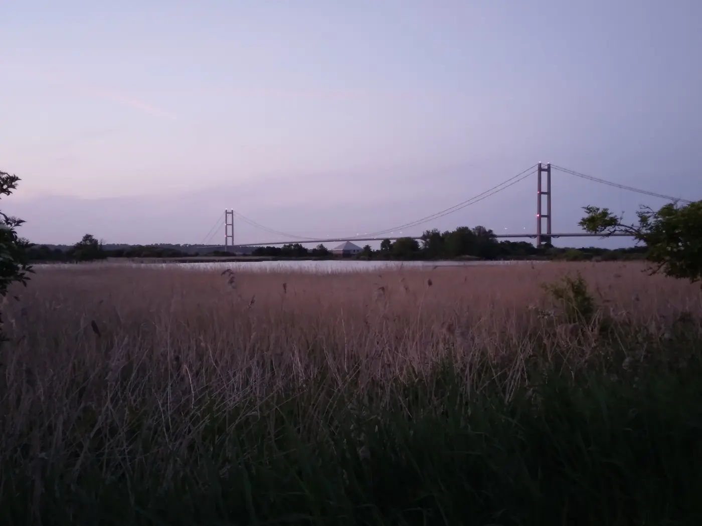
Barton-upon-Humber, North Lincolnshire, England · DN18 5RG
Bitterns among former clay pits and reedbeds, with waterbirds and migration along the Humber bank.
Decide if the visit fits.
Last checked 18 October 2026.
Opening and charges information · checked .
Stay nearby →Reserve overview
Bitterns among former clay pits and reedbeds, with waterbirds and migration along the Humber bank.
Eight checks for a smoother visit.
Conditions change: check the operator and transport notices before travelling.
January: typically look for Goldeneye and Goosander from Pursuit Pit hide. Compare the freshwater pits before adding an estuary walk. A scope helps on open water; independent hide unlocking hours were not published, so check the entrance notices rather than assuming every building is open. February: typically look for Pochard and Tufted Duck from Target Lake hide. Use the established hide and scan the whole lake in sections. Avoid approaching waterside margins, even when a distant duck cannot be confidently identified through binoculars. March: typically look for Bittern and Water Rail from Ness End double-decker hide. The operator identifies the double-decker hide as a legitimate watching place. Listen quietly and let hidden birds remain hidden; booming or a fleeting record does not justify entering the reeds. April: typically look for Reed Warbler from North-west Ness Pit hide. Typically returning reedbed song is often easier to hear than see. Stay at the mapped hide and public trail, allowing for birds to move naturally without playback or repeated approaches. May: typically look for Bearded Tit from North-west Ness Pit hide. Choose a calmer period when calls carry across the reeds. The location is a habitat-based viewing recommendation, not a claim that a particular pair or nesting area can be found there. June: typically look for Great Crested Grebe and Little Grebe from Target Lake hide. Combine Target Lake with a separate Scrapes-hide watch for Little Grebe. Compare open water and vegetated edges, keeping nests and young out of any close-approach plan. July: typically look for Cormorant and Gadwall from Hotel Pit hide. Watch Hotel Pit, adding Pursuit Pit for a different open-water scan. A few sustained watches can be more rewarding than rushing around all three waymarked routes to finish a checklist. August: typically look for Kingfisher from Visitor Centre viewing area. The operator describes the Visitor Centre as a legitimate lake-watching facility. Use its published opening days; do not search banks for nest holes or pursue a bird along the shoreline. September: typically look for Cetti’s Warbler and Teal from Scrapes hide. Listen around the authorised reed-edge route and scan from Scrapes hide as winter ducks typically build. The September 2026 county report supports both birds locally without guaranteeing their return on a visit. October: typically look for Pink-footed Goose and Wigeon from Humber-bank Viking Way. Check the tide and forecast before choosing the public Humber bank. Look for flights as well as feeding birds, but treat flock movements as opportunities rather than a scheduled performance. November: typically look for Dunlin and Redshank from Humber-bank Viking Way. Low water exposes estuary feeding ground, as the operator leaflet explains. Use a scope from the public bank; moving onto intertidal mud for a closer view creates risk and disturbance. December: typically look for Bittern from Ness End double-decker hide, with a separate Goldeneye scan from Pursuit Pit hide. Use Ness End hide for the reedbed watch, with Goldeneye sought separately on the open pits. Vehicle gates have their own hours, so leave a realistic margin for returning to your chosen car park.
Best conditions: Choose a calm morning for reedbed calls, a clear spell for freshwater duck identification and an appropriate tide for the separate Humber-bank watch. A scope helps across open pits and distant mudflats; binoculars are easier for nearby reeds. Rain can make paths slippery and winter wind makes the bank exposed. Match the route to the actual gate hours.
Visit information checked 18 October 2026: the Trust states that the reserve is open at all times and that parking is free at Ness End and the visitor centre. No general reserve admission tariff is displayed on the checked official visit pages. The centre opens Wednesday–Sunday, 10am–4pm, and is closed Mondays and Tuesdays. The centre car park opens 9am–4.30pm, or dusk if earlier. Ness End opens at 8am and locks at 6pm, or dusk if earlier. The shorter nature-reserve listing omits that dusk qualification for Ness End, so follow the fuller visit guidance and posted gate time. An outdoor access right does not keep a locked car park open. Check current Trust notices and conditions before travelling; organised groups need the published advance-visit arrangements.
Access times: Reserve: Trust main visitor page says reserve open at all times; use signed public paths and heed local closures. · Hides: Six hide symbols on current-linked 2021 reserve map; no independent daily unlocking timetable published. Visitor Centre Wednesday–Sunday 10am–4pm. · Car park: Ness End: 8am–6pm daily. Visitor Centre car park: 9am–4.30pm or dusk if earlier. Reserve access does not extend these vehicle hours. · Dawn access: partly. Operator opening information.
Far Ings offers three waymarked circular routes: the Bittern Trail, for which the Trust suggests two hours; the Grebe Trail, about an hour; and the Tadpole Trail, about half an hour. These durations are walking guides rather than a timetable for bird sightings. The former clay pits, reedbeds and surrounding scrub offer a sequence of different feeding habitats, so pause at the transitions rather than marching continuously between hides. Ness End’s double-decker hide is the Trust’s named starting point for Bittern watching. The Humber-bank Viking Way provides a contrasting estuary perspective, using permitted public paths. Two-hour plan, editorial suggestion: begin with a substantial Ness End hide watch, then choose the shorter signed route that leaves time to examine lake edges and return comfortably. Do not feel obliged to complete the entire Bittern Trail simply because its published duration matches the time you have. A quiet half hour can be more productive than trying to locate a shy bird while continuously moving. Full-day plan, editorial suggestion: work through the Bittern Trail in the morning, interrupting the walk with hide stops, then take a picnic break. In the afternoon, add a shorter circuit or a safe Humber-bank section, depending on whether the day’s interest is freshwater feeding or migration along the estuary. Finish near your chosen parking area rather than adding a distant viewpoint late in the day. Keep to signed routes through the sensitive reedbed and stay outside habitat work areas. Large expanses of water visible through the vegetation are not invitations to find an informal shoreline shortcut; use the designed viewing positions and let wildlife come into view.
Use the linked reserve map and directions with current access notices. Species are typical seasonal targets. Light and telescope advice reflects our choice of viewpoint.
Ness Pit and reedbeds
Official operator-recommended Bittern hide at Ness End Farm; do not assume both levels are step-free.
Winter: Bittern, Water Rail
Spring: Bittern, Water Rail
Summer: Bittern, Water Rail
Autumn: Bittern, Water Rail
Light: either. Scope: useful.
Ness Pit and reed fringe
Descriptive location from operator map, not an invented formal name.
Winter: Bearded Tit, Cetti’s Warbler
Spring: Bearded Tit, Reed Warbler, Cetti’s Warbler
Summer: Bearded Tit, Reed Warbler, Cetti’s Warbler
Autumn: Bearded Tit, Reed Warbler, Cetti’s Warbler
Light: either. Scope: useful.
Scrapes and reed-fringed water
Descriptive location from operator map; current wetland layout takes priority over historic scrape expectations.
Winter: Teal, Little Grebe
Spring: Teal, Little Grebe
Summer: Little Grebe
Autumn: Teal, Little Grebe
Light: either. Scope: useful.
Target Lake
Descriptive location from operator map.
Winter: Tufted Duck, Pochard, Great Crested Grebe
Spring: Tufted Duck, Pochard, Great Crested Grebe
Summer: Tufted Duck, Great Crested Grebe
Autumn: Tufted Duck, Pochard, Great Crested Grebe
Light: either. Scope: useful.
Hotel Pit
Descriptive location from operator map.
Winter: Gadwall, Mallard
Spring: Gadwall, Mallard
Summer: Gadwall, Mallard
Autumn: Gadwall, Mallard
Light: either. Scope: useful.
Pursuit Pit
Descriptive location from operator map.
Winter: Goldeneye, Goosander, Cormorant
Spring: Goldeneye, Goosander, Cormorant
Summer: Cormorant
Autumn: Goldeneye, Goosander, Cormorant
Light: either. Scope: useful.
Humber Estuary mudflats and channels
Public bank only; never enter the mudflat or follow birds towards the water.
Winter: Wigeon, Redshank, Black-tailed Godwit, Dunlin, Grey Plover, Knot, Pink-footed Goose
Spring: Wigeon, Redshank, Black-tailed Godwit, Dunlin, Grey Plover, Knot, Pink-footed Goose
Summer: Redshank, Black-tailed Godwit
Autumn: Wigeon, Redshank, Black-tailed Godwit, Dunlin, Grey Plover, Knot, Pink-footed Goose
Light: either. Scope: essential.
Tide: Low water exposes estuary feeding mud; remain on the public bank.
Lake and reserve landscape
Wednesday–Sunday 10am–4pm; both floors described by operator as accessible.
Winter: Kingfisher
Spring: Kingfisher
Summer: Kingfisher
Autumn: Kingfisher
Light: either. Scope: useful.
| Spot | Overlooks | Key species by season | Best light | Scope | Tide |
|---|---|---|---|---|---|
| Ness End double-decker hideOfficial operator-recommended Bittern hide at Ness End Farm; do not assume both levels are step-free. | Ness Pit and reedbeds | Winter: Bittern, Water Rail Spring: Bittern, Water Rail Summer: Bittern, Water Rail Autumn: Bittern, Water Rail | either | useful | — |
| North-west Ness Pit hideDescriptive location from operator map, not an invented formal name. | Ness Pit and reed fringe | Winter: Bearded Tit, Cetti’s Warbler Spring: Bearded Tit, Reed Warbler, Cetti’s Warbler Summer: Bearded Tit, Reed Warbler, Cetti’s Warbler Autumn: Bearded Tit, Reed Warbler, Cetti’s Warbler | either | useful | — |
| Scrapes hideDescriptive location from operator map; current wetland layout takes priority over historic scrape expectations. | Scrapes and reed-fringed water | Winter: Teal, Little Grebe Spring: Teal, Little Grebe Summer: Little Grebe Autumn: Teal, Little Grebe | either | useful | — |
| Target Lake hideDescriptive location from operator map. | Target Lake | Winter: Tufted Duck, Pochard, Great Crested Grebe Spring: Tufted Duck, Pochard, Great Crested Grebe Summer: Tufted Duck, Great Crested Grebe Autumn: Tufted Duck, Pochard, Great Crested Grebe | either | useful | — |
| Hotel Pit hideDescriptive location from operator map. | Hotel Pit | Winter: Gadwall, Mallard Spring: Gadwall, Mallard Summer: Gadwall, Mallard Autumn: Gadwall, Mallard | either | useful | — |
| Pursuit Pit hideDescriptive location from operator map. | Pursuit Pit | Winter: Goldeneye, Goosander, Cormorant Spring: Goldeneye, Goosander, Cormorant Summer: Cormorant Autumn: Goldeneye, Goosander, Cormorant | either | useful | — |
| Humber-bank Viking WayPublic bank only; never enter the mudflat or follow birds towards the water. | Humber Estuary mudflats and channels | Winter: Wigeon, Redshank, Black-tailed Godwit, Dunlin, Grey Plover, Knot, Pink-footed Goose Spring: Wigeon, Redshank, Black-tailed Godwit, Dunlin, Grey Plover, Knot, Pink-footed Goose Summer: Redshank, Black-tailed Godwit Autumn: Wigeon, Redshank, Black-tailed Godwit, Dunlin, Grey Plover, Knot, Pink-footed Goose | either | essential | Low water exposes estuary feeding mud; remain on the public bank. |
| Visitor Centre viewing areaWednesday–Sunday 10am–4pm; both floors described by operator as accessible. | Lake and reserve landscape | Winter: Kingfisher Spring: Kingfisher Summer: Kingfisher Autumn: Kingfisher | either | useful | — |
Month chips show typical presence or our preferred viewing season. Choose birds that suit the time of your visit.
Operator guidance describes exposed Humber mudflats as feeding habitat at low tide. Watch only from the public bank, and use the freshwater pits as a separate option as water covers the mud. No fixed optimum height or arrival interval is verified.
UKHO EasyTide: Humber Bridge — nearby UKHO prediction station · RNLI tide safety
The Trust says many reserve paths are suitable for wheelchairs and identifies access to two bird hides, with a qualification about closed gates when sheep are present. Its visitor centre is accessible on both floors. Those statements are useful starting points, but do not establish that every route, hide level or grazing compartment has the same dimensions. Ask specifically about the trail and hide you wish to use, describing chair width, turning requirements and whether you can manage any threshold independently. A centre visit and a long outdoor circuit demand different levels of stamina, particularly when the Humber wind is strong. Plan a shorter first section with an agreed place to turn back, and keep enough energy for the return after a stationary watch. Changing weather can affect ground firmness even on routes described as generally suitable. If you need toilet transfer dimensions or a reliable rest point, obtain the current details before setting off. An accessible toilet and designated parking are listed among the reserve’s facilities. Avoid inferring access to an upper hide floor from the existence of an accessible entrance elsewhere on the reserve.
The visitor centre has wildlife information, a sightings board, a gift shop and refreshments, with seating overlooking a lake. Picnic benches outside give another place to pause without entering the reedbeds. Toilets and baby changing are provided, and the Trust identifies an alternative toilet option at Ness End when the centre is closed. Bring a drink and enough food for any longer circuit. Cycling within the reserve is not permitted; bike racks are supplied at both parking areas.
Pet dogs are not permitted inside the nature reserve. The Trust welcomes well-behaved dogs in the visitor centre and on the Viking Way and other permitted public paths around the reserve. Assistance dogs are allowed. Follow the route signs carefully: permission on the Humber-bank public path does not extend to every reedbed trail.
Barton-on-Humber is the rail destination for a visit without a car. Use the National Rail or train operator journey planner for your date, then arrange the onward connection to the reserve rather than assuming the station is beside the visitor centre. A pre-booked local taxi can make the final transfer practical, particularly when carrying a telescope or when an outdoor walk between town and reserve would consume the energy you want for birdwatching. Confirm the return pickup point and time with the driver before departure. For visitors staying in Barton, map a permitted walking approach and distinguish the visitor-centre entrance from Ness End before choosing a route. The Viking Way and South Humber Heritage Trail provide broader walking possibilities, as identified by the Trust, but are not substitutes for checking the distance from your own accommodation. Take a saved route map and work backwards from the last suitable train. For the final transfer, arrange a taxi to your chosen reserve entrance before travelling.
Useful bases for an early start.
Booking.com links are affiliate links: we may earn a commission at no extra cost to you. How these links work.
About 1.8 miles by road, roughly 5 minutes’ drive from the measured central base point; OSRM/OpenStreetMap estimate measured 18 October 2026, excluding live traffic, parking and walking.
Measured driving route · 2026-10-18. Map estimates exclude live traffic.
Keeping the reserve transfer short and exploring the Humber bank.Find places to stay in Barton-upon-Humber on Booking.comAbout 12.8 miles by road, roughly 20 minutes’ drive from the measured central base point; OSRM/OpenStreetMap estimate measured 18 October 2026, excluding live traffic, parking and walking.
Measured driving route · 2026-10-18. Map estimates exclude live traffic.
A city base across the Humber Bridge with a wider choice of transport.Find places to stay in Hull on Booking.comAbout 13.0 miles by road, roughly 18 minutes’ drive from the measured central base point; OSRM/OpenStreetMap estimate measured 18 October 2026, excluding live traffic, parking and walking.
Measured driving route · 2026-10-18. Map estimates exclude live traffic.
An inland market-town base south of the reserve.Find places to stay in Brigg on Booking.comExplore Lincolnshire’s full guides and smaller birding sites
For reserve enquiries the Trust publishes 01652 634507 and farings@lincstrust.co.uk. Visitor-centre questions go to 01652 637055 or faringscentre@lincstrust.co.uk; education enquiries use the same telephone number and faringseducation@lincstrust.co.uk. Explain which entrance and trail you intend to use so the reply addresses the right part of the site. Organised groups must submit the Trust’s visit form at least a month ahead. Report damage or an access problem with enough location detail to identify the route without entering a closed area yourself.
Check Lincolnshire Bird Club recent Far Ings and county sightings. monthly county compilations; September 2026 archive Reports show what has been seen, not what will be.
Follow the BTO Birders’ Code and give wildlife space.
Far Ings National Nature Reserve: Free parking at Ness End and visitor centre; no general admission tariff displayed.
Far Ings National Nature Reserve: Pet dogs are not permitted inside the nature reserve.
Far Ings National Nature Reserve: Winter wildfowl · spring breeding birds · autumn migration.
Far Ings National Nature Reserve: The Trust says many reserve paths are suitable for wheelchairs and identifies access to two bird hides, with a qualification about closed gates when sheep are present.
Far Ings National Nature Reserve: Barton-on-Humber is the rail destination for a visit without a car.
Shorter stops within 15 miles in a straight line. Use the operator’s arrival directions for the journey.
Maltkiln Road, Barton-upon-Humber · Ponds, reedbeds, woodland, meadow and Humber foreshore
West of Alkborough, Humber confluence · Reedbeds, wet grassland, intertidal mud and pools
Dryham Lane, North Cave · Lakes, reedbeds, islands and wet grassland
Mortal Ash Hill, Scunthorpe · Former sand and gravel workings with lakes, scrub, grassland and woodland
Sand Lane, near North Cliffe · Broadleaved woodland, small reedbed and lowland heath
B1400 opposite Scallow Grove Farm, Messingham · Lagoons, woodland, marsh, grassland and heath
Nearby complete guides.
Stops with a purpose: use one as a contrasting habitat or weather-proof Plan B. Distances are straight-line estimates, not road journeys.