
Short entry4.2 miles away
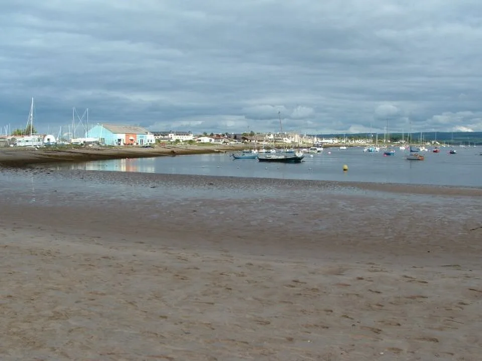
Burghead Bay from Roseisle
Roseisle Forest public arrival, west of Burghead · Open bay, sandy shore, dunes and coastal pinewood
 the ai birderBirding near me
The AI Birder · one-page field sheet
Findhorn, Moray, Scotland · IV36 3YE · IV36 3YE

Wigeon · Redshank · Dunlin · Oystercatcher · Curlew · Shelduck
Findhorn Bay bird hide · Findhorn village foreshore · Kinloss public shoreline · Findhorn beach · Southern shore public bank
Check current access, hide closures and operator notices before travelling. Seasonal birds are possibilities, not promised sightings. Keep to authorised routes and give wildlife space.
Opening and charges checked 2026-10-25. Operator: https://findhornbay.scot/findhorn-bay/
Full guide and current source links: https://aibirder.co.uk/reserves/findhorn-bay-local-nature-reserve
SC 45 · Council reserve guide
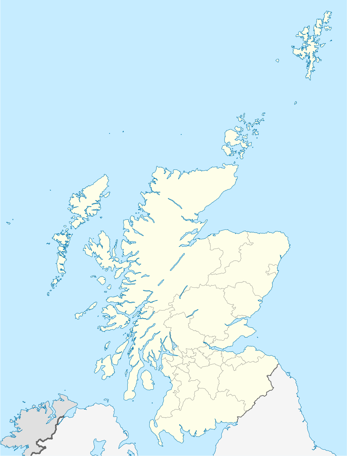
Findhorn, Moray, Scotland · IV36 3YE
A wide Moray estuary where the moving tide matters more than the distance you walk.
Decide if the visit fits.
Last checked 18 October 2026.
Opening and charges information · checked .
Stay nearby →Reserve overview
A wide Moray estuary where the moving tide matters more than the distance you walk.
Eight checks for a smoother visit.
Conditions change: check the operator and transport notices before travelling.
January: typically look for Wigeon and Teal from Findhorn Bay bird hide. Plan around low water. Pick one visible channel and work its margins slowly before making a broad sweep across the bay. February: typically look for Goldeneye and Red-breasted Merganser from Findhorn village foreshore. Scope the channels. Calm water makes diving ducks easier to relocate between dives, so avoid repeatedly changing your position. March: typically look for Ringed Plover from Findhorn village foreshore. Keep a generous distance. Compare smaller waders with the nearby larger birds before attempting distant plumage detail. April: typically look for Black-tailed Godwit from Kinloss public shoreline. Spring passage is variable. A patient channel watch suits passage better than attempting to walk closer across the bay. May: typically look for Shelduck from Southern shore public bank. Remain on the bank. Watch how exposed feeding ground changes as water retreats, while keeping the public return route in sight. June: typically look for Sandwich Tern and Eider from Findhorn beach. Choose a calm sea. Use binoculars for flying terns, then return to the scope for birds settled on distant water. July: typically look for Oystercatcher and Curlew from Southern shore public bank. Do not cross tidal channels. Allow feeding birds to move through the view themselves instead of following them along the shore. August: typically look for Redshank and Dunlin from Findhorn Bay bird hide. Returning waders build through late summer. Check a sample of the flock carefully, then widen your scan to the surrounding mud. September: typically look for Black-tailed Godwit from Kinloss public shoreline. Check actual county news. Count no bird as guaranteed: a promising report is a reason to look, rather than a promised encounter. October: typically look for Golden Plover and Pintail from Kinloss public shoreline. Use a scope. Choose a position with manageable glare and let the scope settle before comparing distant ducks. November: typically look for Long-tailed Duck and Common Scoter from Findhorn beach. Wind can make offshore identification difficult. If the sea view is difficult, spend more time on the sheltered channels from public shore positions. December: typically look for Wigeon and Knot from Findhorn Bay bird hide. Avoid disturbing settled birds. Build warmth and daylight into the plan; a focused short watch can beat a long uncomfortable circuit.
Best conditions: Prefer a clear, relatively calm period around low water: the county recorder’s guide recommends two to three hours either side. Scope from shore, never follow retreating flocks onto the bay. Wind and glare can make the sea view less productive than sheltered channels.
Access and costs, checked 18 October 2026: Findhorn Bay is a Local Nature Reserve with public shore access, rather than a staffed attraction with a single admission gate. The bay's walking guidance explains Scottish recreational access rights and the Scottish Outdoor Access Code. There is no general birdwatching admission ticket. Parking and toilet arrangements depend on the place you use in the village; follow the current signs and the linked local visitor information rather than treating every shore parking area as interchangeable. Use daylight for an unfamiliar visit. Check local notices, tide predictions and the weather before leaving home, because access conditions and available facilities can change. Keep roads and gateways clear for residents and working vehicles.
Access times: Reserve: Public shoreline access; the checked sources give no fixed reserve gate timetable. Follow local signs and tide conditions. · Hides: An eastern-side bird hide is confirmed, but current unlocking hours were not verified. · Car park: Public approach parking is described by the county guide; no single all-night gate policy was verified. · Dawn access: partly. Operator opening information.
Start with the public shoreline at Findhorn village, where you can understand the estuary mouth before considering a longer outing. Look for the boundary between exposed flats and shallow water, then choose a position that lets birds approach at their own pace. Moving continuously around the shoreline can leave you with poorer views than stopping at one useful bend. Keep the sea and estuary sides of your outing distinct: they respond differently to wind and water level. Do not cross tidal channels or walk out onto soft flats to reduce the viewing distance. Two-hour plan, editorial suggestion: spend the opening quarter-hour working out the state of the tide from the village shore, then settle into a slow scan for ducks and waders. Take a short break away from your telescope before watching a second patch of water. Finish by comparing what changed as the tide advanced or retreated. This is particularly useful for a first visit because it teaches the bay's rhythm. Full-day plan, editorial suggestion: make a morning shore watch, take lunch in the village and return when the water level has changed substantially. If you want a contrasting habitat, use our Culbin guide to plan a separate woodland visit, including its own starting point and access arrangements. Keep sufficient daylight for that transfer and avoid turning the second half of the day into a hurried attempt to reach every viewpoint. A calm, sheltered shore watch is the better fallback when exposure or visibility makes a longer walk unrewarding. A useful learning exercise is to choose one conspicuous wader and follow its feeding for several minutes, noting water depth, pace and the way it uses its bill. Then compare a different species in the same patch. This gives a first-time visitor a rewarding purpose even when the wider flock remains too distant for confident identification.
Use the linked reserve map and directions with current access notices. Species are typical seasonal targets. Light and telescope advice reflects our choice of viewpoint.
Eastern bay mudflats
Use public paths and existing viewing places; do not enter exposed tidal ground.
Winter: Dunlin, Wigeon, Teal, Bar-tailed Godwit, Knot
Spring: Dunlin, Wigeon, Teal, Bar-tailed Godwit, Knot, Osprey
Summer: Dunlin, Bar-tailed Godwit, Osprey
Autumn: Dunlin, Wigeon, Teal, Bar-tailed Godwit, Knot, Osprey
Light: either. Scope: essential.
Tide: The county guide favours two to three hours either side of low water.
Lower bay and river channels
Use public paths and existing viewing places; do not enter exposed tidal ground.
Winter: Redshank, Goldeneye, Red-breasted Merganser, Ringed Plover
Spring: Redshank, Goldeneye, Red-breasted Merganser, Ringed Plover
Summer: Ringed Plover
Autumn: Redshank, Goldeneye, Red-breasted Merganser, Ringed Plover
Light: either. Scope: essential.
Tide: The county guide favours two to three hours either side of low water.
South-eastern bay channels
Use public paths and existing viewing places; do not enter exposed tidal ground.
Winter: Pintail, Golden Plover
Spring: Pintail, Golden Plover, Black-tailed Godwit
Summer: Black-tailed Godwit
Autumn: Pintail, Golden Plover, Black-tailed Godwit
Light: either. Scope: essential.
Tide: The county guide favours two to three hours either side of low water.
Moray Firth and estuary mouth
Use public paths and existing viewing places; do not enter exposed tidal ground.
Winter: Sanderling, Eider, Long-tailed Duck, Common Scoter
Spring: Sanderling, Eider, Long-tailed Duck, Common Scoter, Sandwich Tern
Summer: Eider, Sandwich Tern
Autumn: Sanderling, Eider, Long-tailed Duck, Common Scoter, Sandwich Tern
Light: either. Scope: essential.
Tide: The county guide favours two to three hours either side of low water.
Southern mudflats and channels
Use public paths and existing viewing places; do not enter exposed tidal ground.
Winter: Oystercatcher, Curlew, Shelduck
Spring: Oystercatcher, Curlew, Shelduck
Summer: Oystercatcher, Curlew, Shelduck
Autumn: Oystercatcher, Curlew, Shelduck
Light: either. Scope: essential.
Tide: The county guide favours two to three hours either side of low water.
| Spot | Overlooks | Key species by season | Best light | Scope | Tide |
|---|---|---|---|---|---|
| Findhorn Bay bird hideUse public paths and existing viewing places; do not enter exposed tidal ground. | Eastern bay mudflats | Winter: Dunlin, Wigeon, Teal, Bar-tailed Godwit, Knot Spring: Dunlin, Wigeon, Teal, Bar-tailed Godwit, Knot, Osprey Summer: Dunlin, Bar-tailed Godwit, Osprey Autumn: Dunlin, Wigeon, Teal, Bar-tailed Godwit, Knot, Osprey | either | essential | The county guide favours two to three hours either side of low water. |
| Findhorn village foreshoreUse public paths and existing viewing places; do not enter exposed tidal ground. | Lower bay and river channels | Winter: Redshank, Goldeneye, Red-breasted Merganser, Ringed Plover Spring: Redshank, Goldeneye, Red-breasted Merganser, Ringed Plover Summer: Ringed Plover Autumn: Redshank, Goldeneye, Red-breasted Merganser, Ringed Plover | either | essential | The county guide favours two to three hours either side of low water. |
| Kinloss public shorelineUse public paths and existing viewing places; do not enter exposed tidal ground. | South-eastern bay channels | Winter: Pintail, Golden Plover Spring: Pintail, Golden Plover, Black-tailed Godwit Summer: Black-tailed Godwit Autumn: Pintail, Golden Plover, Black-tailed Godwit | either | essential | The county guide favours two to three hours either side of low water. |
| Findhorn beachUse public paths and existing viewing places; do not enter exposed tidal ground. | Moray Firth and estuary mouth | Winter: Sanderling, Eider, Long-tailed Duck, Common Scoter Spring: Sanderling, Eider, Long-tailed Duck, Common Scoter, Sandwich Tern Summer: Eider, Sandwich Tern Autumn: Sanderling, Eider, Long-tailed Duck, Common Scoter, Sandwich Tern | either | essential | The county guide favours two to three hours either side of low water. |
| Southern shore public bankUse public paths and existing viewing places; do not enter exposed tidal ground. | Southern mudflats and channels | Winter: Oystercatcher, Curlew, Shelduck Spring: Oystercatcher, Curlew, Shelduck Summer: Oystercatcher, Curlew, Shelduck Autumn: Oystercatcher, Curlew, Shelduck | either | essential | The county guide favours two to three hours either side of low water. |
Month chips show typical presence or our preferred viewing season. Choose birds that suit the time of your visit.
County guidance favours two to three hours either side of low water. Burghead is the nearby UKHO reference port; its prediction is not a local channel or flood model.
Choose the village shore for the simplest introduction, but do not read a waterside road or nearby parking space as a promise of continuous step-free access. Sloping beach approaches, loose shingle, sand and wet margins make the last few metres important. The local visitor-information page distinguishes parking, toilets and disabled access; use it to select your arrival point before booking accommodation. A person who watches from a vehicle may have different needs from someone using a manual chair or walking frame. Explain the intended viewing style when asking about access, including the distance you can comfortably manage while carrying optics. There is no enclosed reserve visitor centre to provide a guaranteed warm refuge. Wind can make standing or handling a telescope more difficult even where the surface is firm, so choose the sheltered side of a public shore area and retain an easy return. For a mixed-mobility group, agree a meeting point that does not depend on everyone crossing loose beach material. Keep tripods out of the through-route so other visitors can pass without leaving a sound surface.
Findhorn village has visitor services and places to eat; the local visitor page is the useful source for their locations and public toilets. Carry drinking water and a snack for the shore watch itself, especially outside the busiest visitor period. Bring a waterproof sit-mat if you expect to pause at ground level, and protect optics from blown sand and salt spray. Use the village for a proper comfort break between tide sessions rather than assuming there are facilities around every part of the bay.
Keep dogs beside you and away from feeding birds, seals and resting flocks, following the bay-user advice and local signs. A short lead is the sensible choice near wildlife, even on an apparently empty shore. Pick up waste and use an appropriate bin; do not leave bags along the path for a later collection.
Forres is the useful rail gateway, served by ScotRail on the Inverness–Aberdeen route. Check the operator's journey planner for your date and allow time to complete the onward connection rather than assuming a train arrival meets a village bus. Stagecoach's planner is the source for current services towards Findhorn and Kinloss; route patterns and the final return can vary by day. Select the actual village stop you intend to use, save the return journey and identify the shore approach before you board. Where the bus pattern does not work for your proposed tide watch, a pre-arranged taxi from Forres gives you a clearer plan than a speculative roadside connection. Tell the taxi firm which public village arrival point you need and book the return collection. Drivers should approach via the signed village roads and use authorised parking, leaving residential access unobstructed.
Useful bases for an early start.
Booking.com links are affiliate links: we may earn a commission at no extra cost to you. How these links work.
About 5 miles by road, roughly 9 minutes’ drive to Findhorn village shore; OSRM/OpenStreetMap estimate measured 18 October 2026. The drive from Forres leaves parking and the final walk to Findhorn Bay Local Nature Reserve to be added separately.
Measured driving route · 2026-10-18. Map estimates exclude live traffic.
A rail gateway and a short road connection to the village shore.Find places to stay in Forres on Booking.comAbout 15.3 miles by road, roughly 24 minutes’ drive to Findhorn village shore; OSRM/OpenStreetMap estimate measured 18 October 2026. The drive from Nairn leaves parking and the final walk to Findhorn Bay Local Nature Reserve to be added separately.
Measured driving route · 2026-10-18. Map estimates exclude live traffic.
Combining the bay with a wider Moray coast stay.Find places to stay in Nairn on Booking.comAbout 12.7 miles by road, roughly 21 minutes’ drive to Findhorn village shore; OSRM/OpenStreetMap estimate measured 18 October 2026. The drive from Elgin leaves parking and the final walk to Findhorn Bay Local Nature Reserve to be added separately.
Measured driving route · 2026-10-18. Map estimates exclude live traffic.
A larger-town base for several Moray outings.Find places to stay in Elgin on Booking.comExplore Moray’s full guides and smaller birding sites
Use Moray Council for public-land or local access questions and Findhorn's visitor-information service for village facilities. Findhorn Bay Wildlife Watch provides useful bay interpretation and conduct guidance; its older blog posts should not be used as a current goose count. When requesting practical advice, give the date, intended public shore starting point and any mobility requirement. Report an access problem with its location rather than moving signs or creating another route around a restriction. The postcode identifies the village approach, not a safe route across the estuary.
Check Moray and Nairn recorder’s recent records. frequent, unchecked reports Reports show what has been seen, not what will be.
Follow the BTO Birders’ Code and give wildlife space.
Findhorn Bay Local Nature Reserve: Price not published by operator.
Findhorn Bay Local Nature Reserve: Keep dogs beside you and away from feeding birds, seals and resting flocks, following the bay-user advice and local signs.
Findhorn Bay Local Nature Reserve: Winter geese and wildfowl · passage waders · summer osprey.
Findhorn Bay Local Nature Reserve: Choose the village shore for the simplest introduction, but do not read a waterside road or nearby parking space as a promise of continuous step-free access.
Findhorn Bay Local Nature Reserve: Forres is the useful rail gateway, served by ScotRail on the Inverness–Aberdeen route.
Shorter stops within 15 miles in a straight line. Use the operator’s arrival directions for the journey.
Roseisle Forest public arrival, west of Burghead · Open bay, sandy shore, dunes and coastal pinewood
Estate visitor arrival off the A96, west of Forres · Pond, natural woodland and estate-edge habitats
Harbour Street and East Beach approach, Hopeman · Coastal cliffs, rocky coves and grassland above the shore
Oakenhead · Freshwater loch and reedbed
Clifton Road and East Beach bridge arrival, Lossiemouth · Tidal river, mudflats, dunes and estuary-edge scrub
Nearby complete guides.
Stops with a purpose: use one as a contrasting habitat or weather-proof Plan B. Distances are straight-line estimates, not road journeys.