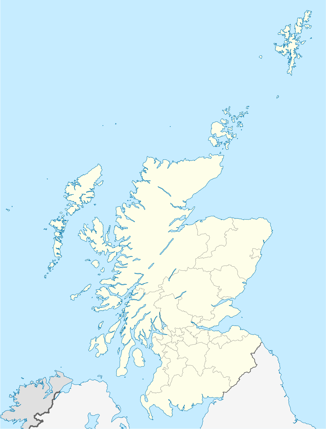
Short entry12.1 miles away
Yellowcraig
Near Dirleton · Coastal woodland, dune grassland and rocky shore
 the ai birderBirding near me
The AI Birder · one-page field sheet
Firth of Forth, off Anstruther, Fife, Scotland · boat departure KY10 3AB · KY10 3AB

Access notice: NatureScot states the island is closed to visitors for autumn and winter. Confirm the next visitor season with the operator before planning a landing.
Oystercatcher · Rock Pipit · Goldcrest · Turnstone · Purple Sandpiper · Short-eared Owl
Green Face viewpoint · Greengates viewpoint · South Horn (public viewing area) · Lady’s Bed (public path) · Visitor Centre (external viewing area) · The Loch (marked west-side path) · Fluke Street (public path) · Main Light (public path)
Check current access, hide closures and operator notices before travelling. Seasonal birds are possibilities, not promised sightings. Keep to authorised routes and give wildlife space.
Opening and charges checked 2026-10-25. Operator: https://www.nature.scot/enjoying-outdoors/visit-our-nature-reserves/isle-may-national-nature-reserve
Full guide and current source links: https://aibirder.co.uk/reserves/isle-of-may-national-nature-reserve
SC 14 · NatureScot reserve guide
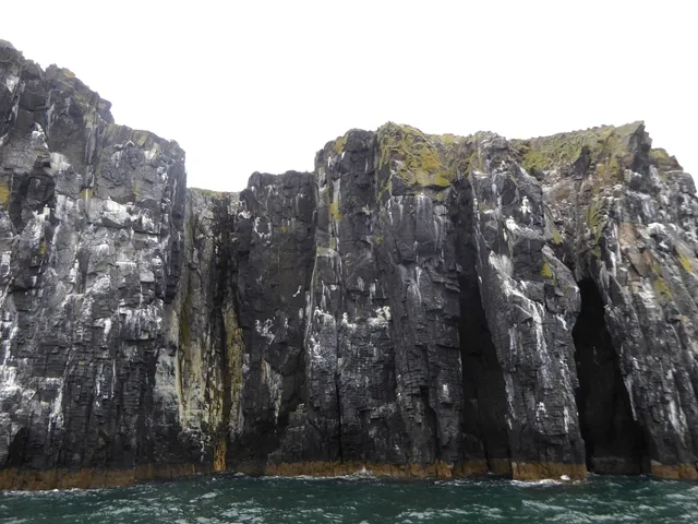
Firth of Forth, off Anstruther, Fife, Scotland · boat departure KY10 3AB
A compact island at the mouth of the Firth of Forth where Puffins burrow in maritime grassland and Guillemots, Razorbills, Kittiwakes, Fulmars, terns, gulls and Eiders breed around 45-metre cliffs and rocky shores. At the summer peak NatureScot records more than a quarter of a million birds; spring and autumn can also funnel an exceptional variety of migrants through Scotland's first bird observatory.
Decide if the visit fits.
Last checked 18 October 2026.
Opening and charges information · checked .
Stay nearby →Reserve overview
A compact island at the mouth of the Firth of Forth where Puffins burrow in maritime grassland and Guillemots, Razorbills, Kittiwakes, Fulmars, terns, gulls and Eiders breed around 45-metre cliffs and rocky shores. At the summer peak NatureScot records more than a quarter of a million birds; spring and autumn can also funnel an exceptional variety of migrants through Scotland's first bird observatory.
Eight checks for a smoother visit.
Conditions change: check the operator and transport notices before travelling.
January: the Isle of May is closed to ordinary visitors. Its winter rocky-shore birds include Turnstone and Purple Sandpiper, but Lady’s Bed is not a public winter destination. Read the operator and observatory reports while planning a permitted spring visit rather than seeking an unadvertised landing.
February: ordinary public landings remain outside the season. The rocky shore may hold resident Rock Pipits and Oystercatchers around Lady’s Bed, but these ecological records do not grant access. Reserve a later sailing and keep winter birdwatching on an appropriate mainland public route.
March: seabirds begin returning and the observatory can report Puffins and migrant Goldcrests, while ordinary landing access is still a separate question. Choose April onwards for Green Face and Greengates. Use the operator’s current year programme rather than extrapolating a staff March trip.
April: typically watch Guillemots from Green Face and Greengates, Kittiwakes at South Horn and Shags from Lady’s Bed. Puffins gather along the marked grassland paths. After the landing briefing, choose a short circuit that leaves a comfortable margin for the ferry return.
May: usually combine the main cliff watch at Green Face with Eiders at The Loch and Kittiwakes at South Horn. The marked Fluke Street path can add Swallows and Pied Wagtails. Keep away from burrow entrances and follow any tern-related diversion set by island staff.
June: typically give Green Face and Greengates time for Guillemots and Razorbills before comparing Shags at Lady’s Bed. Eider groups can use The Loch. June is a colony-observation visit: slow down at a productive public viewpoint instead of searching for a particular nest.
July: usually choose the earlier part for the fullest auk-colony experience at Green Face. Puffins remain a strong subject on the authorised paths, while South Horn can add passing Gannets and Manx Shearwaters. Colony attendance changes as birds leave; a dated report helps set expectations.
August: typically shift towards late Puffins, Shags and passage birds. Lady’s Bed offers the rocky-shore view for returning Turnstones and Purple Sandpipers, with the Main Light public path a Wheatear option. The breeding-season character can change rapidly, so do not assume June’s ledges remain busy.
September: usually combine offshore Gannets, Manx Shearwaters and Common Scoters from South Horn with a quiet migrant search along permitted Fluke Street path margins. Wheatears and Chiffchaffs may pass through. The remaining public sailing season sets a firm limit on how long to linger.
October: ordinary visitor landings have ended and the island closes for the autumn seal season. Reports may still contain Goldcrests and rocky-shore Turnstones, but neither Fluke Street nor Lady’s Bed is an independent visitor option now. Use the reports for interest and next-season planning.
November: public access remains closed. Oystercatchers and Rock Pipits are resident island birds, and winter waders form part of the rocky-shore ecology, but a mainland departure-harbour walk is a different outing. Do not assume a charter gives permission to land at Lady’s Bed or the main harbour.
December: the island remains outside its ordinary visitor season. Turnstone and Purple Sandpiper are winter island species; seeing a staff report from Lady’s Bed or another shore does not open the reserve. Use this period to choose a spring or summer ferry and a weather-contingency day.
Best conditions: Typically a settled sea and clear visibility make a more usable landing day than a theoretical dawn start. NatureScot warns that haar can arrive quickly; in fog keep to the marked paths and use the Visitor Centre, Bath House or South Horn shelter. The observatory notes migrant falls can occur with winds from north-east round to south-south-east, without predicting one. Light and scope ratings are editorial: west-cliff views can benefit from afternoon light, but the ferry and safe access take priority.
Reserve admission is free, with the boat journey paid separately. The 2026 ordinary visitor season has finished; NatureScot's reserve blog confirms closure on 1 October. Landing access is normally April–September. Select an actual published sailing rather than relying on general season dates for a particular day. Mainland parking needs to cover the entire trip and check-in. Fife Council's tariff checked on 18 October 2026 gives East Basin a two-hour maximum during 1 April–30 September, charging 80p for one hour or £1 for two hours, 08:00–18:00 daily. That time limit is unsuitable for a normal landing excursion. Choose a lawful longer-stay alternative and read its own signs. The mainland departure postcode is not an island road destination.
Access times: Reserve: Ordinary public landing season is April–September; the island is closed to ordinary visitors in autumn and winter. Travel only on a confirmed permitted landing trip. · Hides: Official viewpoints, paths and visitor-centre viewing area during the time ashore allowed by your ferry; no unrestricted dawn hide access is offered. · Car park: Mainland departure parking is separate. NatureScot identifies Anstruther harbour parking nearby; gate and charging arrangements belong to Fife Council. · Dawn access: no. Operator opening information.
There are no hides to connect on a conventional circuit. The map supplied with a ferry booking identifies island paths, viewpoints and landmarks, starting from the harbour and visitor-centre area. Green Face and Greengates provide cliff-colony views, South Horn gives another perspective on Kittiwakes, and Lady's Bed is a named Shag-watching area. Choose a few sustained stops rather than treating every historic structure as an essential detour. Two-hour plan ashore: after the staff briefing, orientate yourself at the visitor-centre information area and choose one safe cliff viewpoint. Give the birds an extended watch, comparing ledges with birds approaching from the sea. Follow the signed path back through suitable Puffin-watching ground and make a second settled stop where it leaves room for others. Begin returning to the harbour well before the instructed boarding time. This editorial plan assumes your operator actually allocates that much shore time. Full-day plan: the travel, check-in, crossing and island visit together form the day. Prepare on the mainland, then use the landing allocation for the west-cliff and southern viewpoints that fit comfortably. A standard visitor sailing does not provide an unrestricted full day ashore. Keep the rest of the day flexible for harbour birdwatching or a coastal walk after returning, rather than attaching a time-critical onward activity. Stay on the mapped paths to protect burrows and ground nests, and do not cross to Rona, the research area. Remain well back from unfenced cliff edges and supervise children closely. Watch a Puffin from a stationary position beside the route; if your presence blocks its return to the burrow, give more space. Carry optics ready for a sea watch as well as the land colony, keeping equipment secure when moving between the boat and shore.
Use the linked reserve map and directions with current access notices. Species are typical seasonal targets. Light and telescope advice reflects our choice of viewpoint.
West-cliff seabird ledges and adjacent sea
Use the marked viewpoint and paths; the cliffs have unfenced drops.
Spring: Guillemot, Razorbill, Puffin, Peregrine
Summer: Guillemot, Razorbill, Puffin, Peregrine
Autumn: Peregrine
Light: either. Scope: useful.
Western cliffs and open water
Official cliff viewpoint; keep clear of the edge and allow time to return to the boat.
Spring: Guillemot, Razorbill, Fulmar
Summer: Guillemot, Razorbill, Fulmar
Light: either. Scope: useful.
Southern cliffs and offshore feeding or passage birds
Follow the signed public approach; the shelter has steps and a handrail.
Spring: Kittiwake, Fulmar
Summer: Kittiwake, Gannet, Manx Shearwater
Autumn: Gannet, Manx Shearwater, Common Scoter
Light: either. Scope: useful.
Rocky eastern shore and the inshore water
Observe from the official path; the autumn/winter island closure still applies.
Spring: Shag, Oystercatcher, Rock Pipit
Summer: Shag, Oystercatcher, Rock Pipit
Autumn: Turnstone, Purple Sandpiper
Winter: Turnstone, Purple Sandpiper
Light: either. Scope: useful.
Main harbour, shoreline and south of the island
Step-free visitor building; an external viewing area and sheltered windows are described by NatureScot.
Spring: Eider, Shag, Rock Pipit
Summer: Eider, Swallow, Shag
Autumn: Shag, Oystercatcher
Light: either. Scope: useful.
Freshwater loch and the adjacent maritime grassland
View from the marked path; never cross burrowed turf to the water.
Spring: Eider, Shelduck, Mallard
Summer: Eider, Mallard
Autumn: Mallard, Wheatear
Light: either. Scope: not needed.
Building edges, short turf and permitted sheltered path margins
Keep clear of residences, work areas and bird-observatory research operations.
Spring: Swallow, Pied Wagtail, Wren
Summer: Swallow, Pied Wagtail, Wren
Autumn: Wheatear, Chiffchaff, Goldcrest
Light: either. Scope: not needed.
Island grassland, the buildings’ public surroundings and an open coastal prospect
Use the public approach only; entry to working buildings is not implied.
Spring: Puffin, Rock Pipit
Summer: Puffin, Herring Gull, Lesser Black-backed Gull, Great Black-backed Gull, Short-eared Owl
Autumn: Wheatear, Rock Pipit, Short-eared Owl
Light: either. Scope: not needed.
| Spot | Overlooks | Key species by season | Best light | Scope | Tide |
|---|---|---|---|---|---|
| Green Face viewpointUse the marked viewpoint and paths; the cliffs have unfenced drops. | West-cliff seabird ledges and adjacent sea | Spring: Guillemot, Razorbill, Puffin, Peregrine Summer: Guillemot, Razorbill, Puffin, Peregrine Autumn: Peregrine | either | useful | — |
| Greengates viewpointOfficial cliff viewpoint; keep clear of the edge and allow time to return to the boat. | Western cliffs and open water | Spring: Guillemot, Razorbill, Fulmar Summer: Guillemot, Razorbill, Fulmar | either | useful | — |
| South Horn (public viewing area)Follow the signed public approach; the shelter has steps and a handrail. | Southern cliffs and offshore feeding or passage birds | Spring: Kittiwake, Fulmar Summer: Kittiwake, Gannet, Manx Shearwater Autumn: Gannet, Manx Shearwater, Common Scoter | either | useful | — |
| Lady’s Bed (public path)Observe from the official path; the autumn/winter island closure still applies. | Rocky eastern shore and the inshore water | Spring: Shag, Oystercatcher, Rock Pipit Summer: Shag, Oystercatcher, Rock Pipit Autumn: Turnstone, Purple Sandpiper Winter: Turnstone, Purple Sandpiper | either | useful | — |
| Visitor Centre (external viewing area)Step-free visitor building; an external viewing area and sheltered windows are described by NatureScot. | Main harbour, shoreline and south of the island | Spring: Eider, Shag, Rock Pipit Summer: Eider, Swallow, Shag Autumn: Shag, Oystercatcher | either | useful | — |
| The Loch (marked west-side path)View from the marked path; never cross burrowed turf to the water. | Freshwater loch and the adjacent maritime grassland | Spring: Eider, Shelduck, Mallard Summer: Eider, Mallard Autumn: Mallard, Wheatear | either | not needed | — |
| Fluke Street (public path)Keep clear of residences, work areas and bird-observatory research operations. | Building edges, short turf and permitted sheltered path margins | Spring: Swallow, Pied Wagtail, Wren Summer: Swallow, Pied Wagtail, Wren Autumn: Wheatear, Chiffchaff, Goldcrest | either | not needed | — |
| Main Light (public path)Use the public approach only; entry to working buildings is not implied. | Island grassland, the buildings’ public surroundings and an open coastal prospect | Spring: Puffin, Rock Pipit Summer: Puffin, Herring Gull, Lesser Black-backed Gull, Great Black-backed Gull, Short-eared Owl Autumn: Wheatear, Rock Pipit, Short-eared Owl | either | not needed | — |
Month chips show typical presence or our preferred viewing season. Choose birds that suit the time of your visit.
Let the boat operator select safe departures and landing arrangements; no visitor tide-height threshold is supplied. The public watching circuit is on the island paths above the shore. Never cross to Rona or descend onto rocks to follow a bird; official guidance excludes the research area.
Operator: Anstruther Pleasure Cruises (May Princess); Isle of May Boat Trips (Osprey and Saorsa RIBs).
Booking opens: Isle of May Boat Trips says its 2027 reservations open in early January 2027. A dated 2027 May Princess booking-opening announcement was not found.. Season: Ordinary landings April–September; both Anstruther operators state the 2026 season is finished. Recheck published 2027 departures before booking travel.; closed days: May Princess describes one weekly research day in May and June, usually Tuesdays, with a non-landing cruise option. Use the actual sailing calendar.. Fares: Tariffs displayed and checked on 18 October 2026: May Princess landing £40 adult, £35 concession, £20 ages 3–15, under-threes free. Non-landing May Cruise Around £30 adult, £25 concession and £15 ages 3–15. RIB Isle of May Experience low/high-season adult £47/£57 and child aged 5+ £35/£40; the operator does not define those periods on its trip page, so check the chosen date. These are displayed 2026-season fares, not confirmed 2027 prices.; landing fee: NatureScot reserve entry is free..
Time ashore: May Princess trip 4.5–5 hours with 2.5–3 hours ashore; RIB Experience 4–4.5 hours with 2.5–3 hours ashore. Sea Safari and May Cruise Around do not land.. Landing access: May Princess check-in at the Middle Pier ticket kiosk at least 45 minutes before sailing; boarding begins 30 minutes before. Follow the crew and island briefing.. Weather policy: Landings are not guaranteed. May Princess offers an alternative date or full refund if it cancels; the skipper decides. Check before travel if conditions are uncertain and follow current footwear-cleaning and disinfection instructions.
Discuss the complete journey with the boat operator before booking if mobility is a concern. NatureScot describes partial disabled access on May Princess, while Anstruther Pleasure Cruises' own current terms state that the vessel is unsuitable for wheelchairs under marine-safety regulations. The operator says it tries to accommodate portable equipment and folding buggies, and requires passengers to manage gangways and steps. Its booking-specific assessment takes priority over a broad accessibility description. The visitor centre itself has no steps and contains a fully accessible toilet. Other island shelters differ: South Horn has a flight of steps with a handrail, and the bath house also has entrance steps. Reaching an accessible building does not remove the need to negotiate the crossing and island paths. Explain your balance, transfer and equipment requirements to the relevant operator, including whether you can fold an aid or walk a gangway with assistance. An open RIB has a different seating and boarding experience from the larger passenger vessel. Choose the trip only after establishing that the whole route suits you, including the return in changing sea conditions.
The island visitor centre offers interpretation, an information area and a sheltered wildlife view through large windows. Staff update the outdoor information with island news and sightings. Bring food, water and warm waterproof layers for the shore visit rather than depending on a meal outlet. Take all litter back to the mainland. Keep a waterproof cover for optics and secure loose clothing during boat travel. The mainland harbour provides separate facilities before boarding and after the return.
May Princess' operator prohibits dogs on the boat and island, explicitly including assistance dogs under its landing-licence conditions. Anyone who relies on an assistance dog should contact the operator before planning the journey and establish an appropriate alternative arrangement. Do not assume another island or mainland reserve's dog policy applies here.
Anstruther Harbour is the main Fife departure point. Stagecoach's 2026 Anstruther travel guidance identifies service 95 through East Neuk communities and X61 linking the town with Kirkcaldy and St Andrews. Plan the bus against the actual sailing check-in, leaving a margin for delays and the walk to Middle Pier. The harbour is an interchange with the boat, not the reserve itself. For rail arrivals, use a suitable Fife station and its onward bus or prebooked taxi connection; check the complete journey through the transport operators rather than treating the crossing as the only fixed part of the day. Stay locally before an early departure if the public-transport margin would otherwise be tight. Other licensed trip options depart from North Berwick and Dunbar, as listed by NatureScot. Those are separate mainland journeys and should be booked with the named operator, not reached using an Anstruther ticket. For every departure port, reserve return-travel flexibility because a boat itinerary occupies a substantial part of the day.
Useful bases for an early start.
Booking.com links are affiliate links: we may earn a commission at no extra cost to you. How these links work.
About 0.3 miles by road, roughly 1 minutes’ drive from the mapped town-centre point to Anstruther mainland harbour approach. OpenStreetMap estimate for Anstruther, measured 18 October 2026. For the Anstruther journey linked to Isle of May National Nature Reserve, leave additional time for traffic and reaching your precise accommodation address. The island is reached by a separate booked boat crossing.
Measured driving route · 2026-10-18. Map estimates exclude live traffic.
The simplest start for an Anstruther sailing.Find places to stay in Anstruther on Booking.comAbout 4.3 miles by road, roughly 9 minutes’ drive from the mapped town-centre point to Anstruther mainland harbour approach. OpenStreetMap estimate for Crail, measured 18 October 2026. For the Crail journey linked to Isle of May National Nature Reserve, leave additional time for traffic and reaching your precise accommodation address. The island is reached by a separate booked boat crossing.
Measured driving route · 2026-10-18. Map estimates exclude live traffic.
An East Neuk village stay with a short harbour transfer.Find places to stay in Crail on Booking.comAbout 9.8 miles by road, roughly 18 minutes’ drive from the mapped town-centre point to Anstruther mainland harbour approach. OpenStreetMap estimate for St Andrews, measured 18 October 2026. For the St Andrews journey linked to Isle of May National Nature Reserve, leave additional time for traffic and reaching your precise accommodation address. The island is reached by a separate booked boat crossing.
Measured driving route · 2026-10-18. Map estimates exclude live traffic.
A larger Fife base with bus connections.Find places to stay in St Andrews on Booking.comExplore Fife’s full guides and smaller birding sites
For reserve questions contact NatureScot's Cupar office on 01738 458800. For May Princess bookings use Anstruther Pleasure Cruises, 07957 585200 or info@isleofmayferry.com. Isle of May Boat Trips handles its own RIB reservations on 07429 454055 or info@isleofmayboattrips.co.uk. State which vessel and departure port you mean when asking about access or availability. NatureScot's linked reserve blog provides dated island reports; a mainland operator's sailing notice answers a different planning question.
Check NatureScot island team wildlife blog. several posts a week in the staffed season Reports show what has been seen, not what will be.
Follow the BTO Birders’ Code and give wildlife space.
Isle of May National Nature Reserve: May Princess landing trip £40 adult, £35 concession, £20 ages 3–15; under-threes free.
Isle of May National Nature Reserve: May Princess' operator prohibits dogs on the boat and island, explicitly including assistance dogs under its landing-licence conditions.
Isle of May National Nature Reserve: Breeding seabirds April–July · spring and autumn migration.
Isle of May National Nature Reserve: NatureScot describes partial disabled access on May Princess, while Anstruther Pleasure Cruises' own current terms state that the vessel is unsuitable for wheelchairs under marine-safety regulations.
Isle of May National Nature Reserve: Anstruther Harbour is the main Fife departure point.
Shorter stops within 15 miles in a straight line. Use the operator’s arrival directions for the journey.
Near Dirleton · Coastal woodland, dune grassland and rocky shore
East-side car park, accessed from Cameron Kirk road · Freshwater reservoir, marsh, scrub and conifer fringes
Leven (4 mi / 6.4 km) · Lime-rich dune grassland beside Largo Bay
Pitscottie (2 mi / 3.2 km) · Raised bog, woodland and wetland pools
Nearby complete guides.
Stops with a purpose: use one as a contrasting habitat or weather-proof Plan B. Distances are straight-line estimates, not road journeys.