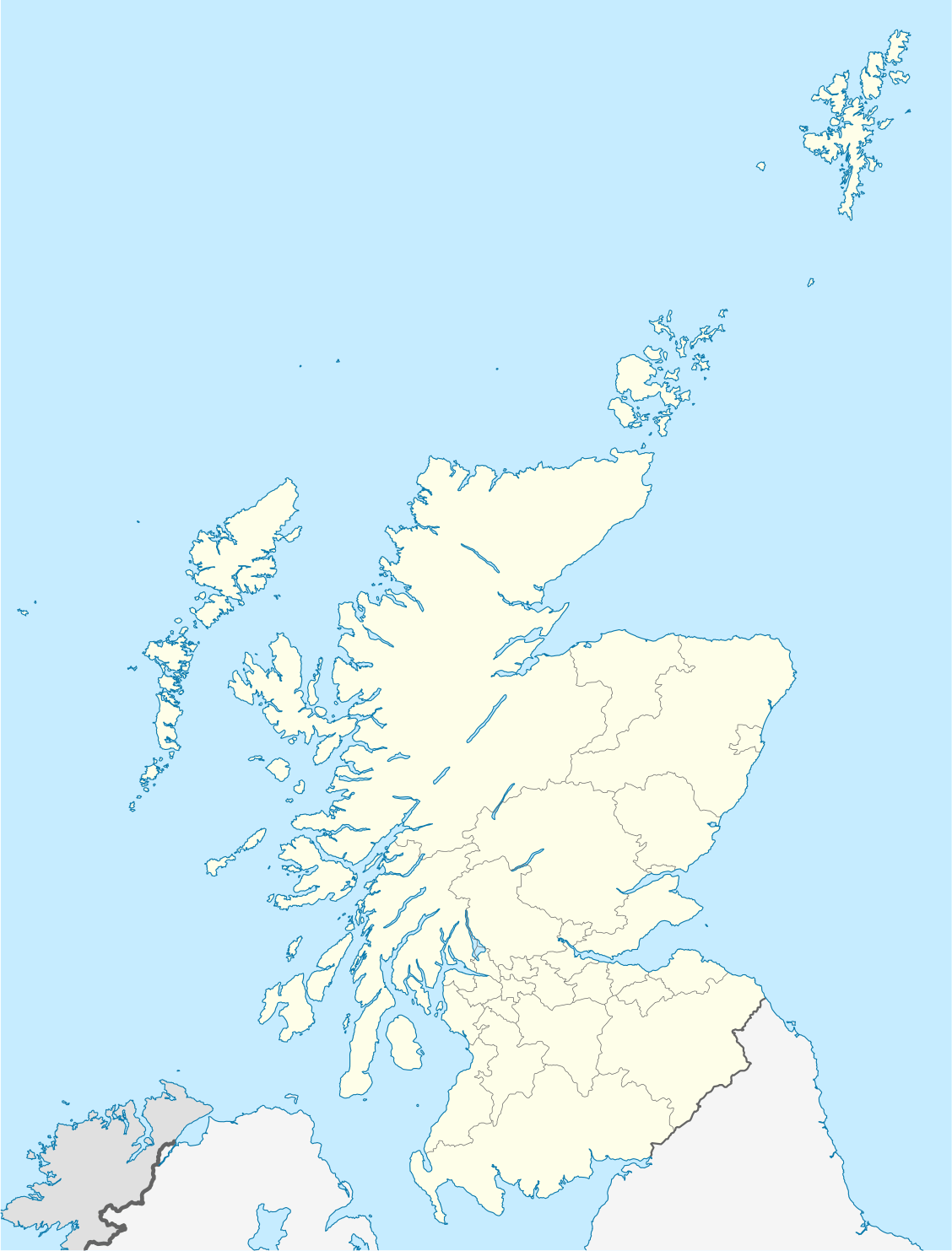

Short entry4.1 miles away
Yellowcraig
Near Dirleton · Coastal woodland, dune grassland and rocky shore
 the ai birderBirding near me
The AI Birder · one-page field sheet
Aberlady, East Lothian, Scotland · EH32 0QB · EH32 0QB

Redshank · Ringed Plover · Water Rail · Blackcap · Common Scoter · Eider
Footbridge and main-path estuary outlook · Marl Loch main-path outlook · Main path through scrub and dunes · Gullane Point public path · Kilspindie Golf Club Road public outlook
Check current access, hide closures and operator notices before travelling. Seasonal birds are possibilities, not promised sightings. Keep to authorised routes and give wildlife space.
Opening and charges checked 2026-10-25. Operator: https://www.eastlothian.gov.uk/libraries-leisure-and-tourism/countryside-and-wildlife/plan-your-visit-east-lothians-countryside/countryside-sites
Full guide and current source links: https://aibirder.co.uk/reserves/aberlady-bay-local-nature-reserve
SC 42 · East Lothian Council reserve guide
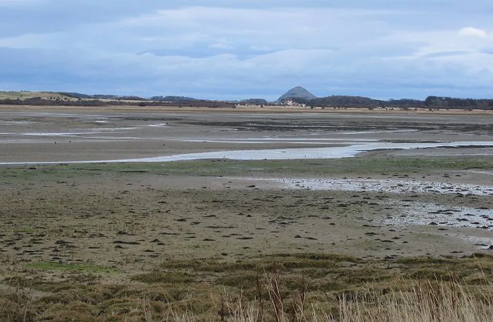
Aberlady, East Lothian, Scotland · EH32 0QB
A varied coastal walk from the footbridge, with autumn geese and winter waders best watched from established paths.
Decide if the visit fits.
Last checked 18 October 2026.
Opening and charges information · checked .
Stay nearby →Reserve overview
A varied coastal walk from the footbridge, with autumn geese and winter waders best watched from established paths.
Eight checks for a smoother visit.
Conditions change: check the operator and transport notices before travelling.
January: Usually compare Redshank from the Footbridge and main-path estuary outlook with Water Rail at Marl Loch main-path outlook. Gullane Point public path offers a longer sea-duck watch for Eider, Common Scoter and Long-tailed Duck if wind and visibility suit. February: Typically use the Main path through scrub and dunes for Snow Bunting, Twite and wintering Blackcap without leaving the route. Check Marl Loch for Water Rail, then compare Eider and grebes from Gullane Point public path. A telescope is particularly useful offshore. March: Redshank and Ringed Plover usually make the Footbridge and main-path estuary outlook worthwhile. Water Rail can remain at Marl Loch, while Blackcap adds interest along the scrub path. Avoid walking towards departing geese or following their flight lines to a resting place. April: Typically listen for Sedge Warbler at Marl Loch main-path outlook and Whitethroat along the Main path through scrub and dunes. Compare Redshank and Ringed Plover on tidal margins from the established estuary outlook. Choose a still spell when wind does not mask song. May: Our choice is the main path for Whitethroat and Blackcap, with a quiet Marl Loch stop for Sedge Warbler and scarcer Lesser Whitethroat. Ringed Plover can be watched from the estuary outlook. Give breeding birds space and remain outside refuge areas. June: Usually combine Sedge Warbler and Water Rail listening at Marl Loch main-path outlook with Whitethroat along the Main path through scrub and dunes. Redshank and Ringed Plover provide a contrast from the estuary path. Shorter, unhurried watches suit a hot or windy day. July: Typically watch Redshank and Ringed Plover from the Footbridge and main-path estuary outlook, then listen around Marl Loch for remaining Sedge Warbler song. Eider can add interest offshore from Gullane Point public path if the longer exposed walk suits your party. August: Returning Little Stint and Curlew Sandpiper are scarcer possibilities from the main-path estuary outlook when wet margins are visible. Typically compare them carefully with Ringed Plover and Redshank. Gullane Point public path can add Red-necked Grebe offshore as the season changes. September: Usually give the estuary a sustained watch for Little Stint, Curlew Sandpiper and Redshank, using the incoming tide from Kilspindie Golf Club Road public outlook or the main reserve path. Pink-footed Goose flights may add atmosphere; watch them without approaching resting flocks. October: Typically compare Redshank on the tidal bay with Water Rail at Marl Loch main-path outlook. A calm, clear sea watch from Gullane Point public path may reveal Common Scoter, Long-tailed Duck or Slavonian Grebe. Goose movements follow conditions rather than a fixed visitor timetable. November: Usually choose the Main path through scrub and dunes for Snow Bunting, Twite and Blackcap, then scan Eider and Common Scoter from Gullane Point public path if conditions permit. Build the visit around useful light and a safe return on the established route. December: Typically combine an estuary Redshank watch with Water Rail at Marl Loch main-path outlook. Snow Bunting may reward the permitted dune path. In strong wind, shorten the walk rather than pressing out to Gullane Point for distant sea ducks.
Best conditions: Our advice: typically choose a calm morning for Marl Loch and scrub songbirds, and clear visibility for the long offshore telescope view. The SOC recommends an incoming tide for more viewable estuary birds. In strong wind, shorten the exposed dune and point walk. Light and scope recommendations are editorial; watch the side with usable illumination without leaving the path.
Visitor information checked 18 October 2026: East Lothian Council manages the reserve through its countryside service. The normal visit uses the small car park off the A198 just east of Aberlady and the public reserve path across the footbridge. Council coastal parking costs £3 a day, with a ticket transferable between its coastal car parks on the same day; Blue Badge holders are currently exempt. There is no separate admission ticket described for walking the reserve. Dogs are excluded from the nature reserve, so make a different plan if travelling with a pet. Check the council's current countryside and parking notices before setting out, since weather, wildlife management and visitor arrangements can affect access.
Access times: Reserve: Public coastal paths; the council gives no fixed reserve closing time. Stay outside wildlife refuge areas. · Hides: No visitor hide timetable is listed; watching is from public-path outlooks. · Car park: Council coastal-site parking is prohibited 23:00–04:00. · Dawn access: yes. Operator opening information.
The footbridge provides an obvious start, followed by the main path through a sequence of estuary, lochan, scrub and dune habitats. Keep to the route that avoids the sensitive refuge areas. It is easy to become so focused on reaching the beach that you pass the most rewarding birdwatching stops without looking. Begin by scanning the nearer water and mud from the public path, then walk quietly towards the lochan and pause before entering the next habitat. Two-hour plan, our suggestion: give the estuary approach a careful scan, continue far enough to sample the lochan and scrub, and return by the same public path while the tide and light have changed. You do not need to reach the outer beach to have a worthwhile visit. Full-day plan, our suggestion: take the main reserve walk at a slow pace, allowing prolonged stops wherever birds are feeding within a comfortable view. Bring a packed lunch and choose a firm public resting place away from wildlife. On the return, repeat one or two productive outlooks instead of searching every dune hollow. An additional coastal stop is best treated as a separate journey after leaving the reserve. Do not make a detour across intertidal ground to reach old wartime remains, and do not follow goose flights towards a roost. The established path already provides the habitat variety that makes Aberlady special. Turning back early in deteriorating weather is a good decision, particularly when wind makes binoculars difficult to hold steadily. Try comparing the lochan with the tidal bay rather than treating them as a single bird list. Watch how the birds feed and where they rest, then note the differences when you return past the same viewpoint. A telescope helps with distant waders, but first use binoculars to locate a small group and a stable landmark. Share that landmark with a companion before discussing fine plumage details. Keep the legs of any tripod out of the main path, and let other walkers pass without forcing them into sensitive vegetation. These simple habits make a shared coastal route more comfortable for people as well as wildlife.
Use the linked reserve map and directions with current access notices. Species are typical seasonal targets. Light and telescope advice reflects our choice of viewpoint.
Peffer Burn estuary, mudflats and saltmarsh from the established route
Stay on the routed public path outside wildlife refuge areas; do not cross mudflats.
Winter: Redshank
Spring: Redshank, Ringed Plover
Summer: Ringed Plover, Redshank
Autumn: Curlew Sandpiper, Little Stint, Redshank
Light: either. Scope: essential.
Tide: An incoming tide covers feeding mud and brings waders towards available higher margins.
Marl Loch freshwater water and reed-fringed margins from the main path
Winter: Water Rail
Spring: Water Rail, Sedge Warbler
Summer: Sedge Warbler, Lesser Whitethroat
Autumn: Water Rail
Light: either. Scope: useful.
Sea-buckthorn scrub, grassland and permitted dune path edges
Use the main path; do not enter scrub or search for owl roosts.
Winter: Snow Bunting, Twite, Blackcap
Spring: Whitethroat, Blackcap
Summer: Whitethroat, Blackcap
Autumn: Blackcap
Light: either. Scope: not needed.
Firth of Forth coastal water from the public path near the point
Longer exposed extension; remain well back from the coast in poor weather.
Winter: Eider, Common Scoter, Long-tailed Duck, Slavonian Grebe
Spring: Eider, Common Scoter
Summer: Eider
Autumn: Red-necked Grebe, Common Scoter
Light: either. Scope: essential.
Tide: Check predictions before any beach section and avoid a shoreline route that can be cut off.
Village-side Peffer Burn and tidal bay from the public road outlook
Use a safe public-road position and leave golf-club entrances clear.
Winter: Redshank
Spring: Redshank, Ringed Plover
Summer: Redshank
Autumn: Little Stint, Curlew Sandpiper
Light: either. Scope: essential.
Tide: The SOC identifies the incoming tide here as useful when the burn fills first.
| Spot | Overlooks | Key species by season | Best light | Scope | Tide |
|---|---|---|---|---|---|
| Footbridge and main-path estuary outlookStay on the routed public path outside wildlife refuge areas; do not cross mudflats. | Peffer Burn estuary, mudflats and saltmarsh from the established route | Winter: Redshank Spring: Redshank, Ringed Plover Summer: Ringed Plover, Redshank Autumn: Curlew Sandpiper, Little Stint, Redshank | either | essential | An incoming tide covers feeding mud and brings waders towards available higher margins. |
| Marl Loch main-path outlook | Marl Loch freshwater water and reed-fringed margins from the main path | Winter: Water Rail Spring: Water Rail, Sedge Warbler Summer: Sedge Warbler, Lesser Whitethroat Autumn: Water Rail | either | useful | — |
| Main path through scrub and dunesUse the main path; do not enter scrub or search for owl roosts. | Sea-buckthorn scrub, grassland and permitted dune path edges | Winter: Snow Bunting, Twite, Blackcap Spring: Whitethroat, Blackcap Summer: Whitethroat, Blackcap Autumn: Blackcap | either | not needed | — |
| Gullane Point public pathLonger exposed extension; remain well back from the coast in poor weather. | Firth of Forth coastal water from the public path near the point | Winter: Eider, Common Scoter, Long-tailed Duck, Slavonian Grebe Spring: Eider, Common Scoter Summer: Eider Autumn: Red-necked Grebe, Common Scoter | either | essential | Check predictions before any beach section and avoid a shoreline route that can be cut off. |
| Kilspindie Golf Club Road public outlookUse a safe public-road position and leave golf-club entrances clear. | Village-side Peffer Burn and tidal bay from the public road outlook | Winter: Redshank Spring: Redshank, Ringed Plover Summer: Redshank Autumn: Little Stint, Curlew Sandpiper | either | essential | The SOC identifies the incoming tide here as useful when the burn fills first. |
Month chips show typical presence or our preferred viewing season. Choose birds that suit the time of your visit.
Use the incoming tide to compare waders as the Peffer Burn and mudflats fill; watch from established public-road or reserve-path outlooks. Stay away from resting geese and keep to the main route outside refuge areas. No beach shortcut across tidal ground.
Season: Typically autumn and winter, when Pink-footed Geese use the wider bay.. Arrival time: Watch flights from an established public outlook around useful daylight; no fixed flight time is promised.. Keep the main path clear and do not follow birds towards their resting place. Parking is prohibited 23:00–04:00; carry enough light for a safe return without illuminating wildlife.
This is an outdoor coastal reserve with a footbridge, natural paths and sandy dune ground, rather than a surfaced visitor-centre circuit. The route's suitability depends on the specific equipment and distance involved. Contact East Lothian's countryside rangers before travelling if you need to know bridge width, gate clearance, gradients or the current surface towards the lochan. Ask about a short viewing option from the start if the complete walk would be too demanding. A small toilet is listed beside the car park, but the council's countryside summary does not establish an accessible layout; obtain the detail you require before planning a long stay. Sand and wet ground can make pushing a chair or buggy much harder than the map distance suggests. Bring a companion if help with balance or carrying equipment is needed, and keep enough energy for the return over the same terrain. For visitors with sensory needs, wind can mask calls and exposed paths offer limited shelter. A calmer day and a short watch near the approach may be more enjoyable than trying to complete the full reserve walk.
The council lists a small toilet adjacent to the car park. Food, drinks and other village services are in Aberlady rather than along the reserve path, so pack what you need before crossing the footbridge. A telescope is useful for distant waders, but binoculars alone suit a relaxed habitat walk. Carry a waterproof layer and a warm extra layer for stationary watching. Use firm public stopping places for snacks and take every wrapper back to the village.
Dogs are not allowed in the nature reserve. Arrange a separate outing for a pet before visiting, and contact the countryside service in advance about any assistance-dog requirement. Do not assume that a quiet dog or a dog remaining close to the bridge is exempt from the reserve's wildlife protection rules.
East Lothian Council and its tourism service identify East Coast Buses as the practical bus approach, with services passing the reserve on the coastal road. Use the operator's current route information and the stop appropriate to the footbridge entrance, confirming the last return before you leave the bus. A rail-based visitor can compare connections via Edinburgh or the East Lothian network, but a nearby station still leaves a separate final leg. Arrange a taxi where the timetable does not suit. Drivers should use the signed small car park off the A198 east of the village and avoid blocking its entrance when spaces are full. The main road can be busy, so approach and cross it deliberately rather than stopping suddenly for a bird. A car-free visit works well when it remains a simple out-and-back walk with a comfortable daylight margin for the bus home.
Useful bases for an early start.
Booking.com links are affiliate links: we may earn a commission at no extra cost to you. How these links work.
About 1.1 miles by road, roughly 3 minutes’ drive to the public visitor approach. OSRM measured the Aberlady journey for Aberlady Bay Local Nature Reserve on 18 October 2026; the estimate excludes live traffic.
Measured driving route · 2026-10-18. Map estimates exclude live traffic.
A nearby Aberlady base for an unhurried start at Aberlady Bay Local Nature Reserve.Find places to stay in Aberlady on Booking.comAbout 2.2 miles by road, roughly 4 minutes’ drive to the public visitor approach. OSRM measured the Gullane journey for Aberlady Bay Local Nature Reserve on 18 October 2026; the estimate excludes live traffic.
Measured driving route · 2026-10-18. Map estimates exclude live traffic.
Compare stays in Gullane if this measured approach fits your wider route.Find places to stay in Gullane on Booking.comAbout 7.3 miles by road, roughly 14 minutes’ drive to the public visitor approach. OSRM measured the North Berwick journey for Aberlady Bay Local Nature Reserve on 18 October 2026; the estimate excludes live traffic.
Measured driving route · 2026-10-18. Map estimates exclude live traffic.
Consider North Berwick when its location suits the other places in your itinerary.Find places to stay in North Berwick on Booking.comExplore Edinburgh and the Lothians’s full guides and smaller birding sites
East Lothian Council's countryside service is the appropriate contact for reserve access and visitor conduct. The council publishes ranger@eastlothian.gov.uk for countryside enquiries. Give the name Aberlady Bay and describe the route or access feature you need, especially if you are asking about the footbridge or a mobility aid. Parking questions have a separate council parking service. For travel, use East Coast Buses and the current journey planner rather than a birdwatching report's old transport description.
Check Birding Lothian: SOC-linked county sightings. regular reports; check each post date Reports show what has been seen, not what will be.
Follow the BTO Birders’ Code and give wildlife space.
Aberlady Bay Local Nature Reserve: Coastal parking £3 per day; Blue Badge holders exempt.
Aberlady Bay Local Nature Reserve: Dogs are not allowed in the nature reserve.
Aberlady Bay Local Nature Reserve: Year-round · autumn geese · winter waders.
Aberlady Bay Local Nature Reserve: A small toilet is listed beside the car park, but the council's countryside summary does not establish an accessible layout; obtain the detail you require before planning a long stay.
Aberlady Bay Local Nature Reserve: East Lothian Council and its tourism service identify East Coast Buses as the practical bus approach, with services passing the reserve on the coastal road.
Shorter stops within 15 miles in a straight line. Use the operator’s arrival directions for the journey.
Near Dirleton · Coastal woodland, dune grassland and rocky shore
Levenhall, east of Musselburgh · Wetland scrapes, lagoons, grassland and shoreline
Dalkeith (3 mi / 4.8 km) · Scrub, grassland and broadleaved woodland
Dunbar (3 mi / 4.8 km) · Mixed woodland with regenerating native trees
Duddingston, Edinburgh · Freshwater loch, reedbed and wooded shore
Leven (4 mi / 6.4 km) · Lime-rich dune grassland beside Largo Bay
Nearby complete guides.
Stops with a purpose: use one as a contrasting habitat or weather-proof Plan B. Distances are straight-line estimates, not road journeys.