

Short entry1.8 miles away
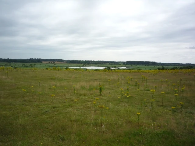
Westleton Heath National Nature Reserve
Dunwich Road, north-east of Westleton · Lowland heath, grassland and woodland
 the ai birderBirding near me
The AI Birder · one-page field sheet
Westleton, Suffolk, England · IP17 3BY

Current planning alert (2026-10-19): Island Mere Hide remains closed for boardwalk repairs reported from 5 October 2026; no reopening is confirmed. The current RSPB wildfire map also restricts the Canopy Hide and Woodland Trail area. Use only the permitted routes; Dunwich Heath and its adjoining beach remain closed.
Bittern · Marsh Harrier · Bearded Tit · Wigeon · Teal · Shoveler
North Hide · East Hide · South Hide · West Hide (Wildlife Lookout) · Bittern Hide · Island Mere Hide · Canopy Hide · Whin Hill Viewpoint · Coastal Viewpoint (Public Viewpoint) · North Wall · North Bushes · North Wall (shore end)
Check current access, hide closures and operator notices before travelling. Seasonal birds are possibilities, not promised sightings. Keep to authorised routes and give wildlife space.
Opening and charges checked 2026-10-08. Operator: https://www.rspb.org.uk/days-out/reserves/minsmere
Full guide and current source links: https://aibirder.co.uk/reserves/rspb-minsmere
EN 02 · RSPB reserve guide
Westleton, Suffolk, England · IP17 3BY
Listen for booming Bitterns and look for Bearded Tits, Marsh Harriers and Avocets across reedbed, shallow lagoons, wet grassland, heath and vegetated shingle.
To interpret a falcon crossing Minsmere’s wetland views, use the Peregrine watching guide, which explains the bird’s outline and responsible public watching.
Decide if the visit fits.
Last checked 8 October 2026.
Island Mere Hide remains closed for boardwalk repairs reported from 5 October 2026; no reopening is confirmed. The current RSPB wildfire map also restricts the Canopy Hide and Woodland Trail area. Use only the permitted routes; Dunwich Heath and its adjoining beach remain closed.
Opening and charges information · checked .
Stay nearby →Reserve overview
Listen for booming Bitterns and look for Bearded Tits, Marsh Harriers and Avocets across reedbed, shallow lagoons, wet grassland, heath and vegetated shingle.
Eight checks for a smoother visit.
Conditions change: check the operator and transport notices before travelling.
January–February: Wigeon, Teal, Shoveler and Gadwall typically feed and rest on the Scrape, while Snipe probe muddy margins and reedbed birds remain more elusive. Start at North Hide or Wildlife Lookout for sheltered lagoon scanning, then try Bittern Hide and the Island Mere area for Marsh Harriers and occasional Bittern flights. Early morning usually gives quieter hides and feeding activity; late afternoon is useful for watching harriers gathering towards their roost. March–April: Bitterns usually begin booming as the breeding season develops, and Marsh Harriers display above the reedbeds. Avocets return to the Scrape and begin establishing nesting territories, while Chiffchaffs and other spring migrants bring song to the woodland and scrub. Listen from the Island Mere area and Bittern Hide early in the morning, then use East Hide or South Hide to watch the lagoons. Calm mornings typically carry booming calls farther than windy afternoons. May–June: breeding activity is usually the main attraction. Avocets defend nests and chicks on the Scrape; Marsh Harriers carry food over the reedbeds; Reed and Sedge Warblers sing from cover. Bitterns may make feeding flights, and Hobbies typically hunt dragonflies as spring turns to summer. Try East Hide and Wildlife Lookout for the nesting lagoons, and Bittern Hide or Island Mere for reedbed flights. Early morning usually favours song and listening; warmer late mornings and afternoons can be better for Hobbies hunting insects. Nightjars typically become active around dusk on heathland, from permitted public routes. July–August: young birds disperse and southbound wader passage usually builds. Look for Black-tailed Godwits, Green Sandpipers, Common Sandpipers, Ruff and later Dunlin feeding around shallow water and exposed mud. East Hide and South Hide are useful starting points for comparing birds on the Scrape; North Wall offers reed-edge watching for Bearded Tits. Early morning usually avoids the strongest heat haze and gives active feeding birds. Warm afternoons can still reward patient watching for Hobbies above the reedbeds. September–October: passage waders typically overlap with arriving winter ducks. Dunlin, Ringed Plover and Ruff use the Scrape; Little Stint or Curlew Sandpiper are possible passage targets. Bearded Tits usually become more conspicuous in autumn, moving and calling along North Wall and near South Hide. Search North Bushes and Sluice Bushes for migrant warblers and Goldcrests. A calm early morning is usually best for reed-edge activity and listening; scan lagoon margins again later as light and water levels alter the view. November–December: winter wildfowl usually become the focus again, with Wigeon, Teal, Shoveler and Gadwall on the Scrape and diving ducks possible on Island Mere. Bitterns remain secretive, while Marsh Harriers hunt over the reedbeds and gather before roosting. North Hide and Wildlife Lookout offer lagoon views; Bittern Hide and the Island Mere area suit longer reedbed watches. Start in the morning for feeding ducks and use the last daylight for harrier movement, allowing time to finish your route.
Best conditions: Usually choose a calm early morning for reedbed listening and Bearded Tits; warmer late mornings and afternoons can suit insect-hunting Hobbies. The RSPB recommends East Hide in morning light and West Hide in the afternoon. In strong coastal wind, use the inland hides instead of exposed shore watching.
Ordinary visits do not need advance booking; pay reserve admission at the Visitor Hub during its opening hours. For an early start, use the published dawn-access information below and the operator’s current route notices. The separate access-times line below distinguishes the reserve, hides and car park. The published non-member prices checked on 8 October 2026 were £10 per adult, £5 per child and £6 per student with valid ID. RSPB members, visitors aged 16–24, under-fives and the first child enter free. The shop and café may be visited without paying reserve admission. The official access guide lists parking as free. Use Minsmere, Westleton, Saxmundham, Suffolk, IP17 3BY for the visitor entrance. Groups of ten or more and externally led tours must pre-book with the reserve team. The Visitor Centre and shop calendar showed 9am–5pm on 19 October; the café showed 10am–4pm. Winter shop hours are listed as 9am–4pm. Accessible toilets follow Visitor Centre opening hours.
Access times: Reserve: Dawn to dusk · Hides: Dawn to dusk, except Christmas Day and Boxing Day; current route and hide closures override these hours · Car park: Dawn to dusk; no overnight parking · Dawn access: partly. Operator opening information.
The Coastal Trail links the Scrape hides, while the Reedbed Trail reaches the Bittern Hide and Island Mere area. The general RSPB map also names the Woodland Trail and Canopy Hide, but the current wildfire map overrides that general layout. Use the updated map linked below before choosing a circuit. Whin Hill provides a more distant view of Island Mere when its permitted approach is available; a telescope is useful for separating small birds across that much open space. The full watching table gives each official hide and viewpoint its own row so that a familiar name is not mistaken for permission to enter a restricted area.
For a two-hour first visit, make the Scrape your priority. Start at the Visitor Hub, walk to North Hide, and use the boardwalk towards East Hide when that route is open. Compare the near margins with the more distant islands before moving on. In morning sunshine, East Hide is the RSPB’s recommended angle; in afternoon sunshine, use West Hide, also called Wildlife Lookout on the facilities page. Add South Hide if your walking time and current route access allow. A slower watch in two hides is usually more useful than a hurried circuit of four.
For a full day, keep the Scrape as one half of the visit and add Bittern Hide for patient reedbed scanning. Include Whin Hill on its permitted approach for the wider landscape. Island Mere Hide and Canopy Hide remain in the inventory, but the dated access information must be followed before adding either to a walking plan. Finish with another lagoon viewpoint in changed light. The general map estimates 90 minutes for the two-mile Coastal Trail and 60 minutes for the 1.5-mile Reedbed Trail; these are walking estimates before birding stops. Details of surfaces and elevated hides remain in Accessibility.
Use the linked reserve map and directions with current access notices. Species are typical seasonal targets. Light and telescope advice reflects our choice of viewpoint.
The northern edge of the Scrape and its islands
Ramped or level entry.
Winter: Wigeon, Teal, Shoveler
Spring: Avocet, Black-tailed Godwit
Summer: Avocet, Black-headed Gull
Autumn: Dunlin, Ruff, Little Stint
Light: either. Scope: useful.
Tide: Managed lagoon water; choose exposed mud and good light.
East Scrape, with views back across the lagoons
Ramped or level entry via the North Wall boardwalk.
Winter: Teal, Gadwall, Pintail
Spring: Avocet, Ringed Plover
Summer: Common Tern, Black-headed Gull
Autumn: Black-tailed Godwit, Dunlin, Ruff
Light: morning. Scope: useful.
Tide: Managed lagoon water; choose exposed mud and good light.
South Scrape and the adjacent reed edge
Ramped or level entry.
Winter: Shoveler, Teal, Shelduck
Spring: Avocet, Garganey
Summer: Common Tern, Avocet
Autumn: Bearded Tit, Dunlin, Spotted Redshank
Light: either. Scope: useful.
Tide: Managed lagoon water; choose exposed mud and good light.
West Scrape and its muddy margins
The facilities page calls this Wildlife Lookout; ramped or level entry.
Winter: Wigeon, Teal, Shoveler
Spring: Avocet, Black-tailed Godwit
Summer: Common Tern, Black-headed Gull
Autumn: Ruff, Dunlin, Water Pipit
Light: afternoon. Scope: useful.
Tide: Managed lagoon water; choose exposed mud and good light.
Reedbeds and channels east of the wooded ridge
Elevated hide with steps; see Accessibility for the count.
Winter: Bittern, Marsh Harrier, Kingfisher
Spring: Bittern, Marsh Harrier
Summer: Bittern, Hobby
Autumn: Marsh Harrier, Kingfisher
Light: either. Scope: useful.
The open water of Island Mere and the surrounding reeds
Boardwalk repairs reported from 5 October 2026; reopening unconfirmed. Do not enter while closed.
Winter: Great Crested Grebe, Little Egret, Marsh Harrier
Spring: Bittern, Bearded Tit
Summer: Hobby, Great Crested Grebe
Autumn: Great White Egret, Marsh Harrier
Light: either. Scope: useful.
The woodland canopy beside the Woodland Trail
Inside the wildfire-restricted woodland on the current RSPB map; do not enter.
Winter: Treecreeper, Marsh Tit
Spring: Blackcap, Chiffchaff
Summer: Blackcap, Treecreeper
Autumn: Chiffchaff, Treecreeper
Light: not applicable. Scope: not needed.
The broad reedbed landscape and distant Island Mere
Ramped or level viewing area; approach only on the currently permitted route.
Winter: Marsh Harrier, Great Crested Grebe
Spring: Bittern, Marsh Harrier
Summer: Hobby, Great Crested Grebe
Autumn: Marsh Harrier, Great White Egret
Light: either. Scope: essential.
The Scrape from the sea-wall side, beside the coastal path
Raised public platform with steps; use only the open coast-path approach.
Winter: Wigeon, Teal
Spring: Avocet, Ringed Plover
Summer: Common Tern, Black-headed Gull
Autumn: Dunlin, Black-tailed Godwit
Light: morning. Scope: useful.
Tide: The Scrape is managed; check sea conditions before using the beach approach.
Reed-fringed channels on the path towards the shore
Stay on the marked path and boardwalk.
Winter: Bearded Tit, Reed Bunting
Spring: Sedge Warbler, Reed Warbler
Summer: Bearded Tit, Reed Warbler
Autumn: Bearded Tit, Reed Bunting
Light: either. Scope: not needed.
Scrub beside the northern visitor paths
Watch from open visitor paths; keep out of the scrub.
Winter: Goldcrest, Bullfinch
Spring: Chiffchaff, Blackcap
Summer: Blackcap, Bullfinch
Autumn: Chiffchaff, Blackcap, Goldcrest
Light: either. Scope: not needed.
The North Sea from the official coast-path approach
Use the open shore approach only; Dunwich Heath and its adjoining beach remain closed.
Winter: Red-throated Diver, Common Scoter
Spring: Red-throated Diver
Autumn: Red-throated Diver, Common Scoter
Light: afternoon. Scope: essential.
Tide: Check Minsmere Sluice predictions and wave conditions; keep a safe return route.
| Spot | Overlooks | Key species by season | Best light | Scope | Tide |
|---|---|---|---|---|---|
| North HideRamped or level entry. | The northern edge of the Scrape and its islands | Winter: Wigeon, Teal, Shoveler Spring: Avocet, Black-tailed Godwit Summer: Avocet, Black-headed Gull Autumn: Dunlin, Ruff, Little Stint | either | useful | Managed lagoon water; choose exposed mud and good light. |
| East HideRamped or level entry via the North Wall boardwalk. | East Scrape, with views back across the lagoons | Winter: Teal, Gadwall, Pintail Spring: Avocet, Ringed Plover Summer: Common Tern, Black-headed Gull Autumn: Black-tailed Godwit, Dunlin, Ruff | morning | useful | Managed lagoon water; choose exposed mud and good light. |
| South HideRamped or level entry. | South Scrape and the adjacent reed edge | Winter: Shoveler, Teal, Shelduck Spring: Avocet, Garganey Summer: Common Tern, Avocet Autumn: Bearded Tit, Dunlin, Spotted Redshank | either | useful | Managed lagoon water; choose exposed mud and good light. |
| West Hide (Wildlife Lookout)The facilities page calls this Wildlife Lookout; ramped or level entry. | West Scrape and its muddy margins | Winter: Wigeon, Teal, Shoveler Spring: Avocet, Black-tailed Godwit Summer: Common Tern, Black-headed Gull Autumn: Ruff, Dunlin, Water Pipit | afternoon | useful | Managed lagoon water; choose exposed mud and good light. |
| Bittern HideElevated hide with steps; see Accessibility for the count. | Reedbeds and channels east of the wooded ridge | Winter: Bittern, Marsh Harrier, Kingfisher Spring: Bittern, Marsh Harrier Summer: Bittern, Hobby Autumn: Marsh Harrier, Kingfisher | either | useful | — |
| Island Mere HideBoardwalk repairs reported from 5 October 2026; reopening unconfirmed. Do not enter while closed. | The open water of Island Mere and the surrounding reeds | Winter: Great Crested Grebe, Little Egret, Marsh Harrier Spring: Bittern, Bearded Tit Summer: Hobby, Great Crested Grebe Autumn: Great White Egret, Marsh Harrier | either | useful | — |
| Canopy HideInside the wildfire-restricted woodland on the current RSPB map; do not enter. | The woodland canopy beside the Woodland Trail | Winter: Treecreeper, Marsh Tit Spring: Blackcap, Chiffchaff Summer: Blackcap, Treecreeper Autumn: Chiffchaff, Treecreeper | not applicable | not needed | — |
| Whin Hill ViewpointRamped or level viewing area; approach only on the currently permitted route. | The broad reedbed landscape and distant Island Mere | Winter: Marsh Harrier, Great Crested Grebe Spring: Bittern, Marsh Harrier Summer: Hobby, Great Crested Grebe Autumn: Marsh Harrier, Great White Egret | either | essential | — |
| Coastal Viewpoint (Public Viewpoint)Raised public platform with steps; use only the open coast-path approach. | The Scrape from the sea-wall side, beside the coastal path | Winter: Wigeon, Teal Spring: Avocet, Ringed Plover Summer: Common Tern, Black-headed Gull Autumn: Dunlin, Black-tailed Godwit | morning | useful | The Scrape is managed; check sea conditions before using the beach approach. |
| North WallStay on the marked path and boardwalk. | Reed-fringed channels on the path towards the shore | Winter: Bearded Tit, Reed Bunting Spring: Sedge Warbler, Reed Warbler Summer: Bearded Tit, Reed Warbler Autumn: Bearded Tit, Reed Bunting | either | not needed | — |
| North BushesWatch from open visitor paths; keep out of the scrub. | Scrub beside the northern visitor paths | Winter: Goldcrest, Bullfinch Spring: Chiffchaff, Blackcap Summer: Blackcap, Bullfinch Autumn: Chiffchaff, Blackcap, Goldcrest | either | not needed | — |
| North Wall (shore end)Use the open shore approach only; Dunwich Heath and its adjoining beach remain closed. | The North Sea from the official coast-path approach | Winter: Red-throated Diver, Common Scoter Spring: Red-throated Diver Autumn: Red-throated Diver, Common Scoter | afternoon | essential | Check Minsmere Sluice predictions and wave conditions; keep a safe return route. |
Month chips show typical presence or our preferred viewing season. Choose birds that suit the time of your visit.
The Scrape has managed water levels: choose lagoon views by exposed mud and light, without waiting for a high-tide spectacle. For the shore, check the Minsmere Sluice tide prediction and wave forecast before using the beach section. At high water or with waves reaching the shingle route, return by the inland trails.
Minsmere has both flat and undulating ground, with surfaces that vary between firm paths, loose material, boardwalk and coastal shingle. The Access for All boardwalk links North Wall to East Hide and improves access for wheelchair users, mobility scooters and pushchairs. It does not make every trail equally suitable: the coastal section towards the Sluice includes loose, uneven shingle, and a route that works for one visitor may be unsuitable for another. Use the official access map when choosing your circuit. North, Wildlife Lookout, East, South and Island Mere hides have ramped or level entry, as does the Whin Hill viewing area. Bittern Hide has 32 steps, Canopy Hide 46 steps and the Public Viewpoint 16 steps; none has a ramp or lift. The Visitor Centre is on one ground floor, with step-free internal access and a slight entrance slope. There are heavy outward-opening doors, a doorbell for assistance, a low counter, chairs on request, good lighting and a hearing loop. Eight Blue Badge bays are about 80 metres from the Visitor Centre along a sloping approach. The drop-off area outside the centre is level pea gravel. Three mobility scooters can be borrowed by advance booking on 01728 648281. Accessible toilets, baby changing and the café are reached through the centre; opening arrangements are in Entry. Visitors needing a particular accessible route can discuss their requirements with the reserve team before travelling.
The Visitor Centre brings together reception, a gift shop and café. Use a refreshment break to compare your morning observations and choose an afternoon route. There is also a separate general toilet block, picnic space and cycle parking. The café serves hot and cold drinks, snacks and light meals, while the picnic areas suit visitors bringing their own food. RSPB binocular hire is available from the shop; the published daily hire price started at £5 when checked on 8 October 2026. The unlit car park has 243 spaces and room for two coaches. Cycle racks are outside the Visitor Centre. The RSPB facilities page reported its two electric-vehicle charging points temporarily out of order on 8 October 2026, so plan charging elsewhere. Opening hours and parking rules are collected in Entry.
Pet dogs are welcome in the Visitor Hub and may be exercised in the car park on a short lead, but they are not permitted on the nature trails. Water bowls are provided at the café terrace and Visitor Hub entrance. Visitors with assistance dogs are welcome at RSPB Minsmere, including throughout its visitor routes. If you need a separate dog walk, request the current dog-walking map from the reserve team before travelling; wildfire-related path closures have reduced those options. Never leave a dog in a parked car.
Darsham is the nearest railway station, on Greater Anglia's Ipswich–Lowestoft route. From the station to the Visitor Hub, the mapped road route is about 5.3 miles, roughly 15–20 minutes' drive or taxi ride via Westleton. That is the driven route, rather than the shorter distance quoted on the RSPB location page. Book the taxi's outward and return legs in advance; the RSPB access guide lists Darsham Cars on 01728 668039 and A2B Taxis on 01728 633003. Leiston Main Street is the nearest scheduled bus stop, about four miles from the reserve. Border Bus 522 links Beccles, Halesworth, Darsham station, Saxmundham, Leiston and Aldeburgh, with a roughly hourly core daytime service Monday–Friday, excluding public holidays. Route 521 also serves Leiston via Knodishall and supplies roughly hourly Saturday daytime journeys, including links with Darsham and Saxmundham; school-day variations affect weekday trips. Neither published timetable includes Sunday service. These buses stop in Leiston, not at the reserve entrance. Arrange a taxi or accessible onward transport rather than treating the rural-road approach as a routine bus interchange. The RSPB lists Coastal Accessible Transport Services (C.A.T.S.), 01728 635938, for transfers from Leiston bus stop or Darsham and Saxmundham stations, booked at least a week ahead. Confirm pickup and return arrangements when booking. Greater Anglia and the Border Bus timetables linked below provide the dated journey details. For drivers, follow the brown tourist signs from the A12 via Westleton. The RSPB also gives walking approaches of about 2.5 miles from Westleton and 1.7 miles from Eastbridge: at an assumed three miles per hour, allow roughly 50 and 35 minutes respectively, before stops. These are planning estimates for rural roads, not assessed accessible walking times. There are cycle racks at the Visitor Centre; cycling on nature trails is not permitted. Road journey estimates here and in Where to stay use OSRM/OpenStreetMap routes to the Visitor Hub, measured on 8 October 2026, without live traffic.
Useful bases for an early start.
Booking.com links are affiliate links: we may earn a commission at no extra cost to you. How these links work.
About 2.5 miles by road, roughly 10 minutes' drive to the Visitor Hub.
Measured driving route · 2026-10-09. Map estimates exclude live traffic.
Best for early starts and village inns, B&Bs or self-catering close to the reserve.Find places to stay in Westleton on Booking.comAbout 1.7 miles by road, roughly 5–10 minutes' drive to the Visitor Hub.
Measured driving route · 2026-10-09. Map estimates exclude live traffic.
Best for a quiet village base beside the Minsmere landscape and a short onward journey. Accommodation search covers nearby Leiston; Eastbridge remains a village option within that wider area.Find places to stay in Eastbridge on Booking.comAbout eight miles by road, roughly 20 minutes' drive to the Visitor Hub. Rail arrivals can pre-book C.A.T.S. transfers at least a week ahead.
Measured driving route · 2026-10-09. Map estimates exclude live traffic.
Best for train arrivals, shops and services, with town accommodation and access to the wider Suffolk coast.Find places to stay in Saxmundham on Booking.comAbout 11.5 miles by road, roughly 25 minutes' drive to the Visitor Hub via the A12 and Westleton.
Measured driving route · 2026-10-09. Map estimates exclude live traffic.
Best for a longer coastal break with hotels, guesthouses and holiday lets.Find places to stay in Southwold on Booking.comAbout nine miles by road, roughly 25 minutes' drive to the Visitor Hub via Leiston and Eastbridge.
Measured driving route · 2026-10-09. Map estimates exclude live traffic.
Best for combining Minsmere with seaside walking, estuary birding and a wider choice of places to eat.Find places to stay in Aldeburgh on Booking.comExplore Suffolk’s full guides and smaller birding sites
For visitor information and route-specific access questions, call 01728 648281 or email minsmere@rspb.org.uk. The Visitor Hub is the check-in point for visitors and provides the trail map and guidance on permitted areas. Keep to marked paths, give birds space and follow closure signs rather than entering a blocked route for a better view. Ask the team to arrange entry for parties of at least ten and any externally led tour. Use the official weekly sightings link for recent wildlife reports and the separate operator pages below for opening, admission, facilities and accessibility. The transport links provide timetables and road-route evidence for journey planning.
Check RSPB Minsmere weekly wildlife sightings. weekly; check the dates within the report Reports show what has been seen, not what will be.
Follow the BTO Birders’ Code and give wildlife space.
RSPB Minsmere: Adults £10, paying children £5, students £6; members free; parking free.
RSPB Minsmere: Pet dogs are welcome in the Visitor Hub and may be exercised in the car park on a short lead, but they are not permitted on the nature trails.
RSPB Minsmere: Spring migration · rewarding year-round.
RSPB Minsmere: The Access for All boardwalk links North Wall to East Hide and improves access for wheelchair users, mobility scooters and pushchairs.
RSPB Minsmere: Darsham is the nearest railway station, on Greater Anglia's Ipswich–Lowestoft route.
Shorter stops within 15 miles in a straight line. Use the operator’s arrival directions for the journey.
Dunwich Road, north-east of Westleton · Lowland heath, grassland and woodland
Dunwich · Coastal wetland and reedbed
Marsh Lane approach, near Aldeburgh · Tidal marsh, mudflats and estuary pools
A1095 Halesworth Road, near Southwold · Reedbeds, pools, coastal grazing marsh and river wall
Near Wangford, north of Southwold · Ancient coppice woodland and sunny rides
Bridge Road, Snape · Reedbed, grazing marsh, dykes and woodland edge
Church Lane, Iken, near Snape · Saltmarsh and tidal mudflats
Off the B1069 between Tunstall and Snape · Lowland heath, scrub and woodland edge
Boyton · Coastal wetland
Nearby complete guides.
Stops with a purpose: use one as a contrasting habitat or weather-proof Plan B. Distances are straight-line estimates, not road journeys.