


Short entry0.6 miles away
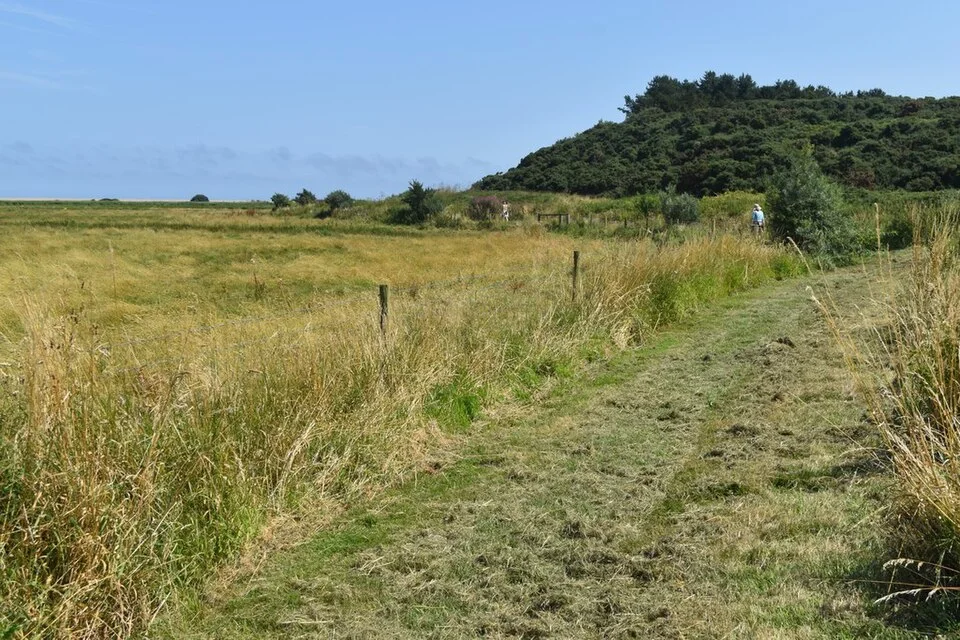
Walsey Hills
Between Cley-next-the-Sea and Salthouse · woodland · scrub · coast
 the ai birderBirding near me
The AI Birder · one-page field sheet
Coast Road, Cley-next-the-Sea, Holt, Norfolk, England · NR25 7SA · NR25 7SA

Current planning alert (2026-10-09): Winter storm floods can affect Cley’s exposed coast. NWT may move the Gillmor Discovery Hide to safety when a major storm is forecast; obey any signed path or hide closure.
Marsh Harrier · Bearded Tit · Brent Goose · Pink-footed Goose · Pintail · Lapwing
Avocet Hide · Daukes Hide · Teal Hide · Bishop’s Hide · Babcock Hide · Gillmor Discovery Hide · Richardson’s Lookout · East Bank · West Bank · Attenborough Walk · Cley beach car park (Coastguards) · Salthouse coastal path
Check current access, hide closures and operator notices before travelling. Seasonal birds are possibilities, not promised sightings. Keep to authorised routes and give wildlife space.
Opening and charges checked 2026-10-18. Operator: https://www.norfolkwildlifetrust.org.uk/CleyMarshes
Full guide and current source links: https://aibirder.co.uk/reserves/nwt-cley-and-salthouse-marshes
EN 20 · Norfolk Wildlife Trust reserve guide
Coast Road, Cley-next-the-Sea, Holt, Norfolk, England · NR25 7SA
One of Britain's classic migration watchpoints, with Avocets and Redshanks breeding around the scrapes, regular feeding Spoonbills, Marsh Harriers and Bitterns, and the possibility of scarce migrants after suitable spring or autumn weather. Winter brings Brent and Pink-footed Geese, Pintail and other wildfowl.
Decide if the visit fits.
Last checked 18 October 2026.
Winter storm floods can affect Cley’s exposed coast. NWT may move the Gillmor Discovery Hide to safety when a major storm is forecast; obey any signed path or hide closure.
Opening and charges information · checked .
Stay nearby →Reserve overview
One of Britain's classic migration watchpoints, with Avocets and Redshanks breeding around the scrapes, regular feeding Spoonbills, Marsh Harriers and Bitterns, and the possibility of scarce migrants after suitable spring or autumn weather. Winter brings Brent and Pink-footed Geese, Pintail and other wildfowl.
Eight checks for a smoother visit.
Conditions change: check the operator and transport notices before travelling.
January: typically begin at Gillmor Discovery Hide for Brent Geese, Pink-footed Geese and Pintail on North Scrape. Then compare the ducks from Teal Hide. A scope is worthwhile across open water; keep the shingle approach out of the plan if waves are reaching it.
February: usually combine Pintail and Shoveler at the central scrapes with Snow Buntings along the Salthouse coastal path. Let the flock move towards you rather than walking it along the beach. East Bank is a separate option for Marsh Harriers when the shoreline is uncomfortable.
March: typically watch Avocets from Bishop’s Hide and listen for Bitterns from the permitted path and hide. East Bank gives a broad reedbed watch for Marsh Harriers and Bearded Tits. Pause in calmer conditions; loud wind makes calling birds harder to locate.
April: usually favour the East Bank reed edge for Sedge Warbler and Bearded Tit, then use Bishop’s Hide for Avocets. The central boardwalk provides a slower alternative to a long exposed circuit. These are feeding and general habitat watches, not instructions to locate nests.
May: typically try Reed Warblers from East Bank, Avocets from Bishop’s Hide and feeding Spoonbills from Teal Hide. Several short scans separated by a quiet wait are more useful than continually changing hides. Non-members need their hide permit before entering the paid central area.
June: usually divide the visit between Shoveler at Daukes Hide and Lapwing, Redshank and Gadwall around Babcock Hide. Watch all birds from the public viewing route. If people are waiting behind you, leave a viewing window free and move the tripod out of the passage.
July: typically check the Watling Water margins from Babcock Hide for returning Green Sandpipers, with Wood Sandpiper a scarcer passage possibility. At Teal Hide, feeding Spoonbills offer a different subject. Shallow muddy margins matter more than a fixed hour or a sea-tide calculation.
August: usually repeat the Babcock Hide scan for passage Green and Wood Sandpipers, then compare Teal Hide and Bishop’s Hide for Spoonbills. Water levels alter which scrape is productive. Use the current bird-club reports to choose the first stop without treating an earlier report as a guarantee.
September: typically give East Bank a patient Bearded Tit watch and inspect the remaining shallow water from Babcock Hide for Green Sandpipers. Seawatching from a safe position at Cley beach car park can add Common Scoter. A telescope becomes much more important for distant birds offshore.
October: usually combine Common Scoter and Red-throated Diver offshore from Cley beach car park with Bearded Tits along East Bank. Stonechats can make Attenborough Walk a worthwhile sheltered contrast. Northerly weather can change the sea passage, but personal safety and a dry retreat come first.
November: typically make North Scrape the winter priority from Gillmor Discovery Hide, looking for Brent and Pink-footed Geese and Pintail. Add the Salthouse coastal path for Snow Buntings if conditions permit. Do not cross marsh vegetation to shorten the distance to a flock.
December: usually concentrate on winter wildfowl from the central hides and Gillmor Discovery Hide rather than attempting the whole reserve. Look for Shoveler at Daukes Hide and Pintail across North Scrape. Finish the exposed part while there is sufficient daylight for the return.
Best conditions: Typically choose a light-wind morning for listening and watching along the reedbed edge; exposed East Bank is less rewarding for small birds in strong wind. Compare glare through each central hide before settling. The light and scope ratings are editorial fieldcraft suggestions from the mapped views, not operator promises. In rough northerly weather use safe landward seawatching positions and abandon any wave-washed coastal route.
Prices checked on NWT's pages on 18 October 2026: paid reserve and hide access costs non-members £5.40 standard or £6 with Gift Aid, including parking; members and children aged 16 or under enter free. The wider reserve and visitor centre are free to enter. Centre hours are 10am–5pm from March to the last Sunday in October, then 10am–4pm from the following Monday through February; it closes on Christmas Eve and Christmas Day, and the café closes 30 minutes earlier. Official parking tariffs conflict: the reserve page lists £6 daily, £4 half-day and £1.50 hourly, while the dedicated FAQ gives £5 for six hours and £3 for three. Check the machine or contact NWT before budgeting for parking alone. Paid reserve tickets include parking, and the FAQ confirms free parking for Blue Badge holders and specified eligible visitors.
Access times: Reserve: Daily, dawn to dusk; public perimeter paths are distinguished from the paid central reserve. · Hides: Dawn to dusk within reserve access; central hides need a valid permit for non-members. Gillmor Discovery Hide is free. · Car park: Visitor-centre and beach parking are listed by NWT; separate gate hours are not published. · Dawn access: partly. Operator opening information.
Use the official reserve map to choose a route around the scrapes and reedbeds before extending onto the coastal banks. The central hides, Bishop's Hide and East Bank offer complementary views, while the eastern marshes and Attenborough Walk make a longer outing possible. A bird hidden by reeds from one angle can be easier to identify from another, so changing viewpoint has a purpose beyond simply increasing the distance walked. Two-hour plan — an editorial itinerary: begin with the central hides and allow a substantial first watch over the pools. Choose Bishop's Hide for the second angle or take a shorter section of East Bank, depending on the day's birds and your return time. Keep the final part for retracing the route and crossing back to the centre. If a mixed wader flock is close, spend more time comparing it rather than rushing to another hide. Full-day plan — an editorial itinerary: start with the central reserve, take a centre break, then use East Bank and the eastern marshes for a broader view. Add a shingle or Salthouse section only if weather, surfaces and daylight suit your group. Finish by returning to a productive pool for a second scan. This sequence can be shortened at several points; it is a suggested birdwatching day rather than a compulsory circuit of the entire coast. For wader identification, compare bill shape, feeding action and body proportions before concentrating on fine plumage. Separate birds wading at the shallow edge from those on dry islands; different feeding depths often help explain the mix. When a marsh harrier passes, watch how the flocks respond and then allow them to settle. Stay on public paths and outside any wildlife protection cordons, and keep clear of livestock on the grazed parts of the reserve.
Use the linked reserve map and directions with current access notices. Species are typical seasonal targets. Light and telescope advice reflects our choice of viewpoint.
Whitwell Scrape and adjoining shallow pools
Central-hide boardwalk; a valid NWT permit is required for non-members.
Spring: Avocet, Shelduck
Summer: Avocet, Little Egret
Autumn: Green Sandpiper
Winter: Shoveler, Gadwall
Light: either. Scope: useful.
Simmond’s Scrape and reed-fringed drains
One of the three central hides reached along the boardwalk.
Spring: Water Rail, Shoveler
Summer: Reed Warbler, Mallard
Autumn: Green Sandpiper
Winter: Water Rail, Shoveler
Light: either. Scope: useful.
Pat’s Pool and the adjoining ditch margins
Central-hide boardwalk, shared with the Avocet and Daukes approaches.
Spring: Avocet, Shoveler
Summer: Avocet, Shoveler
Autumn: Spoonbill
Winter: Pintail, Shelduck
Light: either. Scope: useful.
Pat’s Pool and the central reedbed edge
Short path from the southern reserve path; operator access guidance describes the hardened approach.
Spring: Avocet, Bittern
Summer: Avocet, Little Egret
Autumn: Spoonbill
Winter: Pintail, Gadwall
Light: either. Scope: useful.
Watling Water and Pope’s Marsh grazing meadows
Follow the mapped permissive route off Attenborough Walk; do not cross the fields.
Spring: Lapwing, Redshank
Summer: Gadwall, Oystercatcher
Autumn: Green Sandpiper, Wood Sandpiper
Winter: Brent Goose, Lapwing
Light: either. Scope: useful.
North Scrape, viewed inland from the shingle side
Free hide on the public/permissive coastal route; NWT can move it to safety before major storms.
Spring: Avocet, Lapwing
Summer: Avocet, Oystercatcher
Autumn: Lapwing
Winter: Brent Goose, Pink-footed Goose, Pintail
Light: either. Scope: useful.
Tide: The scrape is managed water; check coastal conditions before using the shingle approach.
Arnold’s Marsh and the northern end of East Bank
Mapped shelter at the coastward end of East Bank; exposed approach.
Spring: Redshank
Summer: Black-headed Gull, Ringed Plover
Autumn: Redshank
Winter: Brent Goose, Redshank
Light: either. Scope: useful.
Tide: Use the landward bank and shelter; do not wait on wave-washed shingle.
Central reedbed, the Serpentine and Arnold’s Marsh
Raised hardened path; the operator describes a sloping approach.
Spring: Bearded Tit, Marsh Harrier, Sedge Warbler
Summer: Bearded Tit, Reed Warbler, Redshank
Autumn: Bearded Tit, Green Sandpiper
Winter: Brent Goose, Marsh Harrier
Light: either. Scope: useful.
Western grazing marshes and the Glaven side of the reserve
Public raised bank; stay on the bank rather than entering grazing fields.
Spring: Lapwing, Skylark
Summer: Marsh Harrier, Little Egret
Autumn: Lapwing
Winter: Pink-footed Goose, Lapwing
Light: either. Scope: useful.
Grazing marsh, reed-fringed ditches and scrub south of Pope’s Marsh
Mapped grassy permissive/public path; it is a different surface from the central boardwalk.
Spring: Sedge Warbler, Skylark, Cetti’s Warbler
Summer: Sedge Warbler, Skylark
Autumn: Stonechat
Winter: Stonechat
Light: either. Scope: not needed.
Sea and the shingle shoreline
Watch from a safe landward position; keep the car park entrance clear.
Autumn: Common Scoter, Red-throated Diver
Winter: Common Scoter, Red-throated Diver
Light: either. Scope: essential.
Tide: Leave the shingle when waves reach the route; no operator-published birding tide height was found.
Shingle, low coastal vegetation and the marshes north of Salthouse
Public coastal path; keep away from roped wildlife areas and give feeding flocks space.
Spring: Stonechat
Summer: Redshank
Autumn: Stonechat
Winter: Snow Bunting, Brent Goose
Light: either. Scope: useful.
Tide: Use the inland alternative if the coastal route is wave-washed.
| Spot | Overlooks | Key species by season | Best light | Scope | Tide |
|---|---|---|---|---|---|
| Avocet HideCentral-hide boardwalk; a valid NWT permit is required for non-members. | Whitwell Scrape and adjoining shallow pools | Spring: Avocet, Shelduck Summer: Avocet, Little Egret Autumn: Green Sandpiper Winter: Shoveler, Gadwall | either | useful | — |
| Daukes HideOne of the three central hides reached along the boardwalk. | Simmond’s Scrape and reed-fringed drains | Spring: Water Rail, Shoveler Summer: Reed Warbler, Mallard Autumn: Green Sandpiper Winter: Water Rail, Shoveler | either | useful | — |
| Teal HideCentral-hide boardwalk, shared with the Avocet and Daukes approaches. | Pat’s Pool and the adjoining ditch margins | Spring: Avocet, Shoveler Summer: Avocet, Shoveler Autumn: Spoonbill Winter: Pintail, Shelduck | either | useful | — |
| Bishop’s HideShort path from the southern reserve path; operator access guidance describes the hardened approach. | Pat’s Pool and the central reedbed edge | Spring: Avocet, Bittern Summer: Avocet, Little Egret Autumn: Spoonbill Winter: Pintail, Gadwall | either | useful | — |
| Babcock HideFollow the mapped permissive route off Attenborough Walk; do not cross the fields. | Watling Water and Pope’s Marsh grazing meadows | Spring: Lapwing, Redshank Summer: Gadwall, Oystercatcher Autumn: Green Sandpiper, Wood Sandpiper Winter: Brent Goose, Lapwing | either | useful | — |
| Gillmor Discovery HideFree hide on the public/permissive coastal route; NWT can move it to safety before major storms. | North Scrape, viewed inland from the shingle side | Spring: Avocet, Lapwing Summer: Avocet, Oystercatcher Autumn: Lapwing Winter: Brent Goose, Pink-footed Goose, Pintail | either | useful | The scrape is managed water; check coastal conditions before using the shingle approach. |
| Richardson’s LookoutMapped shelter at the coastward end of East Bank; exposed approach. | Arnold’s Marsh and the northern end of East Bank | Spring: Redshank Summer: Black-headed Gull, Ringed Plover Autumn: Redshank Winter: Brent Goose, Redshank | either | useful | Use the landward bank and shelter; do not wait on wave-washed shingle. |
| East BankRaised hardened path; the operator describes a sloping approach. | Central reedbed, the Serpentine and Arnold’s Marsh | Spring: Bearded Tit, Marsh Harrier, Sedge Warbler Summer: Bearded Tit, Reed Warbler, Redshank Autumn: Bearded Tit, Green Sandpiper Winter: Brent Goose, Marsh Harrier | either | useful | — |
| West BankPublic raised bank; stay on the bank rather than entering grazing fields. | Western grazing marshes and the Glaven side of the reserve | Spring: Lapwing, Skylark Summer: Marsh Harrier, Little Egret Autumn: Lapwing Winter: Pink-footed Goose, Lapwing | either | useful | — |
| Attenborough WalkMapped grassy permissive/public path; it is a different surface from the central boardwalk. | Grazing marsh, reed-fringed ditches and scrub south of Pope’s Marsh | Spring: Sedge Warbler, Skylark, Cetti’s Warbler Summer: Sedge Warbler, Skylark Autumn: Stonechat Winter: Stonechat | either | not needed | — |
| Cley beach car park (Coastguards)Watch from a safe landward position; keep the car park entrance clear. | Sea and the shingle shoreline | Autumn: Common Scoter, Red-throated Diver Winter: Common Scoter, Red-throated Diver | either | essential | Leave the shingle when waves reach the route; no operator-published birding tide height was found. |
| Salthouse coastal pathPublic coastal path; keep away from roped wildlife areas and give feeding flocks space. | Shingle, low coastal vegetation and the marshes north of Salthouse | Spring: Stonechat Summer: Redshank Autumn: Stonechat Winter: Snow Bunting, Brent Goose | either | useful | Use the inland alternative if the coastal route is wave-washed. |
Month chips show typical presence or our preferred viewing season. Choose birds that suit the time of your visit.
The main scrapes and Watling Water are managed wetland, so shallow exposed margins matter more than a sea-tide hour. For a beach watch check high water and wave conditions first; do not use the shingle route when overtopped. No minimum birding tide height is published in the sources checked.
NWT's dedicated access page describes designated parking spaces but a rough surface on the approach to the centre. Push-button doors, a lift, hearing loop and a wheelchair are listed. Discuss any equipment reservation and personal assistance requirement before travel, particularly if your visit depends on the loan chair. To reach the reserve from the centre car park, use the pedestrian crossing. The approach uses compacted hoggin; the left-hand option reaches a boardwalk with passing places towards the hides, while the right-hand route leads towards Bishop's Hide and East Bank. East Bank has an access slope and a raised hardened surface. These descriptions help distinguish the main reserve routes from the shingle shore, which demands a different assessment. Choose the viewpoints that fit your chair, walking aid or stamina, and allow for returning as well as reaching a hide. For a long seated watch, explain any need for back support or a particular window height when discussing the route with NWT. A shorter central-hide visit can still provide varied waterbird watching. The operator's comfortable-walking grade does not remove the need to consider an individual's access requirements or the coastal weather.
The visitor centre provides a café, shop, exhibitions and the Simon Aspinall Wildlife Education Centre. Toilets, including wheelchair-accessible facilities and baby changing, are available during building hours. The café lists seasonal food, hot and cold drinks and dietary choices; speak directly to the team about any specific requirement. Bring water and an outdoor snack for a longer bank walk so you can choose a break around the birdwatching. Guided walks and family activities have their own programme and booking arrangements.
Assistance dogs are permitted on the reserve and inside the centre. Pet dogs may use Beach Road, the shingle boundary and East Bank on a lead, and are allowed onto the outside decking via the centre. Keep to those permitted routes, observe signs and remove waste; do not take a pet dog into the central reserve hides.
Sanders Coaches' Coasthopper CH1 is the practical bus route along this part of the north Norfolk coast. The current operator timetable names the Norfolk Wildlife Trust stop at Cley next the Sea, serving the reserve rather than leaving you to find an unspecified village connection. CH1 links the coast through Salthouse, Sheringham, Blakeney and Wells next the Sea. Use the date-specific timetable for outward and return journeys, since seasonal and Sunday patterns differ. Sheringham provides a rail connection for a train-and-bus visit; allow time to reach the bus stop and make the onward connection. NWT's main reserve directions place the visitor centre on the landward side of the A149 and the reserve entrance across the road. That distinction is useful when planning where to alight and where to begin a walk. The parking information page offers half-price reserve admission to Coasthopper arrivals. Check the eligibility arrangements with NWT when planning your journey. For a linear coastal outing, identify your return stop before leaving the centre, rather than extending the walk until the last convenient bus has gone.
Useful bases for an early start.
Booking.com links are affiliate links: we may earn a commission at no extra cost to you. How these links work.
About 0.9 miles by road, roughly 3 minutes’ drive from Cley next the Sea centre; OSRM / OpenStreetMap estimate measured 18 October 2026, excluding live traffic.
Measured driving route · 2026-10-18. Map estimates exclude live traffic.
A village base close to the centre and central reserve.Find places to stay in Cley next the Sea on Booking.comAbout 4.5 miles by road, roughly 8 minutes’ drive from Holt centre; OSRM / OpenStreetMap estimate measured 18 October 2026, excluding live traffic.
Measured driving route · 2026-10-18. Map estimates exclude live traffic.
An inland Norfolk base for a longer coast-and-countryside break.Find places to stay in Holt on Booking.comAbout 7.1 miles by road, roughly 14 minutes’ drive from Sheringham centre; OSRM / OpenStreetMap estimate measured 18 October 2026, excluding live traffic.
Measured driving route · 2026-10-18. Map estimates exclude live traffic.
A rail-connected coastal town for a train-and-Coasthopper stay.Find places to stay in Sheringham on Booking.comExplore Norfolk’s full guides and smaller birding sites
Contact Cley on 01263 740008; the centre page also lists ewanc@norfolkwildlifetrust.org.uk. Give the date, intended route and practical requirement when asking about access or a group visit. The reserve map and centre team can help you decide which pool or bank deserves most time. Use dated official reports as context for your trip rather than assuming a bird mentioned earlier is still present. In your own notes, record the hide or bank as well as the species: the scale of this coastal reserve makes a precise viewpoint more useful than a general Cley sighting.
Check Cley Bird Club wildlife reports. most days; reports show the preceding 14 days Reports show what has been seen, not what will be.
Follow the BTO Birders’ Code and give wildlife space.
NWT Cley and Salthouse Marshes: Paid reserve £5.40 standard / £6 Gift Aid including parking; NWT members and under-17s free.
NWT Cley and Salthouse Marshes: Assistance dogs are permitted on the reserve and inside the centre.
NWT Cley and Salthouse Marshes: Autumn migration · spring and summer breeding birds · winter geese and wildfowl.
NWT Cley and Salthouse Marshes: Push-button doors, a lift, hearing loop and a wheelchair are listed.
NWT Cley and Salthouse Marshes: Sanders Coaches' Coasthopper CH1 is the practical bus route along this part of the north Norfolk coast.
Shorter stops within 15 miles in a straight line. Use the operator’s arrival directions for the journey.
Between Cley-next-the-Sea and Salthouse · woodland · scrub · coast
Blakeney · wetland · grassland · scrub
Meadow Lane approach from Kelling village · Coastal grazing marsh, pool, hedges and shingle shore
Morston · coast · wetland
Kelling · woodland · heathland · coast
Near Kelling and Weybourne · heathland · woodland · scrub
Weybourne Hope · coast · grassland
Holt · Woodland
Holt, reached through Holt Country Park · Heathland · Woodland
Lower Bodham, between High Kelling and Hempstead · wetland · woodland
Thornage, near Holt · grassland · woodland · wetland
Between Weybourne station and Sheringham Park · woodland · heathland
West of Sheringham · coast · grassland
Stiffkey · coast · wetland
Upper Sheringham · woodland · grassland
Sheringham · Cemetery trees, shrubs, grassland and neighbouring open ground
Briningham · grassland · woodland
Sheringham · coast
Edgefield · wetland · grassland · woodland
Sheringham · Woodland
Between Sheringham and Beeston Regis · wetland · grassland · woodland
Sheringham, Norfolk · Coast · Grassland · Scrub
Matlaske and Barningham Park · wetland · woodland · grassland
Lower Gresham · Arable farmland, hedgerows and beck
Northeast of Fakenham, beside the A148 · Woodland
West Runton · coast · grassland
Roman Camp, West Runton, Norfolk · Heathland · Woodland
Aylmerton · Village pond, reedbed and waterside vegetation
Between East and West Runton, Norfolk · Heathland · Scrub · Grassland
Near Little Snoring, northeast of Fakenham · Woodland · Heathland
East Runton, west of Cromer · Coast · Woodland
Between Saxthorpe and Little Barningham · woodland
Felbrigg, near Cromer · woodland · wetland · grassland
Mannington, near Itteringham · woodland · wetland · grassland
Sustead · wetland · grassland · woodland
Southwest of Cromer · grassland · woodland
Cromer · coast
Near Fakenham · wetland · woodland · grassland
Cromer, Norfolk · Coast · Scrub · Grassland
Heydon · Historic parkland, woodland, meadows and pond
Erpingham · Wet grassland, fen, scrub and ponds
Overstrand · coast
Blickling, near Aylsham · woodland · wetland · grassland
Sculthorpe, near Fakenham · wetland · woodland · grassland
Foxley, northwest of Norwich · Woodland
Aylsham · Nursery gardens, hedgerows, wet meadows and woodland edges
Booton, near Reepham · wetland · grassland · woodland
Lower Southrepps, near Gunton station · Reedbeds · Woodland · Grassland
Suffield · woodland
Off Burnham Overy Staithe · coast · wetland
Between Marsham and Cawston · heathland · woodland
Nearby complete guides.
Stops with a purpose: use one as a contrasting habitat or weather-proof Plan B. Distances are straight-line estimates, not road journeys.