

Short entry5.1 miles away
Canvey Wick
Canvey Island · Grassland and scrub
 the ai birderBirding near me
The AI Birder · one-page field sheet
Kent, England · ME3 8DS · ME3 8DS

Current planning alert (2026-10-18): The RSPB currently lists the Heronry Trail as closed. Its toilet descriptions also conflict, including a temporary-closure entry; confirm facilities before travelling if they are essential.
Marsh Harrier · Little Egret · Grey Heron · Gadwall · Tufted Duck · Mute Swan
Ernie Hemsley viewpoint · Sweeney viewpoint · Woodland viewpoint · Woodland Trail · Heronry viewpoint — CLOSED trail
Check current access, hide closures and operator notices before travelling. Seasonal birds are possibilities, not promised sightings. Keep to authorised routes and give wildlife space.
Opening and charges checked 2026-10-18. Operator: https://www.rspb.org.uk/days-out/reserves/northward-hill
Full guide and current source links: https://aibirder.co.uk/reserves/rspb-northward-hill
EN 55 · RSPB reserve guide
Kent, England · ME3 8DS
Herons over marshland, Nightingales in spring and a contrasting wooded ridge.
Decide if the visit fits.
Last checked 18 October 2026.
The RSPB currently lists the Heronry Trail as closed. Its toilet descriptions also conflict, including a temporary-closure entry; confirm facilities before travelling if they are essential.
Opening and charges information · checked .
Stay nearby →Reserve overview
Herons over marshland, Nightingales in spring and a contrasting wooded ridge.
Eight checks for a smoother visit.
Conditions change: check the operator and transport notices before travelling.
January: Typically use Ernie Hemsley viewpoint for Wigeon and wider raptor scans. Peregrine is a winter target, but a clear calm spell is more useful than a guaranteed-species checklist.
February: Usually Ernie Hemsley viewpoint suits Wigeon and Grey Heron feeding across the marsh. Heronry nests are not a viewing attraction: the operator says they cannot be seen from the Heronry Viewpoint.
March: Typically Lapwing and Redshank activity increases across the marsh, best scanned from Ernie Hemsley viewpoint. Watch displaying birds at a distance without attempting to locate nests or enter grazing fields.
April: Usually listen for Blackcap and Chiffchaff along Woodland Trail, then scan Little Egret from Ernie Hemsley viewpoint. Listen for Nightingale from the public Woodland Trail without pursuing birds into cover.
May: Typically combine woodland song with open marsh watching: Whitethroat along Woodland Trail and Marsh Harrier from Ernie Hemsley viewpoint. Respect the Heronry Trail closure throughout the breeding season.
June: Usually Ernie Hemsley viewpoint is a good starting point for Marsh Harrier, Gadwall and Tufted Duck. The actual June 2026 group visit recorded these birds across the grazing-marsh pools.
July: Typically watch Hobby and Marsh Harrier over the marsh from Ernie Hemsley viewpoint, then try Chaffinch from Woodland Trail. A distant flyover does not establish a breeding or roost site.
August: Usually start at Ernie Hemsley viewpoint for Marsh Harrier and Green Sandpiper across available pools. Conditions change with water levels, so read recent county reports without expecting yesterday’s exact birds.
September: Typically compare Green Sandpiper across the marsh from Ernie Hemsley viewpoint with Jay along Woodland Trail. Keep to open signed paths; an old map cannot authorise the closed trail.
October: Usually give Ernie Hemsley viewpoint time for Marsh Harrier and returning winter wildfowl, then look for Jay along Woodland Trail. The reserve has no staffed visitor centre for an indoor fallback.
November: Typically use Ernie Hemsley viewpoint for Wigeon and Peregrine. Watch winter harriers and owls from the public viewpoints; finish a walk without following them into cover.
December: Usually a short daylight circuit is enough: Wigeon from Ernie Hemsley viewpoint and Blackbird along Woodland Trail. The car park closes at 4pm, so leave a comfortable return margin.
Best conditions: Our choice is a calm dry morning for woodland listening followed by a patient marsh scan. A telescope helps distant wildfowl, while binoculars suit woodland and flying harriers. Light and scope ratings are editorial. Wind and glare can conceal small birds on the pools. Follow the current open-trail signs rather than attempting the closed heronry route.
Admission information checked 18 October 2026: the RSPB lists free adult and child entry. Its published charges table does not include a parking tariff, so no paid parking price is assumed here. Ordinary visits do not require advance booking; contact the reserve for a group outing. The generic charges-page instruction to pay at a visitor centre is inconsistent with the facilities page, which says there is no visitor centre or on-site staff. The facilities page gives the car park as open daily 10:00–16:00. The opening calendar retrieved during review shows 24-hour reserve access, but that does not extend the parking hours. A dusk roost watch therefore needs a departure plan that respects the gate. Check current notices before travelling, particularly the separate Heronry Trail closure and the conflicting toilet information. Do not use a quiet lane or gateway as overflow parking if the available space is unsuitable.
Access times: Reserve: Open 24 hours on the RSPB calendar, using open public routes only. Heronry Trail is CLOSED. · Hides: No enclosed hide is advertised; use only open signed viewpoints. The closed Heronry Trail is not part of a suggested circuit. · Car park: Bromhey Farm car park daily 10am–4pm; potholes and uneven ground. · Dawn access: partly. Operator opening information.
Begin with a view across the Thames Marshes before deciding how far to walk. Northward Hill’s mix of ridge, woodland and wetland means that the direction of the light and the strength of the wind can be as important as the distance. The RSPB publishes a 0.7-mile Short Trail and a 2.3-mile Woodland Trail. Choose the shorter route if you want to spend most of a visit watching, or the woodland circuit for a more varied walk. The operator lists several viewpoints, with the main one relatively close to the car park. Look over the wetland for feeding Grey Herons and Little Egrets and use the wooded stretches for birdsong in spring. Do not interpret a heronry name as a promise of a visible nesting colony: the RSPB specifically says the nests are not visible from the viewpoint. A good visit here comes from observing birds moving between habitats rather than trying to find a nest entrance. Two-hour plan — our suggestion: start with a long marsh scan, take the Short Trail slowly and pause where a different angle opens over the wetland. In spring, allow a quiet listening stop beside the wooded or scrubby edge before returning. Use the remaining time at the viewpoint with the best light rather than adding a distant extension that leaves only a few minutes for birds. Full-day plan — our suggestion: make the Woodland Trail the main morning outing, alternating listening with open views. Return for a packed lunch, then spend a separate afternoon session on the accessible open route and marsh viewpoints. Keep the current Heronry Trail out of the plan while its dated closure remains in force. Finish according to the car-park arrangements rather than being drawn into a late session without a suitable way out. These suggested sequences allow plenty of stopping time and are not official guided itineraries. Stay on marked permitted paths, leave birds and grazing animals space, and avoid using an informal track merely because it appears to lead towards a flock. Northward Hill is a useful contrast to the open estuary reserves elsewhere in North Kent, particularly when you want woodland song as well as wetland birds.
Use the linked reserve map and directions with current access notices. Species are typical seasonal targets. Light and telescope advice reflects our choice of viewpoint.
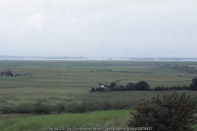
Grazing marsh, pools and the wider marsh landscape
On the yellow Short Trail shown in the2018 RSPB map. Current RSPB keeps the Short Trail available; follow current signs. No distance-to-name correspondence is assumed.
Winter: Wigeon, Peregrine, Hen Harrier, Short-eared Owl
Spring: Lapwing, Redshank, Marsh Harrier
Summer: Marsh Harrier, Gadwall, Tufted Duck, Little Egret
Autumn: Marsh Harrier, Green Sandpiper, Hen Harrier, Short-eared Owl
Light: either. Scope: essential.
Grazing marsh, hayfield margins and the distant Thames landscape
On the yellow Short Trail in the2018 official map. Do not continue onto the closed green Heronry branch or the old Gordon’s Hide spur.
Winter: Green Woodpecker, Linnet
Spring: Cuckoo, Green Woodpecker, Linnet
Summer: Green Woodpecker, Linnet
Autumn: Green Woodpecker, Linnet
Light: either. Scope: useful.
Woodland edge and the wider farm landscape from the red Woodland Trail
Named on the red Woodland Trail in the2018 RSPB map. Current facilities keep that trail available; steep unsurfaced sections remain unsuitable for wheelchairs.
Spring: Blackcap, Chiffchaff
Summer: Chaffinch, Blackcap
Autumn: Jay
Winter: Jay, Blackbird
Light: either. Scope: not needed.
Oak woodland, scrub and the wooded hill from the signed route
2.3-mile unsurfaced route with a steep incline; follow the open route and leave the closed Heronry Trail alone.
Winter: Jay, Blackbird
Spring: Blackcap, Chiffchaff, Whitethroat, Nightingale
Summer: Blackcap, Chiffchaff, Chaffinch, Nightingale
Autumn: Jay, Blackbird
Light: either. Scope: not needed.
Former woodland-edge heronry-related outlook; no current public route is recommended
Heronry Trail CLOSED on the current RSPB page. The operator says nests cannot be seen from this viewpoint; no alternative nest route is supplied.
Light: not applicable. Scope: not needed.
| Spot | Overlooks | Key species by season | Best light | Scope | Tide |
|---|---|---|---|---|---|
| Ernie Hemsley viewpointOn the yellow Short Trail shown in the2018 RSPB map. Current RSPB keeps the Short Trail available; follow current signs. No distance-to-name correspondence is assumed. | Grazing marsh, pools and the wider marsh landscape | Winter: Wigeon, Peregrine, Hen Harrier, Short-eared Owl Spring: Lapwing, Redshank, Marsh Harrier Summer: Marsh Harrier, Gadwall, Tufted Duck, Little Egret Autumn: Marsh Harrier, Green Sandpiper, Hen Harrier, Short-eared Owl | either | essential | — |
| Sweeney viewpointOn the yellow Short Trail in the2018 official map. Do not continue onto the closed green Heronry branch or the old Gordon’s Hide spur. | Grazing marsh, hayfield margins and the distant Thames landscape | Winter: Green Woodpecker, Linnet Spring: Cuckoo, Green Woodpecker, Linnet Summer: Green Woodpecker, Linnet Autumn: Green Woodpecker, Linnet | either | useful | — |
| Woodland viewpointNamed on the red Woodland Trail in the2018 RSPB map. Current facilities keep that trail available; steep unsurfaced sections remain unsuitable for wheelchairs. | Woodland edge and the wider farm landscape from the red Woodland Trail | Spring: Blackcap, Chiffchaff Summer: Chaffinch, Blackcap Autumn: Jay Winter: Jay, Blackbird | either | not needed | — |
| Woodland Trail2.3-mile unsurfaced route with a steep incline; follow the open route and leave the closed Heronry Trail alone. | Oak woodland, scrub and the wooded hill from the signed route | Winter: Jay, Blackbird Spring: Blackcap, Chiffchaff, Whitethroat, Nightingale Summer: Blackcap, Chiffchaff, Chaffinch, Nightingale Autumn: Jay, Blackbird | either | not needed | — |
| Heronry viewpoint — CLOSED trailHeronry Trail CLOSED on the current RSPB page. The operator says nests cannot be seen from this viewpoint; no alternative nest route is supplied. | Former woodland-edge heronry-related outlook; no current public route is recommended | — | not applicable | not needed | — |
Month chips show typical presence or our preferred viewing season. Choose birds that suit the time of your visit.
The Short Trail is the RSPB’s suggested accessible option:0.7 miles on an unsurfaced route with small inclines. That description should be read alongside recent ground conditions and your own equipment. The Woodland Trail has a steep incline and is described as inaccessible to wheelchairs. Avoid assuming that all woodland paths offer the same access as the shorter open route. The car park has uneven ground and large potholes, with no marked bays. Benches are provided at intervals, mainly near viewpoints, but the operator says they have no backs or armrests. The main viewpoint is about 300 metres from parking and another is around 400 metres away. More distant viewing positions involve longer approaches; one includes a stile and narrow footbridge. Those details are useful when choosing a definite turnaround point rather than a full circuit. If you need a firm surface, particular seating or a step-free approach, contact the reserve before travelling and name the route you are considering. A short walk with several comfortable pauses may suit you better than a longer route that uses all your energy before the final view. Bring protection for a stationary marsh watch, where exposed wind can matter as much as the walking distance. The published information does not provide a detailed specification for every gate and viewpoint.
Bring food and drink because the reserve has no café or shop. The RSPB directs visitors needing refreshments towards Cooling or High Halstow, but a packed lunch keeps a birdwatching day independent of village opening times. Toilets are described in contradictory ways on the operator’s pages: some entries list them, while the baby-changing entry says they are temporarily closed and names Hoo as an alternative. Confirm availability before leaving home if it affects the visit. Barbecues are prohibited, and litter should leave with you.
Dogs are permitted on public footpaths under close control, with particular care needed around ground-nesting birds and farm animals. Keep your dog beside you where a bird is feeding near the route and prevent it from entering the marsh. Remove dog waste for disposal away from the reserve. Assistance dogs are welcome in every part of the reserve open to visitors.
The RSPB describes public transport to this rural site as difficult and recommends contacting the reserve for advice. Arriva service 191 links Chatham and Grain and has journeys serving High Halstow, including Harrison Drive. That is a village connection rather than a bus to Bromhey Farm. Check the actual journey and stop with Arriva, then assess the remaining walk before choosing it; rural lanes and a reserve entrance are separate stages of the trip. Rail to the Medway towns followed by a booked taxi is the more direct car-free choice for many visitors. Give the taxi company Northward Hill at Bromhey Farm, Cooling, ME 3 8 DS, and arrange the return as well. Do not depend on finding a waiting taxi at the reserve after a long afternoon watch. Drivers approach from the A 228 via High Halstow and Cooling Road, following the reserve signs. The RSPB says there are no cycle racks, so discuss cycle storage if you plan to arrive by bike. Whatever the transport choice, leave enough margin for a slow birding walk and the separate parking gate arrangements.
Useful bases for an early start.
Booking.com links are affiliate links: we may earn a commission at no extra cost to you. How these links work.
About 6.3 miles by road, roughly 13 minutes’ drive; OSRM estimate measured 18 October 2026, without live traffic.
Measured driving route · 2026-10-18. Map estimates exclude live traffic.
A historic town and rail gateway for a booked rural transfer.Find places to stay in Rochester on Booking.comAbout 7.8 miles by road, roughly 16 minutes’ drive; OSRM estimate measured 18 October 2026, without live traffic.
Measured driving route · 2026-10-18. Map estimates exclude live traffic.
A Medway base with the 191 bus connection towards High Halstow.Find places to stay in Chatham on Booking.comAbout 13.1 miles by road, roughly 21 minutes’ drive; OSRM estimate measured 18 October 2026, without live traffic.
Measured driving route · 2026-10-18. Map estimates exclude live traffic.
A separate rail-linked town west of the reserve.Find places to stay in Gravesend on Booking.comExplore Kent’s full guides and smaller birding sites
Contact the RSPB North Kent Marshes team at northkentmarshes@rspb.org.uk or 01634 222480. The reserve address is Northward Hill, Bromhey Farm, Rochester, Medway, ME 3 8 DS. Give the date, trail and arrival method when asking about a visit, especially if access or the final walk from a village bus stop is important. The reserve’s current pages are the primary source for trail notices. Ask about the specific facility you need rather than assuming that a generic facilities icon means it is usable on your chosen day.
Check RSPB Bexley: actual Northward Hill 7 June 2026 report. irregular trip reports Reports show what has been seen, not what will be.
Follow the BTO Birders’ Code and give wildlife space.
RSPB Northward Hill: Free entry; parking tariff not published.
RSPB Northward Hill: Dogs are permitted on public footpaths under close control, with particular care needed around ground-nesting birds and farm animals.
RSPB Northward Hill: Spring woodland song · winter wildfowl and corvids.
RSPB Northward Hill: The Short Trail is the RSPB’s suggested accessible option:0.7 miles on an unsurfaced route with small inclines.
RSPB Northward Hill: The RSPB describes public transport to this rural site as difficult and recommends contacting the reserve for advice.
Shorter stops within 15 miles in a straight line. Use the operator’s arrival directions for the journey.
Canvey Island · Grassland and scrub
Canvey Island · Grazing marsh, reedbeds, lagoons and saltmarsh
Public island approach off Belton Way, Leigh-on-Sea · Thames Estuary mudflats, saltmarsh, saline lagoon, reedbed and rough grassland
Stanford-le-Hope · Estuary mudflats, scrub and seawall
Mucking Wharf Road, Stanford-le-Hope · Reedbed, stream, marsh and rough grassland
Bowers Gifford · Wetland and grassland
Pitsea Hall Lane, Pitsea · Tidal creek, fleet, reedbed, grassland and woodland
Vange · Freshwater and saline lagoons, reedbeds and grassland
Public foot access from Daws Heath Road, Thundersley · Woodland, meadows, hedges and acid grassland
Shoebury Common Road, Shoeburyness · Coastal grassland, pond, remnant dunes and estuary edge
South Woodham Ferrers, River Crouch · Grazing marsh, borrow dykes and tidal riverside
Ferrers Road approach, South Woodham Ferrers · Saltmarsh, rough grassland, creek and scrub
Nature Discovery Centre, Hawkswood Road, Downham · Reservoir, woodland, ponds and wetland margins
Blue House Farm Chase, North Fambridge · Coastal grazing marsh, wet grassland and estuary
Romford Road, Aveley, South Ockendon · Ancient and working woodland, meadows and lakes
The Avenue, Brentwood · Ancient woodland, birch, beech and pond
Nearby complete guides.
Stops with a purpose: use one as a contrasting habitat or weather-proof Plan B. Distances are straight-line estimates, not road journeys.