

Short entry6.3 miles away
Blue House Farm
Blue House Farm Chase, North Fambridge · Coastal grazing marsh, wet grassland and estuary
 the ai birderBirding near me
The AI Birder · one-page field sheet
Rochford, Essex · SS4 2HD

Current planning alert (2026-10-18): The RSPB says South Trail is closed for Environment Agency seawall works. Use the other signed trails and do not cross the works area.
Avocet · Brent Goose · Marsh Harrier · Short-eared Owl · Wigeon · Teal
Caroline’s Hide · Stokes Lagoon shelter · Grass Farm Lagoon shelter · Grass Farm–Acresfleet raised viewing area · Raised viewing area south of Grass Farm Lagoon · School House viewpoint · Half Moon viewpoint
Check current access, hide closures and operator notices before travelling. Seasonal birds are possibilities, not promised sightings. Keep to authorised routes and give wildlife space.
Opening and charges checked 2026-10-18. Operator: https://www.rspb.org.uk/days-out/reserves/wallasea-island
Full guide and current source links: https://aibirder.co.uk/reserves/rspb-wallasea-island
EN 40 · RSPB reserve guide
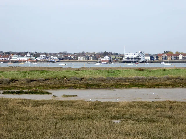
Rochford, Essex
Winter waders and dark-bellied brent geese, with marsh harriers over the grassland
Decide if the visit fits.
Last checked 18 October 2026.
The RSPB says South Trail is closed for Environment Agency seawall works. Use the other signed trails and do not cross the works area.
Opening and charges information · checked .
Stay nearby →Reserve overview
Winter waders and dark-bellied brent geese, with marsh harriers over the grassland
Eight checks for a smoother visit.
Conditions change: check the operator and transport notices before travelling.
January: typically look for Pintail and Shoveler from Caroline’s Hide. Start with the managed lagoons and compare birds in similar light. Opening at 8am is not pre-dawn vehicle access, and the earlier of dusk or 8pm controls departure. February: typically look for Brent Goose and Shelduck from School House viewpoint. Use a scope from the established sea-wall viewpoint. Check the tide before choosing the outer walk, but never follow feeding birds onto mud or saltmarsh. March: typically look for Avocet from Stokes Lagoon shelter. Give the lagoon time rather than completing a rapid circuit. Water levels are managed as well as influenced by weather, so exposed feeding margins cannot be promised on a particular date. April: typically look for Redshank and Lapwing from Grass Farm–Acresfleet raised viewing area. Watch across the visible grassland without entering fields or islands. Keep away from any alarming birds and let the public route determine where you stop, rather than a desired photograph. May: typically look for Avocet and Skylark from Grass Farm–Acresfleet raised viewing area. Combine slow lagoon scans with listening above the grassland. Choose a manageable wind and leave sensitive breeding areas alone; a broad habitat recommendation is not a nest location. June: typically look for Little Grebe and Little Egret from Grass Farm Lagoon shelter. A patient nearer-lagoon session suits a shorter visit. Use the surfaced approach where needed and ask about current routing instead of assuming the longer grass circuit has the same surface. July: typically look for Black-tailed Godwit from Caroline’s Hide. Returning waders can change the balance of a summer day. Work through the lagoon margins with a scope and compare feeding action before relying on distant plumage detail. August: typically look for Dunlin and Ringed Plover from Stokes Lagoon shelter. Passage is variable and depends on suitable feeding edges. Check recent county reports, then choose an open signed route; a report from yesterday is not a promise for today. September: typically look for Linnet and Marsh Harrier from Grass Farm–Acresfleet raised viewing area. Scan both grassland and skyline from the public facility. Avoid concentrating so closely on ducks that passing birds are missed, while leaving roost-searching out of the plan. October: typically look for Wigeon and Teal from Caroline’s Hide. Typically increasing wildfowl make the lagoons useful in autumn. Return before the published gate limit and do not interpret the opening calendar’s generic 8pm entry as permission to stay after dusk. November: typically look for Grey Plover and Dunlin from Half Moon viewpoint. An actual November operator-group visit used rising water and high tide to watch Jubilee Marsh. No numeric threshold is supplied; choose safe public viewing and keep closed seawall routes out. December: typically look for Golden Plover and Pintail from Caroline’s Hide. Use the best daylight for careful flock scans. In cold wind, a sustained hide watch can be more useful than extending the walk to every viewpoint, provided the signed return remains straightforward.
Best conditions: Our choice is clear light, manageable wind and enough time to compare tidal marsh with managed lagoons. Use a scope for distant estuary flocks and binoculars for the closer water. Exposed sea walls can be uncomfortable in gusts; choose the nearer shelters if the outer circuit is unsuitable. High tide can concentrate marsh birds, but no universal height or timing offset is verified.
Admission is free for adults and children. The RSPB charges page checked on 18 October 2026 lists non-member parking at £2, with members parking free; advance booking is unnecessary. This is a parking payment rather than a per-person entrance ticket. The parking area does not permit overnight stays, camping or coaches. The facilities page gives daily access from 8am to dusk or 8pm, whichever is earlier. The live October calendar displays 8am–8pm for the reserve, hide, toilets and car park, which conflicts with the earlier-dusk condition in autumn. Plan to be out by dusk and confirm the gate notice, rather than using the calendar to justify remaining after dark. The car park is locked outside the permitted period. Check the RSPB's current notices and weather before setting off, because temporary works can alter the walking options.
Access times: Reserve: Main/facilities page: daily from 8am until dusk or 8pm, whichever is earlier. South Trail currently closed for Environment Agency seawall works. · Hides: Caroline’s Hide and official viewpoints operate with reserve hours; no unrestricted dawn hide access. · Car park: Daily 8am–dusk or 8pm, whichever is earlier; closed outside these hours. Main page takes precedence over generic calendar 8am–8pm. · Dawn access: no. Operator opening information.
Wallasea's mix of seawall walks, saline pools and grazing marsh makes it useful to choose a route around the birds and the wind. Allfleets Marsh follows the public footpath towards School House viewpoint, while Jubilee Marsh leads towards Half Moon viewpoint. The Beagle Lagoons and Grass Farm area offer nearer water views. Caroline's Hide sits on New Pool Trail with views over Fitzroy and Darwin lagoons. The RSPB describes a 4.5-kilometre Marsh Flat loop and a shorter 1.5-kilometre loop near the lagoons. Its facilities text is inconsistent about the surfacing of the wider loop; choose the fully described surfaced approach to the lagoon shelters if ground conditions matter. Exposed seawalls can feel much colder than the car park, so stop at a sheltered viewpoint before committing to the longer outer section. South Trail is currently closed for Environment Agency seawall works. No reopening date is verified; keep this route out of the plan until the operator confirms access. Two-hour plan: begin with the nearer Beagle or Grass Farm lagoon view, then make Caroline's Hide the principal stationary watch if time and current routing permit. Divide each watch between water margins, islands and the skyline so a passing harrier is not missed while identifying ducks. Return by the most direct signed route, saving the distant seawall viewpoints for another visit. Full-day plan: spend the morning on the open Allfleets or Jubilee Marsh route that best fits the tide, then break for the food you have brought. Use the afternoon for the inland lagoon network, Caroline's Hide and the viewing shelters. Revisit one productive pool rather than extending a walk simply to complete a circuit. This editorial itinerary depends on the day's signed diversions and the distance you can comfortably manage; do not use a closed seawall route to join two otherwise open paths.
Use the linked reserve map and directions with current access notices. Species are typical seasonal targets. Light and telescope advice reflects our choice of viewpoint.
Fitzroy and Darwin Lagoons
Surfaced New Pool Trail approach; follow current signed routes.
Winter: Wigeon, Teal, Shoveler, Pintail, Golden Plover, Black-tailed Godwit
Spring: Wigeon, Teal, Shoveler, Pintail, Golden Plover, Black-tailed Godwit
Summer: Black-tailed Godwit
Autumn: Wigeon, Teal, Shoveler, Pintail, Golden Plover, Black-tailed Godwit
Light: either. Scope: useful.
Stokes Lagoon
Surfaced approach; shelter is not an enclosed visitor centre.
Winter: Avocet, Ringed Plover
Spring: Avocet, Ringed Plover
Summer: Avocet, Ringed Plover
Autumn: Avocet, Ringed Plover
Light: either. Scope: useful.
Grass Farm Lagoon
Surfaced approach from the nearer lagoon trail.
Winter: Redshank, Little Grebe
Spring: Redshank, Little Grebe
Summer: Redshank, Little Grebe
Autumn: Redshank, Little Grebe
Light: either. Scope: useful.
Grass Farm and Acresfleet Lagoons
Official raised seating area; no separate proper name supplied.
Winter: Lapwing, Marsh Harrier, Linnet, Short-eared Owl, Hen Harrier
Spring: Lapwing, Marsh Harrier, Skylark, Linnet, Short-eared Owl, Hen Harrier
Summer: Lapwing, Marsh Harrier, Skylark, Linnet
Autumn: Lapwing, Marsh Harrier, Skylark, Linnet, Short-eared Owl, Hen Harrier
Light: either. Scope: useful.
Southern side of Grass Farm Lagoon
Official raised seating area; no separate proper name supplied.
Winter: Little Egret, Kestrel
Spring: Little Egret, Kestrel
Summer: Little Egret, Kestrel
Autumn: Little Egret, Kestrel
Light: either. Scope: useful.
Allfleets Marsh and Crouch Estuary
Eastern end of Allfleets Marsh Trail; unsurfaced grass sea wall and ramp approach.
Winter: Brent Goose, Shelduck
Spring: Brent Goose, Shelduck
Summer: Shelduck
Autumn: Brent Goose, Shelduck
Light: either. Scope: essential.
Tide: Compare exposed feeding mud with rising-water movements from the public sea wall.
Jubilee Marsh intertidal habitat
South end of Jubilee Marsh Trail; do not use the closed South Trail to connect routes.
Winter: Grey Plover, Dunlin
Spring: Grey Plover, Dunlin
Summer: Dunlin
Autumn: Grey Plover, Dunlin
Light: either. Scope: essential.
Tide: Operator-group visit found a useful high-tide marsh watch; no fixed height or arrival interval verified.
| Spot | Overlooks | Key species by season | Best light | Scope | Tide |
|---|---|---|---|---|---|
| Caroline’s HideSurfaced New Pool Trail approach; follow current signed routes. | Fitzroy and Darwin Lagoons | Winter: Wigeon, Teal, Shoveler, Pintail, Golden Plover, Black-tailed Godwit Spring: Wigeon, Teal, Shoveler, Pintail, Golden Plover, Black-tailed Godwit Summer: Black-tailed Godwit Autumn: Wigeon, Teal, Shoveler, Pintail, Golden Plover, Black-tailed Godwit | either | useful | — |
| Stokes Lagoon shelterSurfaced approach; shelter is not an enclosed visitor centre. | Stokes Lagoon | Winter: Avocet, Ringed Plover Spring: Avocet, Ringed Plover Summer: Avocet, Ringed Plover Autumn: Avocet, Ringed Plover | either | useful | — |
| Grass Farm Lagoon shelterSurfaced approach from the nearer lagoon trail. | Grass Farm Lagoon | Winter: Redshank, Little Grebe Spring: Redshank, Little Grebe Summer: Redshank, Little Grebe Autumn: Redshank, Little Grebe | either | useful | — |
| Grass Farm–Acresfleet raised viewing areaOfficial raised seating area; no separate proper name supplied. | Grass Farm and Acresfleet Lagoons | Winter: Lapwing, Marsh Harrier, Linnet, Short-eared Owl, Hen Harrier Spring: Lapwing, Marsh Harrier, Skylark, Linnet, Short-eared Owl, Hen Harrier Summer: Lapwing, Marsh Harrier, Skylark, Linnet Autumn: Lapwing, Marsh Harrier, Skylark, Linnet, Short-eared Owl, Hen Harrier | either | useful | — |
| Raised viewing area south of Grass Farm LagoonOfficial raised seating area; no separate proper name supplied. | Southern side of Grass Farm Lagoon | Winter: Little Egret, Kestrel Spring: Little Egret, Kestrel Summer: Little Egret, Kestrel Autumn: Little Egret, Kestrel | either | useful | — |
| School House viewpointEastern end of Allfleets Marsh Trail; unsurfaced grass sea wall and ramp approach. | Allfleets Marsh and Crouch Estuary | Winter: Brent Goose, Shelduck Spring: Brent Goose, Shelduck Summer: Shelduck Autumn: Brent Goose, Shelduck | either | essential | Compare exposed feeding mud with rising-water movements from the public sea wall. |
| Half Moon viewpointSouth end of Jubilee Marsh Trail; do not use the closed South Trail to connect routes. | Jubilee Marsh intertidal habitat | Winter: Grey Plover, Dunlin Spring: Grey Plover, Dunlin Summer: Dunlin Autumn: Grey Plover, Dunlin | either | essential | Operator-group visit found a useful high-tide marsh watch; no fixed height or arrival interval verified. |
Month chips show typical presence or our preferred viewing season. Choose birds that suit the time of your visit.
Use the public estuary viewpoints to compare exposed feeding mud with birds moving onto the marsh as water rises. An operator November visit used high tide, but no fixed ideal height or arrival interval is verified. Managed lagoons offer a different water-level setting.
UKHO EasyTide: Burnham-on-Crouch — nearby UKHO prediction port · RNLI tide safety
Two Blue Badge spaces are provided near the trail entrances within the 34-space car park. The Allfleets and Jubilee Marsh approaches pass through a wheelchair-friendly kissing gate and climb a 1:12 ramp onto the seawall. Their grass surfaces can affect effort and traction, particularly after rain. The operator reports no further width restrictions or stiles on its land, but the surface still determines whether a particular route suits your equipment. A surfaced path runs east towards Beagle Lagoons and Grass Farm Lagoon. The approach to Caroline's Hide along Marsh Flats and New Pool trails uses granite toppings and concrete, with a short cockleshell section at the entrance. Surfaced approaches also reach the Stokes and Grass Farm viewing shelters. These routes offer alternatives to the longer grass seawalls for visitors who need firmer ground or frequent sheltered stops. An accessible toilet is now available on the reserve. Raised viewing areas have seating, allowing a rest during a longer visit. Contact the reserve if you need exact path widths, turning spaces or the latest condition of an access ramp. The facilities page describes the main Marsh Flat loop as both surfaced and unsurfaced in adjacent wording, so do not assume its entire length provides a firm all-weather circuit.
Bring all food and drinking water: Wallasea has no café or visitor centre. Benches around the reserve provide picnic stops, but the exposed setting makes a waterproof lunch bag useful. The operator lists nearby refreshments at Essex Marina, Canewdon and Rochford. Bicycle racks are provided at the car park, although bicycles are unsuitable for the reserve paths. There is no baby-changing facility. Barbecues and fires are prohibited, and drones require advance permission from the site management team.
Pet dogs are allowed only on the Allfleets Marsh public-footpath trail, on a short lead and under close control. They cannot accompany you on the other reserve trails or ordinary guided walks. Assistance dogs may use all parts of the reserve. Take dog waste away because there are no dog-waste bins on site, and keep clear of grazing livestock.
Rochford is the RSPB's recommended rail station, about six miles from the reserve. Its location page names bus 60A as the onward service. Stephensons of Essex's current route index links to a timetable showing selected 60A journeys serving Essex Marina Office, while most journeys terminate at Canewdon Loftmans Corner. The timetable runs Monday–Saturday excluding public holidays and is dated from 29 July 2024, so check the selected day carefully. From the marina, the RSPB gives an approximately one-kilometre onward approach to the reserve. Do not assume every 60A reaches the marina or that a bus enters the visitor car park. A prebooked taxi from Rochford is the simpler alternative if the connection or final walk is unsuitable. The RSPB also describes a summer boat link from Burnham-on-Crouch to Wallasea Marina. A current operating timetable and booking arrangement were not established in the sources checked, so confirm the crossing and return before using it. Drivers approach via Ashingdon Road, Brays Lane and Creeksea Ferry Road, following the reserve access road through the green gate.
Useful bases for an early start.
Booking.com links are affiliate links: we may earn a commission at no extra cost to you. How these links work.
About 7.4 miles by road, roughly 13 minutes’ drive (OSRM, measured 18 October 2026; estimate without live traffic).
Measured driving route · 18 October 2026. Map estimates exclude live traffic.
The closest rail-connected town baseFind places to stay in Rochford on Booking.comAbout 10.5 miles by road, roughly 22 minutes’ drive (OSRM, measured 18 October 2026; estimate without live traffic).
Measured driving route · 18 October 2026. Map estimates exclude live traffic.
A coastal base with a wider range of places to stayFind places to stay in Southend-on-Sea on Booking.comAbout 22.0 miles by road, roughly 34 minutes’ drive (OSRM, measured 18 October 2026; estimate without live traffic).
Measured driving route · 18 October 2026. Map estimates exclude live traffic.
A city base for a wider Essex tripFind places to stay in Chelmsford on Booking.comExplore Essex’s full guides and smaller birding sites
Email wallasea@rspb.org.uk for reserve enquiries, including current paths, equipment access and any proposed organised visit. The RSPB's main reserve page links to its facilities, charges, calendar and location information, which answer different parts of the journey. Ask Stephensons directly about bus 60A's final stop rather than assuming that the reserve address is served. For a longer coastal day, share the planned return time with your party before starting along the seawall, as there is no staffed visitor centre to organise your departure.
Check RSPB Chelmsford actual Wallasea visit report. dated November 2024 archive Reports show what has been seen, not what will be.
Follow the BTO Birders’ Code and give wildlife space.
RSPB Wallasea Island: Free entry; non-member parking £2; members park free.
RSPB Wallasea Island: Pet dogs are allowed only on the Allfleets Marsh public-footpath trail, on a short lead and under close control.
RSPB Wallasea Island: Winter wildfowl and waders; spring and autumn passage.
RSPB Wallasea Island: The Allfleets and Jubilee Marsh approaches pass through a wheelchair-friendly kissing gate and climb a 1:12 ramp onto the seawall.
RSPB Wallasea Island: Rochford is the RSPB's recommended rail station, about six miles from the reserve.
Shorter stops within 15 miles in a straight line. Use the operator’s arrival directions for the journey.
Blue House Farm Chase, North Fambridge · Coastal grazing marsh, wet grassland and estuary
Shoebury Common Road, Shoeburyness · Coastal grassland, pond, remnant dunes and estuary edge
South Woodham Ferrers, River Crouch · Grazing marsh, borrow dykes and tidal riverside
Public foot access from Daws Heath Road, Thundersley · Woodland, meadows, hedges and acid grassland
Ferrers Road approach, South Woodham Ferrers · Saltmarsh, rough grassland, creek and scrub
Public path and seawall beside St Peter’s Chapel, Bradwell-on-Sea · Coastal seawall, saltmarsh outlook, shore and scrub
Public island approach off Belton Way, Leigh-on-Sea · Thames Estuary mudflats, saltmarsh, saline lagoon, reedbed and rough grassland
Chigborough Road, Heybridge; nearest postcode, not the precise entrance · Former gravel pits, lakes, willow carr, marsh and grassland
Coast Road, West Mersea · Harbour, boats and Blackwater Estuary outlook
Seaview Avenue, West Mersea · Beach-hut seafront and Blackwater Estuary outlook
Canvey Island · Grazing marsh, reedbeds, lagoons and saltmarsh
Bowers Gifford · Wetland and grassland
Heath entrance, Tiptree · Lowland heath, rough grassland, scrub and ponds
Canvey Island · Grassland and scrub
Broman’s Lane, East Mersea · Coastal grassland, grazing meadow, pond and estuary views
Nature Discovery Centre, Hawkswood Road, Downham · Reservoir, woodland, ponds and wetland margins
Vange · Freshwater and saline lagoons, reedbeds and grassland
Pitsea Hall Lane, Pitsea · Tidal creek, fleet, reedbed, grassland and woodland
Nearby complete guides.
Stops with a purpose: use one as a contrasting habitat or weather-proof Plan B. Distances are straight-line estimates, not road journeys.